


Weather Webcast with Tom Wachs
Cold tonight with temperatures dropping into the single digits and wind chills -5 to -15 by morning. Wind chills below zero all day on Monday with gradual clearing.
Cold tonight with temperatures dropping into the single digits and wind chills -5 to -15 by morning. Wind chills below zero all day on Monday with gradual clearing.
Weather webcast with Rob Haswell
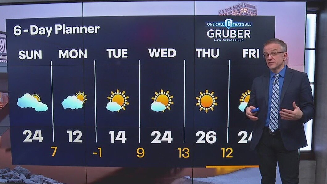
Highs today will be in the low to mid 20s but we cool to single digits tonight and only get to a high of 12 on Monday! We stay cold Tuesday but warm slightly Wednesday.
Highs today will be in the low to mid 20s but we cool to single digits tonight and only get to a high of 12 on Monday! We stay cold Tuesday but warm slightly Wednesday.
Weather webcast with Rob Haswell
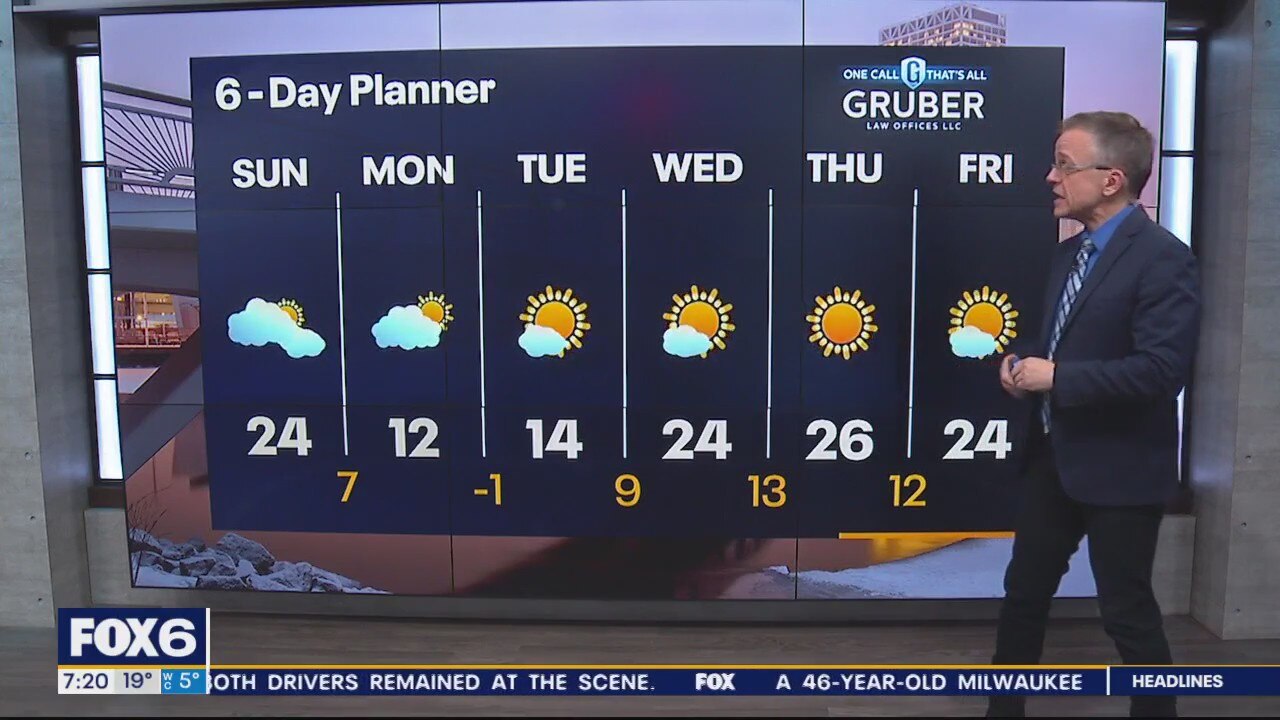
With the snow wrapped up for the time being, the focus turns to the cold air on the way. Highs today will be in the low to mid 20s but we cool to single digits tonight and only get to a high of 12 on Monday!
With the snow wrapped up for the time being, the focus turns to the cold air on the way. Highs today will be in the low to mid 20s but we cool to single digits tonight and only get to a high of 12 on Monday!
Weather Webcast with Meteorologist Eric Manges
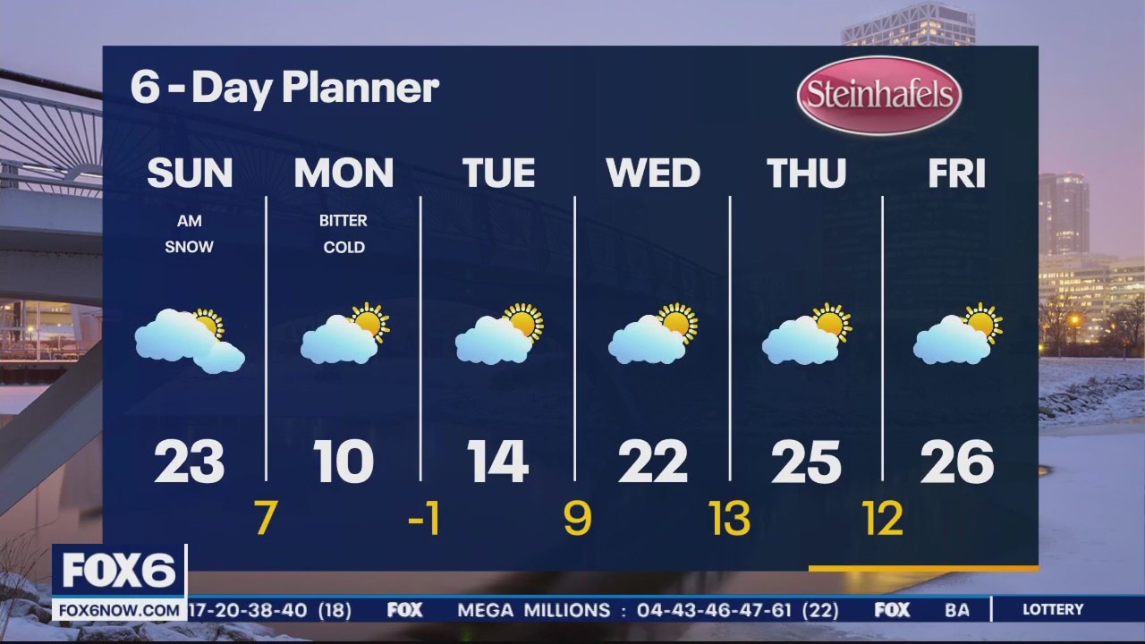
FOX6 News at 9 offers the day's news. weather, and sports in southeast Wisconsin, the nation, and the world.
FOX6 News at 9 offers the day's news. weather, and sports in southeast Wisconsin, the nation, and the world.
Weather Webcast with Meteorologist Eric Manges
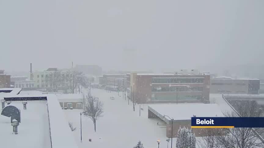
Widespread snow continues through tonight with areas closer to Lake Michigan and South favored to see the highest totals
Widespread snow continues through tonight with areas closer to Lake Michigan and South favored to see the highest totals
Weather Webcast with Meteorologist Lisa Michaels
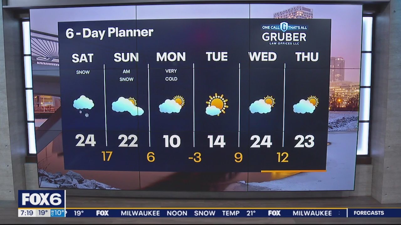
A system coming from the west will bring snow late morning through Sunday morning. Intensity of snow picks up Saturday afternoon and evening. Northern areas have a chance of 2-4" while central and southern counties could see a sharp cut-off from 3-8" with isolated locations near the lakefront up to 9+" Snow moves out Sunday, but frigid cold temperatures move in for next week. Monday and Tuesday will only have high temps in the single digits to lower teens. Wind chills will feel -10 to -20 below zero.
A system coming from the west will bring snow late morning through Sunday morning. Intensity of snow picks up Saturday afternoon and evening. Northern areas have a chance of 2-4" while central and southern counties could see a sharp cut-off from 3-8" with isolated locations near the lakefront up to 9+" Snow moves out Sunday, but frigid cold temperatures move in for next week. Monday and Tuesday will only have high temps in the single digits to lower teens. Wind chills will feel -10 to -20 below zero.

Weather Webcast with Meteorologist Eric Manges
FOX6 News at 5 offers the day's news, weather, and sports in southeast Wisconsin, the nation, and the world.
FOX6 News at 5 offers the day's news, weather, and sports in southeast Wisconsin, the nation, and the world.

Weather Webcast with Meteorologist Stephanie Barichello
Snow tapers off later this afternoon but we stay windy and chilly. Dry and cold tonight with lows in the single digits and teens, then another round of accumulating snow late Saturday morning through early Sunday. Several inches possible.
Snow tapers off later this afternoon but we stay windy and chilly. Dry and cold tonight with lows in the single digits and teens, then another round of accumulating snow late Saturday morning through early Sunday. Several inches possible.
Weather webcast with Rob Haswell
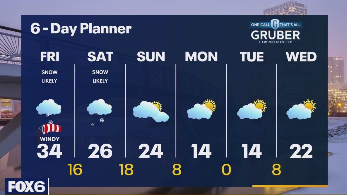
A cold front cuts across Wisconsin today. Ahead of that front we can expect a strong SW windy gusting to near 35mph. Snow showers are likely ahead of and along the front with accumulations around 1" at most but the snow will reduce visibility and cause poor driving conditions at times. We should warm to the low 30s before the front passes but then fall into the teens overnight and only get into the 20s for highs this weekend. Another round of snow arrives Saturday with the potential for a more significant accumulation of snow.
A cold front cuts across Wisconsin today. Ahead of that front we can expect a strong SW windy gusting to near 35mph. Snow showers are likely ahead of and along the front with accumulations around 1" at most but the snow will reduce visibility and cause poor driving conditions at times. We should warm to the low 30s before the front passes but then fall into the teens overnight and only get into the 20s for highs this weekend. Another round of snow arrives Saturday with the potential for a more significant accumulation of snow.

Weather Webcast with Tom Wachs
Snow and wind after 7-8am Friday. Low visibility likely for the morning commute. Scattered afternoon snow showers. Heavier snow likely on Saturday.
Snow and wind after 7-8am Friday. Low visibility likely for the morning commute. Scattered afternoon snow showers. Heavier snow likely on Saturday.
Weather Webcast with Tom Wachs
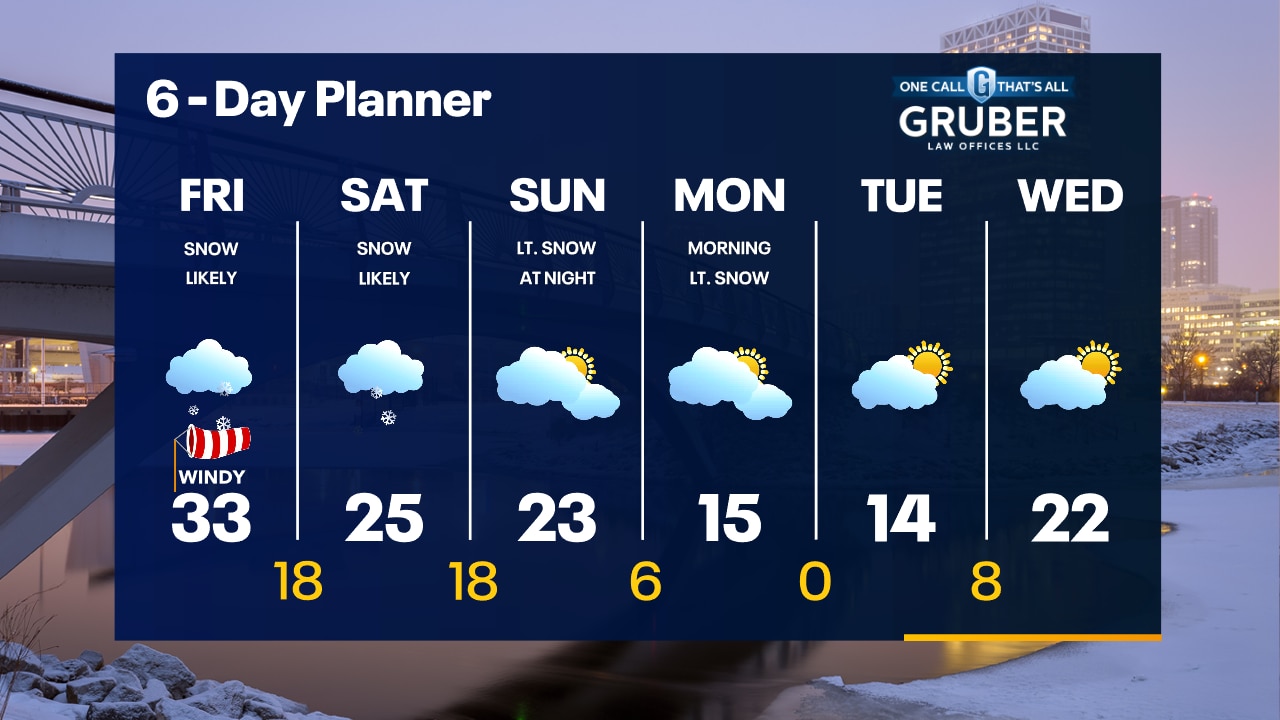
Skies will start to clear out briefly tonight as temperatures drop into the teens. Slow for the Friday AM commute with snow and strong winds. Low visibility likely.
Skies will start to clear out briefly tonight as temperatures drop into the teens. Slow for the Friday AM commute with snow and strong winds. Low visibility likely.

Weather webcast with Rob Haswell
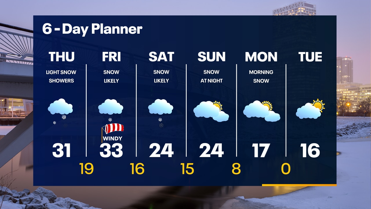
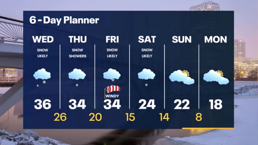
Snow showers continue off and on throughout the day with another half inch of snow possible. Temperatures will reach the low 30s today and fall to the teens overnight. A few more snow showers are likely on Friday with light accumulation again and temperatures once again in the low to mid 30s for highs. We will be windy on Friday as a cold front sweeps through the area. Behind that cold front temperatures fall into the teens and 20s for highs through the middle of next week.
Snow showers continue off and on throughout the day with another half inch of snow possible. Temperatures will reach the low 30s today and fall to the teens overnight. A few more snow showers are likely on Friday with light accumulation again and temperatures once again in the low to mid 30s for highs. We will be windy on Friday as a cold front sweeps through the area. Behind that cold front temperatures fall into the teens and 20s for highs through the middle of next week.
Weather Webcast with Tom Wachs
Watch out for slick roads overnight with light snow and temperatures falling into the 20s causing wet roads to freeze. Light snow showers continue on Thursday with a steadier batch Friday morning.
Watch out for slick roads overnight with light snow and temperatures falling into the 20s causing wet roads to freeze. Light snow showers continue on Thursday with a steadier batch Friday morning.

Weather Webcast with Tom Wachs
Light snow showers and flurries tonight. Little accumulation. A few more scattered snow showers on Thursday with highs in the 30s. Snow and wind move through Friday morning.
Light snow showers and flurries tonight. Little accumulation. A few more scattered snow showers on Thursday with highs in the 30s. Snow and wind move through Friday morning.
Weather Webcast with Meteorologist Stephanie Barichello
An inch or two of snow will possible through this evening, then a few more rounds of light snow possible Thursday into Friday. An additional inch possible. Yet another storm Saturday, then expect plummeting temperatures to end the month.
An inch or two of snow will possible through this evening, then a few more rounds of light snow possible Thursday into Friday. An additional inch possible. Yet another storm Saturday, then expect plummeting temperatures to end the month.

Weather webcast with Rob Haswell
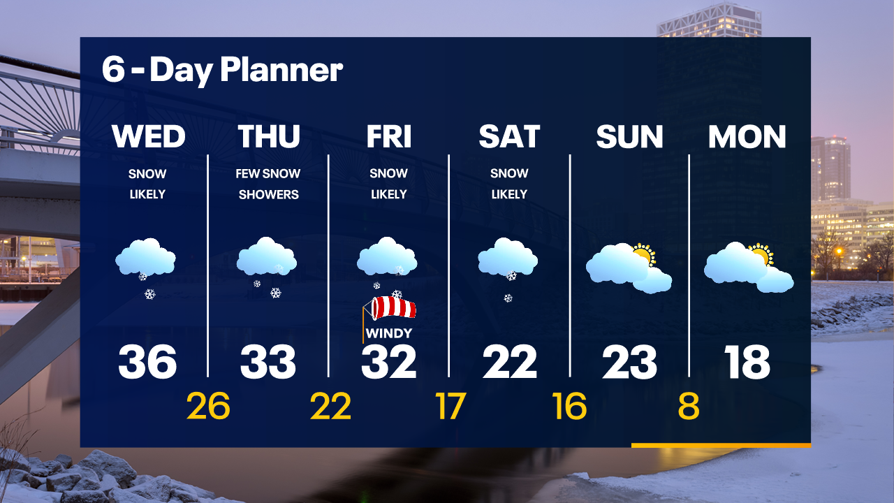
Winter Weather Advisory for Milwaukee, Racine, Kenosha and Walworth Countis starts at 4am. 2-4" of snow are possible in parts of these counties by the end of the day. Areas farther north and northwest will see far less - if any. Highs today will be in the low to mid 30s and cool to the low 30s Thursday and Friday before falling into the teens and low 20s this weekend and early next week. Snow showers are possible Thursday with light snow returning Friday and Saturday
Winter Weather Advisory for Milwaukee, Racine, Kenosha and Walworth Countis starts at 4am. 2-4" of snow are possible in parts of these counties by the end of the day. Areas farther north and northwest will see far less - if any. Highs today will be in the low to mid 30s and cool to the low 30s Thursday and Friday before falling into the teens and low 20s this weekend and early next week. Snow showers are possible Thursday with light snow returning Friday and Saturday
Weather Webcast with Tom Wachs
Snow moves in after 5am Wednesday and light snow continues all day. There could be a heavier band in Milwaukee, Racine and Kenosha counties. Most areas 1-2" by Wednesday night. A few slick roads possible.
Snow moves in after 5am Wednesday and light snow continues all day. There could be a heavier band in Milwaukee, Racine and Kenosha counties. Most areas 1-2" by Wednesday night. A few slick roads possible.
Weather Webcast with Tom Wachs
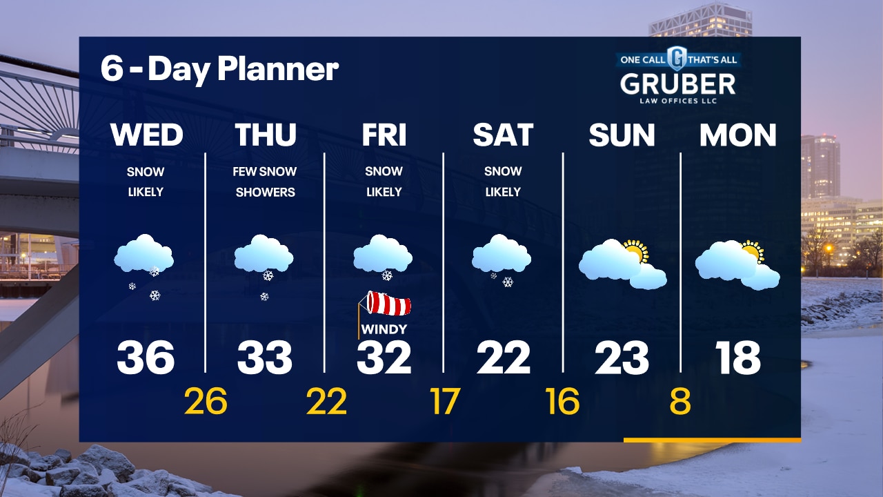
Dry tonight with temperatures in the upper 20s to low 30s. Snow moves in after 5am Wednesday. 1-2" of snow in most areas Wednesday with a few slick roads.
Dry tonight with temperatures in the upper 20s to low 30s. Snow moves in after 5am Wednesday. 1-2" of snow in most areas Wednesday with a few slick roads.
Weather Webcast with Meteorologist Stephanie Barichello
Cloudy this afternoon then snow showers arrive early Wednesday, lasting through the afternoon. An inch or two of accumulation possible, highest near the WI/IL state line. Fairly active weather continues through the weekend with light snow possible through Sunday. It'll also be a much colder weekend in the 20s.
Cloudy this afternoon then snow showers arrive early Wednesday, lasting through the afternoon. An inch or two of accumulation possible, highest near the WI/IL state line. Fairly active weather continues through the weekend with light snow possible through Sunday. It'll also be a much colder weekend in the 20s.
Weather webcast with Rob Haswell
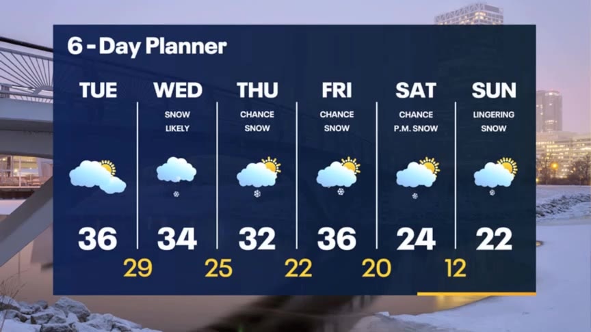
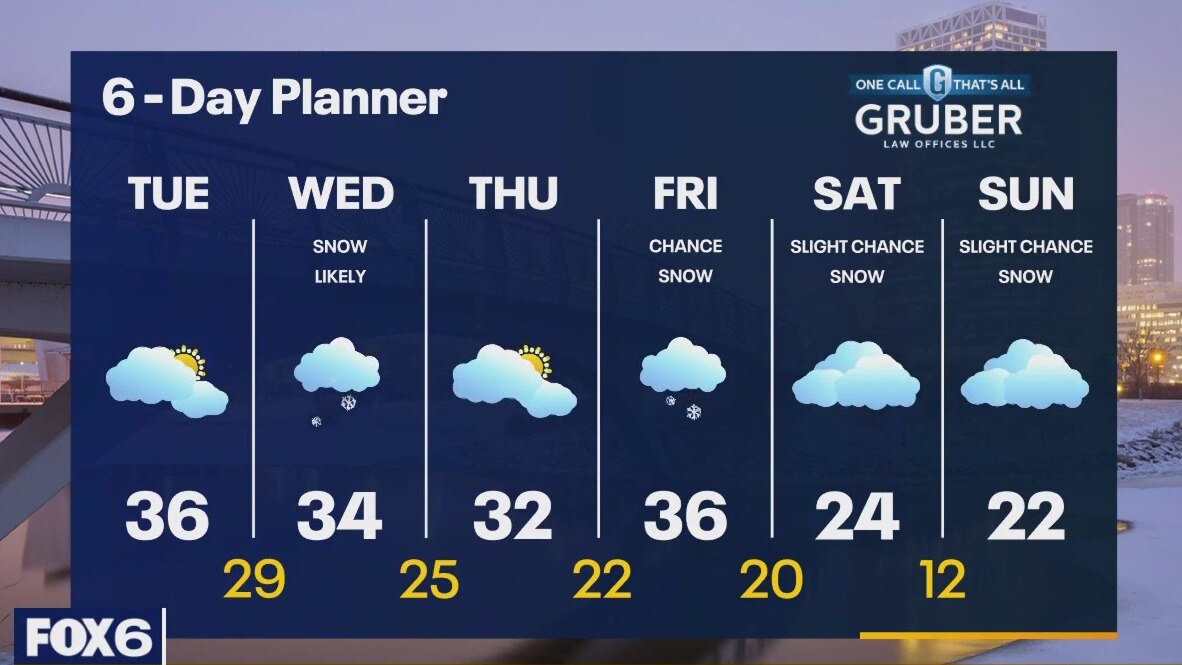
A fairly uneventful day today with a few morning breaks and then overcast for the afternoon and evening. Temperatures remain above average today with highs in the mid 30s. A strong low passes well to our southeast on Wednesday but tracks just far enough to the NW to clip our area with some light snow on Wednesday. There is a chance we may see some lake effect or lake enhanced snow with this system, but most areas will see an 1-3" at most.
A fairly uneventful day today with a few morning breaks and then overcast for the afternoon and evening. Temperatures remain above average today with highs in the mid 30s. A strong low passes well to our southeast on Wednesday but tracks just far enough to the NW to clip our area with some light snow on Wednesday. There is a chance we may see some lake effect or lake enhanced snow with this system, but most areas will see an 1-3" at most.