

Weather Webcast with Meteorologist Eric Manges
FOX6 News at 11 offers the day's news, weather, and sports in southeast Wisconsin, the nation, and the world.
FOX6 News at 11 offers the day's news, weather, and sports in southeast Wisconsin, the nation, and the world.
Weather webcast with Rob Haswell
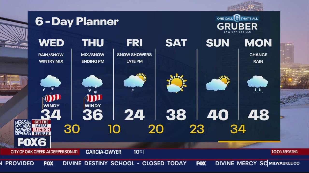
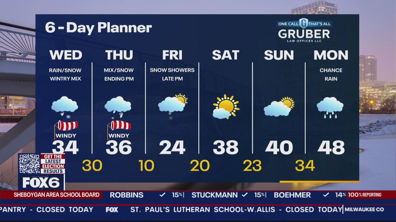
Winter Storm Warning 6am Wed. to Noon Thu. For Milwaukee, Waukesha, Jefferson, Dodge, Washington, Ozaukee, Sheboygan and Fond du Lac Cos. Ice Storm Warning Racine, Kenosha and Walworth Co. from 6am Wed. to Noon Thu. A strong low moves from Missouri today into Michigan by tomorrow afternoon. It will bring rain, snow, sleet and freezing rain to our area over the next 25-36 hours. Areas north of a line from Beaver Dam to Port Washington could see 6 inches of snow or more. South of that line to a line from Fort Atkinson to Oak Creek can expect a wintry mix and snow. South of that line will be mostly sleet and freezing rain with up to half an inch of ice possible.
Winter Storm Warning 6am Wed. to Noon Thu. For Milwaukee, Waukesha, Jefferson, Dodge, Washington, Ozaukee, Sheboygan and Fond du Lac Cos. Ice Storm Warning Racine, Kenosha and Walworth Co. from 6am Wed. to Noon Thu. A strong low moves from Missouri today into Michigan by tomorrow afternoon. It will bring rain, snow, sleet and freezing rain to our area over the next 25-36 hours. Areas north of a line from Beaver Dam to Port Washington could see 6 inches of snow or more. South of that line to a line from Fort Atkinson to Oak Creek can expect a wintry mix and snow. South of that line will be mostly sleet and freezing rain with up to half an inch of ice possible.
Weather Webcast with Tom Wachs
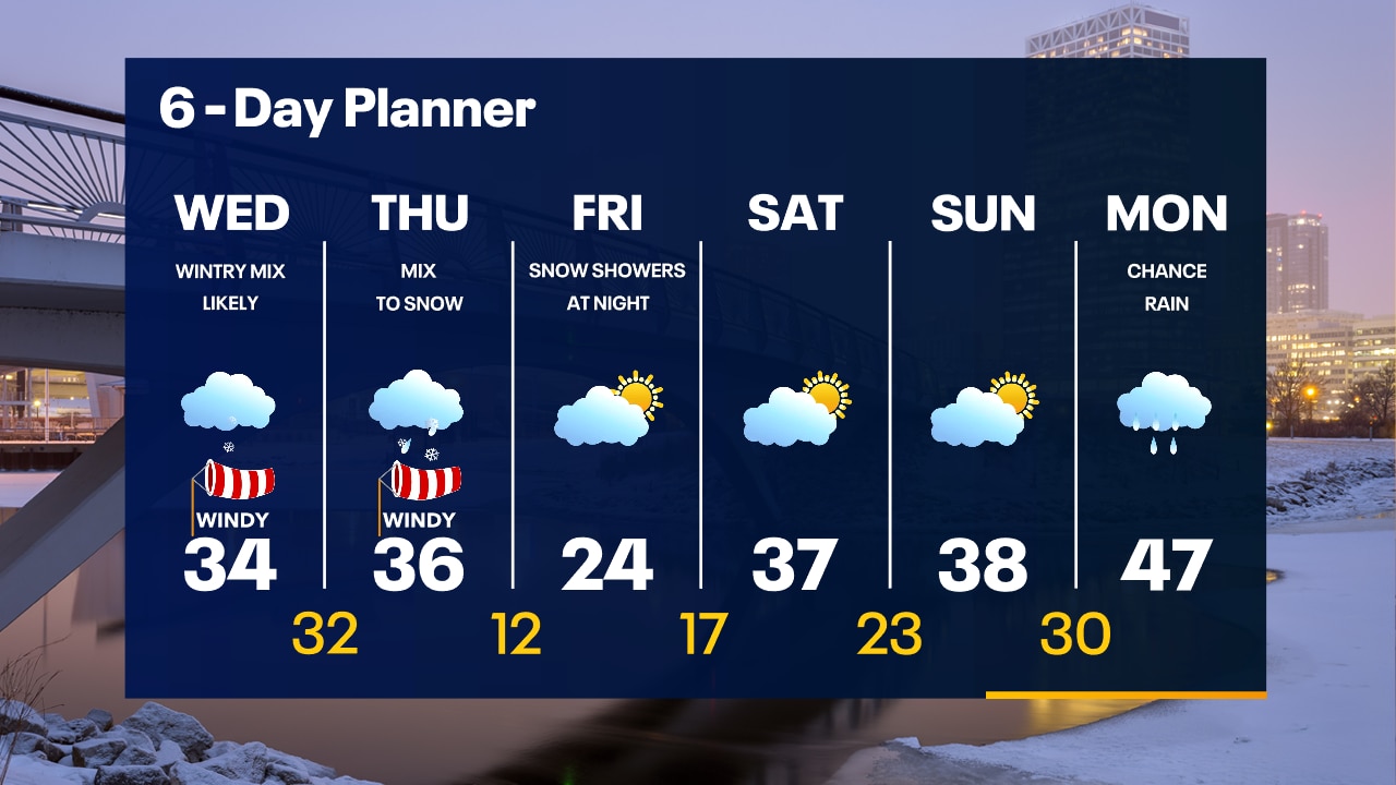
Winter Storm and Ice Storm Warnings start at 9am Wednesday and run until Noon Thursday. It will be extremely slick across SE WI starting late morning and especially by Wednesday afternoon and evening.
Winter Storm and Ice Storm Warnings start at 9am Wednesday and run until Noon Thursday. It will be extremely slick across SE WI starting late morning and especially by Wednesday afternoon and evening.
Weather Webcast with Tom Wachs
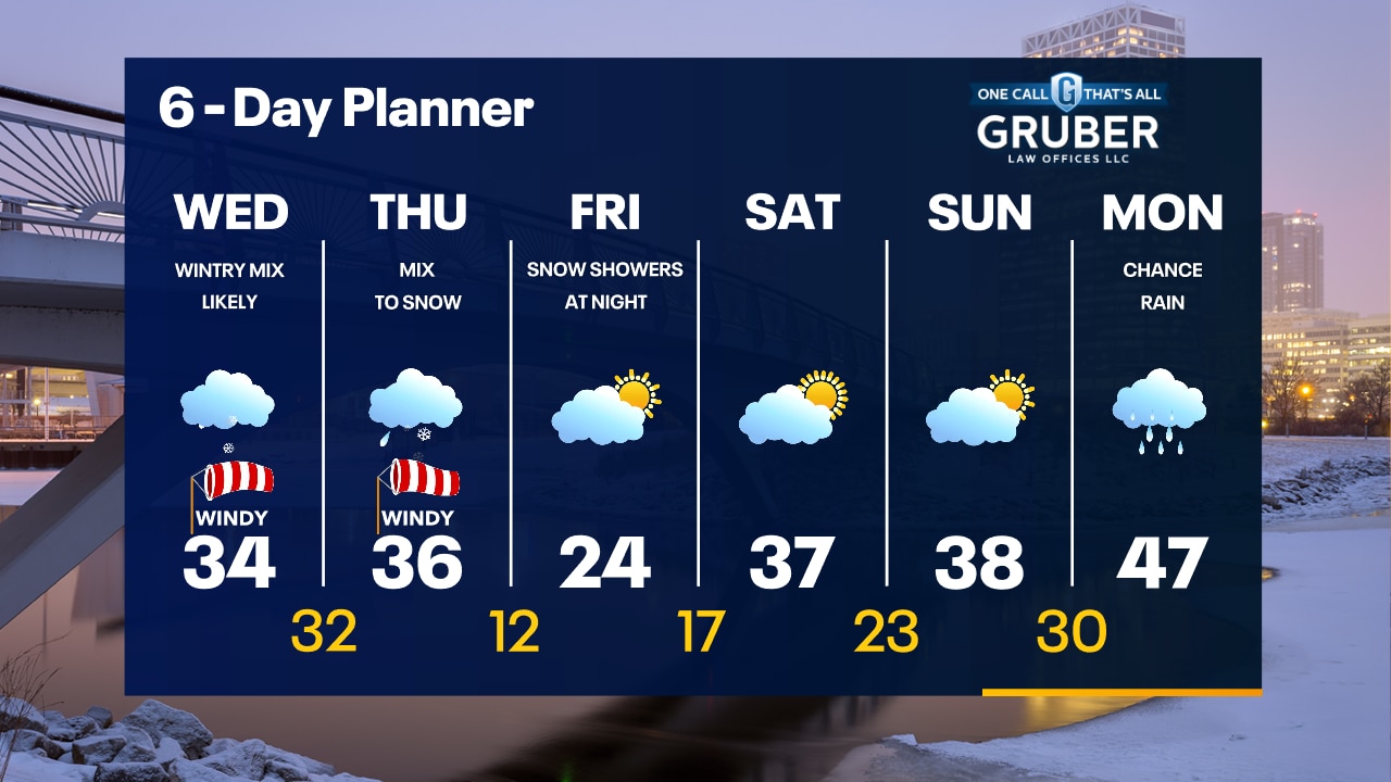
Winter Storm and Ice Storm Warnings take effect at 9am Wednesday. Light snow tonight with light accumulation far north. An icy/wintry mess expected Wednesday afternoon and Wednesday night.
Winter Storm and Ice Storm Warnings take effect at 9am Wednesday. Light snow tonight with light accumulation far north. An icy/wintry mess expected Wednesday afternoon and Wednesday night.
Weather Webcast with Meteorologist Stephanie Barichello
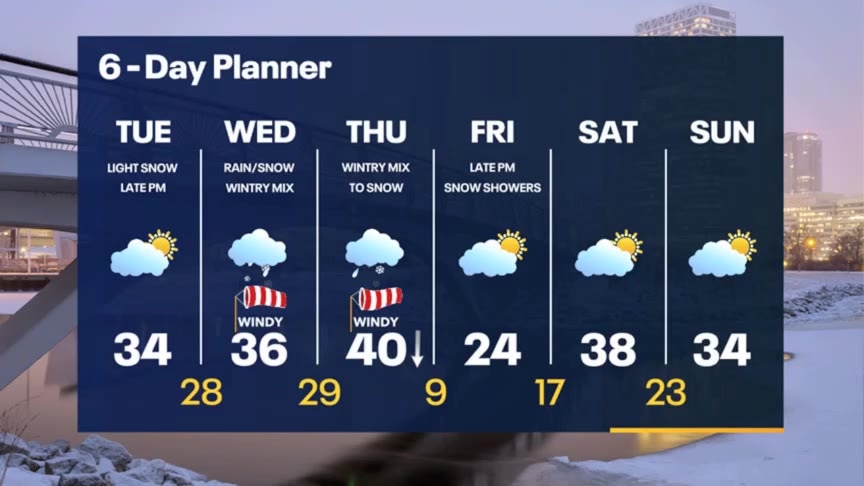
Quiet this afternoon then light snow possible later tonight. A wintry mess of snow, sleet and freezing rain expected by mid-morning Wednesday. Both snow and ice accumulation possible.
Quiet this afternoon then light snow possible later tonight. A wintry mess of snow, sleet and freezing rain expected by mid-morning Wednesday. Both snow and ice accumulation possible.
Weather webcast with Rob Haswell
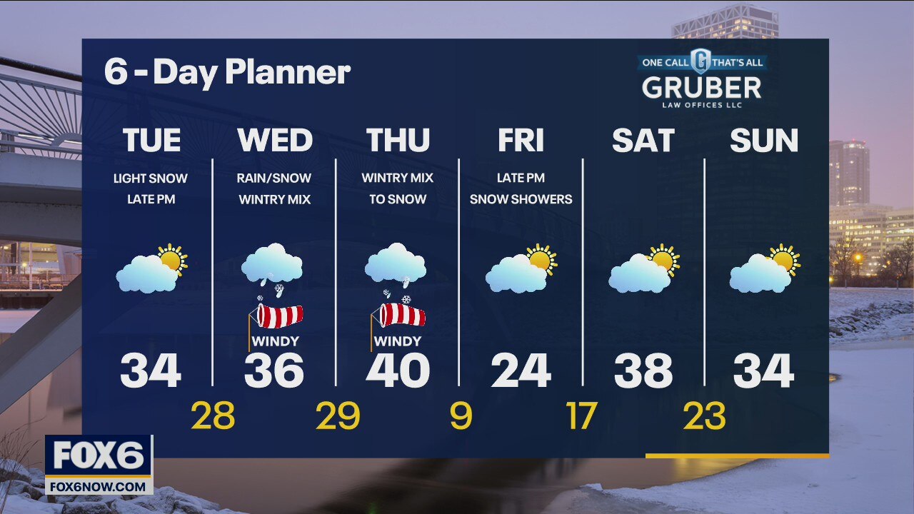
A series of disturbances keep us busy for the next couple of days. Later today and tonight we can expect some light snow. That will be followed by more extensive snow, rain and a wintry mix on Wednesday and into Thursday. A Winter Storm Watch goes into effect Wednesday afternoon for all of SE Wisconsin. We cool down and calm down on Friday. Temperatures rebound by the weekend.
A series of disturbances keep us busy for the next couple of days. Later today and tonight we can expect some light snow. That will be followed by more extensive snow, rain and a wintry mix on Wednesday and into Thursday. A Winter Storm Watch goes into effect Wednesday afternoon for all of SE Wisconsin. We cool down and calm down on Friday. Temperatures rebound by the weekend.
Weather Webcast with Tom Wachs
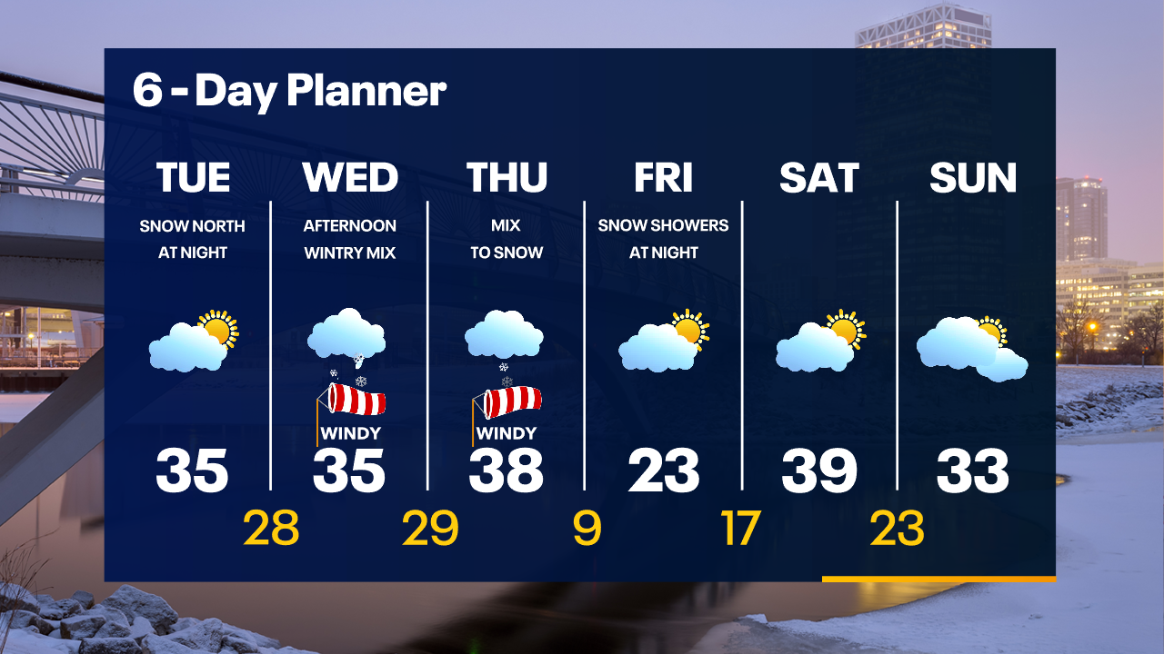
Windy overnight with temperatures in the 20s. Partly sunny on Tuesday with highs in the 30s. Light snow north of Milwaukee Tuesday night. An icy mess is possible Wednesday.
Windy overnight with temperatures in the 20s. Partly sunny on Tuesday with highs in the 30s. Light snow north of Milwaukee Tuesday night. An icy mess is possible Wednesday.
Weather Webcast with Tom Wachs
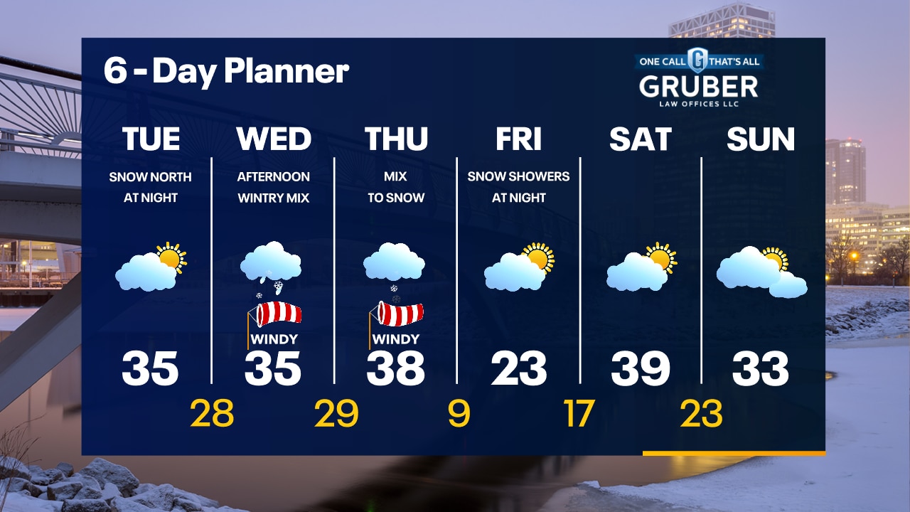
A light rain/snow shower possible this evening as the wind picks up. Partly sunny on Tuesday with light snow at night. An icy mess is likely on Wednesday.
A light rain/snow shower possible this evening as the wind picks up. Partly sunny on Tuesday with light snow at night. An icy mess is likely on Wednesday.
Weather Webcast with Meteorologist Stephanie Barichello
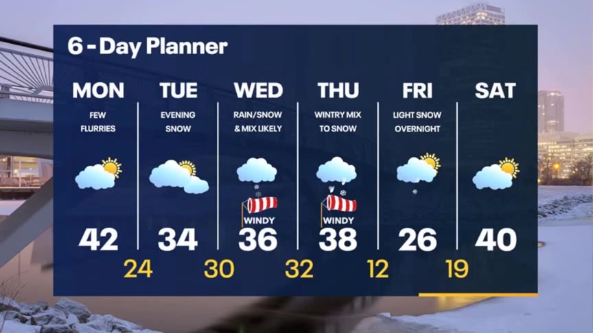
Quiet today and tomorrow, then snow returns Tuesday night into Wednesday. After a brief dry break, a mix of snow/sleet/freezing rain moves back in midday Wednesday and lasts through Thursday night. It'll be a messy couple of days.
Quiet today and tomorrow, then snow returns Tuesday night into Wednesday. After a brief dry break, a mix of snow/sleet/freezing rain moves back in midday Wednesday and lasts through Thursday night. It'll be a messy couple of days.
Weather webcast with Rob Haswell
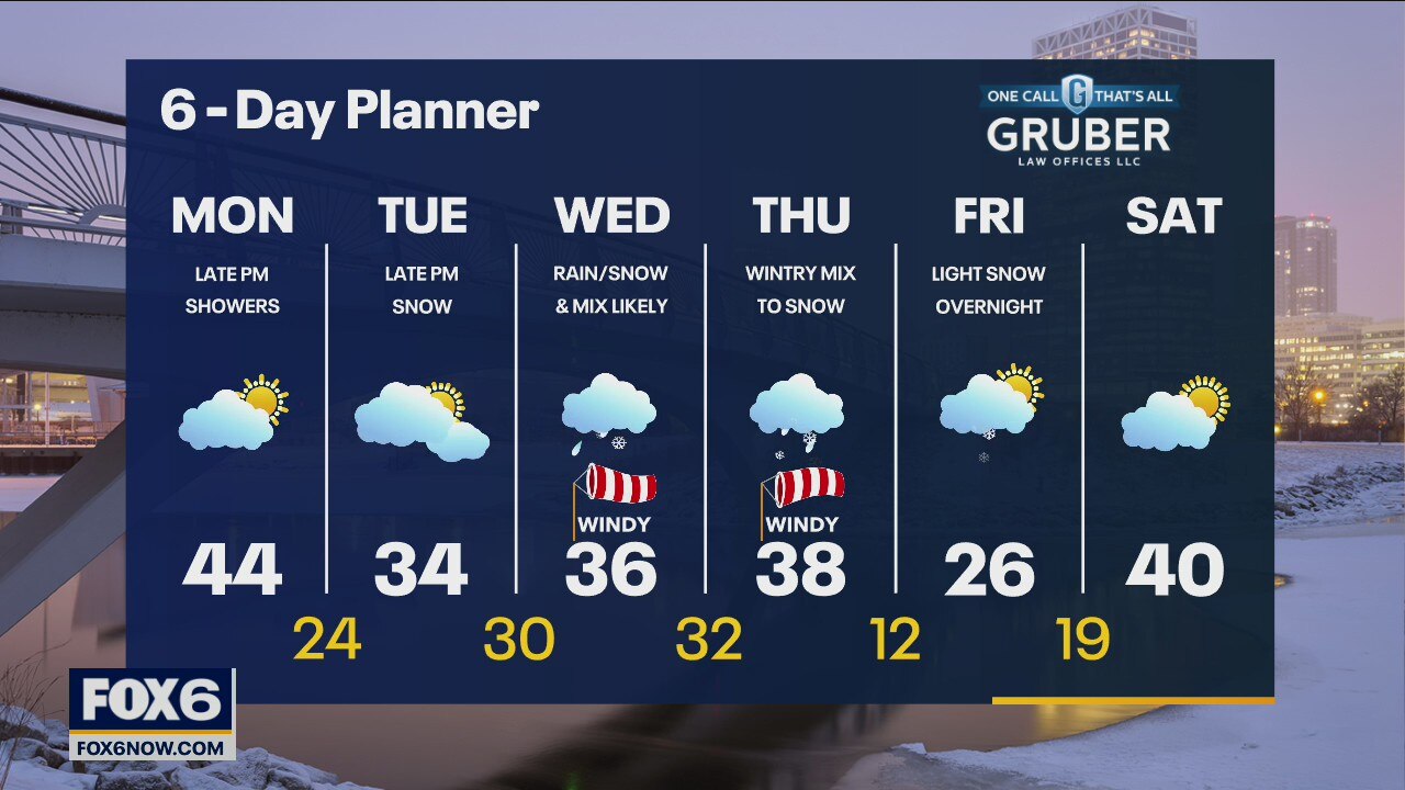
A low moves through today and we warm into the low to mid 40s today ahead of that system but cool overnight with the passing cold front. There is a slight chance for a few showers this evening and overnight - possibly becoming snow showers as we cool. Another low arrives later Tuesday with a round of light snow late in the day and overnight. Yet another system keeps our more active patter going for Wednesday and Thursday with rain, snow and a wintry mix of freezing rain and sleet.
A low moves through today and we warm into the low to mid 40s today ahead of that system but cool overnight with the passing cold front. There is a slight chance for a few showers this evening and overnight - possibly becoming snow showers as we cool. Another low arrives later Tuesday with a round of light snow late in the day and overnight. Yet another system keeps our more active patter going for Wednesday and Thursday with rain, snow and a wintry mix of freezing rain and sleet.
Weather Webcast with Tom Wachs
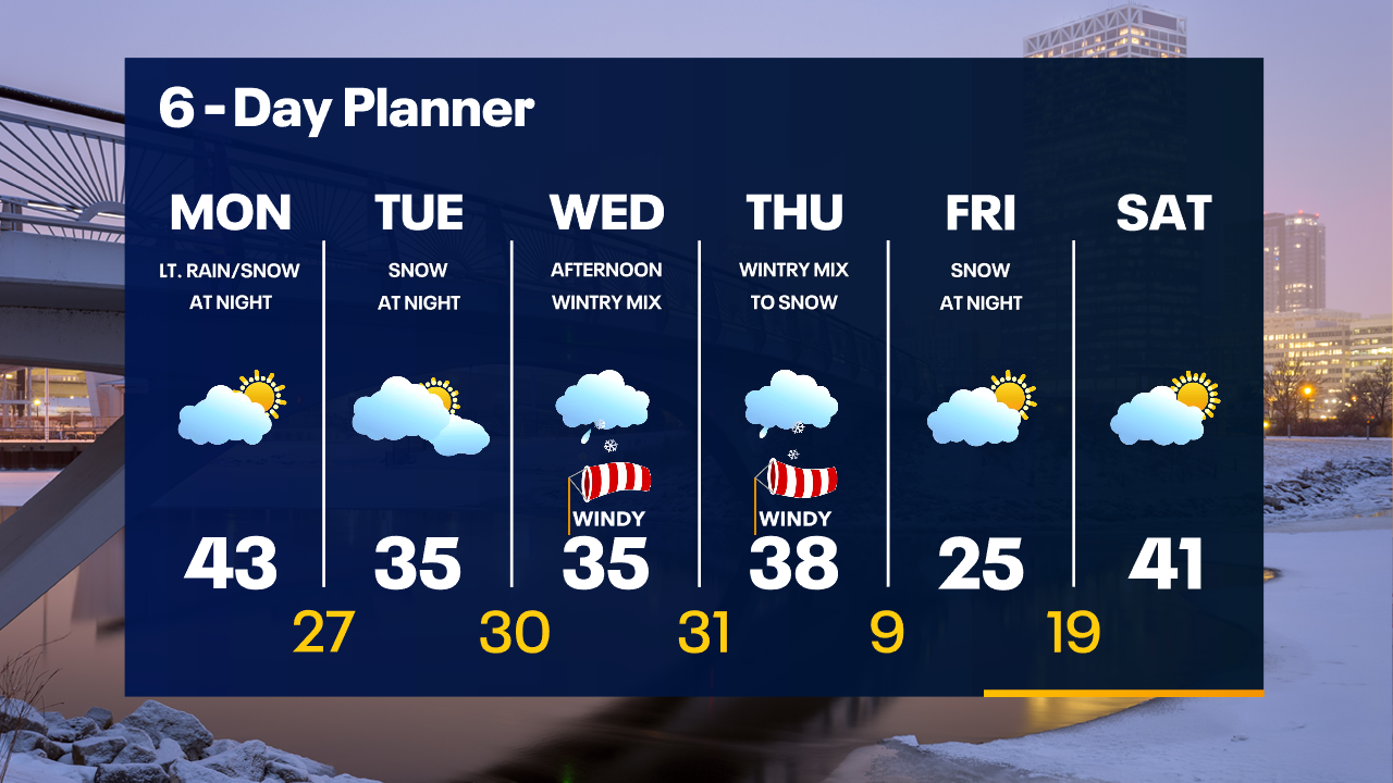
Partly to mostly cloudy on Monday with highs in the 40s. A few light rain/snow showers are possible Monday night. A Winter Storm moves in mid-week with a mix of freezing rain, sleet and snow.
Partly to mostly cloudy on Monday with highs in the 40s. A few light rain/snow showers are possible Monday night. A Winter Storm moves in mid-week with a mix of freezing rain, sleet and snow.
Weather Webcast with Tom Wachs
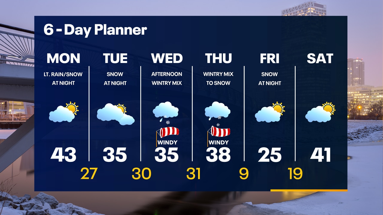
A few clouds tonight with temperatures falling through the 30s. Mild on Monday before a winter storm of freezing rain, sleet and snow moves in mid-week.
A few clouds tonight with temperatures falling through the 30s. Mild on Monday before a winter storm of freezing rain, sleet and snow moves in mid-week.
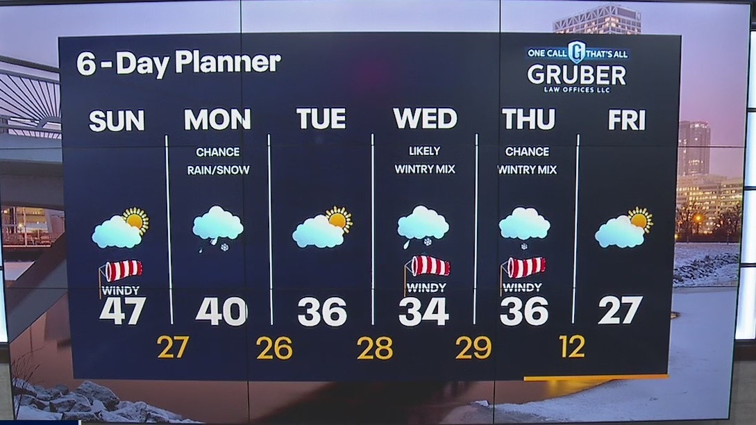
Weather Webcast with Meteorologist Lisa Michaels
A warm front that lifted north of SE Wisconsin will drive temperatures into the low to upper 40s area wide today. A clipper system moves on Monday brining an increase of cloud cover and the chance of rain and snow. Little impacts expected.
A warm front that lifted north of SE Wisconsin will drive temperatures into the low to upper 40s area wide today. A clipper system moves on Monday brining an increase of cloud cover and the chance of rain and snow. Little impacts expected.
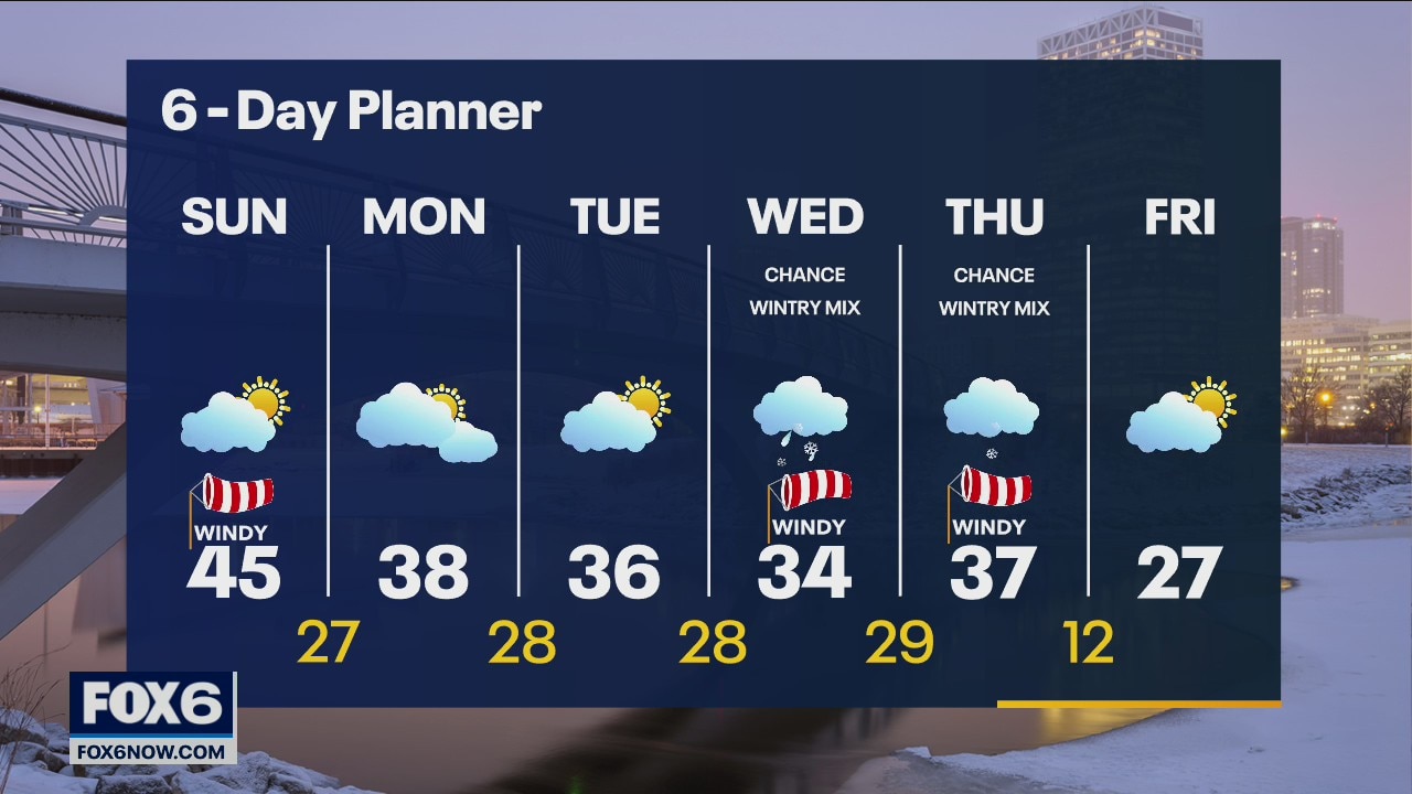
Weather Webcast with Meteorologist Eric Manges
Enjoy Sunday because the rest of the week doesn't look so great
Enjoy Sunday because the rest of the week doesn't look so great

Weather Webcast with Meteorologist Eric Manges
Mild weather continues then a brief chance of precip Monday but mostly north then widespread sleet possible Wednesday and Thursday
Mild weather continues then a brief chance of precip Monday but mostly north then widespread sleet possible Wednesday and Thursday
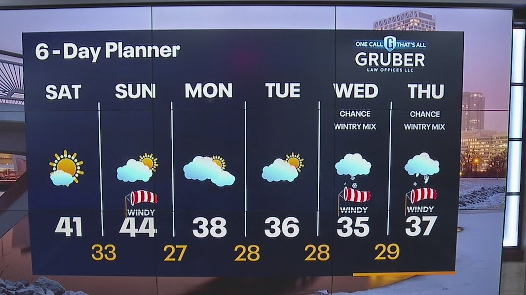
Weather Webcast with Meteorologist Lisa Michaels
Mostly sunny skies starting off the weekend. Mild temperatures in the 40s over the next few days. Cooler temperatures return in the 30s next week. A clipper system could bring some light snow showers Monday night into early Tuesday.
Mostly sunny skies starting off the weekend. Mild temperatures in the 40s over the next few days. Cooler temperatures return in the 30s next week. A clipper system could bring some light snow showers Monday night into early Tuesday.

Weather Webcast with Meteorologist Eric Manges
Warmer for the weekend but then another messy system possible mid next week
Warmer for the weekend but then another messy system possible mid next week
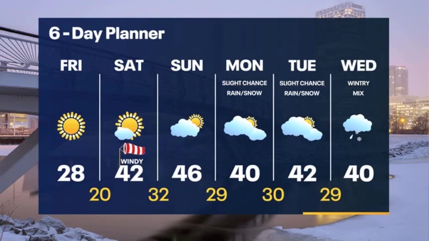
Weather Webcast with Meteorologist Stephanie Barichello
Sunny and chilly today then more clouds this weekend, but 40s return. Wintry mix returns at times next week.
Sunny and chilly today then more clouds this weekend, but 40s return. Wintry mix returns at times next week.
Weather webcast with Rob Haswell
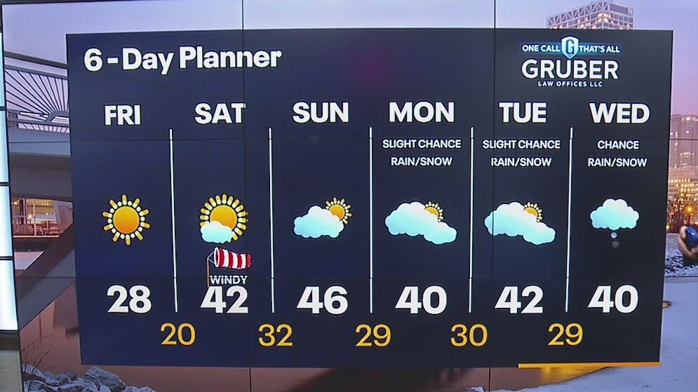
A ridge of high pressure builds over the region today and through the weekend. We will be sunny but chilly today with highs in the upper 20s. The wind shifts to the southwest tomorrow to warm us into the 40s for the weekend. We can expect a few more clouds later this weekend but should stay dry both Saturday and Sunday. A few chance for very light rain and snow showers come next week.
A ridge of high pressure builds over the region today and through the weekend. We will be sunny but chilly today with highs in the upper 20s. The wind shifts to the southwest tomorrow to warm us into the 40s for the weekend. We can expect a few more clouds later this weekend but should stay dry both Saturday and Sunday. A few chance for very light rain and snow showers come next week.

Weather Webcast with Tom Wachs
Snow tapering off overnight but staying windy. Temperatures dropping into the teens. Mostly sunny on Friday with highs in the upper 20s.
Snow tapering off overnight but staying windy. Temperatures dropping into the teens. Mostly sunny on Friday with highs in the upper 20s.