

Weather Webcast with Tom Wachs
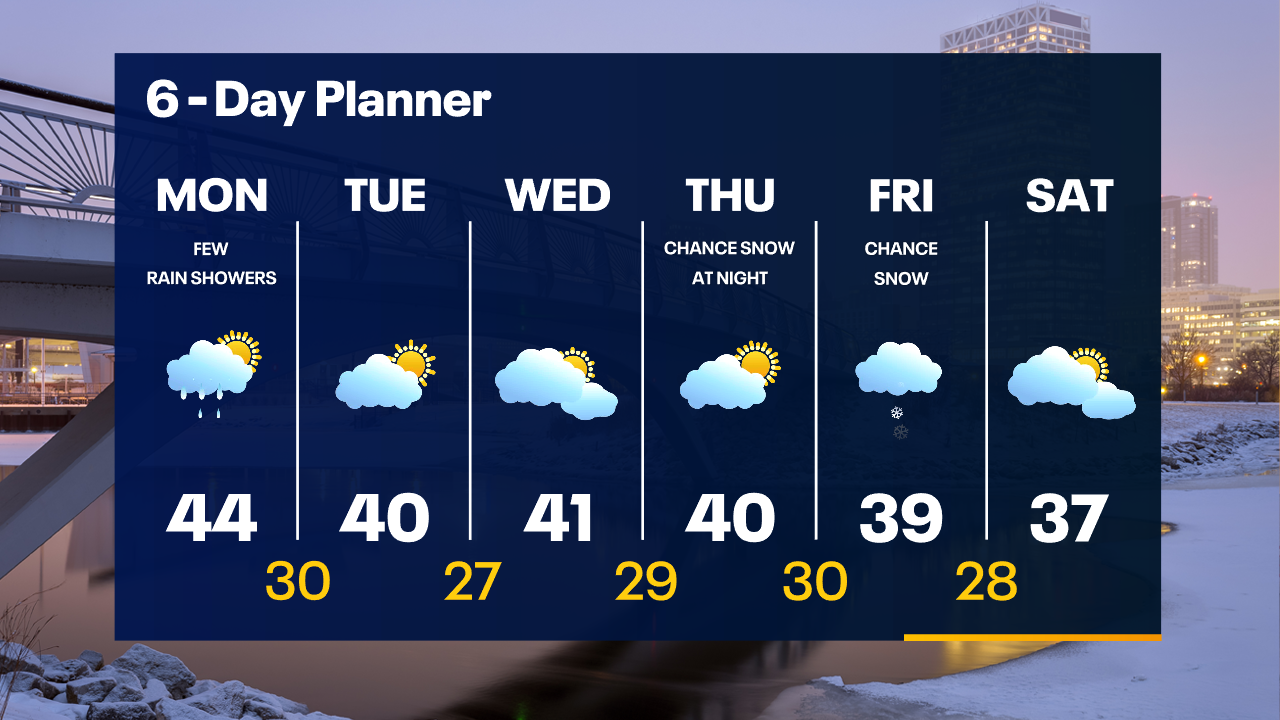
Rain moves in this evening, changing to a mix/snow north of Milwaukee overnight. Heaviest precipitation will be overnight before tapering off around 6am. 1-3" snow possible well north of Milwaukee.
Rain moves in this evening, changing to a mix/snow north of Milwaukee overnight. Heaviest precipitation will be overnight before tapering off around 6am. 1-3" snow possible well north of Milwaukee.
Weather Webcast with Meteorologist Lisa Michaels
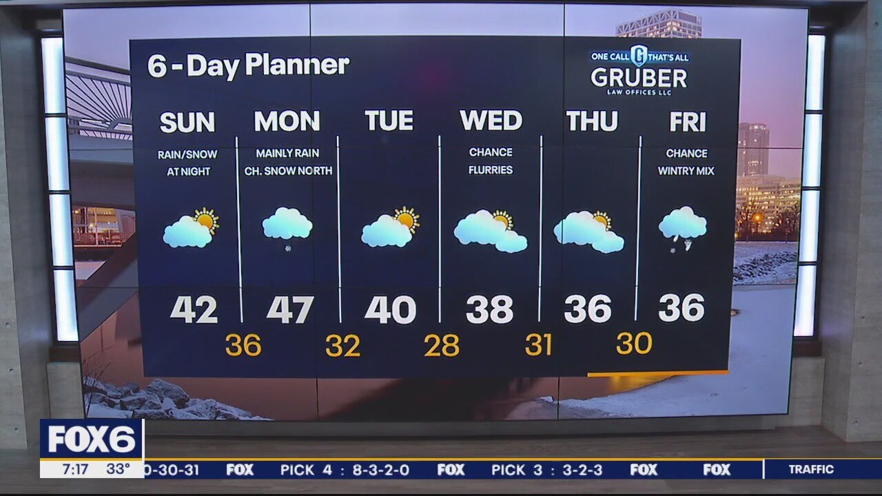
Sunday morning will be frosty again with temperatures in the upper 20s to low 30s. Partly cloudy skies today with slightly cooler high temps near the lake due to easterly winds around an area of high pressure. Rain and snow showers move in Sunday night, changing to primarily rain Monday, although northern counties may stay as snow. Below average temperatures are favorable for portions of next week with highs in the 30s. Another round of rain/snow is likely on Friday.
Sunday morning will be frosty again with temperatures in the upper 20s to low 30s. Partly cloudy skies today with slightly cooler high temps near the lake due to easterly winds around an area of high pressure. Rain and snow showers move in Sunday night, changing to primarily rain Monday, although northern counties may stay as snow. Below average temperatures are favorable for portions of next week with highs in the 30s. Another round of rain/snow is likely on Friday.
Weather Webcast with Meteorologist Stephanie Barichello
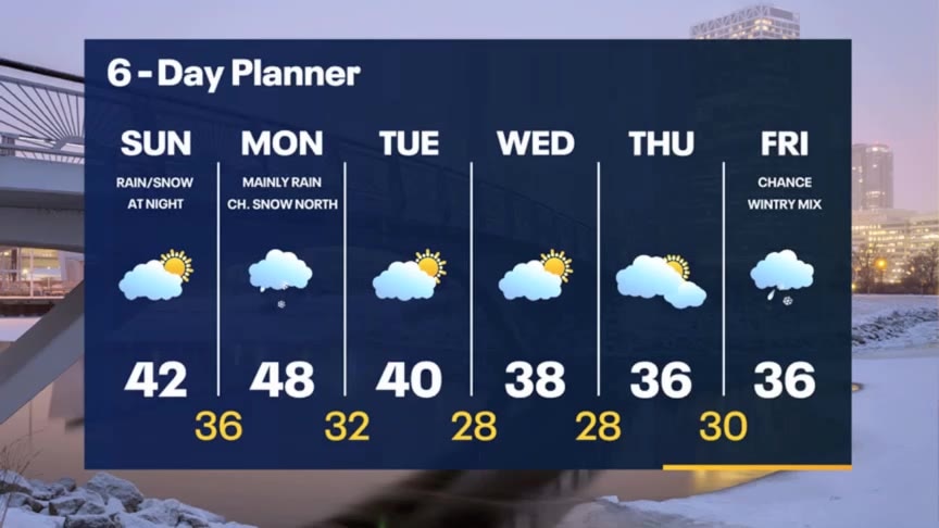
Clouds move back in Sunday and it'll be cooler lakeside. Rain/snow Sunday night then primarily rain Monday. Cooler the rest of next week.
Clouds move back in Sunday and it'll be cooler lakeside. Rain/snow Sunday night then primarily rain Monday. Cooler the rest of next week.
Weather Webcast with Meteorologist Lisa Michaels
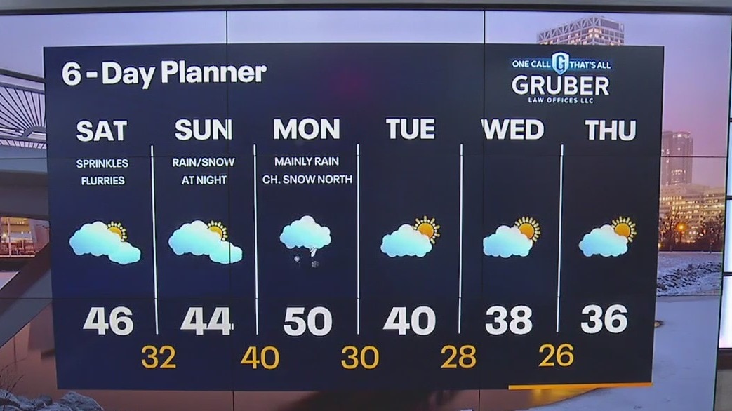
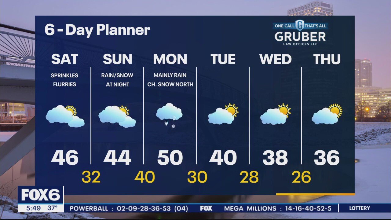
Freezing fog & frosty conditions start Saturday. Brief sunshine before clouds increase through the day. Warmer temperatures by the afternoon. Isolated showers/drizzle with flurries possible north. Dry through most of Sunday, but rain/snow chances increase Sunday night into early Monday. Cooler temperatures welcome the second week of March in the 30s.
Freezing fog & frosty conditions start Saturday. Brief sunshine before clouds increase through the day. Warmer temperatures by the afternoon. Isolated showers/drizzle with flurries possible north. Dry through most of Sunday, but rain/snow chances increase Sunday night into early Monday. Cooler temperatures welcome the second week of March in the 30s.
Weather Webcast with Meteorologist Eric Manges
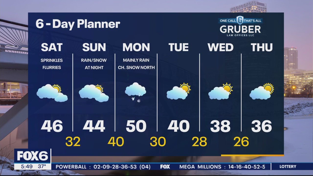
Few spotty rain chances Saturday but overall warmer and cloudy for the weekend.
Few spotty rain chances Saturday but overall warmer and cloudy for the weekend.
Weather Webcast with Meteorologist Eric Manges
FOX6 News at 5 offers the day's news, weather, and sports in southeast Wisconsin, the nation, and the world.
FOX6 News at 5 offers the day's news, weather, and sports in southeast Wisconsin, the nation, and the world.
Weather Webcast with Meteorologist Stephanie Barichello
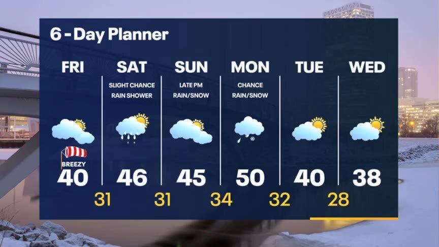
Cloudy and breezy this afternoon, then a chance for sprinkles Saturday afternoon and evening. A more organized system will bring rain and some snow Sunday night into Monday. Expect a few warmer days.
Cloudy and breezy this afternoon, then a chance for sprinkles Saturday afternoon and evening. A more organized system will bring rain and some snow Sunday night into Monday. Expect a few warmer days.

Weather webcast with Rob Haswell
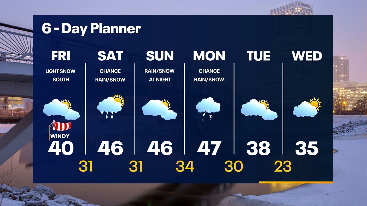
The strong storm low that we were tracking all week long has finally settled into a track that will keep it south of our area. We will be cloudy today with highs near 40. Clouds will break up a bit overnight. The weekend looks mild with highs in the mid to upper 40s. There is a slight chance for a few showers on Saturday and a better chance for rain Sunday night. We stay warm into Monday, but we cool to near seasonal temperatures Tuesday and Wednesday.
The strong storm low that we were tracking all week long has finally settled into a track that will keep it south of our area. We will be cloudy today with highs near 40. Clouds will break up a bit overnight. The weekend looks mild with highs in the mid to upper 40s. There is a slight chance for a few showers on Saturday and a better chance for rain Sunday night. We stay warm into Monday, but we cool to near seasonal temperatures Tuesday and Wednesday.
Weather Webcast with Tom Wachs
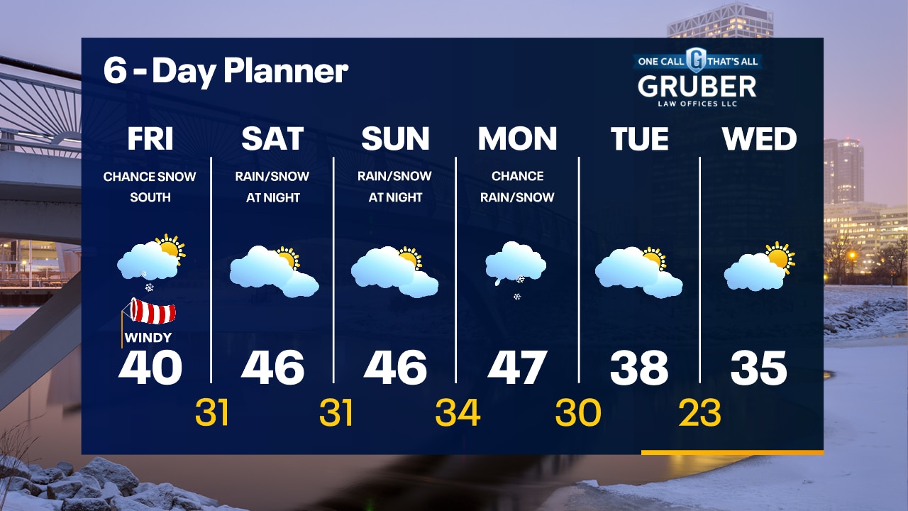
Mostly cloudy overnight with temperatures in the upper 20s to low 30s. Mostly cloudy and windy on Friday with a high around 40. Light snow/mix possible near the Illinois border later in the day.
Mostly cloudy overnight with temperatures in the upper 20s to low 30s. Mostly cloudy and windy on Friday with a high around 40. Light snow/mix possible near the Illinois border later in the day.
Weather Webcast with Tom Wachs
Mostly cloudy tonight with steady temperatures in the upper 20s to low 30s. The bulk of the snow will miss us south on Friday. Only a chance for snow (mixed with rain) mainly near the Illinois border.
Mostly cloudy tonight with steady temperatures in the upper 20s to low 30s. The bulk of the snow will miss us south on Friday. Only a chance for snow (mixed with rain) mainly near the Illinois border.

Weather Webcast with Meteorologist Eric Manges
FOX6 News at 11 offers the day's news, weather, and sports in southeast Wisconsin, the nation, and the world.
FOX6 News at 11 offers the day's news, weather, and sports in southeast Wisconsin, the nation, and the world.
Weather webcast with Rob Haswell
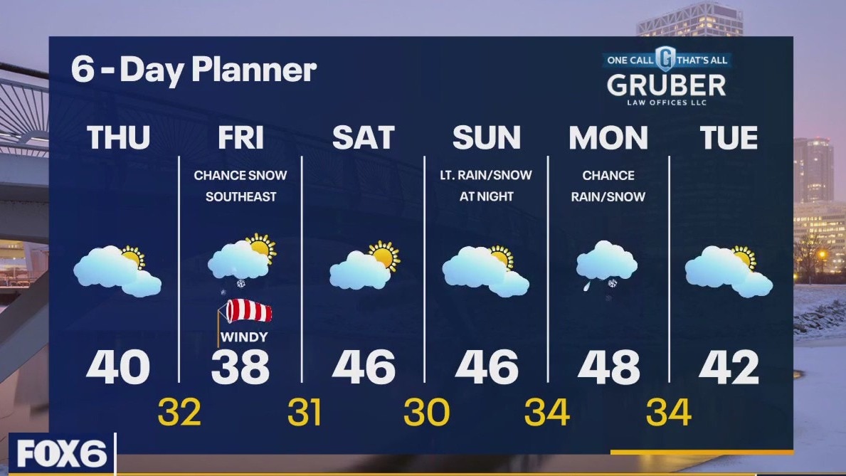
High pressure builds across the area today and will keep us dry but won't be enough to clear our clouds. Highs will be in the upper 30s to low 40s which is above average but noticeably cooler than yesterday. A strong low passes to our southeast on Friday. The track of this storm is still in question but is trending back to the south keeping us at just a slight risk for snow. Our far southeast counties may see accumulating snow from this system with the current track but that track may still change. Stay tuned for updates.
High pressure builds across the area today and will keep us dry but won't be enough to clear our clouds. Highs will be in the upper 30s to low 40s which is above average but noticeably cooler than yesterday. A strong low passes to our southeast on Friday. The track of this storm is still in question but is trending back to the south keeping us at just a slight risk for snow. Our far southeast counties may see accumulating snow from this system with the current track but that track may still change. Stay tuned for updates.
Weather Webcast with Tom Wachs
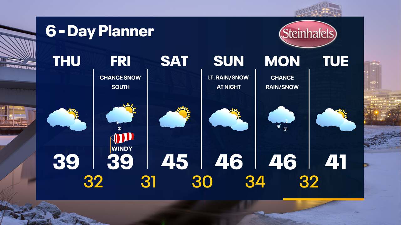
Increasing clouds overnight with sunrise temperatures in the upper 20s to low 30s. Mostly cloudy on Thursday with highs in the upper 30s. Snow is possible on Friday.
Increasing clouds overnight with sunrise temperatures in the upper 20s to low 30s. Mostly cloudy on Thursday with highs in the upper 30s. Snow is possible on Friday.
Weather Webcast with Tom Wachs
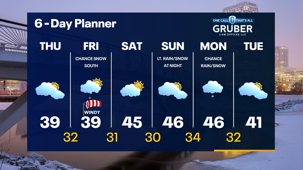
Increasing clouds tonight with temperatures dropping through the 40s and into the 30s. Mostly cloudy & cooler Thursday. Stay tuned for updates on the storm track for Friday's possible snow.
Increasing clouds tonight with temperatures dropping through the 40s and into the 30s. Mostly cloudy & cooler Thursday. Stay tuned for updates on the storm track for Friday's possible snow.
Weather Webcast with Meteorologist Stephanie Barichello
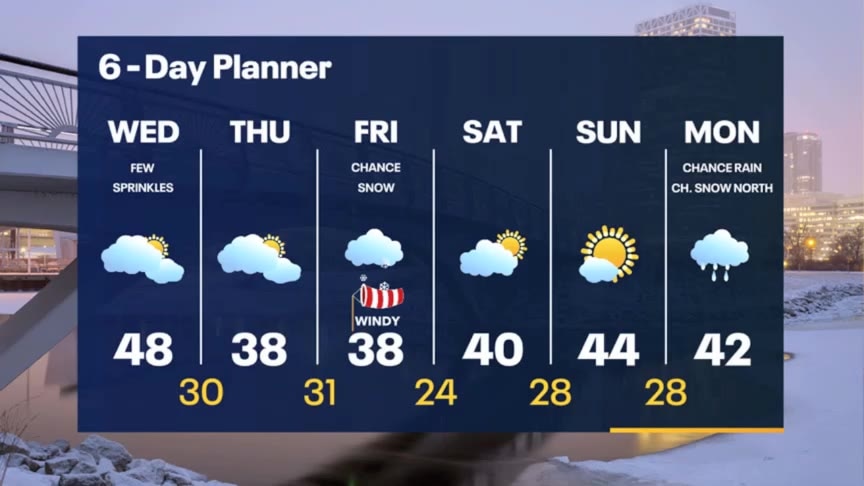
Mostly cloudy and mild today with a few sprinkles north of Milwaukee. Colder tonight and the rest of the week. Chance for snow Friday -- dependent on storm track.
Mostly cloudy and mild today with a few sprinkles north of Milwaukee. Colder tonight and the rest of the week. Chance for snow Friday -- dependent on storm track.
Weather webcast with Rob Haswell
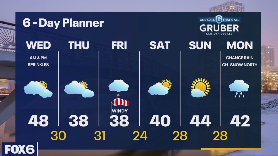
A weak disturbance will generate a few showers this morning before some brief clearing in some areas this afternoon. Highs today will be well above average - into the mid to upper 40s. A more substantial low passes to our north later today and tonight and may bring a few isolated showers to our area this afternoon and evening. Our next chance for significant precipitation comes Friday. There is a great deal of uncertainty regarding the track of this low. Stay tuned for updates.
A weak disturbance will generate a few showers this morning before some brief clearing in some areas this afternoon. Highs today will be well above average - into the mid to upper 40s. A more substantial low passes to our north later today and tonight and may bring a few isolated showers to our area this afternoon and evening. Our next chance for significant precipitation comes Friday. There is a great deal of uncertainty regarding the track of this low. Stay tuned for updates.
Weather Webcast with Tom Wachs
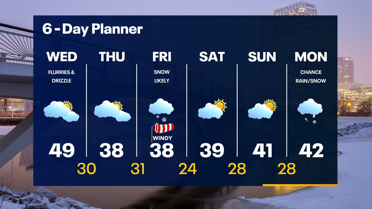
Light rain/snow will taper off before sunrise. Temperatures in the 30s. Mostly cloudy and mild for the first day of March. Highs in the upper 40s.
Light rain/snow will taper off before sunrise. Temperatures in the 30s. Mostly cloudy and mild for the first day of March. Highs in the upper 40s.
Weather Webcast with Tom Wachs
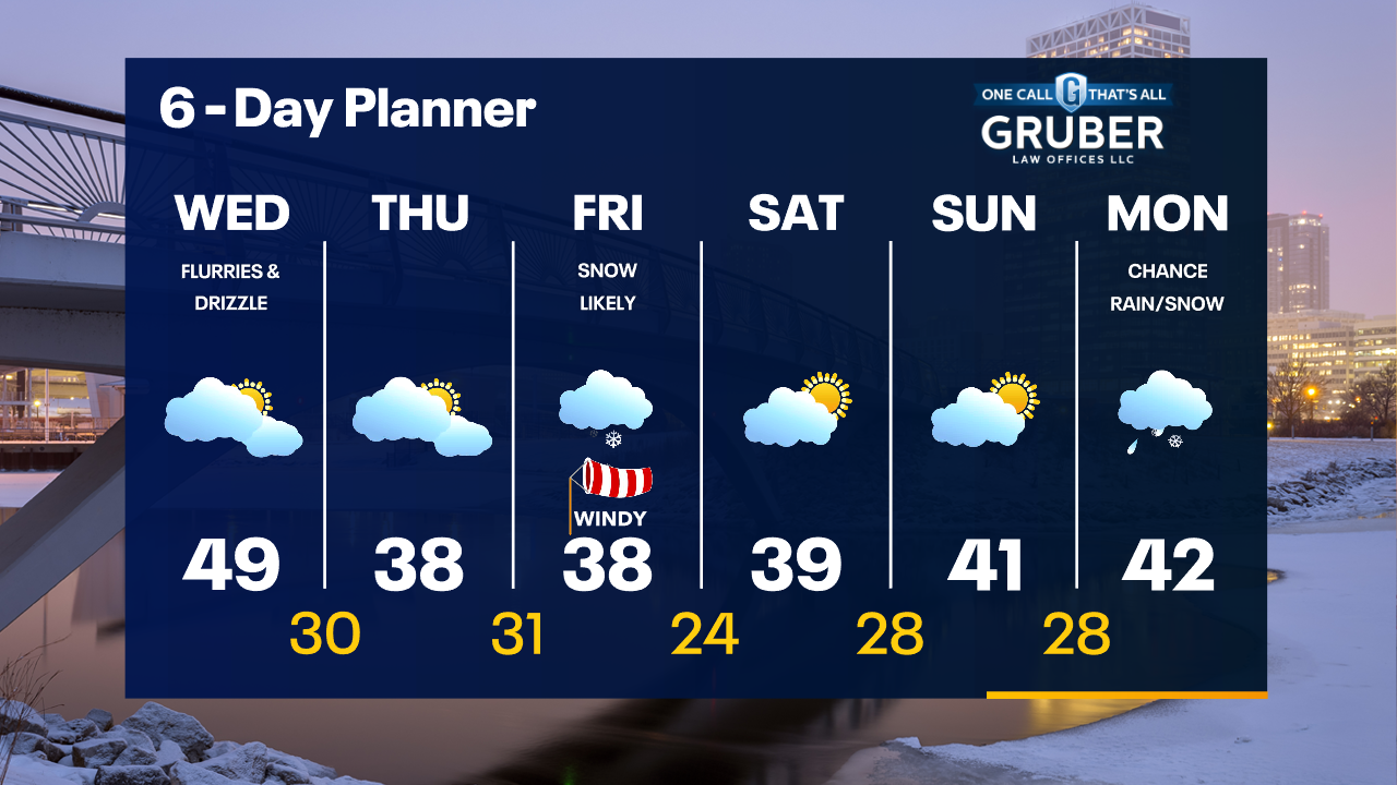
Light rain/snow will move through tonight and move out before sunrise. Mostly cloudy and mild on Wednesday with highs near 50.
Light rain/snow will move through tonight and move out before sunrise. Mostly cloudy and mild on Wednesday with highs near 50.
Weather Webcast with Meteorologist Stephanie Barichello
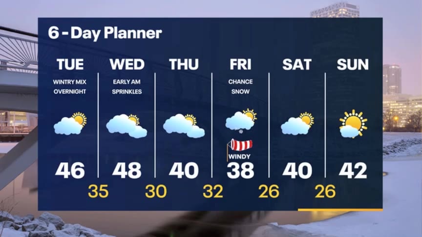
Clouds return later today and there is a chance for wintry mix overnight tonight. Flurries or sprinkles still possible at times Wednesday otherwise another round of snow is possible by Friday.
Clouds return later today and there is a chance for wintry mix overnight tonight. Flurries or sprinkles still possible at times Wednesday otherwise another round of snow is possible by Friday.

Weather webcast with Rob Haswell
High pressure builds across our area today giving us a day to dry up with a few mid-day sunny breaks. A disturbance moves over us tonight with a chance for rain and snow showers and the possibility of a wintry mix including freezing rain. This should be very light. Temperatures remain mild today and tomorrow with highs in the mid 40s today (although cooler to the north) and mid to upper 40s tomorrow. Friday is looking better for snow as a low to our southeast is trending farther to the north. Stay tuned for updates.
High pressure builds across our area today giving us a day to dry up with a few mid-day sunny breaks. A disturbance moves over us tonight with a chance for rain and snow showers and the possibility of a wintry mix including freezing rain. This should be very light. Temperatures remain mild today and tomorrow with highs in the mid 40s today (although cooler to the north) and mid to upper 40s tomorrow. Friday is looking better for snow as a low to our southeast is trending farther to the north. Stay tuned for updates.