


Weather Webcast with Meteorologist Eric Manges
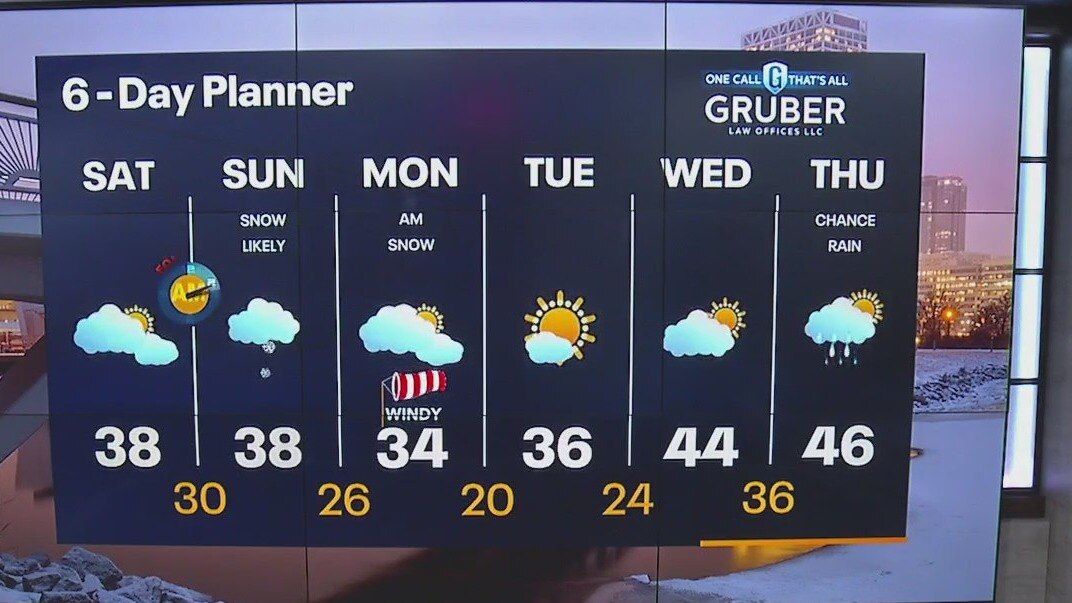
Snow moves in tonight and continues Sunday, 1-3" possible for most.
Snow moves in tonight and continues Sunday, 1-3" possible for most.
Weather Webcast with Meteorologist Eric Manges
Mostly cloudy throughout the day then snow moves in overnight and continues through Sunday. For a majority of southeast Wisconsin, this is looking like 1-3" of snow with higher totals for areas north. Windy Monday but finally some clearing skies in Tuesday.
Mostly cloudy throughout the day then snow moves in overnight and continues through Sunday. For a majority of southeast Wisconsin, this is looking like 1-3" of snow with higher totals for areas north. Windy Monday but finally some clearing skies in Tuesday.
Weather Webcast with Meteorologist Eric Manges
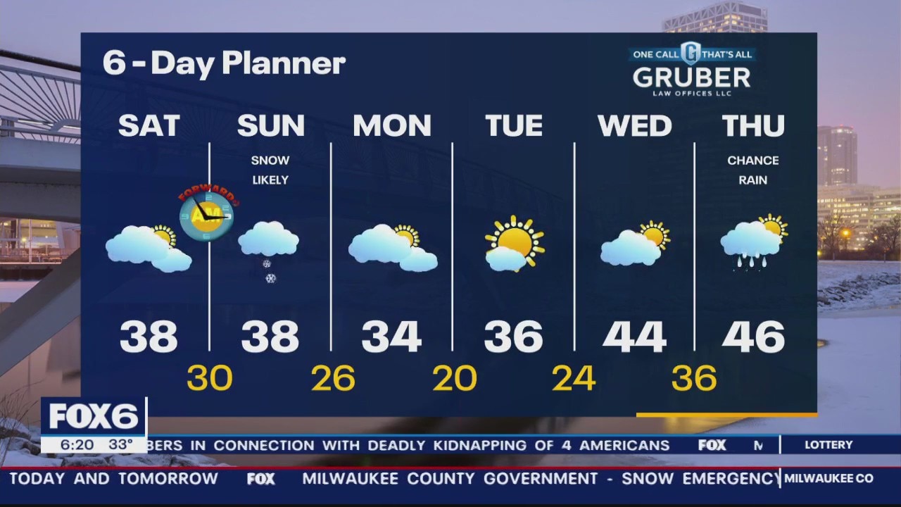
Biggest snow in 5 years for Milwaukee and a little more on the way Sunday
Biggest snow in 5 years for Milwaukee and a little more on the way Sunday
Weather Webcast with Meteorologist Stephanie Barichello
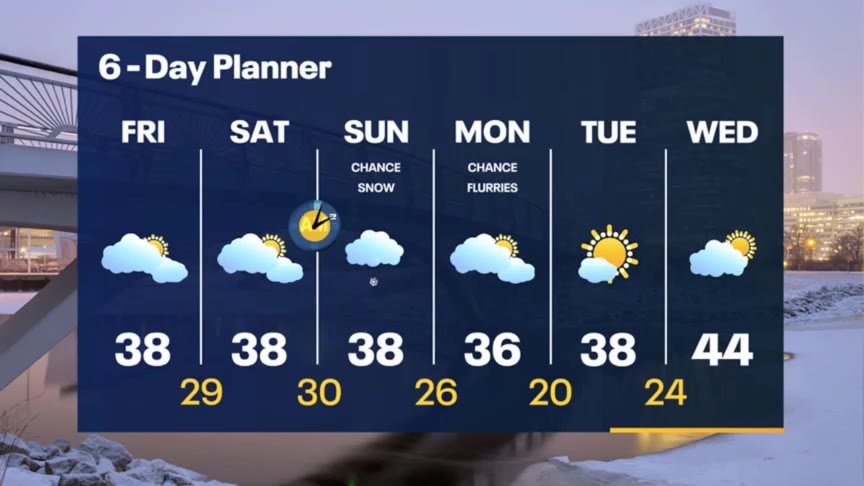
Much better this afternoon with temperatures in the mid to upper 30s, allowing for some melting. Refreeze is possible tonight as temperatures drop into the 20s then there is another round of snow on the way Sunday.
Much better this afternoon with temperatures in the mid to upper 30s, allowing for some melting. Refreeze is possible tonight as temperatures drop into the 20s then there is another round of snow on the way Sunday.

FOX6 WakeUp News at 4 (winter storm coverage)
Winter Weather Advisory and Winter Storm Warning end today at 10am. Waking up to several inches of snow and we can expect another 1-3" before the last flake falls. Highs today will be in the mid to upper 30s and we should stay in that range through the weekend. Saturday will be a calmer day but light snow returns to the area on Sunday.
Winter Weather Advisory and Winter Storm Warning end today at 10am. Waking up to several inches of snow and we can expect another 1-3" before the last flake falls. Highs today will be in the mid to upper 30s and we should stay in that range through the weekend. Saturday will be a calmer day but light snow returns to the area on Sunday.
Weather Webcast with Meteorologist Eric Manges
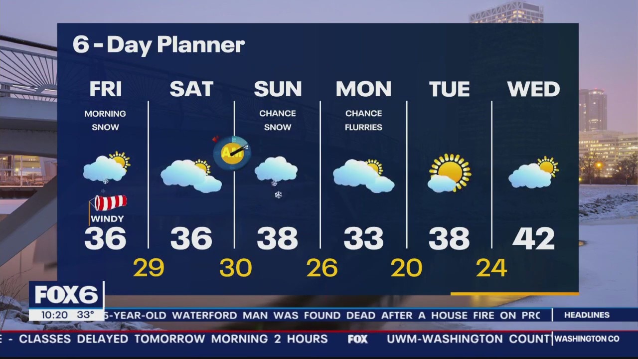
Heavy snow through tonight giving much of the area 5-9"
Heavy snow through tonight giving much of the area 5-9"
Weather Webcast with Meteorologist Stephanie Barichello
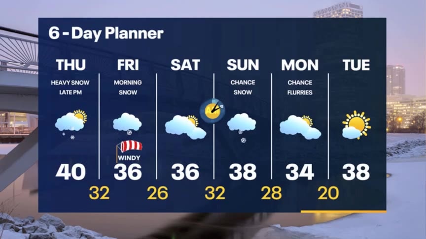
Snow arrives later this afternoon and evening and continues through midday Friday. 4-6" possible inland with 6-8" lakeside, IF there's lake enhancement. Plan on slow Friday morning commute.
Snow arrives later this afternoon and evening and continues through midday Friday. 4-6" possible inland with 6-8" lakeside, IF there's lake enhancement. Plan on slow Friday morning commute.
Weather webcast with Rob Haswell
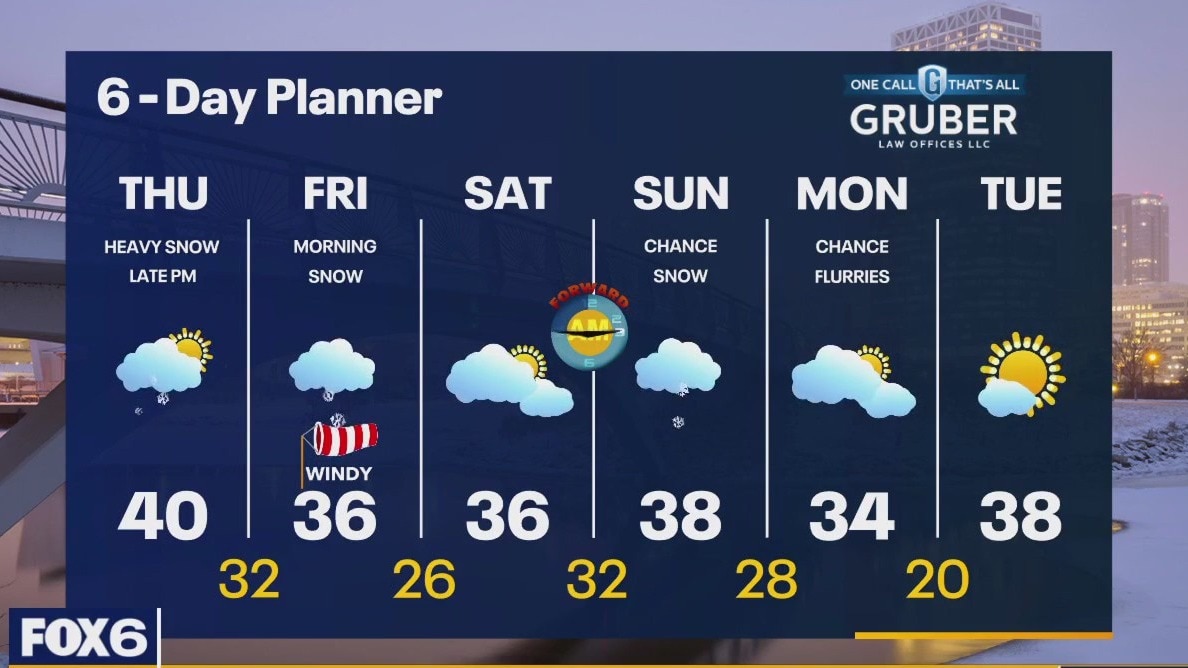
Winter Weather Advisory and Winter Storm Warning from 6pm Thursday to early Friday for all of our viewing area. Snow will start in the afternoon and evening and continue into the midday on Friday. Most areas will see around 4-6" worth of snow with some areas nearest to Lake Michigan in a 5-9" range. We start cloudy and mild buy only warm slightly to a high near 40. We cool into the mid to upper 30s Friday and through the weekend.
Winter Weather Advisory and Winter Storm Warning from 6pm Thursday to early Friday for all of our viewing area. Snow will start in the afternoon and evening and continue into the midday on Friday. Most areas will see around 4-6" worth of snow with some areas nearest to Lake Michigan in a 5-9" range. We start cloudy and mild buy only warm slightly to a high near 40. We cool into the mid to upper 30s Friday and through the weekend.

Weather Webcast with Tom Wachs
Winter Weather Advisory Thursday Night. Snow moves in late Thursday afternoon and really picks up Thursday night into Friday morning. 4-8" expected.
Winter Weather Advisory Thursday Night. Snow moves in late Thursday afternoon and really picks up Thursday night into Friday morning. 4-8" expected.
Weather Webcast with Tom Wachs
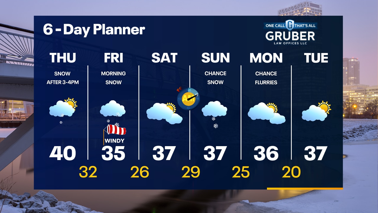
Increasing clouds tonight with temperatures in the 30s. Snow moves in late in the day into the evening Thursday. It will really pick up Thursday night into Friday morning. 4-8" expected.
Increasing clouds tonight with temperatures in the 30s. Snow moves in late in the day into the evening Thursday. It will really pick up Thursday night into Friday morning. 4-8" expected.
Weather Webcast with Meteorologist Stephanie Barichello
Quiet today then snow arrives Thursday afternoon, lasting through Friday morning. 4-8" of snowfall possible in most spots. Drying out Saturday then more light snow Sunday.
Quiet today then snow arrives Thursday afternoon, lasting through Friday morning. 4-8" of snowfall possible in most spots. Drying out Saturday then more light snow Sunday.
Weather webcast with Rob Haswell
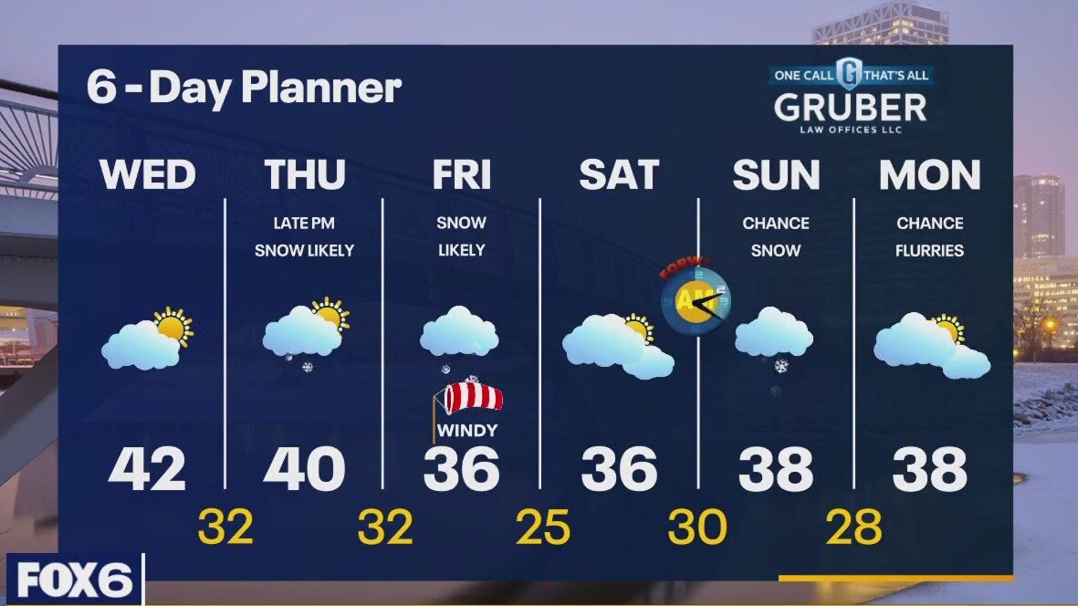
A ridge of high pressure over us today keeps things calm and partly sunny with highs in the low 40s. A low arrives late in the day tomorrow bringing significant snow. A Winter Storm Watch goes into effect at 6pm on Thursday. Several inches of snow are expected across our entire viewing area. Snow should wind down by the early afternoon on Friday.
A ridge of high pressure over us today keeps things calm and partly sunny with highs in the low 40s. A low arrives late in the day tomorrow bringing significant snow. A Winter Storm Watch goes into effect at 6pm on Thursday. Several inches of snow are expected across our entire viewing area. Snow should wind down by the early afternoon on Friday.
Weather Webcast with Tom Wachs
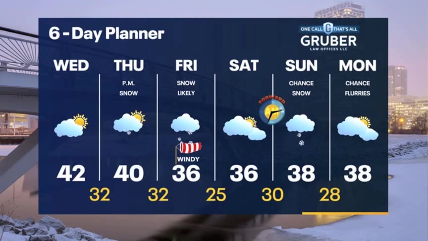
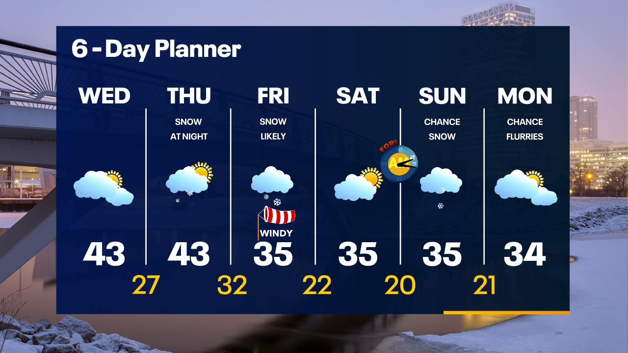
Mostly cloudy on Wednesday with highs in the 40s. A possible winter storm is on the way Thursday afternoon into Friday. Several inches of snow likely.
Mostly cloudy on Wednesday with highs in the 40s. A possible winter storm is on the way Thursday afternoon into Friday. Several inches of snow likely.
Weather Webcast with Tom Wachs
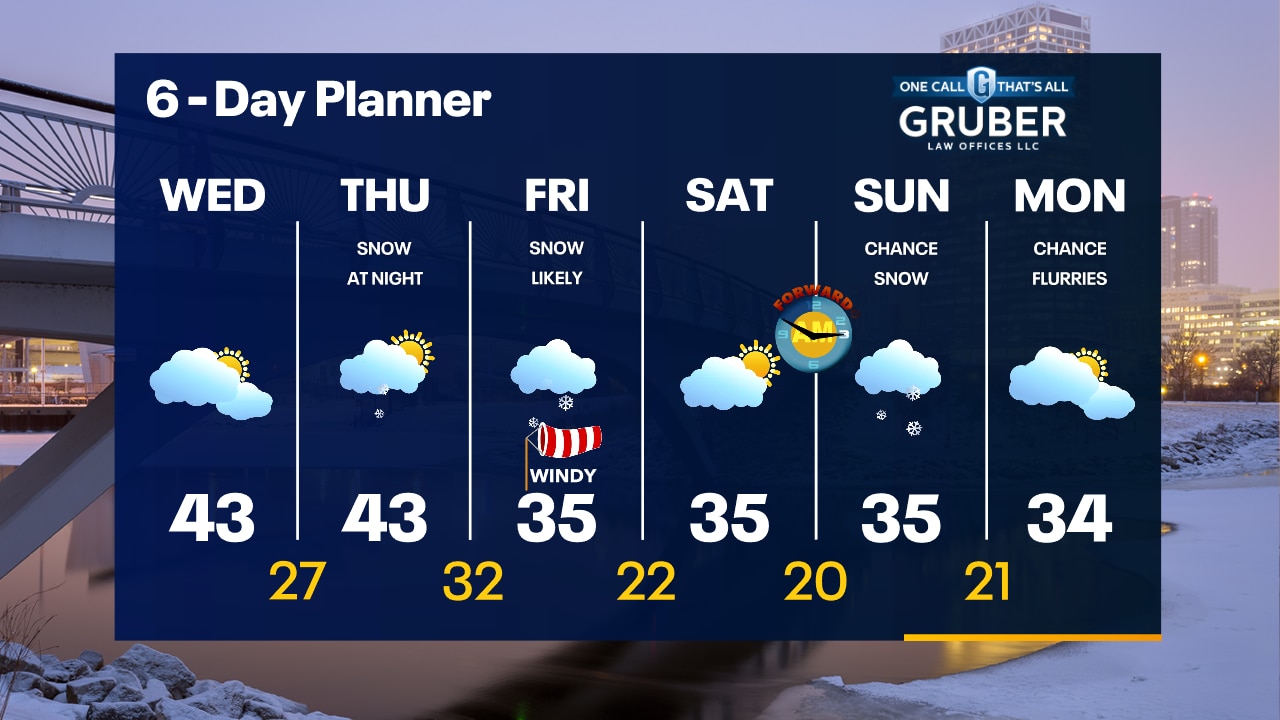
We are tracking a potential winter storm Thursday night into Friday with snow and wind. Several inches of snow likely.
We are tracking a potential winter storm Thursday night into Friday with snow and wind. Several inches of snow likely.
Weather webcast with Rob Haswell
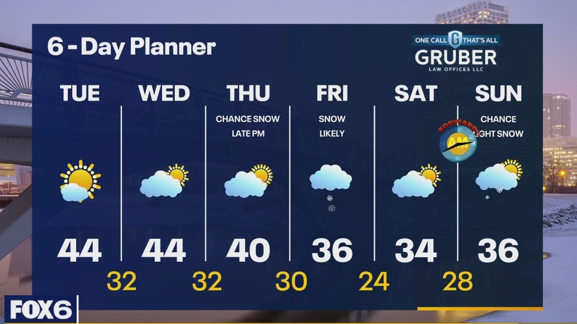
High pressure builds across our area today helping to clear our sky and keep us dry today through late Thursday. Highs today will be in the low to mid 40 and near that again tomorrow. We should still be near 40 Thursday before cooling later this week. A strong low arrives late Thursday and into Friday. While it is early, it is likely we will see a few inches of snow from this low. We should calm down and cool down for this weekend but there is a chance for light snow late Saturday into Sunday.
High pressure builds across our area today helping to clear our sky and keep us dry today through late Thursday. Highs today will be in the low to mid 40 and near that again tomorrow. We should still be near 40 Thursday before cooling later this week. A strong low arrives late Thursday and into Friday. While it is early, it is likely we will see a few inches of snow from this low. We should calm down and cool down for this weekend but there is a chance for light snow late Saturday into Sunday.
Weather Webcast with Tom Wachs
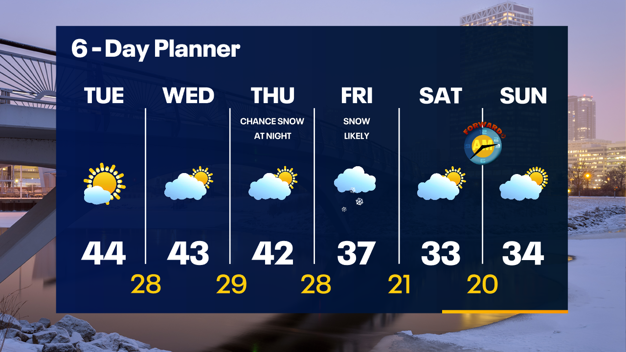
Patchy drizzle/flurries overnight. Temperatures in the upper 20s to low 30s by sunrise. Mostly sunny on Tuesday with highs in the low-to-mid 40s.
Patchy drizzle/flurries overnight. Temperatures in the upper 20s to low 30s by sunrise. Mostly sunny on Tuesday with highs in the low-to-mid 40s.
Weather Webcast with Tom Wachs
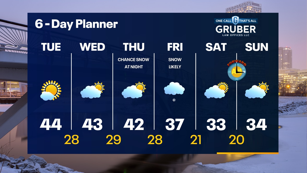
Light rain/snow this evening with temperatures in the 30s. The sun returns on Tuesday with highs in the 40s.
Light rain/snow this evening with temperatures in the 30s. The sun returns on Tuesday with highs in the 40s.
Weather Webcast with Meteorologist Stephanie Barichello
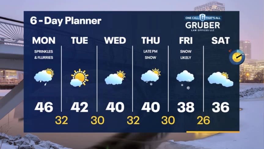
A few more sprinkles or flurries possible this evening then drying out overnight with sunshine returning Tuesday. Cooling a little each day the rest of the week. A chance for snow returns on Friday.
A few more sprinkles or flurries possible this evening then drying out overnight with sunshine returning Tuesday. Cooling a little each day the rest of the week. A chance for snow returns on Friday.
Weather webcast with Rob Haswell
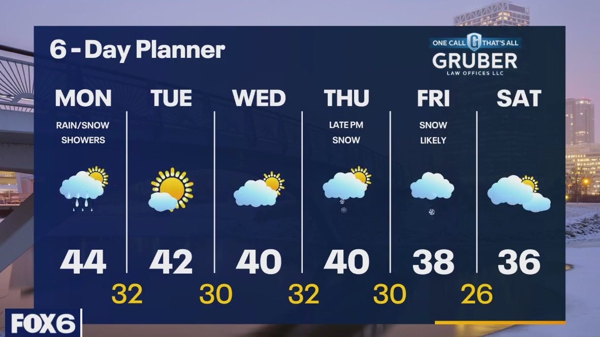
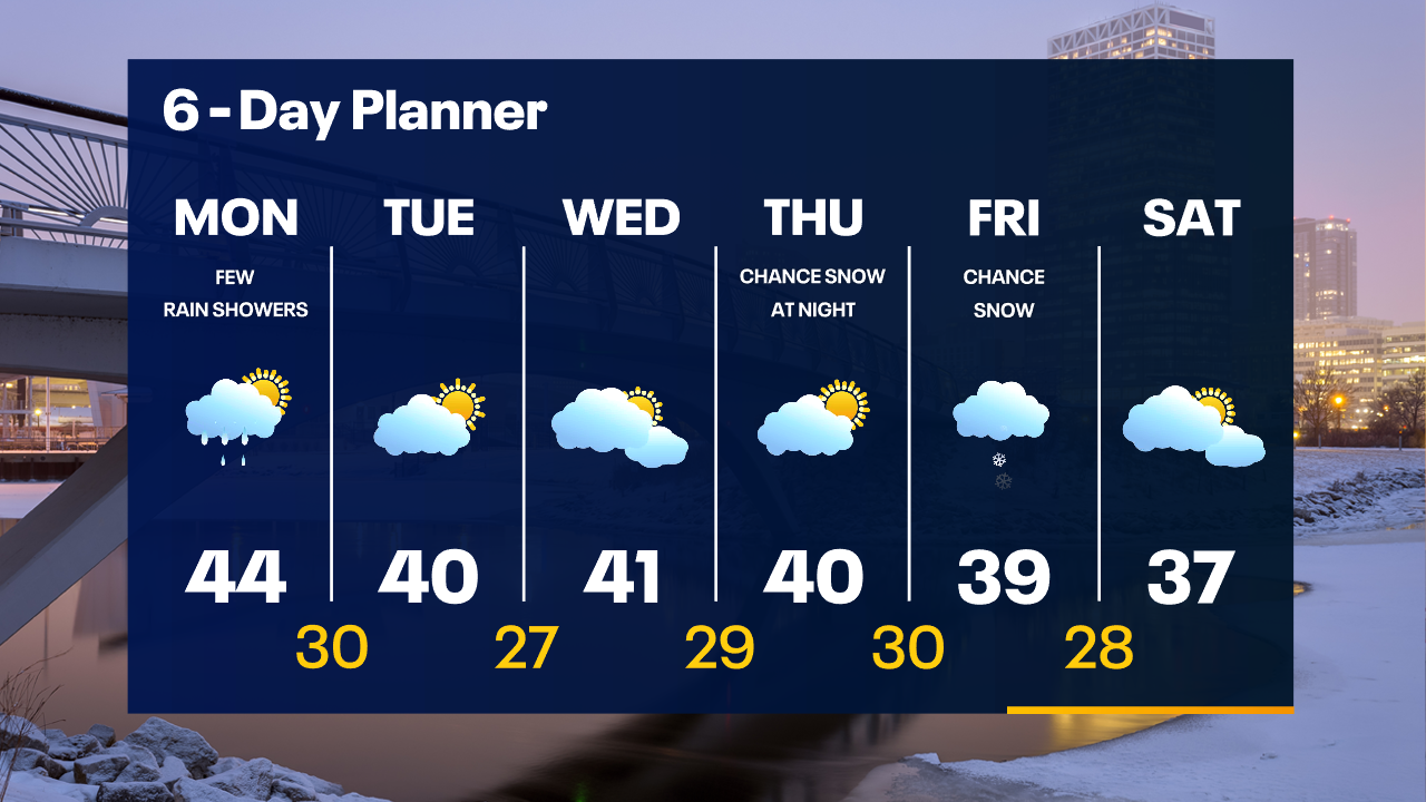
A low passes to our east today with a few more showers or snow showers possible this afternoon. Some areas may only see drizzle. Highs today will reach the low to mid 40s. We stay dry Tuesday and Wednesday as high pressure builds over the region. Temperatures will stay in the low 40s for highs and upper 20s and low 30s for lows. A stronger low arrives late Thursday into Friday with snow likely. Some light to moderate accumulations are possible.
A low passes to our east today with a few more showers or snow showers possible this afternoon. Some areas may only see drizzle. Highs today will reach the low to mid 40s. We stay dry Tuesday and Wednesday as high pressure builds over the region. Temperatures will stay in the low 40s for highs and upper 20s and low 30s for lows. A stronger low arrives late Thursday into Friday with snow likely. Some light to moderate accumulations are possible.
Weather Webcast with Tom Wachs
Rain and snow overnight...even a few t-storms. 1-3" of slushy snow possible well north of Milwaukee. No issues for the AM commute in Milwaukee as the precipitation ends around 6am.
Rain and snow overnight...even a few t-storms. 1-3" of slushy snow possible well north of Milwaukee. No issues for the AM commute in Milwaukee as the precipitation ends around 6am.