

Milwaukee weather: A stormy week ahead
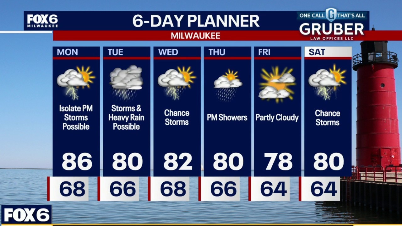
The unsettled pattern hangs around for another couple of days, with scattered showers and storms possible through the week. Another significant storm complex could roll across southern Wisconsin Tuesday morning into the afternoon, bringing heavy downpours and the potential for strong to severe wind gusts.
The unsettled pattern hangs around for another couple of days, with scattered showers and storms possible through the week. Another significant storm complex could roll across southern Wisconsin Tuesday morning into the afternoon, bringing heavy downpours and the potential for strong to severe wind gusts.
Milwaukee weather: A stormy week ahead
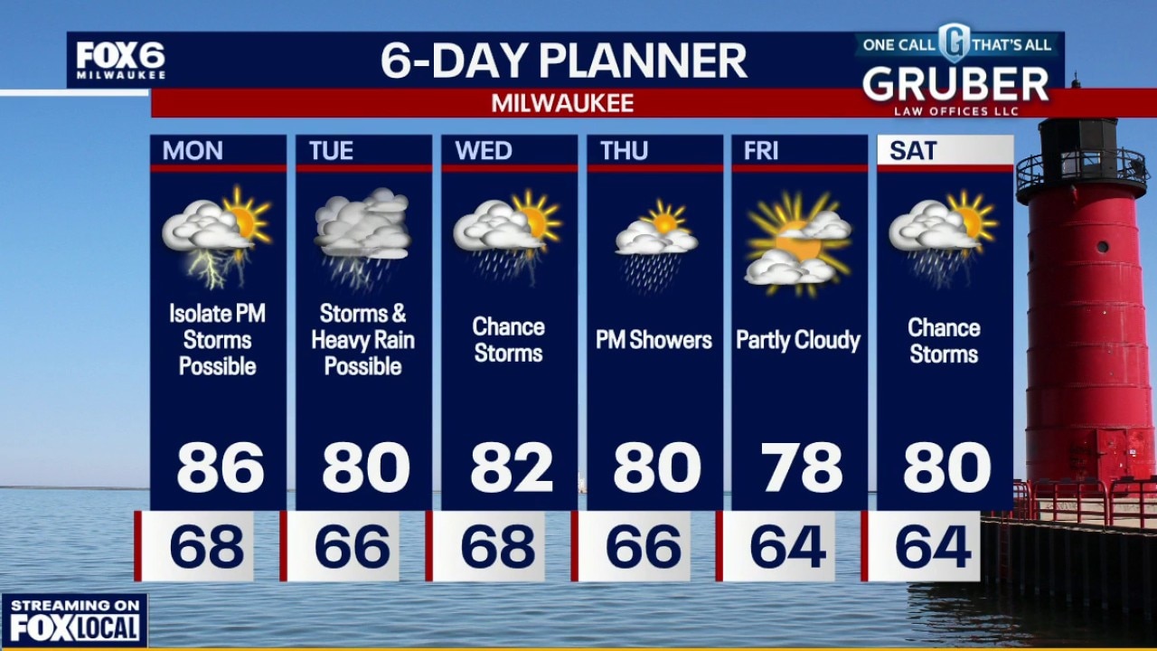
The unsettled pattern hangs around for another couple of days, with scattered showers and storms possible through the week. Another significant storm complex could roll across southern Wisconsin Tuesday morning into the afternoon.
The unsettled pattern hangs around for another couple of days, with scattered showers and storms possible through the week. Another significant storm complex could roll across southern Wisconsin Tuesday morning into the afternoon.
Milwaukee weather: Partly cloudy, storms possible
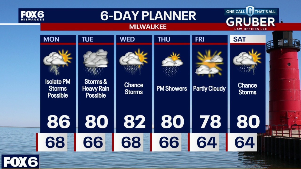
The unsettled pattern hangs around for another couple of days, with scattered showers and storms possible through the week. Another significant storm complex could roll across southern Wisconsin Tuesday morning into the afternoon, bringing heavy downpours and the potential for strong to severe wind gusts
The unsettled pattern hangs around for another couple of days, with scattered showers and storms possible through the week. Another significant storm complex could roll across southern Wisconsin Tuesday morning into the afternoon, bringing heavy downpours and the potential for strong to severe wind gusts
Milwaukee weather: Spotty storms tonight
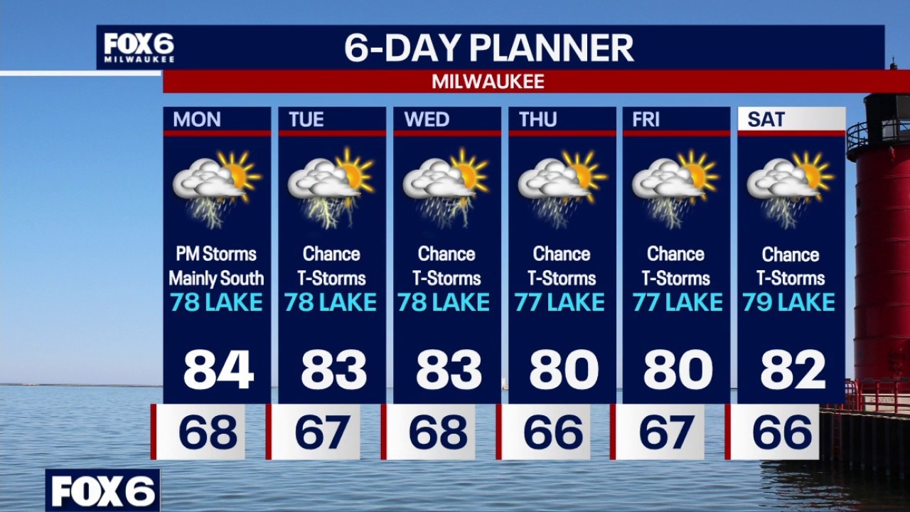
Chance for t-storms tonight, especially late evening and overnight. A few storms could be strong, especially south of Milwaukee. Areas of fog, especially near the lake. Temperatures in the 60s. Humid on Monday with a chance for afternoon/evening t-storms, especially south of Milwaukee. Highs in the mid-80s inland, upper 70s near the lake. We have daily chance for showers and t-storms through Saturday. HOWEVER, it will not be all day washouts and some storms may miss us to the south.
Chance for t-storms tonight, especially late evening and overnight. A few storms could be strong, especially south of Milwaukee. Areas of fog, especially near the lake. Temperatures in the 60s. Humid on Monday with a chance for afternoon/evening t-storms, especially south of Milwaukee. Highs in the mid-80s inland, upper 70s near the lake. We have daily chance for showers and t-storms through Saturday. HOWEVER, it will not be all day washouts and some storms may miss us to the south.
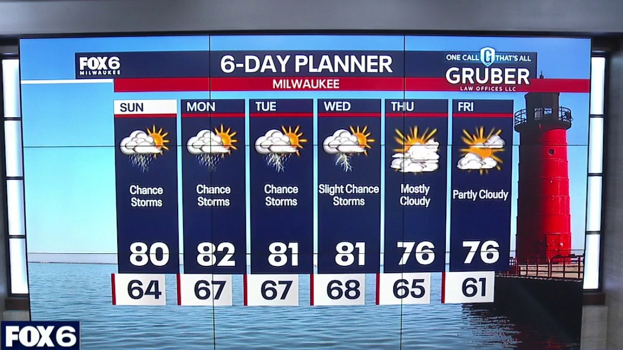
Milwaukee weather: Isolated rain/storm early Sunday
An isolated shower early Sunday morning, otherwise increasing clouds. Strong to severe storms are looking favorable from 10AM-3PM on Sunday. Heavy rain, strong winds, and an isolated tornado are possible.
An isolated shower early Sunday morning, otherwise increasing clouds. Strong to severe storms are looking favorable from 10AM-3PM on Sunday. Heavy rain, strong winds, and an isolated tornado are possible.
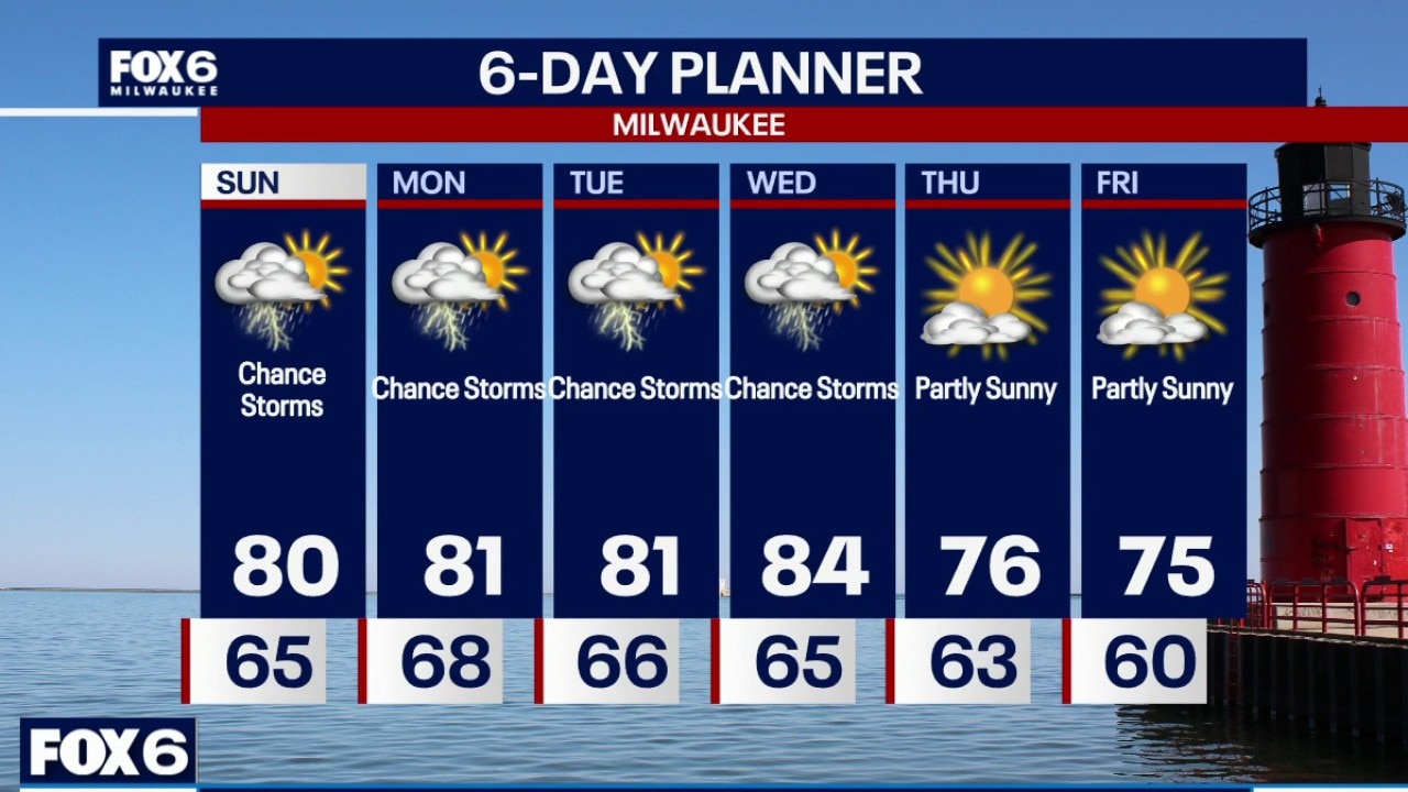
Milwaukee weather: Rain returns to the forecast.
Strong to severe storms return Sunday.
Strong to severe storms return Sunday.
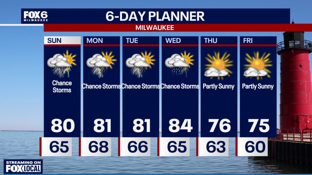
Milwaukee weather: Rain returns to the forecast.
Rain returns to the forecast.
Rain returns to the forecast.
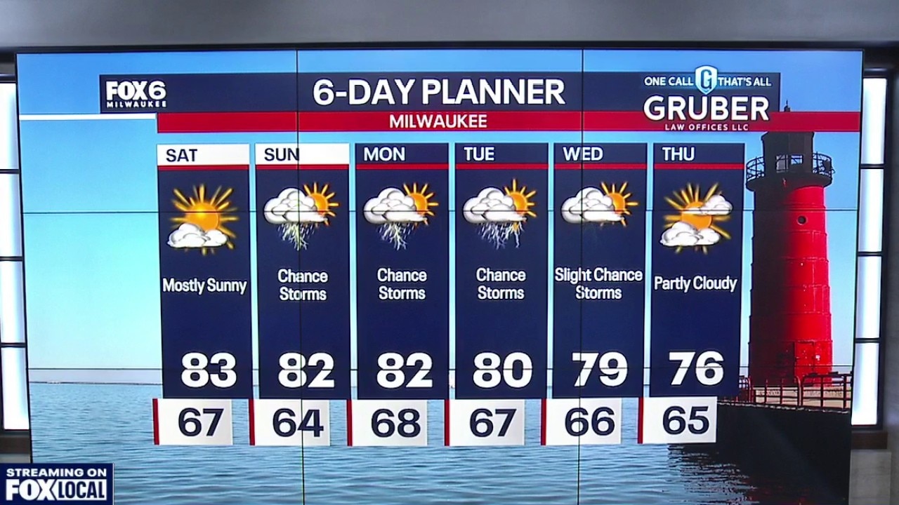
Milwaukee weather: Dry and mostly sunny Saturday
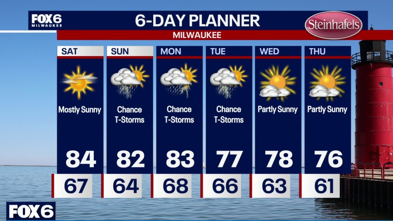
Mostly sunny skies on Saturday with high temps in the low 80s. A shift in the winds out of the northwest will slightly lower dew points this afternoon.
Mostly sunny skies on Saturday with high temps in the low 80s. A shift in the winds out of the northwest will slightly lower dew points this afternoon.
Milwaukee weather: Nice weather for Saturday.
A Happy Holly Forecast is on the way for Saturday!
A Happy Holly Forecast is on the way for Saturday!
Milwaukee weather: Warm and humid
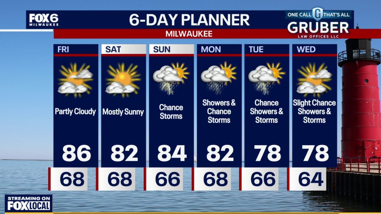
A warm and humid day, staying mostly dry for our Friday, but a weakening batch of showers and thunderstorms could reach southern Wisconsin Friday night.
A warm and humid day, staying mostly dry for our Friday, but a weakening batch of showers and thunderstorms could reach southern Wisconsin Friday night.
Milwaukee weather: Warm and humid
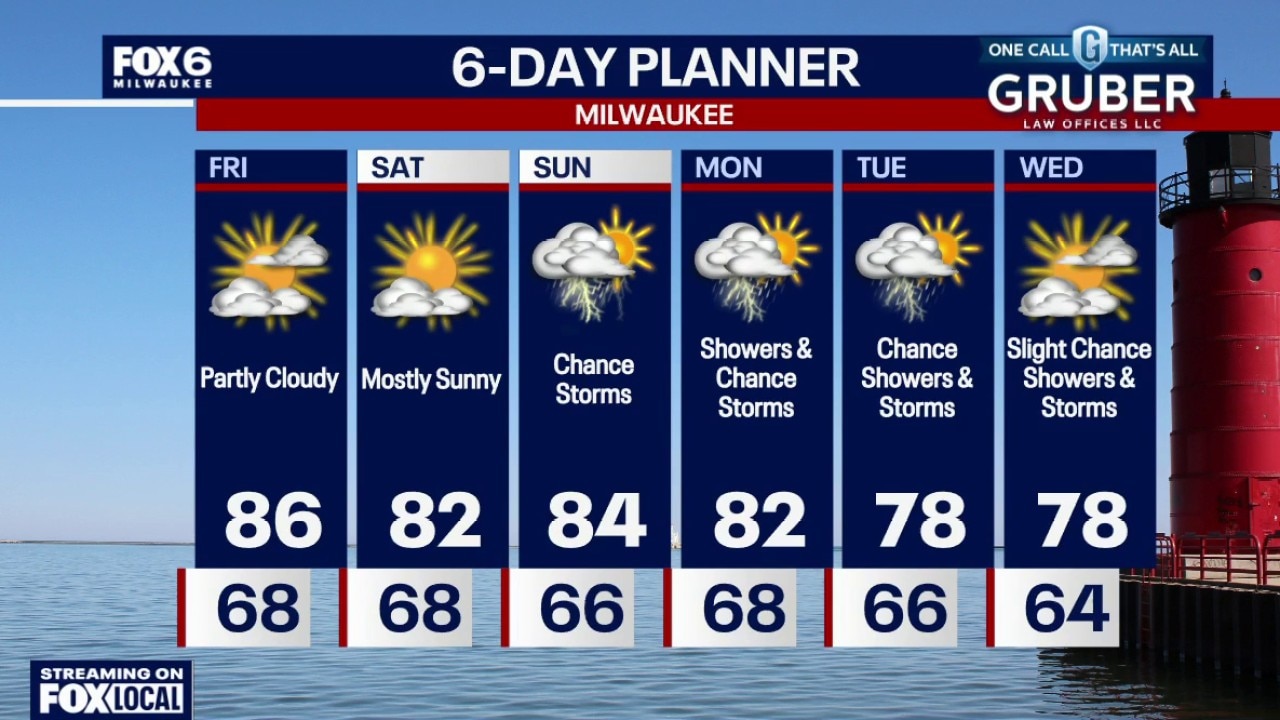
A warm and humid day, staying mostly dry for our Friday, but a weakening batch of showers and thunderstorms could reach southern Wisconsin Friday night.
A warm and humid day, staying mostly dry for our Friday, but a weakening batch of showers and thunderstorms could reach southern Wisconsin Friday night.
Milwaukee weather: Warm & Humid Friday, Isolated T-Storm
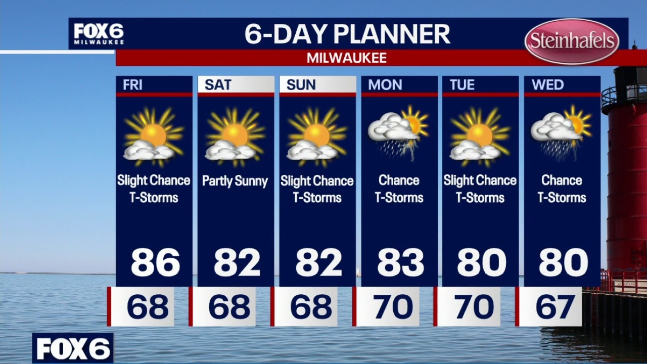
Patchy fog developing again overnight. Temperatures will settle in the upper 60s by sunrise. Morning fog possible on Friday. Partly sunny, warm and humid with a slight chance for an afternoon/evening t-storm. Highs in the mid-80s with a dew point around 70. Partly sunny and less humid on Saturday with highs in the low 80s. Slight chance for t-storms on Sunday with highs in the low 80s.
Patchy fog developing again overnight. Temperatures will settle in the upper 60s by sunrise. Morning fog possible on Friday. Partly sunny, warm and humid with a slight chance for an afternoon/evening t-storm. Highs in the mid-80s with a dew point around 70. Partly sunny and less humid on Saturday with highs in the low 80s. Slight chance for t-storms on Sunday with highs in the low 80s.
Milwaukee weather: Humid tonight, Warm on Friday
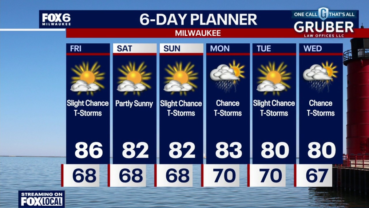
Becoming partly cloudy tonight with fog developing again overnight. Temperatures will drop through the 70s and settle in the upper 60s overnight. Morning fog possible on Friday. Partly sunny, warm and humid with a slight chance for an afternoon/evening t-storm. Highs in the mid-80s with a dew point around 70.
Becoming partly cloudy tonight with fog developing again overnight. Temperatures will drop through the 70s and settle in the upper 60s overnight. Morning fog possible on Friday. Partly sunny, warm and humid with a slight chance for an afternoon/evening t-storm. Highs in the mid-80s with a dew point around 70.
Milwaukee weather: Gradual sunshine today, humid
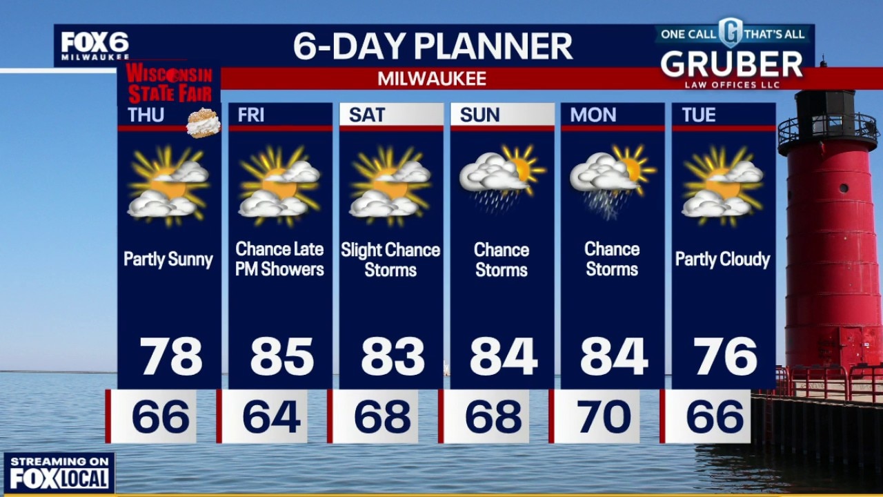
After a dry Thursday with seasonable temperatures, warmer air and higher humidity begin building back into southern Wisconsin on Friday. A few showers and thunderstorms could arrive late Friday evening as a cold front moves through.
After a dry Thursday with seasonable temperatures, warmer air and higher humidity begin building back into southern Wisconsin on Friday. A few showers and thunderstorms could arrive late Friday evening as a cold front moves through.
Milwaukee weather: Early fog then partly sunny
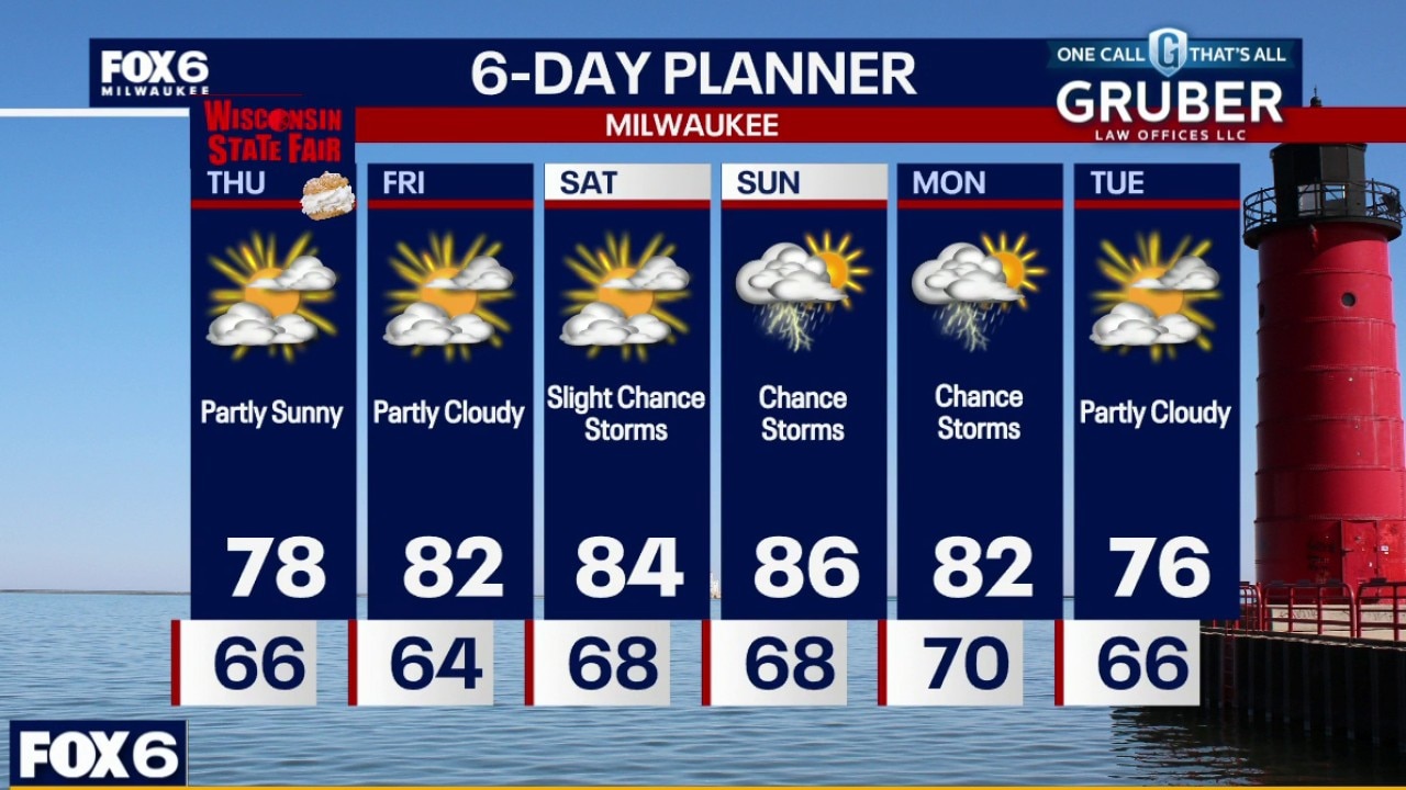
Quiet weather is back, but keep an eye out for areas of fog early Thursday morning where skies clear overnight. After a dry Thursday with seasonable temperatures, warmer air and higher humidity begin building back into southern Wisconsin on Friday.
Quiet weather is back, but keep an eye out for areas of fog early Thursday morning where skies clear overnight. After a dry Thursday with seasonable temperatures, warmer air and higher humidity begin building back into southern Wisconsin on Friday.
Milwaukee weather: Fog Thursday morning, Mild for State Fair
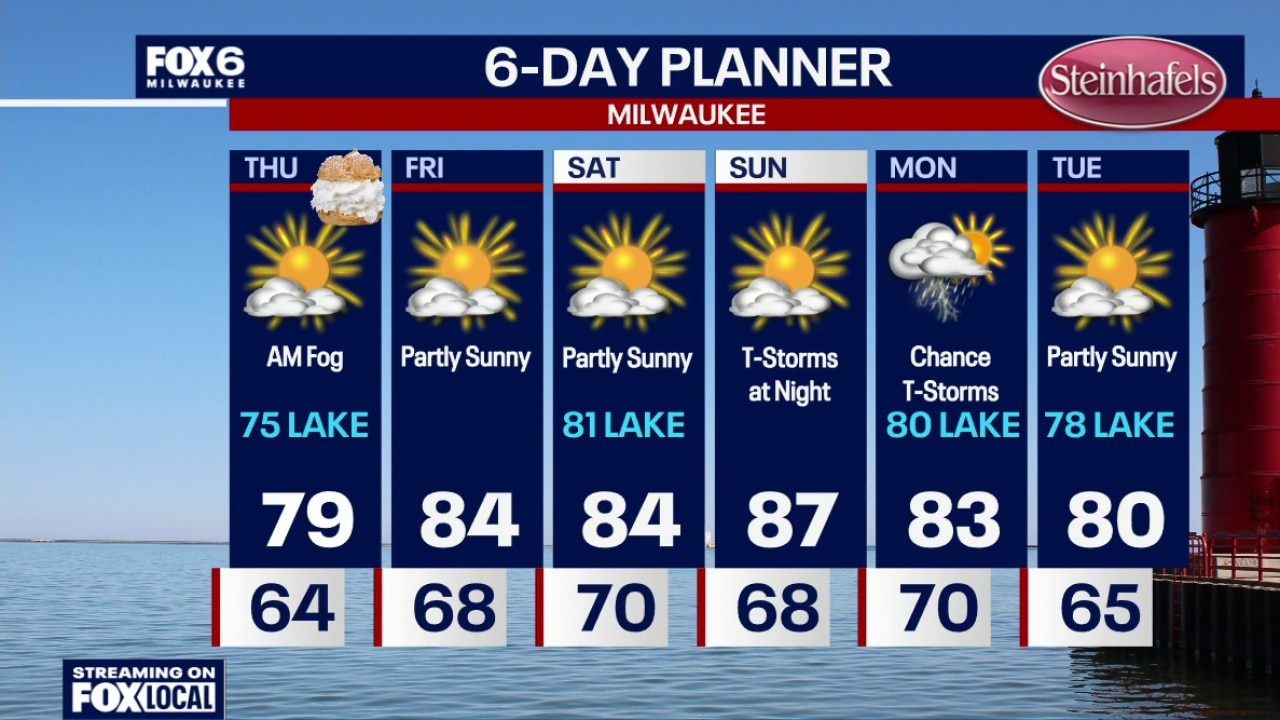
Fog developing overnight. Temperatures dropping into the 60s. Morning fog on Thursday, otherwise gradual clearing. Highs in the mid-to-upper 70s with a dew point in the mid-60s. Fog returns Thursday night. Partly sunny and warmer on Friday with highs in the low-to-mid 80s and dew points in the upper 60s. An isolated t-storm is possible Friday night.
Fog developing overnight. Temperatures dropping into the 60s. Morning fog on Thursday, otherwise gradual clearing. Highs in the mid-to-upper 70s with a dew point in the mid-60s. Fog returns Thursday night. Partly sunny and warmer on Friday with highs in the low-to-mid 80s and dew points in the upper 60s. An isolated t-storm is possible Friday night.
Milwaukee weather: Isolated evening storm, fog overnight
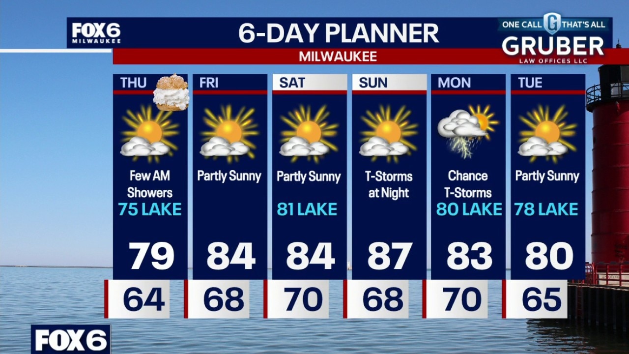
Scattered showers and t-storms this evening. Fog developing overnight. Temperatures dropping into the 60s. A few morning showers on Thursday, otherwise gradual clearing. Highs in the mid-to-upper 70s with a dew point in the mid-60s. Fog returns Thursday night. Partly sunny and warmer on Friday with highs in the low-to-mid 80s and dew points in the upper 60s. An isolated t-storm is possible Friday night.
Scattered showers and t-storms this evening. Fog developing overnight. Temperatures dropping into the 60s. A few morning showers on Thursday, otherwise gradual clearing. Highs in the mid-to-upper 70s with a dew point in the mid-60s. Fog returns Thursday night. Partly sunny and warmer on Friday with highs in the low-to-mid 80s and dew points in the upper 60s. An isolated t-storm is possible Friday night.
Milwaukee weather: Few evening showers then fog
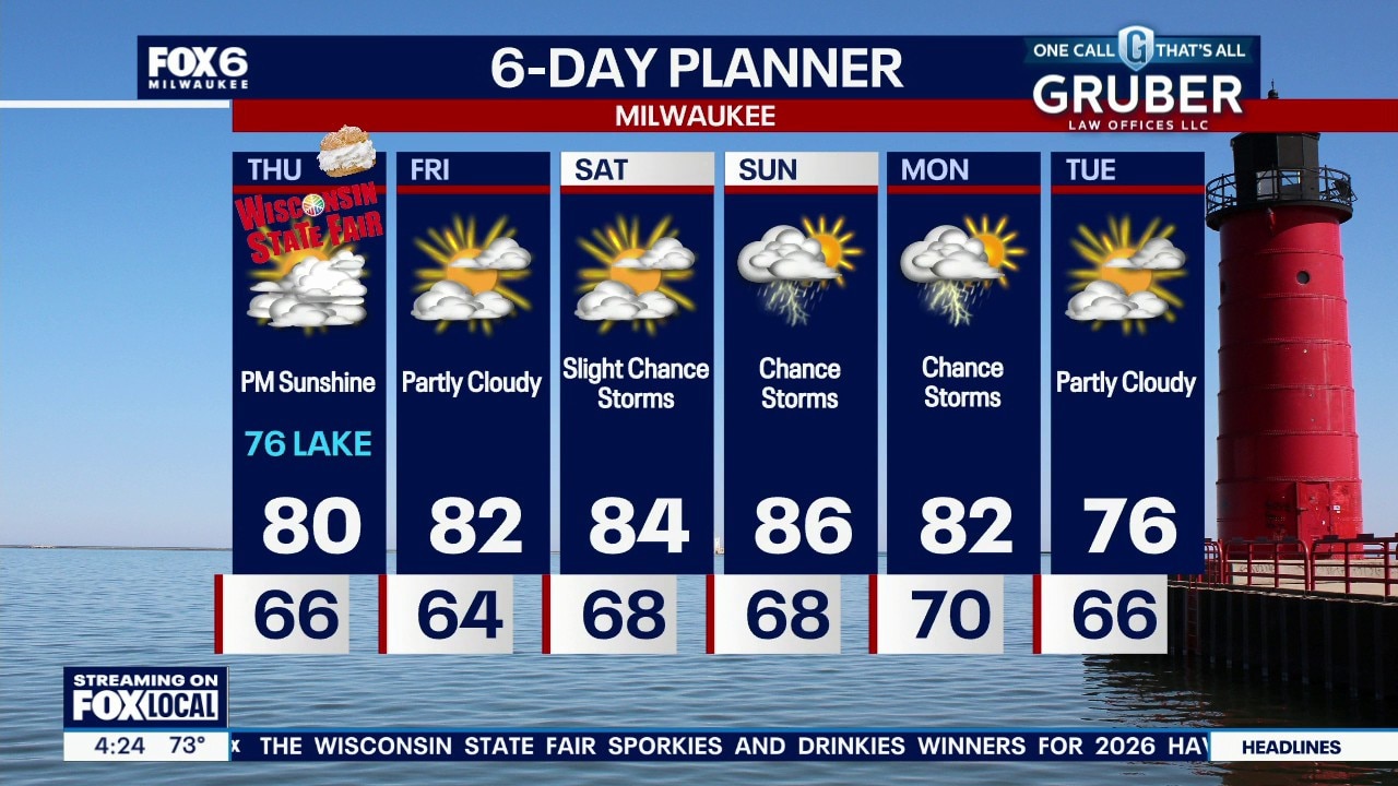
Still a chance for a few showers or storms this evening, then patchy fog expected overnight. Lingering clouds to start Thursday then gradual clearing. Cooler but humid for the first day of the state fair, then heating up over the weekend. Storm chances return Sunday into Monday.
Still a chance for a few showers or storms this evening, then patchy fog expected overnight. Lingering clouds to start Thursday then gradual clearing. Cooler but humid for the first day of the state fair, then heating up over the weekend. Storm chances return Sunday into Monday.
Milwaukee weather: Chance of rain and thunderstorms
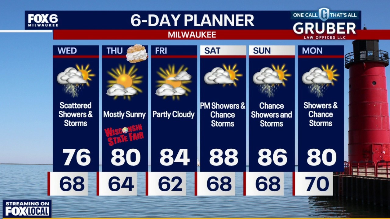
Showers and thunderstorms will continue through Wednesday, with the biggest concern being heavy downpours that could lead to localized flooding, especially in low-lying and urban areas.
Showers and thunderstorms will continue through Wednesday, with the biggest concern being heavy downpours that could lead to localized flooding, especially in low-lying and urban areas.
Milwaukee weather: Heavy rain possible on Wednesday
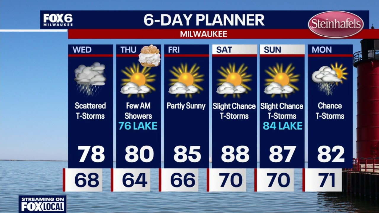
Scattered showers and t-storms overnight. Temperatures dropping into the 60s. A slow moving cold front will bring showers and t-storms through the area on Wednesday with highs in the mid-to-upper 70s. Heavy rain is possible. A few AM showers on Thursday, otherwise becoming partly sunny. High around 80 inland, mid-70s near the lake.
Scattered showers and t-storms overnight. Temperatures dropping into the 60s. A slow moving cold front will bring showers and t-storms through the area on Wednesday with highs in the mid-to-upper 70s. Heavy rain is possible. A few AM showers on Thursday, otherwise becoming partly sunny. High around 80 inland, mid-70s near the lake.