

Winter weather advisory Wednesday; 2-4 inches of snow possible
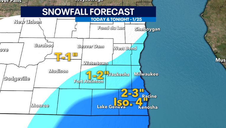
MILWAUKEE - A strong low-pressure system will move off to the south and east today bringing small amounts measurable snow to southeast Wisconsin. 1-2" is possible for most counties, but there is potential for higher amounts nearing the 3-4" category if lake effect snowbands form. This is most likely from Milwaukee south towards Racine and Kenosha counties. Not everyone will experience higher snowfall accumulations, but areas that are under these snow bands can. This is why we will be watching where these bands form closely when the event takes place.
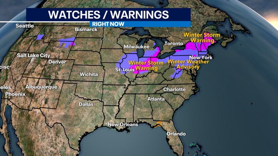
This massive system has prompted severe weather in the south and winter storm warnings and advisories in the Midwest to New England.
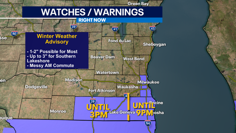
The National Weather Service has even issued a winter weather advisory for Milwaukee, Racine and Kenosha counties through 9PM Wednesday. Rock and Walworth Counties are in this advisory through 3pm Wednesday.
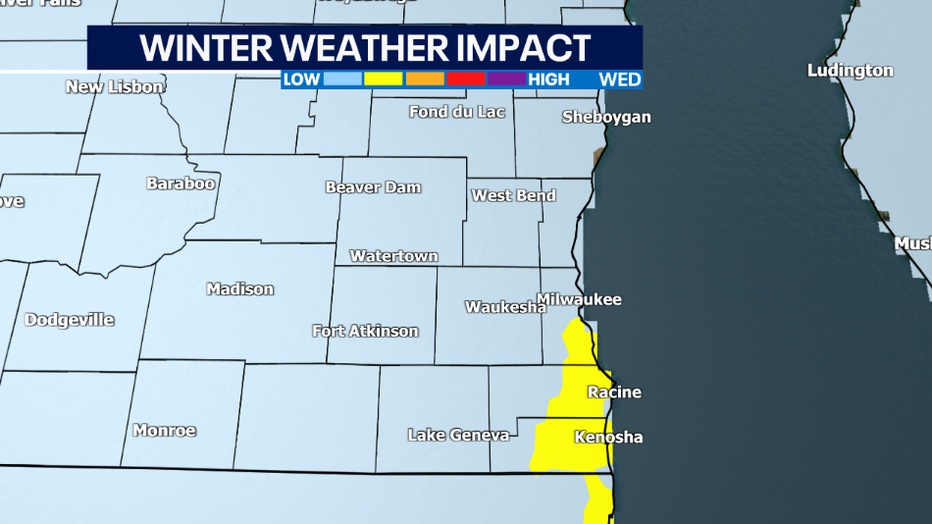
Snow will continue to impact southeast Wisconsin Wednesday afternoon and evening. Activity will decrease by Wednesday night as the center of the low moves farther east.
Even if your county is not under a winter weather advisory, impacts will impact everyone with slippery and/or covered roads in addition to reduced visibility which can be less than a mile at times.
This is not looking to be a major snow event across our region, but travel will be impacted.
SIGN UP TODAY: Get daily headlines, breaking news emails from FOX6 News
Plan for extra travel time today and tonight – and keep extra distance between you and other vehicles.