

Will Hurricane Sandy be the next “Perfect Storm”?
In late October 1991 a massive storm system in the Atlantic Ocean turned into a historic Nor'easter. Labeled the “Perfect Storm” by the National Weather Service , the weather event inspired a book and later a movie which made Mark Wahlburg and George Clooney look grimy sword-fishermen. While the story of the ill fated Andrea Gail fishing vessel captivated audiences, the development and decay of the “Perfect Storm” captivated meteorologists. It started as an extra-tropical cyclone, absorbed the smaller Hurricane Grace into its circulation, drifted over the warm Gulf Stream waters, developed a new unnamed hurricane within the larger non-tropical storm itself, and finally moved ashore in Eastern Canada. Despite its sensational name this unique storm was not the most devastating. It’s lashing winds and crushing waves caused about $200 million in damage. Next week, Hurricane Sandy could write a similar story. But this sequel could be better (aka: worse) than its predecessor.
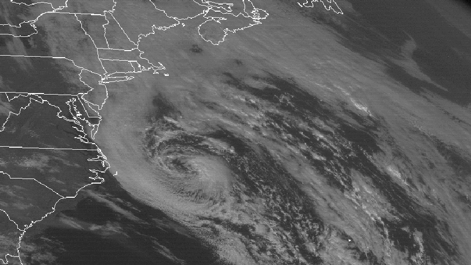
Here is how Hurricane Sandy is expected to play out. As it moves up the Atlantic Coast this weekend it will eventually lose its tropical characteristics. What does that mean? It simply means it’s in a different league but not necessarily less dangerous. A hurricane has a dense, circular shield of clouds around its center with uniform temperatures spinning around storm. An extra-tropical cyclone typically has a comma shape with a cold and warm sector. However, winds can move just as fast as a weak hurricane. In addition, the extra-tropical cyclone has a wind field that extends well beyond the reach of a hurricane which typically keeps its fastest winds close to the eye or center. Think of a figure skater spinning with her arms next to her side. She spins very fast in a small area, kind of like a hurricane. When she spreads her arms out she slows down but spins over a larger area. This is like a strong extra-tropical storm.
The storm formerly known as Sandy (I’ll still call it Sandy to keep the title short) will likely take a left turn and strike the East Coast between Delaware and Massachusetts with a minimum central pressure of 950-960 mb. (equal to typical category 3 hurricane!). The “Perfect Storm” 21 years ago did not achieve a pressure this low and never hit the U.S. directly but instead hit Eastern Canada. As Sandy drifts west it mixes with cold Canadian air gliding south across New England turning much of the precipitation on its western edge into a rain/snow mix. Coastal areas will be drenched with flooding rains (5-10” maybe? Too early for an accurate prediction) while parts of the Appalachians will hear the roar of snow plows clearing the road.
While the winds from next week’s version of Sandy will probably not max out close to the 105mph winds Hurricane Sandy is bringing to the Bahamas today (10/25/12), gusts could easily top hurricane force at 74mph or greater. In the end Sandy’s bill will certainly top the $200 million from the “Perfect Storm” and could possibly top $1 billion… Stay tuned!
And by the way, some media outlets have used the term “Frankenstorm” to describe this event. I would go on about how laughable that name is, but if you’ve read this far into my blog I don’t want to keep you any longer.
For a complete write of the “Perfect Storm” from NOAA, CLICK HERE.