

Plenty of humidity: Midwest will see surge of hot southern air as we enter mid-July
SOUTHEAST WISCONSIN -- Late next week, as we enter mid-July, the Midwest will see a surge of hot southern air that will bring with it plenty of humidity. Long-term model forecasts aren't quite as aggressive when it comes to temperatures, but well above average conditions are very likely.
This means temperatures near 90˚ and dewpoints near 70˚ will continue as we enter mid-July.
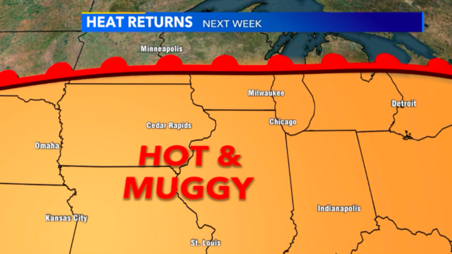
Heat returns at the end of next week which gives us more shots at hitting 90˚
Old model runs had mid-90s for a high almost all of next week but now the hottest day looks to be Friday, July 17 -- with highs climbing well above the 90-degree mark. The worst of the heat stays to our south but that doesn't mean we won't see some dangerous conditions to be outside without water and shade.
The average high throughout the month of July is around 80˚ but most of southeast Wisconsin will stay well above average through the mid-part of the month.
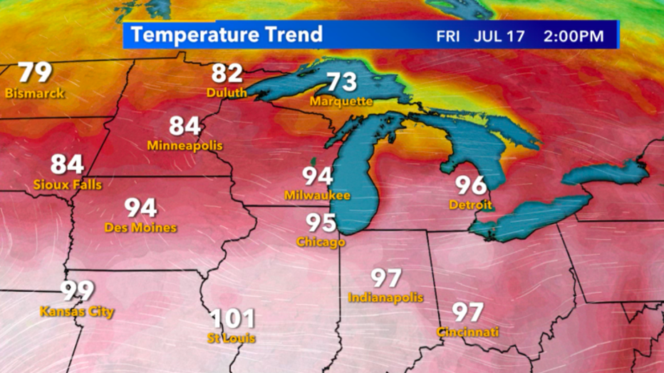
Temperature forecast for Friday, July 17