

Heat index values soar into the 90s this weekend, but rain chances might bail us out
SOUTHEAST WISCONSIN -- While these last couple of days have been some of the coolest weather we've seen all of July, that all changes by the weekend. Dew points will skyrocket into the low to mid-70s by Sunday, July 26 but there is a good chance it gets back to more comfortable levels by Monday, July 27.
The determining factor is the timing of storms and how much relief we get from the rain-cooled air.
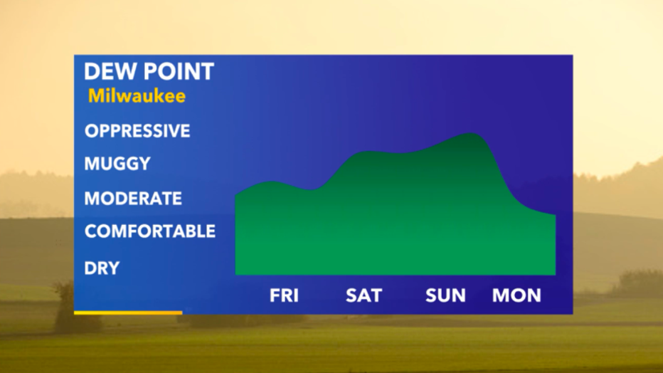
Dew Point forecast from Friday, July 24 to Monday, July 27
The latest atmospheric model runs continue to favor afternoon rain potential on Sunday, July 26 -- which should give us just enough relief from the heat to not make it feel like Florida. But if these storms take longer to arrive, than it's very likely heat index values will climb into the upper 90s no problem.
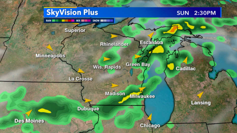
Skyvison Plus future radar look at Sunday, July 26
A positive to look at least for Saturday, July 25 is the muggiest of air stays to our west but rain chances will be very isolated so not much relief is likely. Thanks to so much moisture in the air, heat index values will still be in the low 90s, but as of now Sunday, July 26 looks much more uncomfortable if we don't see afternoon rain.
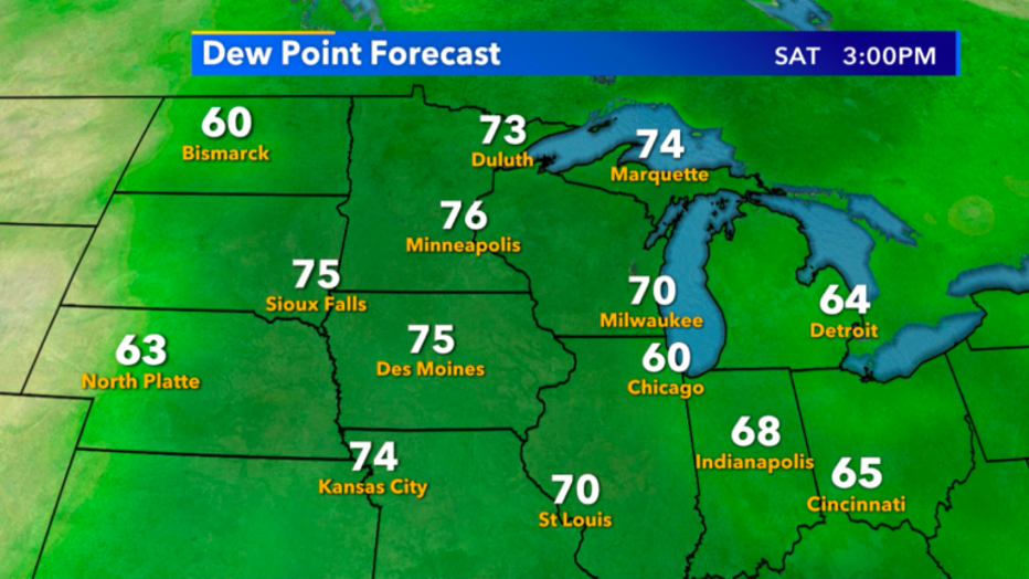
Dew Point Forecast for Saturday, July 24