

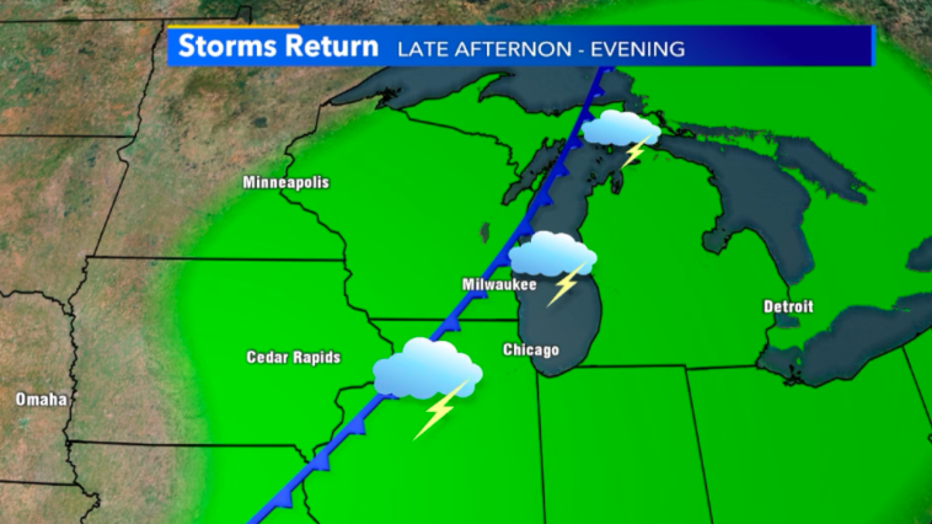
Another round of thunderstorms expected Wednesday afternoon, evening
MILWAUKEE -- Another round of rumbling thunderstorms arrives Wednesday, July 15 as a cold front slowly works through the state. Spotty afternoon storms lead to widespread heavy rainfall into the evening.
The only severe chances we have will be isolated and short-lived.
Rain chances continue today, July 15 thanks to a slow-moving cold front
During the afternoon, most of our rain potential will stay spotty at best. Few areas of heavy rain are possible but won't last long. A majority of the heavy rainfall stays in parts of Iowa and western Wisconsin during daylight hours.
These storms will feed off of humid and warm air at the surface, but once they pass will give us a noticeable relief in mugginess.
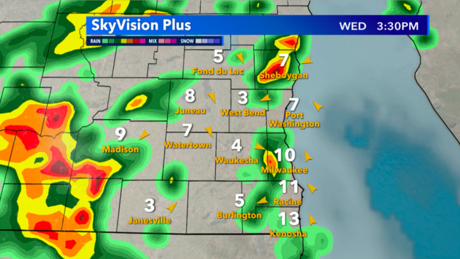
Skyvision Plus look at radar for this afternoon, July 15
The rain that will stretch across the entire section of southeast Wisconsin really arrives late afternoon into the evening. The main timing looks to be between 5 p.m. to 8 p.m. as gusty storms should give us some manageable rainfall totals. Most accumulations will stay near 1" when it's all said and done-- but isolated areas could receive closer to 2" of rain.
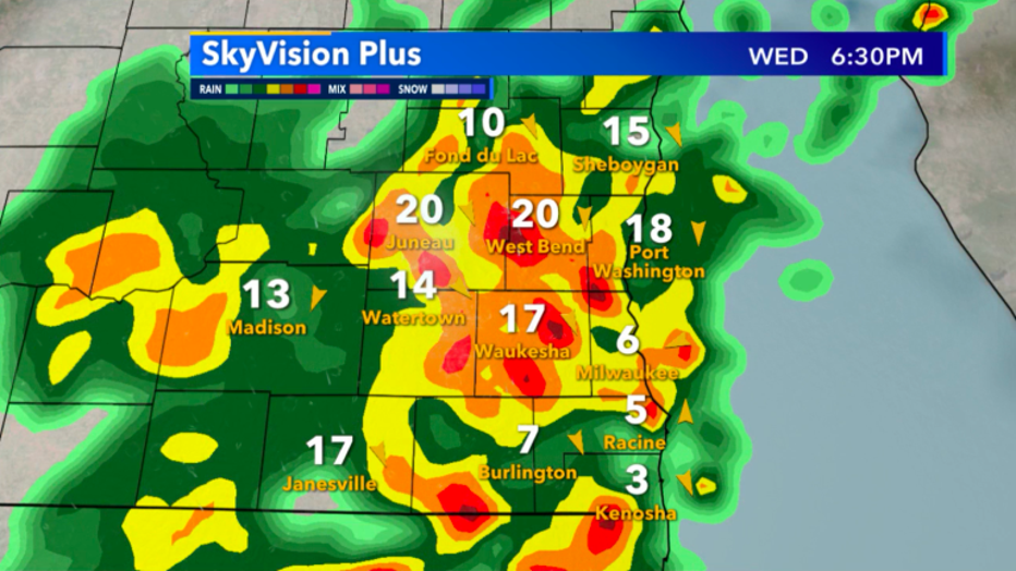
Skyvision Plus look at radar for the evening, July 15