


Weather webcast with Rob Haswell
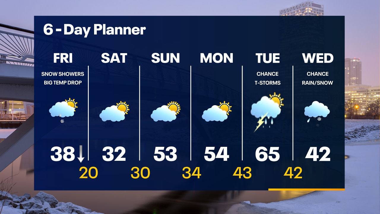
Ahead of a cold front this morning we will see some early sun and mild temperatures. The cold front moves through our area between 8am and 11 a.m. As the front moves through, we can expect some snow showers. Much colder air arrives behind the front with temperatures falling from near 40 this morning to the 20s this afternoon. A strong and chilly NE wind could also bring periods of lake effect snow this afternoon and evening. We should calm and clear overnight. The weekend starts chilly but sunny and then warms from highs in the 30s Saturday to highs in the 50s Sunday. 60s return by early next week.
Ahead of a cold front this morning we will see some early sun and mild temperatures. The cold front moves through our area between 8am and 11 a.m. As the front moves through, we can expect some snow showers. Much colder air arrives behind the front with temperatures falling from near 40 this morning to the 20s this afternoon. A strong and chilly NE wind could also bring periods of lake effect snow this afternoon and evening. We should calm and clear overnight. The weekend starts chilly but sunny and then warms from highs in the 30s Saturday to highs in the 50s Sunday. 60s return by early next week.
Weather Webcast with Tom Wachs
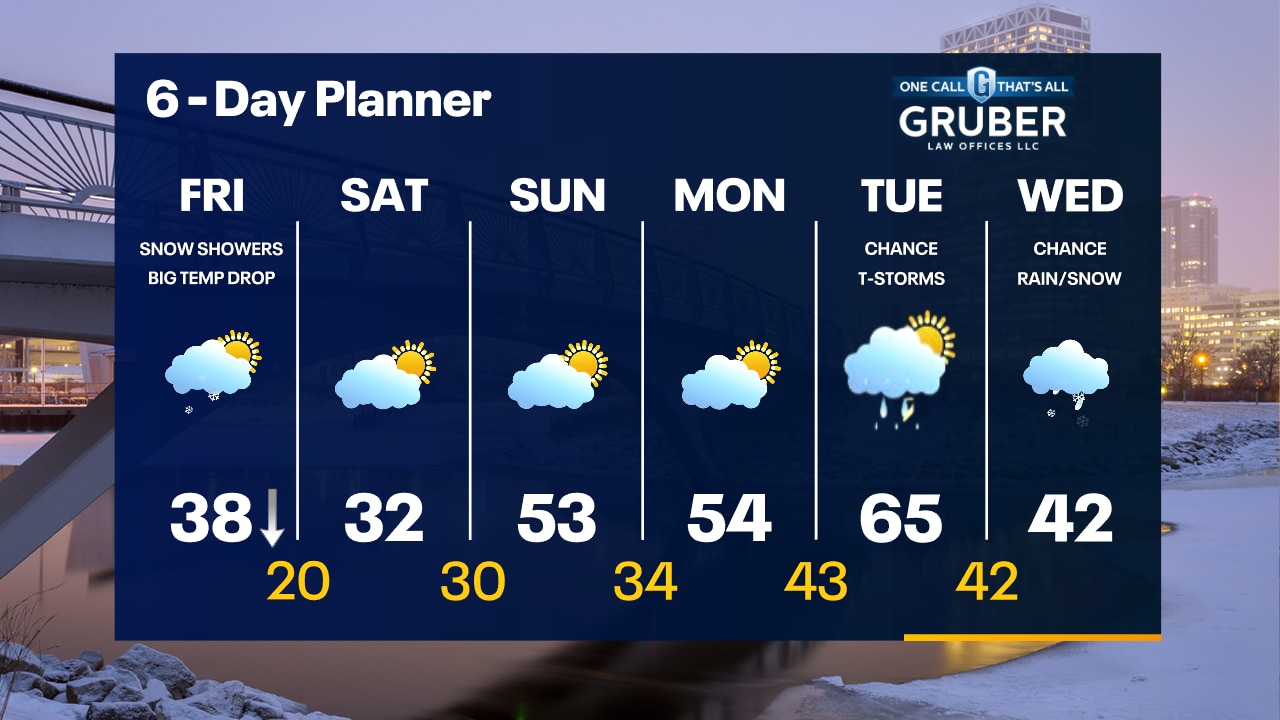
Big changes on the way Friday. Snow moves in Friday afternoon with gusty winds and falling temperatures. Slick spots possible with low visibility at times.
Big changes on the way Friday. Snow moves in Friday afternoon with gusty winds and falling temperatures. Slick spots possible with low visibility at times.
Weather Webcast with Tom Wachs
Quiet tonight with temperatures falling into the 30s. Big changes on Friday. Afternoon snow and gusty winds causing temperatures to drop into the 20s later in the day.
Quiet tonight with temperatures falling into the 30s. Big changes on Friday. Afternoon snow and gusty winds causing temperatures to drop into the 20s later in the day.

Weather Webcast with Stephanie Barichello
Mostly sunny and warm again this afternoon then we cool big time Friday with an incoming cold front. There is also a chance for flurries or periods of light snow during the day. Sunny Saturday but still cool, then we jump into the 50s by Sunday.
Mostly sunny and warm again this afternoon then we cool big time Friday with an incoming cold front. There is also a chance for flurries or periods of light snow during the day. Sunny Saturday but still cool, then we jump into the 50s by Sunday.


Milwaukee River strange ice formation seen near West Bend
The FOX6 Weather Experts were very excited to get these amazing pictures from FOX6 viewer Amanda H. in the West Bend area. This is what is known as frazil ice.
The FOX6 Weather Experts were very excited to get these amazing pictures from FOX6 viewer Amanda H. in the West Bend area. This is what is known as frazil ice.
Weather webcast with Rob Haswell
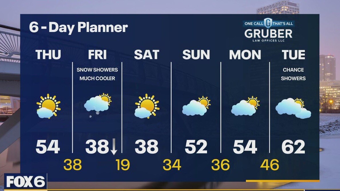
Another mild day today but not as warm as Wednesday. Highs will be in the low to mid 50s. A cold front arrives on Friday causing temperatures to fall later in the day on Friday. Temperatures will be 20 or more degrees cooler by Friday afternoon. A few snow showers are possible Friday with that passing front. A few tenths of an inch of accumulation are possible. We stay cooler Saturday but warm back to the 50s and 60s Sunday through the middle of next week.
Another mild day today but not as warm as Wednesday. Highs will be in the low to mid 50s. A cold front arrives on Friday causing temperatures to fall later in the day on Friday. Temperatures will be 20 or more degrees cooler by Friday afternoon. A few snow showers are possible Friday with that passing front. A few tenths of an inch of accumulation are possible. We stay cooler Saturday but warm back to the 50s and 60s Sunday through the middle of next week.

Weather Webcast with Tom Wachs
Mostly cloudy overnight with temperatures dropping into the 30s. Becoming partly sunny on Thursday with highs in the 50s. A big temperature drop is expected Friday.
Mostly cloudy overnight with temperatures dropping into the 30s. Becoming partly sunny on Thursday with highs in the 50s. A big temperature drop is expected Friday.


2024 Milwaukee storm spotter training; register for in-person training
The National Weather Service wants you to be a storm spotter.
The National Weather Service wants you to be a storm spotter.


Pollen season marches toward peak activity across southern US
Forecast models continue to show above-normal temperatures continuing through early March and likely beyond for a large part of the Lower 48.
Forecast models continue to show above-normal temperatures continuing through early March and likely beyond for a large part of the Lower 48.
Weather webcast with Lisa Michaels
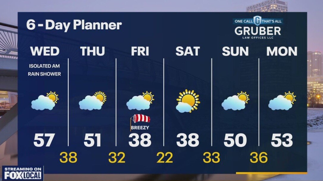
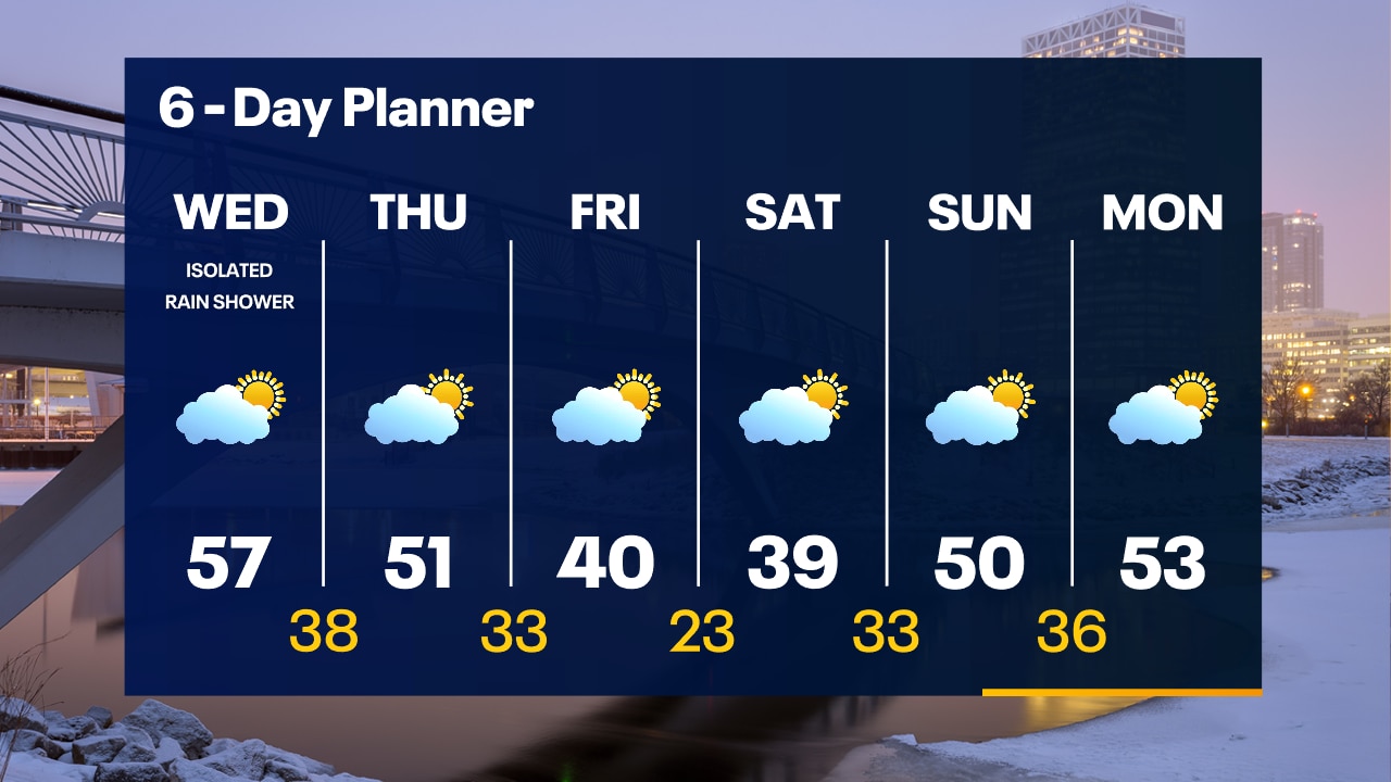
A few sprinkles/light shower possible this morning. Otherwise, mostly cloudy with temps in the 30s & 40s. Partly sunny and warm on Wednesday with highs in the mid-to-upper 50s. An isolated rain shower is possible. Partly sunny Thursday with highs in the upper 40s to low 50s. Much cooler on Friday and Saturday with highs in the upper 30s to low 40s. Warming up late in the weekend into early next week. Thunderstorms and a big warm up are possible next week Tuesday.
A few sprinkles/light shower possible this morning. Otherwise, mostly cloudy with temps in the 30s & 40s. Partly sunny and warm on Wednesday with highs in the mid-to-upper 50s. An isolated rain shower is possible. Partly sunny Thursday with highs in the upper 40s to low 50s. Much cooler on Friday and Saturday with highs in the upper 30s to low 40s. Warming up late in the weekend into early next week. Thunderstorms and a big warm up are possible next week Tuesday.
Weather Webcast with Tom Wachs
A few spotty light rain showers are possible on Wednesday morning, otherwise get ready for a warm day. Highs in the mid-to-upper 50s.
A few spotty light rain showers are possible on Wednesday morning, otherwise get ready for a warm day. Highs in the mid-to-upper 50s.
Weather Webcast with Tom Wachs
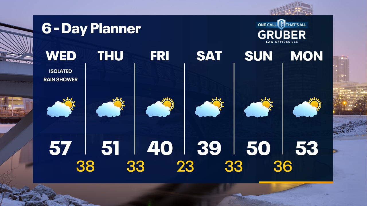
Mostly clear tonight with temperatures dropping through the 40s and into the 30s. An isolated rain shower is possible Wednesday, otherwise warmer. Highs in the mid-to-upper 50s.
Mostly clear tonight with temperatures dropping through the 40s and into the 30s. An isolated rain shower is possible Wednesday, otherwise warmer. Highs in the mid-to-upper 50s.

Wisconsin freezing fog makes icy wonderland
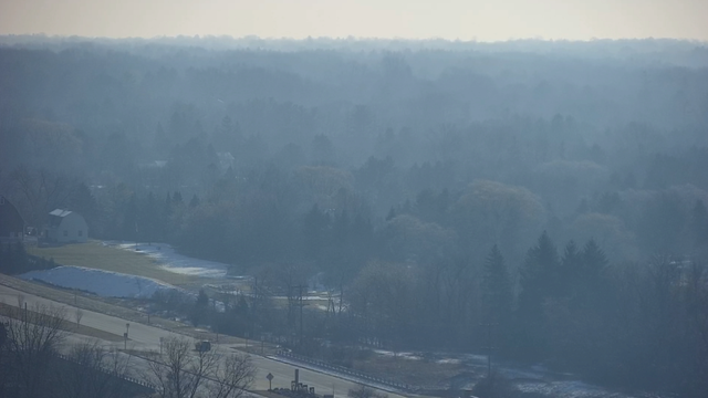
A foggy picture captured by the FOX6 doppler tower camera in Brown Deer on Tuesday morning, Feb. 20 is a great example of that fog and low clouds hanging in the trees.
A foggy picture captured by the FOX6 doppler tower camera in Brown Deer on Tuesday morning, Feb. 20 is a great example of that fog and low clouds hanging in the trees.

Weather webcast with Chief Meteorologist Rob Haswell
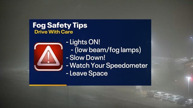
A chilly and foggy drive to work today! Dense fog advisory until 9 a.m. Why the afternoon drive will be the complete opposite.
A chilly and foggy drive to work today! Dense fog advisory until 9 a.m. Why the afternoon drive will be the complete opposite.

SE Wisconsin dense fog advisory Tuesday morning, Feb. 20
Dense fog advisory Tuesday morning for SE Wisconsin
Dense fog advisory Tuesday morning for SE Wisconsin
Weather webcast with Lisa Michaels
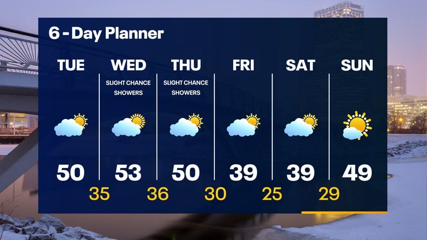
Mostly clear skies tonight with temps dropping into the mid 20s inland and low 30s near the lake. Fog is possible Wednesday morning. Otherwise, mostly sunny to partly cloudy skies. Highs in the upper 40s to low 50s.50s are favorable on Wednesday and Thursday. There is also a slight chance of a shower or two on these days.A slight cool down Friday and Saturday as we slip to near 40 but then we warm back into the mid to upper 40s Sunday.
Mostly clear skies tonight with temps dropping into the mid 20s inland and low 30s near the lake. Fog is possible Wednesday morning. Otherwise, mostly sunny to partly cloudy skies. Highs in the upper 40s to low 50s.50s are favorable on Wednesday and Thursday. There is also a slight chance of a shower or two on these days.A slight cool down Friday and Saturday as we slip to near 40 but then we warm back into the mid to upper 40s Sunday.
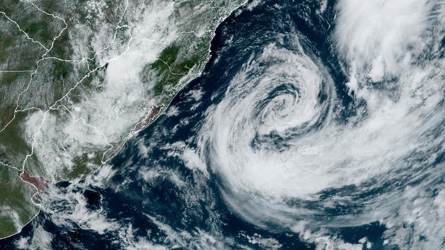

Rare Tropical Storm Akará forms off coast of Brazil
Akará is the first named system in the South Atlantic Basin since 2022.
Akará is the first named system in the South Atlantic Basin since 2022.
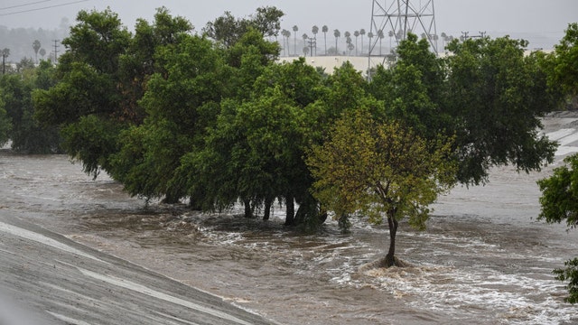

Extreme weather, flooding influencing where millions in US decide to live, research shows
As people choose different areas to move to and try to get away from flooding hazards, storms with relentless precipitation are continuing to impact several U.S. regions, and it’s taking its toll on infrastructure.
As people choose different areas to move to and try to get away from flooding hazards, storms with relentless precipitation are continuing to impact several U.S. regions, and it’s taking its toll on infrastructure.
Weather webcast with Chief Meteorologist Rob Haswell
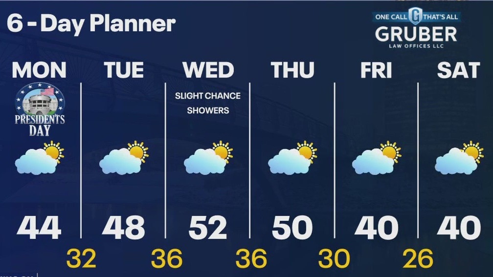
A cooler start but sun and a light southerly breeze will help us warm into the low to mid 40s today. We continue a long calm stretch today and through most of the week. The only chance for any precipitation is Thursday when we may see a few rain showers. Temperatures warm into the upper 40s tomorrow and low 50s Wednesday and Thursday. A slight cool down Friday and Saturday as we slip to near 40 but then we warm back into the mid to upper 40s Sunday.
A cooler start but sun and a light southerly breeze will help us warm into the low to mid 40s today. We continue a long calm stretch today and through most of the week. The only chance for any precipitation is Thursday when we may see a few rain showers. Temperatures warm into the upper 40s tomorrow and low 50s Wednesday and Thursday. A slight cool down Friday and Saturday as we slip to near 40 but then we warm back into the mid to upper 40s Sunday.

Weather Webcast with Stephanie Barichello
Clear and cold tonight with lows in the teens and 20s, then more sunshine Monday and a high around 44. We continue to climb through midweek with a few chances for 50s. Only chance for precip will be on Wednesday.
Clear and cold tonight with lows in the teens and 20s, then more sunshine Monday and a high around 44. We continue to climb through midweek with a few chances for 50s. Only chance for precip will be on Wednesday.