


Future Forecaster: Meet 12-year-old Brinnly
She wanted to be a Future Forecaster -- and that's exactly what FOX6 WakeUp News is helping her?accomplish.
She wanted to be a Future Forecaster -- and that's exactly what FOX6 WakeUp News is helping her?accomplish.
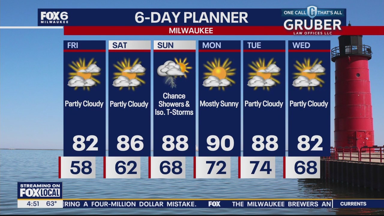
Weather webcast with Rob Haswell
High pressure slowly inches to the east of our area over the next couple of days encouraging a warmer, more southerly flow of air. Temperatures and dew points will surge through the weekend into early next week. We remain rain-free today and Saturday but there is a chance of showers and thunderstorms on Sunday, mostly in the morning hours. We should return to average conditions later next week.
High pressure slowly inches to the east of our area over the next couple of days encouraging a warmer, more southerly flow of air. Temperatures and dew points will surge through the weekend into early next week. We remain rain-free today and Saturday but there is a chance of showers and thunderstorms on Sunday, mostly in the morning hours. We should return to average conditions later next week.
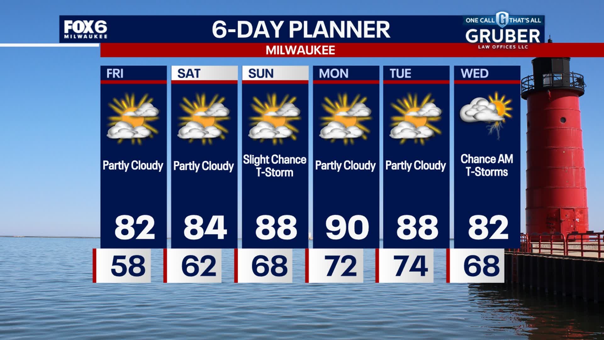
Weather Webcast with Stephanie Barichello
Heating up in the coming days with slight chances for showers and storms, especially on Sunday.
Heating up in the coming days with slight chances for showers and storms, especially on Sunday.
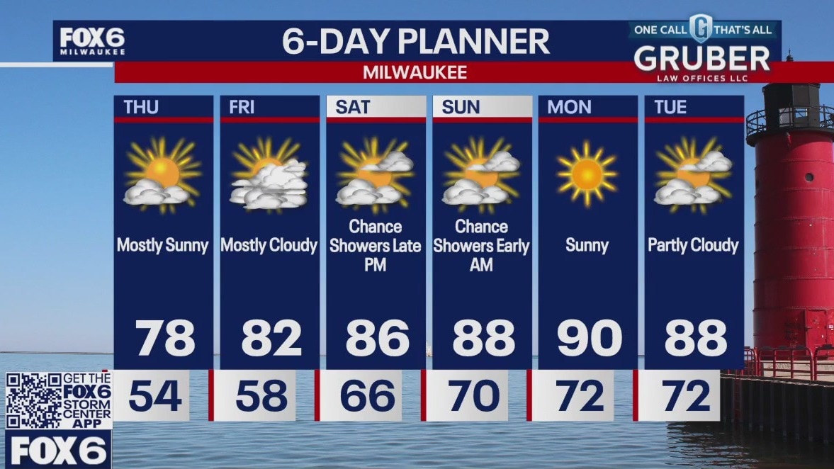
Weather webcast with Rob Haswell
Another day with a strong ridge of high pressure in charge of our forecast. Ample sunshine and warming today with highs in the mid to upper 70s. We warm into the low 80s Friday and then start a stretch of hot weather as high temperatures reach the upper 80s to near 90 from Saturday through the middle of next week. We stay dry today and have only a slight chance of showers and isolated thunderstorms late Saturday night into early Sunday morning.
Another day with a strong ridge of high pressure in charge of our forecast. Ample sunshine and warming today with highs in the mid to upper 70s. We warm into the low 80s Friday and then start a stretch of hot weather as high temperatures reach the upper 80s to near 90 from Saturday through the middle of next week. We stay dry today and have only a slight chance of showers and isolated thunderstorms late Saturday night into early Sunday morning.
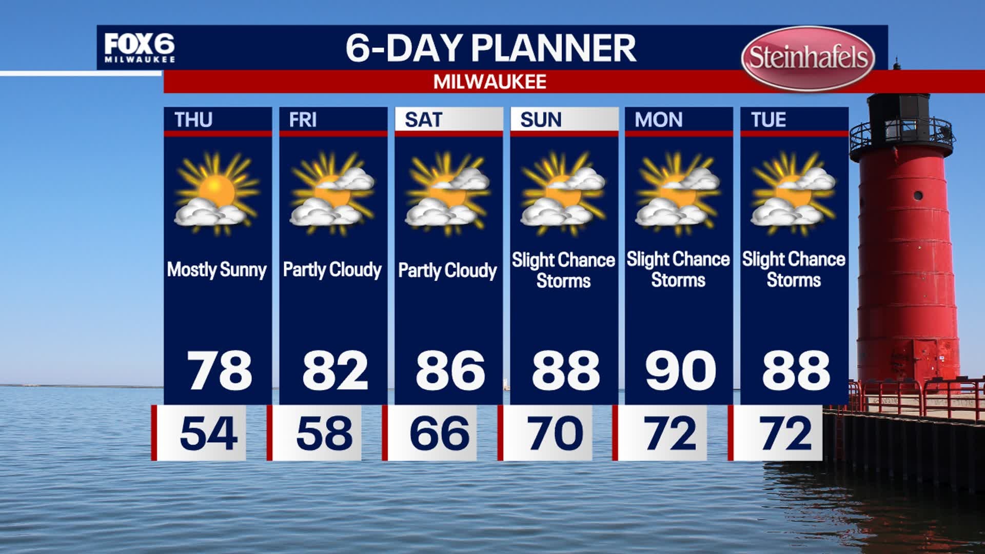
Weather webcast with Lisa Michaels
Clear and calm again tonight with temperatures dropping into the low 50s, possibly 40s inland. A bit warmer Thursday but still comfortable, then low 80s expected on Friday. Heating up this weekend and early next week, with highs in the 80s to around 90. Dew points will also be in the low 70s. Precipitation chances are limited at this time -- potentially a few t-storms Sunday and Tuesday, not nothing major.
Clear and calm again tonight with temperatures dropping into the low 50s, possibly 40s inland. A bit warmer Thursday but still comfortable, then low 80s expected on Friday. Heating up this weekend and early next week, with highs in the 80s to around 90. Dew points will also be in the low 70s. Precipitation chances are limited at this time -- potentially a few t-storms Sunday and Tuesday, not nothing major.


Milwaukee Riverkeeper encourages smart salting, discusses pollution
Milwaukee Riverkeeper said chloride, a component of road salt, can pollute bodies of water that connect to our drinking supply.
Milwaukee Riverkeeper said chloride, a component of road salt, can pollute bodies of water that connect to our drinking supply.

Weather Webcast with Stephanie Barichello
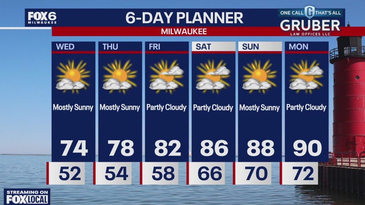
More sunshine and quiet weather the rest of the week. Heating up over the weekend with higher humidity. Slight chance for t-storms Saturday night into Sunday and again Tuesday.
More sunshine and quiet weather the rest of the week. Heating up over the weekend with higher humidity. Slight chance for t-storms Saturday night into Sunday and again Tuesday.
Weather webcast with Rob Haswell
High pressure sits right over our region today keeping us clear and calm. Highs will be in the low to mid 70s with low dew points for a very Fall-like feel yet again. We begin our slow warm up Thursday and return to near seasonal average temperatures late week. We should be well above by the weekend into early next week. We stay dry for several days yet with the next chance of any rain coming Saturday night.
High pressure sits right over our region today keeping us clear and calm. Highs will be in the low to mid 70s with low dew points for a very Fall-like feel yet again. We begin our slow warm up Thursday and return to near seasonal average temperatures late week. We should be well above by the weekend into early next week. We stay dry for several days yet with the next chance of any rain coming Saturday night.
Weather webcast with Lisa Michaels
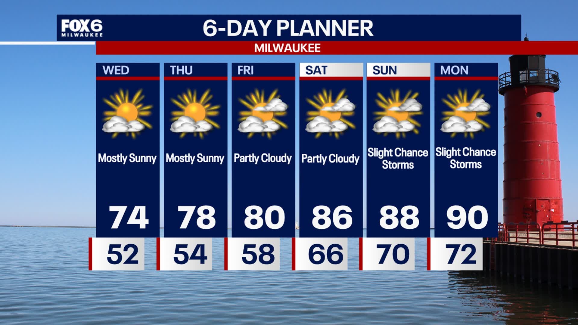
Clear and cool again tonight with temperatures falling into the low 50s, possibly even upper 40s far inland. Mostly sunny Wednesday with highs in the low 70s, then upper 70s on Thursday. Temperatures soar into the 80s this weekend, with a shot at 90? on Monday. Slight chances for showers over the weekend otherwise no major storm systems in sight.
Clear and cool again tonight with temperatures falling into the low 50s, possibly even upper 40s far inland. Mostly sunny Wednesday with highs in the low 70s, then upper 70s on Thursday. Temperatures soar into the 80s this weekend, with a shot at 90? on Monday. Slight chances for showers over the weekend otherwise no major storm systems in sight.

Watch: Connecticut home collapses amid historic flooding
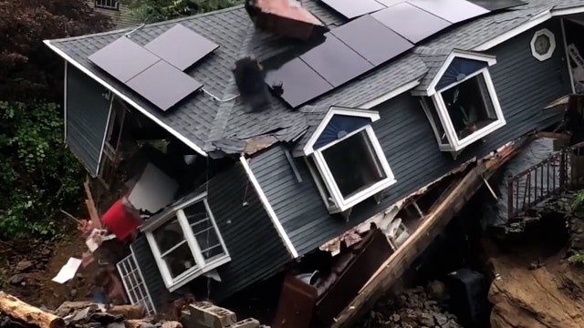
A Connecticut house collapsed on Monday following a weekend of historic and unprecedented flash flooding.
A Connecticut house collapsed on Monday following a weekend of historic and unprecedented flash flooding.
Weather Webcast with Stephanie Barichello
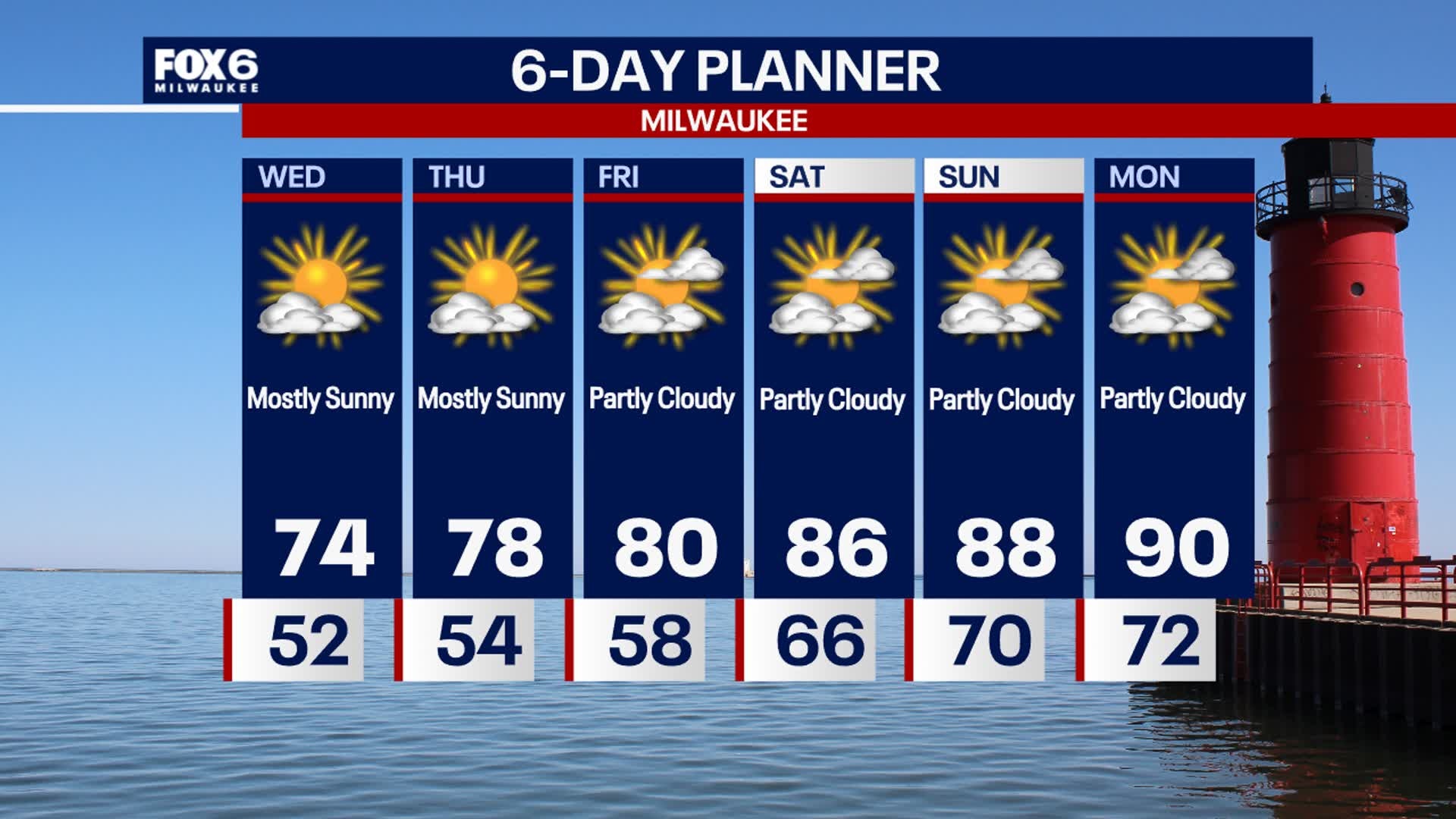
More glorious weather ahead in the coming days! Heat and humidity are back by the weekend.
More glorious weather ahead in the coming days! Heat and humidity are back by the weekend.
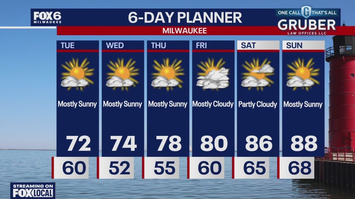
Weather webcast with Rob Haswell
High pressure dominates our forecast for the next few days giving us ample sun and dry conditions. Temperatures will be a bit cool today with highs in the low 70s and upper 60s lakeside.
High pressure dominates our forecast for the next few days giving us ample sun and dry conditions. Temperatures will be a bit cool today with highs in the low 70s and upper 60s lakeside.

Weather Webcast with Chief Meteorologist Tom Wachs
Partly cloudy overnight with the Full Moon overhead. Temperatures dropping into the 50s away from the lake. Partly sunny, breezy and cooler on Tuesday with highs in the upper 60s to low 70s.
Partly cloudy overnight with the Full Moon overhead. Temperatures dropping into the 50s away from the lake. Partly sunny, breezy and cooler on Tuesday with highs in the upper 60s to low 70s.
Weather Webcast with Chief Meteorologist Tom Wachs
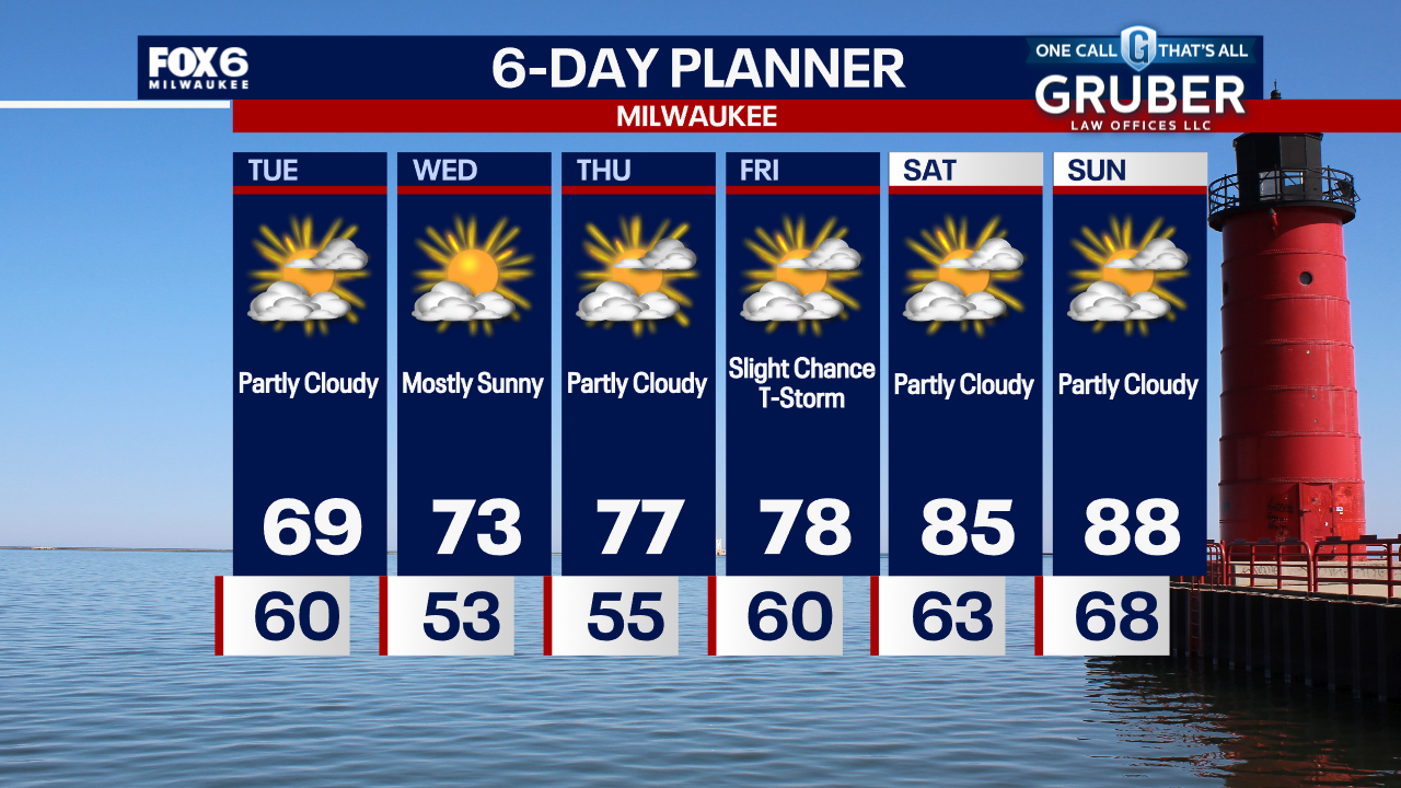
Partly cloudy tonight with the Full Blue Supermoon shining bright in the southeast sky this evening. Temperatures dropping into the 50 away from the lake overnight. Cool on Tuesday with highs in the upper 60s.
Partly cloudy tonight with the Full Blue Supermoon shining bright in the southeast sky this evening. Temperatures dropping into the 50 away from the lake overnight. Cool on Tuesday with highs in the upper 60s.
Weather webcast with Lisa Michaels
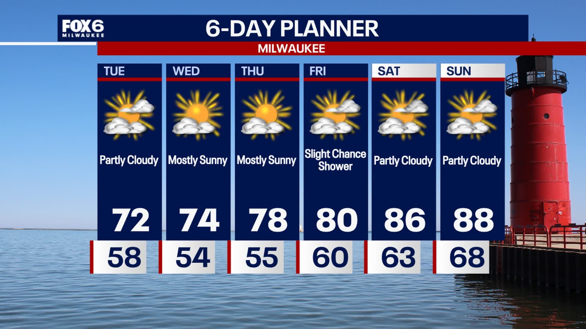
Partly cloudy tonight with temperatures dropping through the 60s and settling in the upper 50s to around 60 by morning.
Partly cloudy tonight with temperatures dropping through the 60s and settling in the upper 50s to around 60 by morning.
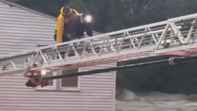

Watch: Connecticut Firefighters rescue 19 people, dog from 'life-threatening' floods
Firefighters safely rescued 19 people and a dog from raging floodwaters Sunday evening in southwestern Connecticut during a flood emergency.
Firefighters safely rescued 19 people and a dog from raging floodwaters Sunday evening in southwestern Connecticut during a flood emergency.
Weather webcast with Rob Haswell
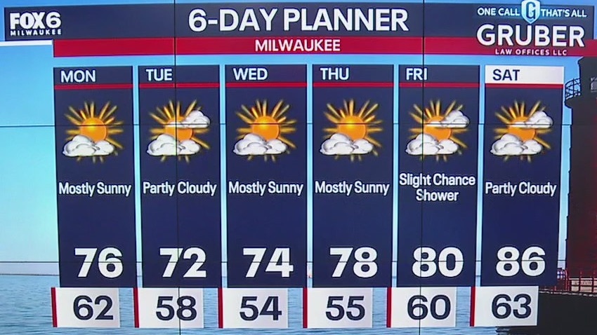
High pressure builds over the region today and for the next few days. An isolated showers is still possible today but otherwise a dry stretch ahead with warming temperatures.
High pressure builds over the region today and for the next few days. An isolated showers is still possible today but otherwise a dry stretch ahead with warming temperatures.
Weather Webcast with Chief Meteorologist Tom Wachs
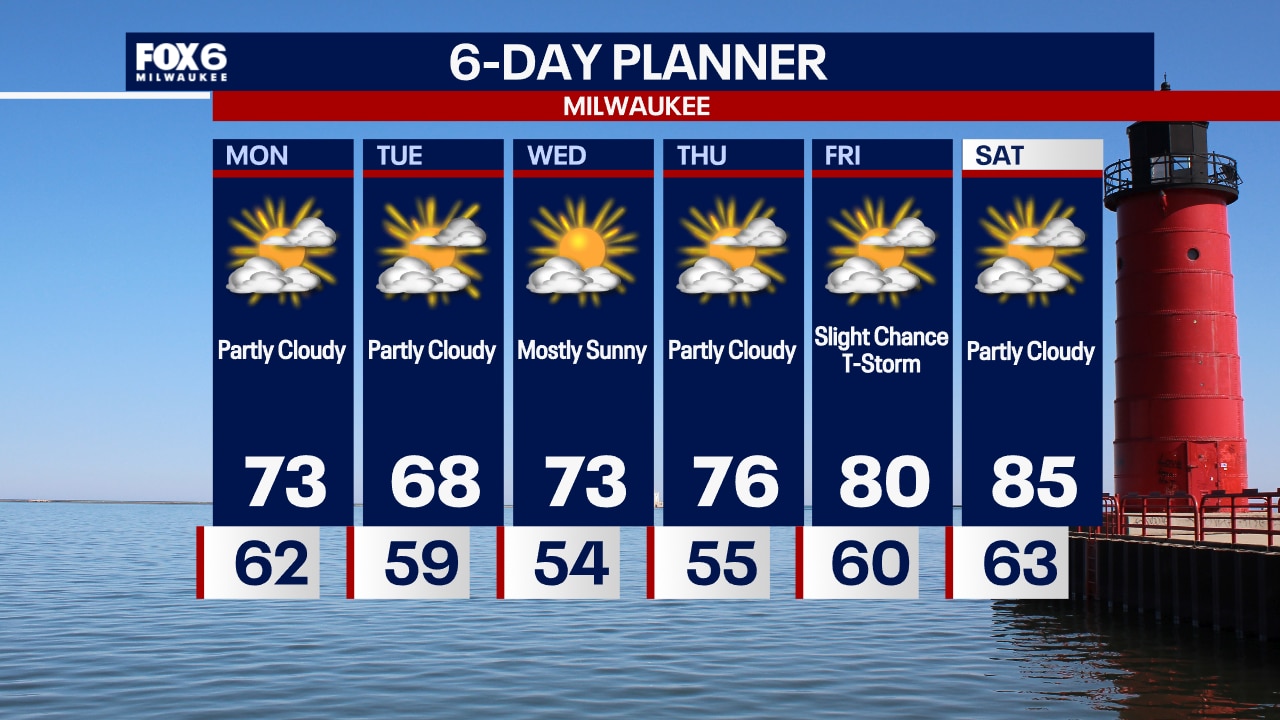
Quiet overnight with breezy conditions at times. Temperatures in the 50s to low 60s by sunrise. Partly sunny, cooler and less humid on Monday. Highs in the low-to-mid 70s.
Quiet overnight with breezy conditions at times. Temperatures in the 50s to low 60s by sunrise. Partly sunny, cooler and less humid on Monday. Highs in the low-to-mid 70s.
Weather Webcast with Chief Meteorologist Tom Wachs
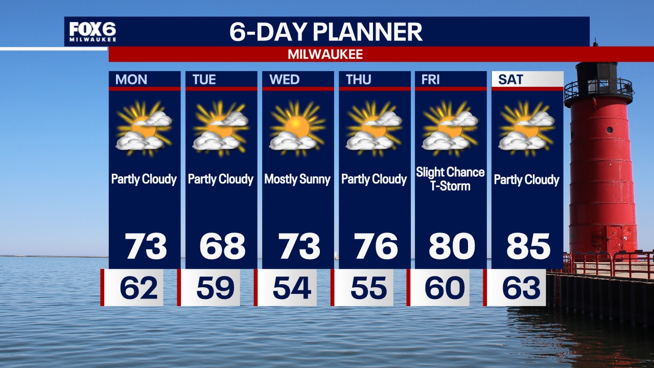
Cooler and less humid on Monday with highs in the low 70s. We have a below average week ahead in terms of temperatures, but our summer heat isn't done yet.
Cooler and less humid on Monday with highs in the low 70s. We have a below average week ahead in terms of temperatures, but our summer heat isn't done yet.

Severe thunderstorm causes inflatable slide to go airborne in Alabama
The Storm Prediction Center warned of winds up to 70 mph and hail at least the size of ping pong balls.
The Storm Prediction Center warned of winds up to 70 mph and hail at least the size of ping pong balls.