

Weather webcast with Stephanie Barichello
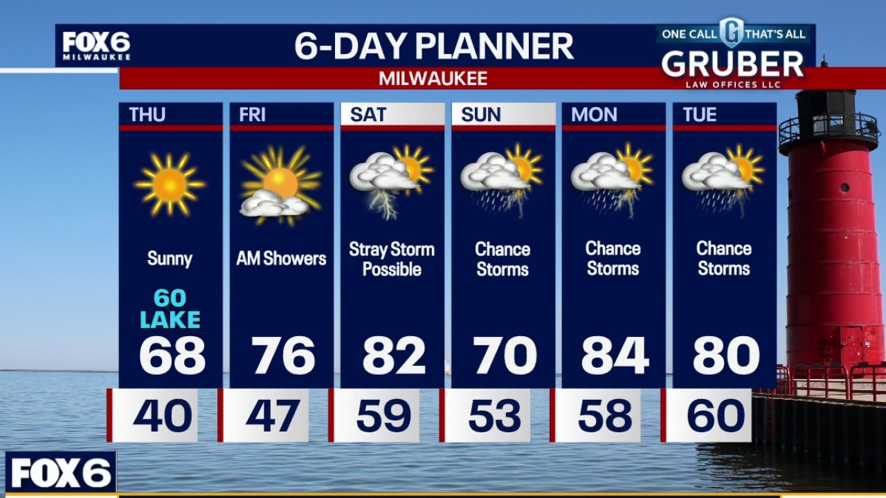
Thursday rebounds nicely with sunshine and highs back into the 70s. Rain chances Thursday night into Friday morning continue to look fairly spotty and light, so this still does not appear to be a meaningful soaking rain event for most of the area.
Thursday rebounds nicely with sunshine and highs back into the 70s. Rain chances Thursday night into Friday morning continue to look fairly spotty and light, so this still does not appear to be a meaningful soaking rain event for most of the area.
Weather webcast with Rob Haswell
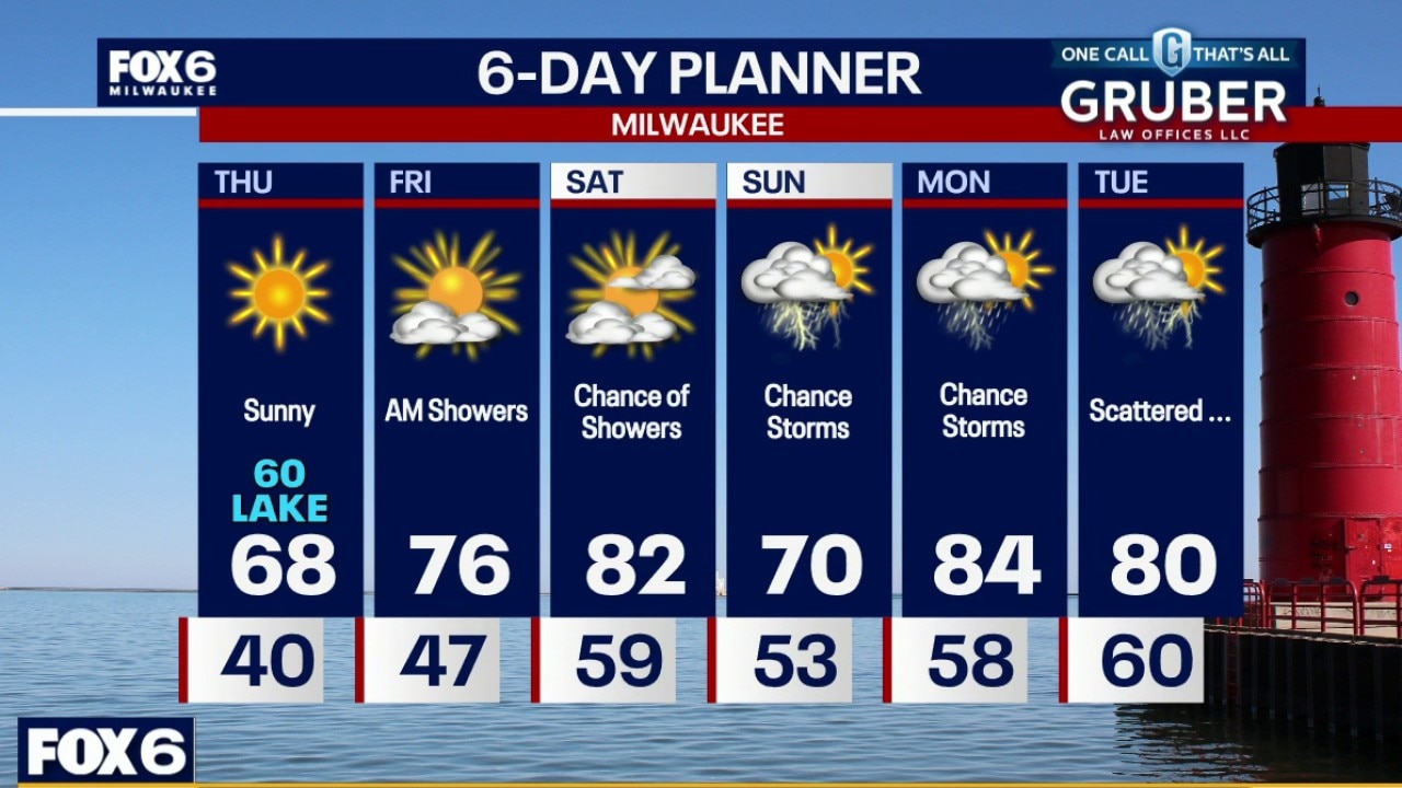
Patchy frost is possible early Thursday in the colder valleys and rural spots, but overall, Thursday rebounds nicely with sunshine and highs back into the 70s.
Patchy frost is possible early Thursday in the colder valleys and rural spots, but overall, Thursday rebounds nicely with sunshine and highs back into the 70s.
Weather Webcast with Chief Meteorologist Tom Wachs
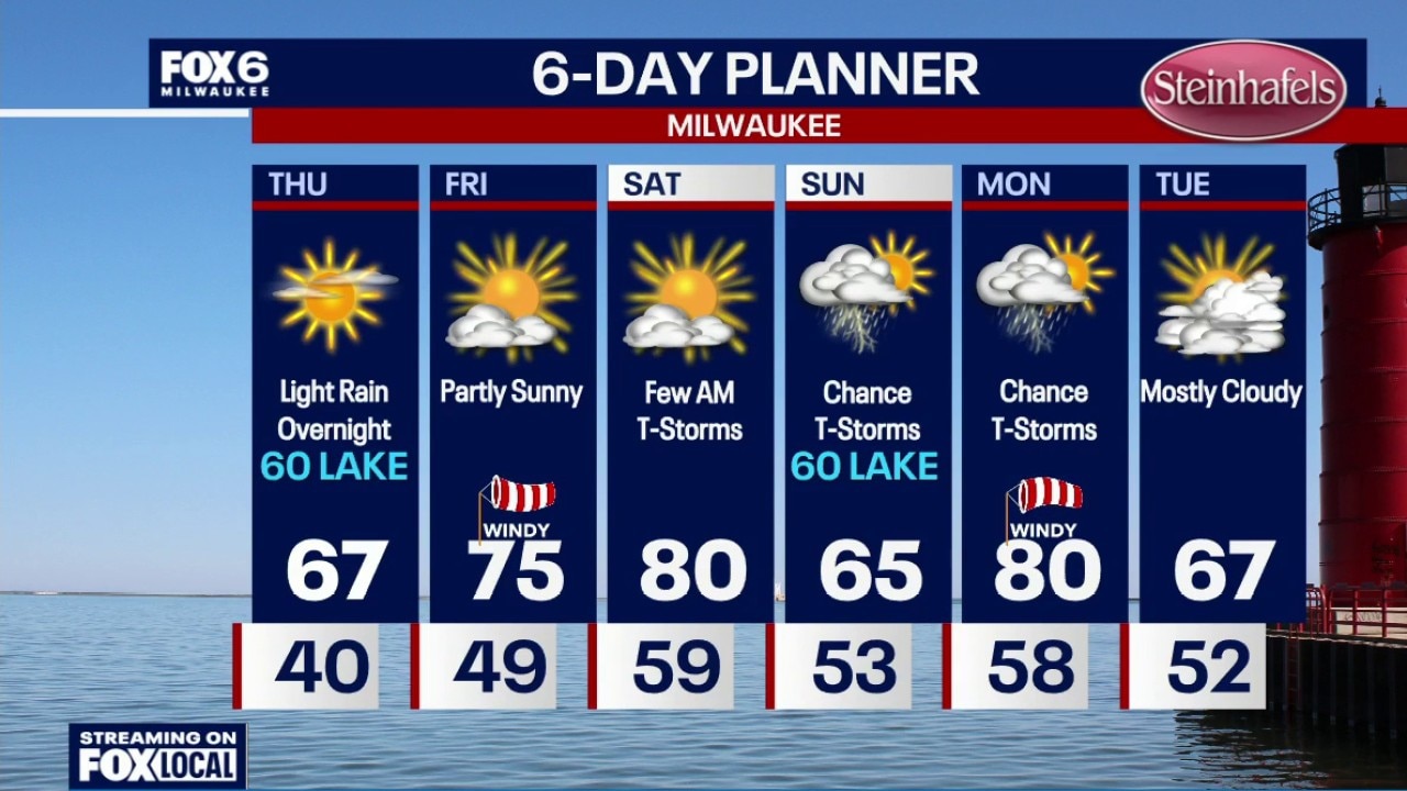
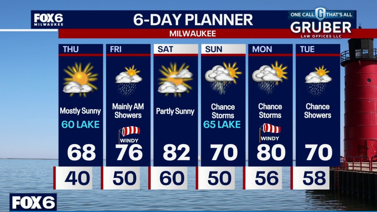
Mostly clear overnight. Patchy frost possible inland. Temperatures will settle around 40 overnight. Mostly sunny on Thursday with a high in the mid-to-upper 60s inland, around 60 near the lake. Light rain will move through overnight Thursday night with 0.10" or less.
Mostly clear overnight. Patchy frost possible inland. Temperatures will settle around 40 overnight. Mostly sunny on Thursday with a high in the mid-to-upper 60s inland, around 60 near the lake. Light rain will move through overnight Thursday night with 0.10" or less.
Weather Webcast with Chief Meteorologist Tom Wachs
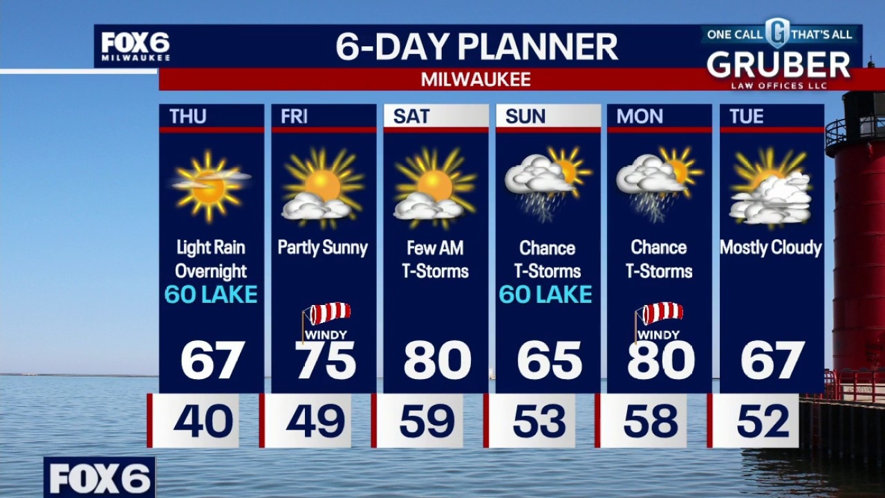
Mostly clear tonight. Patchy frost possible inland overnight. Temperatures will drop through the 50s this evening and settle around 40 overnight. Mostly sunny on Thursday with a high in the mid-to-upper 60s inland, around 60 near the lake. Light rain will move through overnight Thursday night with 0.10" or less.
Mostly clear tonight. Patchy frost possible inland overnight. Temperatures will drop through the 50s this evening and settle around 40 overnight. Mostly sunny on Thursday with a high in the mid-to-upper 60s inland, around 60 near the lake. Light rain will move through overnight Thursday night with 0.10" or less.
Weather Webcast with Stephanie Barichello
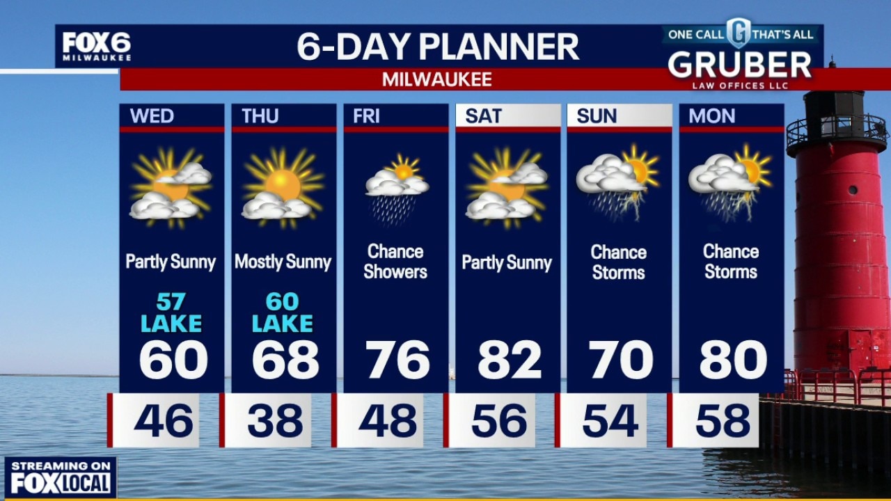
Calmer tonight, then sunny and pleasant on Thursday. Rain expected Thursday night into Friday morning with another batch potentially Friday night. Heating up Saturday then stormy Sunday into Monday.
Calmer tonight, then sunny and pleasant on Thursday. Rain expected Thursday night into Friday morning with another batch potentially Friday night. Heating up Saturday then stormy Sunday into Monday.
Weather webcast with Stephanie Barichello
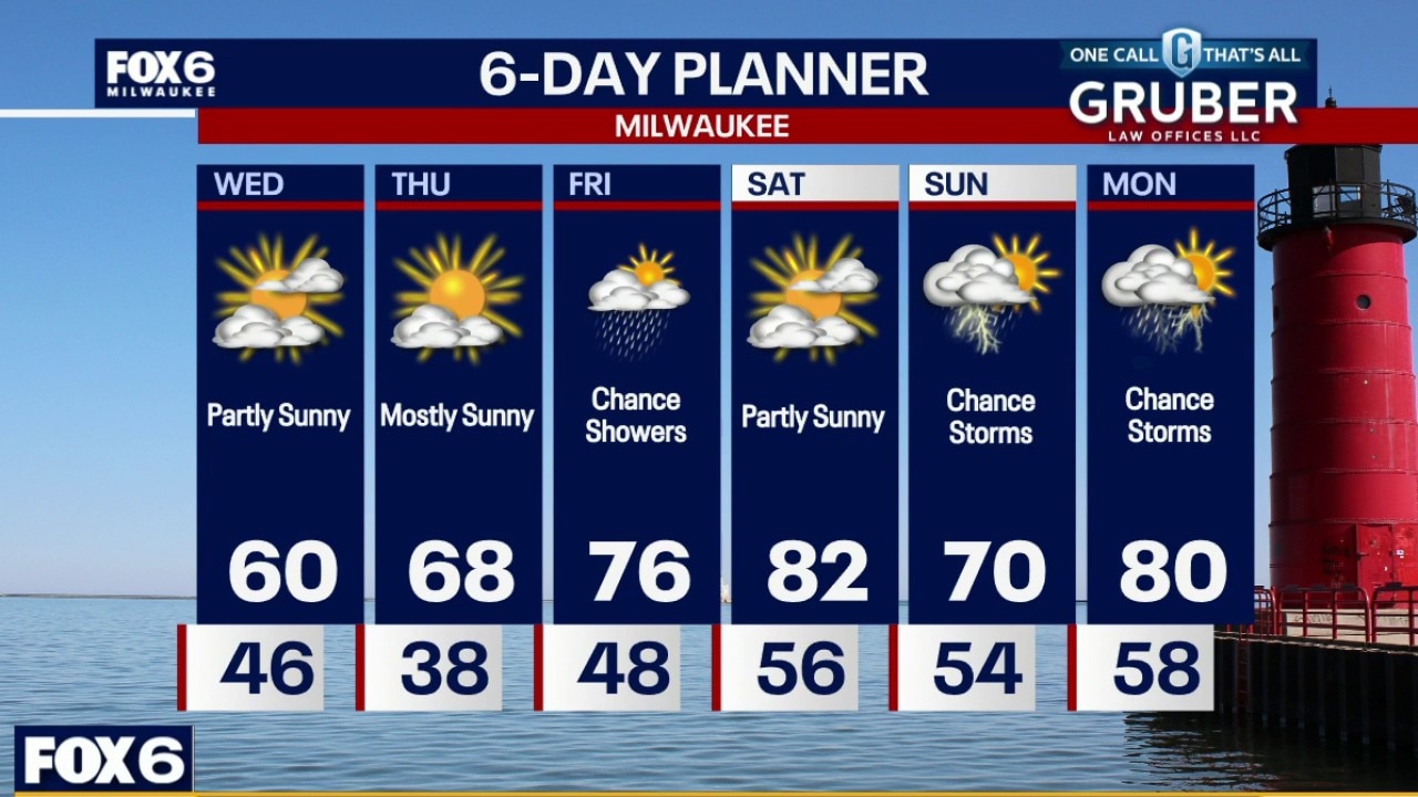
After Tuesday’s storms and gusty winds, we get a quieter and cooler break for our Wednesday with breezy northwest winds and highs mainly in the 60s.
After Tuesday’s storms and gusty winds, we get a quieter and cooler break for our Wednesday with breezy northwest winds and highs mainly in the 60s.
Weather webcast with Rob Haswell
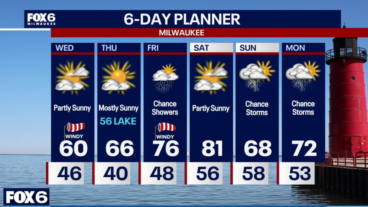
A few showers and/or storms possible early tonight with the passing of a cold front. Partly cloudy this evening with breezy northwesterly winds. Temperatures will be way cooler on Wednesday with highs in the upper 50s to low 60s and windy with gusts near 30mph. Partly sunny skies.
A few showers and/or storms possible early tonight with the passing of a cold front. Partly cloudy this evening with breezy northwesterly winds. Temperatures will be way cooler on Wednesday with highs in the upper 50s to low 60s and windy with gusts near 30mph. Partly sunny skies.
Weather Webcast with Holly Baker
Cooler temperatures arrive for Wednesday.
Cooler temperatures arrive for Wednesday.
Weather webcast with Lisa Michaels
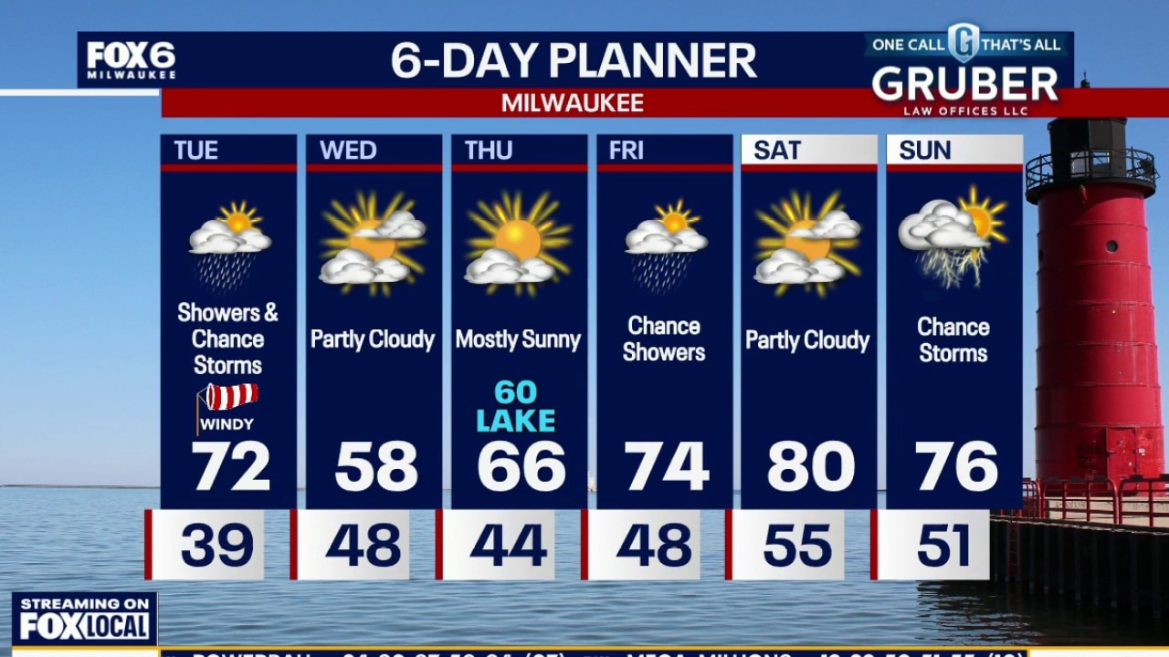
Southern Wisconsin gets a quick shot of active weather Tuesday as a clipper system spreads morning showers across the state, followed by the chance of a few afternoon thunderstorms as a cold front swings through.
Southern Wisconsin gets a quick shot of active weather Tuesday as a clipper system spreads morning showers across the state, followed by the chance of a few afternoon thunderstorms as a cold front swings through.
Weather webcast with Rob Haswell
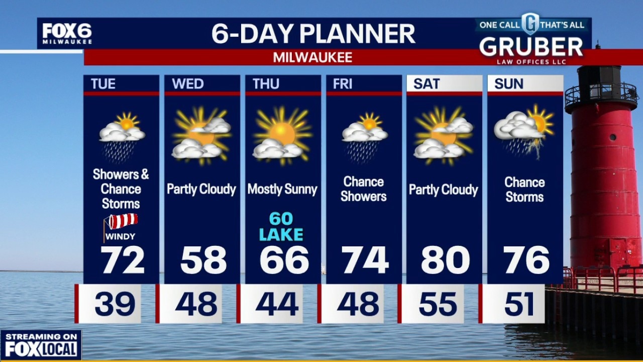
Southern Wisconsin gets a quick shot of active weather Tuesday as a clipper system spreads morning showers across the state, followed by the chance of a few afternoon thunderstorms as a cold front swings through.
Southern Wisconsin gets a quick shot of active weather Tuesday as a clipper system spreads morning showers across the state, followed by the chance of a few afternoon thunderstorms as a cold front swings through.
Weather Webcast with Chief Meteorologist Tom Wachs
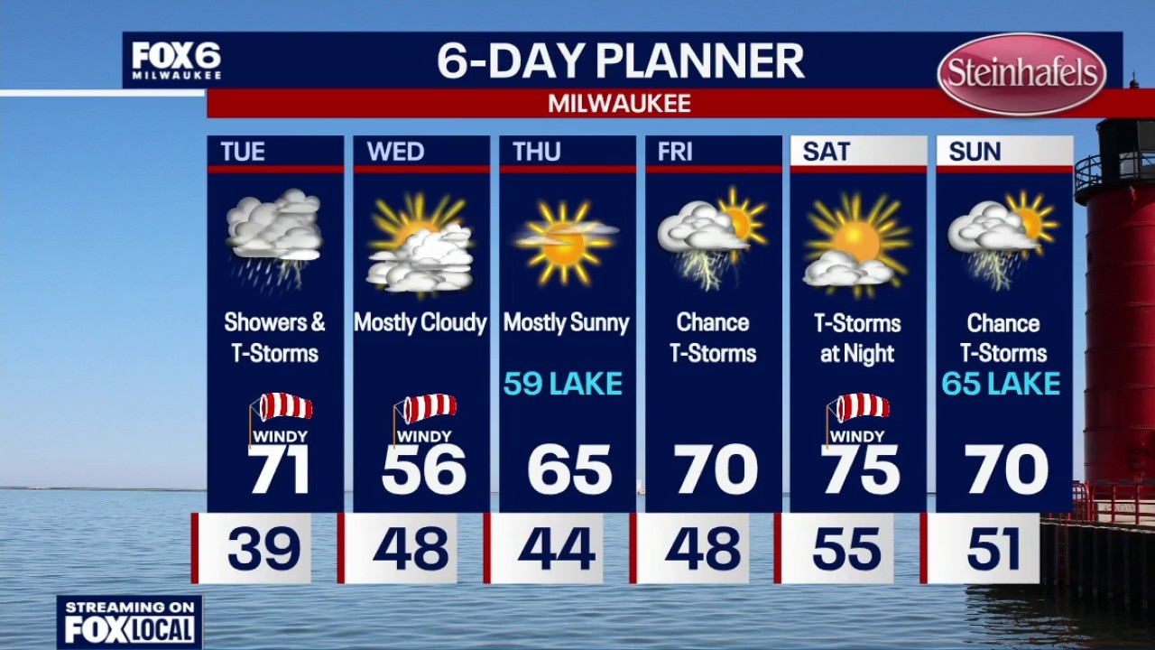
Increasing clouds overnight with temperatures settling in the upper 30s by sunrise. Rain showers will move in after 8am, picking up midday and ending by mid-afternoon. Around 0.10" of rain expected.
Increasing clouds overnight with temperatures settling in the upper 30s by sunrise. Rain showers will move in after 8am, picking up midday and ending by mid-afternoon. Around 0.10" of rain expected.
Weather Webcast with Chief Meteorologist Tom Wachs
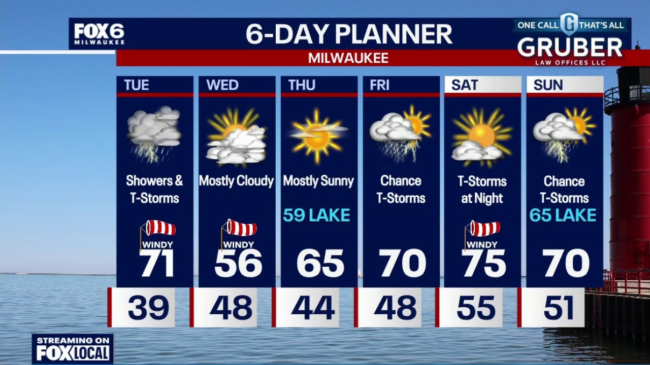
Mostly clear this evening, increasing clouds overnight. Temperatures will drop through the 40s and settle in the upper 30s overnight. Rain showers will move in after 8am, picking up midday and ending by mid-afternoon. Around 0.10" of rain expected.
Mostly clear this evening, increasing clouds overnight. Temperatures will drop through the 40s and settle in the upper 30s overnight. Rain showers will move in after 8am, picking up midday and ending by mid-afternoon. Around 0.10" of rain expected.
Weather webcast with Stephanie Barichello
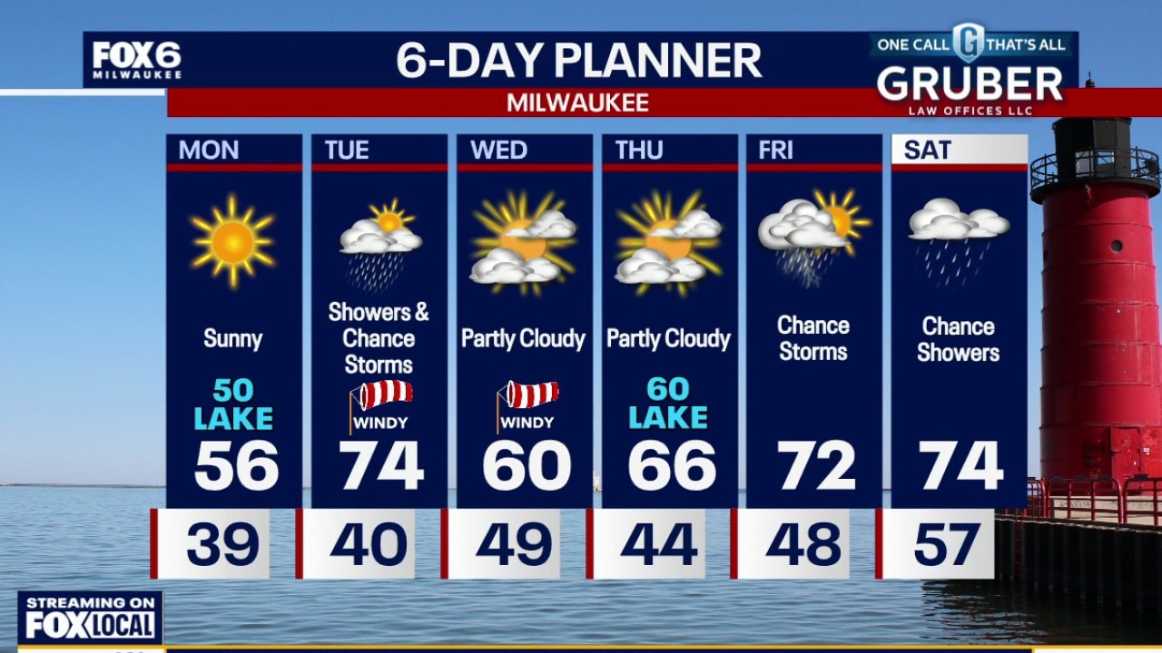
A lake breeze will create a pretty sharp temperature split between the lakeshore and inland areas, with 50s near the lake and near 60 farther west.
A lake breeze will create a pretty sharp temperature split between the lakeshore and inland areas, with 50s near the lake and near 60 farther west.
Weather webcast with Rob Haswell
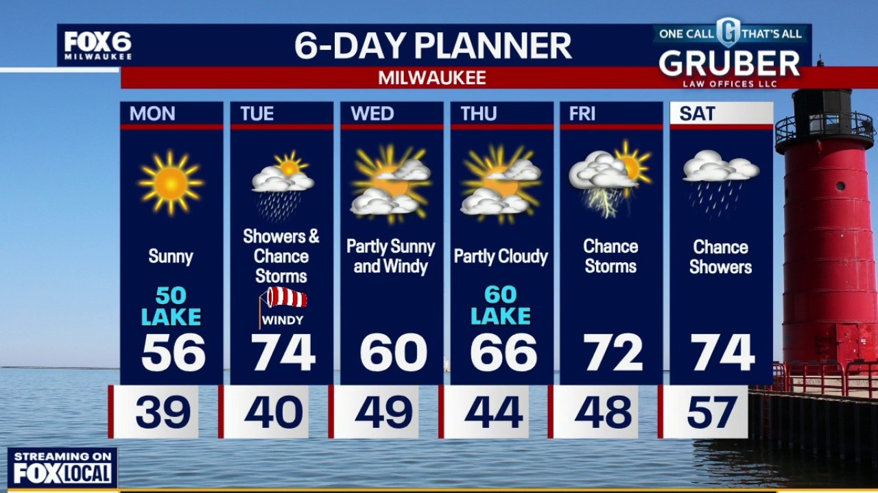
Another chilly start Monday morning with widespread frost away Lake Michigan. A lake breeze will create a pretty sharp temperature split between the lakeshore and inland areas, with 50s near the lake and near 60 farther west.
Another chilly start Monday morning with widespread frost away Lake Michigan. A lake breeze will create a pretty sharp temperature split between the lakeshore and inland areas, with 50s near the lake and near 60 farther west.
Weather Webcast with Chief Meteorologist Tom Wachs
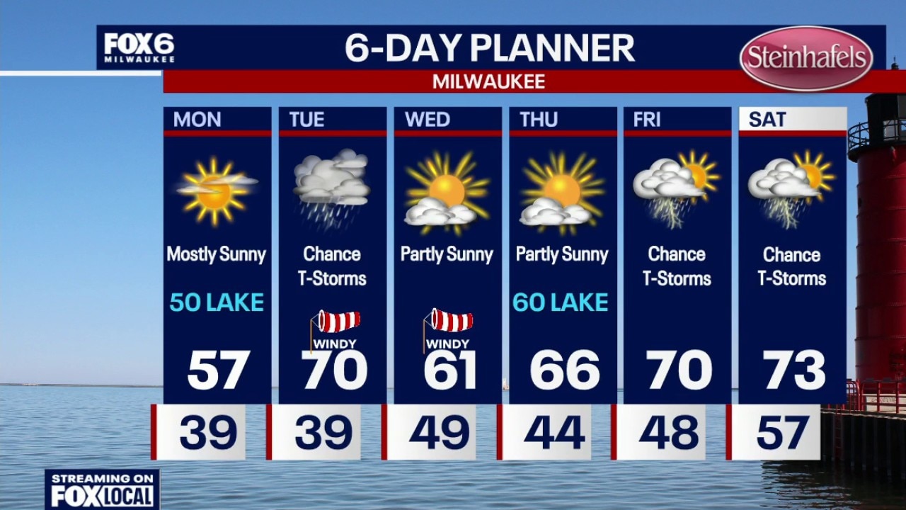
Frost Advisory 12am-8am for Waukesha, Jefferson, Walworth, Dodge, Washington, Ozaukee, Sheboygan and Fond du Lac Co. Clearing skies overnight with more frost on the way away from the lake. Temperatures will dip into the 30s by sunrise. Frost is also possible on Tuesday morning.
Frost Advisory 12am-8am for Waukesha, Jefferson, Walworth, Dodge, Washington, Ozaukee, Sheboygan and Fond du Lac Co. Clearing skies overnight with more frost on the way away from the lake. Temperatures will dip into the 30s by sunrise. Frost is also possible on Tuesday morning.
Weather Webcast with Chief Meteorologist Tom Wachs
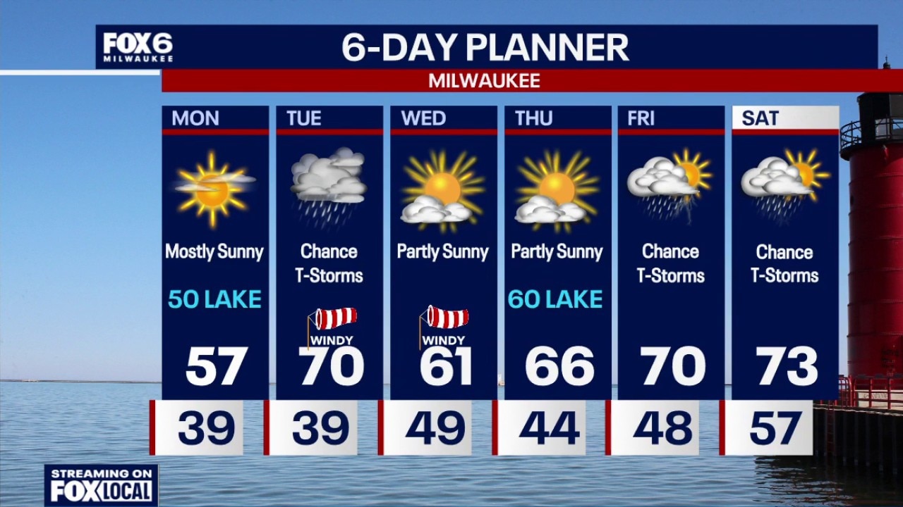
Frost Advisory 12am-8am for Waukesha, Jefferson, Walworth, Dodge, Washington, Ozaukee, Sheboygan and Fond du Lac Co.
Frost Advisory 12am-8am for Waukesha, Jefferson, Walworth, Dodge, Washington, Ozaukee, Sheboygan and Fond du Lac Co.
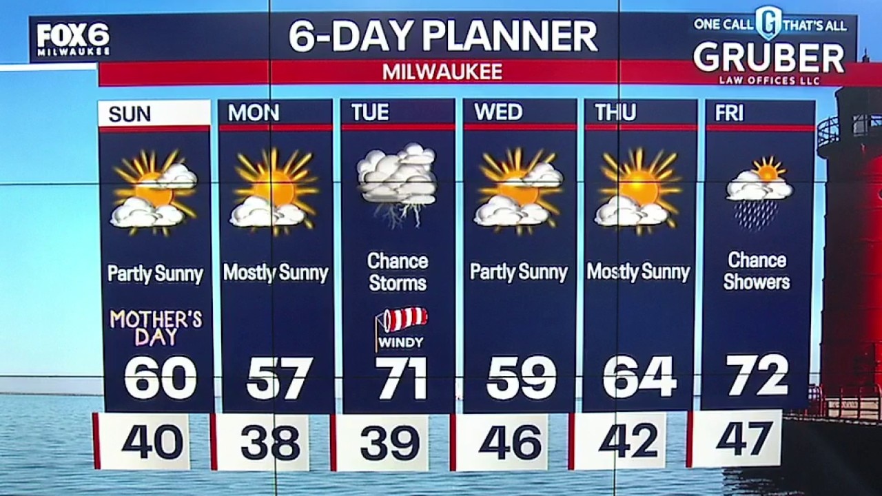
Weather webcast with meteorologist Lisa Michaels
Mostly sunny skies with partly sunny skies in the afternoon. There is a slight chance for a few sprinkles, but most areas remain dry. Highs near 60F on Sunday.
Mostly sunny skies with partly sunny skies in the afternoon. There is a slight chance for a few sprinkles, but most areas remain dry. Highs near 60F on Sunday.
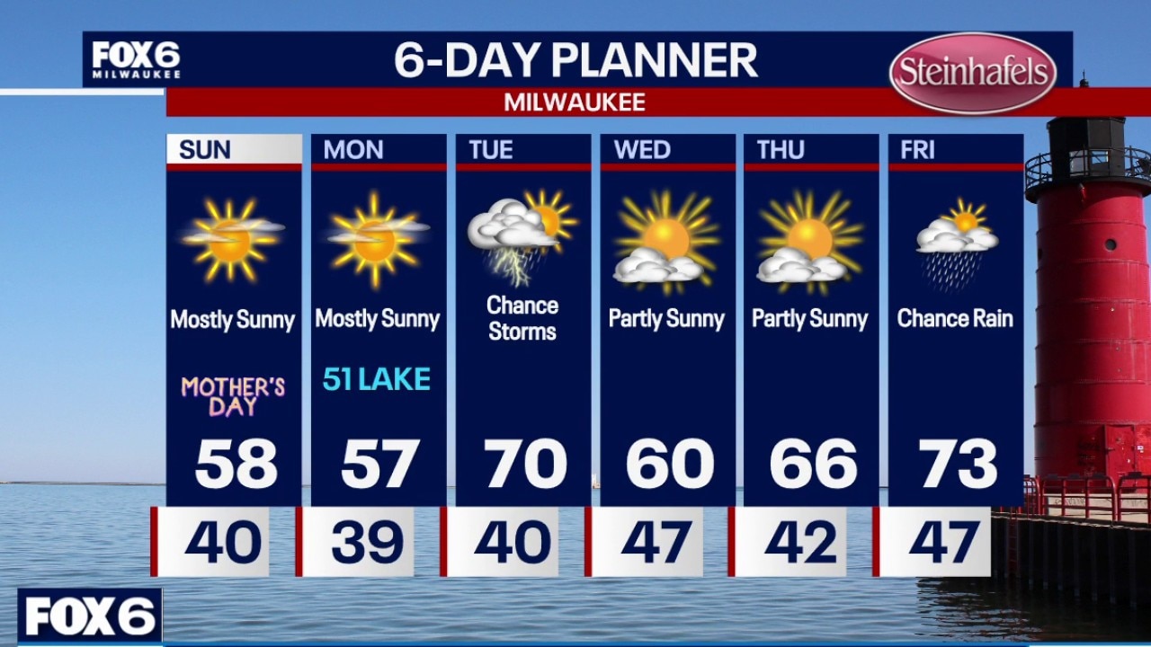
Weather Webcast with Holly Baker
Beautiful weather for Mother's Day.
Beautiful weather for Mother's Day.
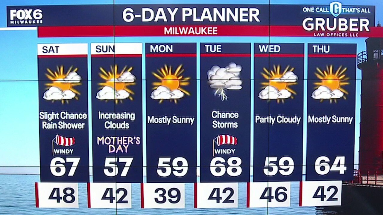
Weather webcast with meteorologist Lisa Michaels
Partly sunny skies on Saturday with a slight chance for a few sprinkles or a shower. Temperatures warmer on Saturday in the mid to upper 60s. Isolated 70s near the border. Breezy with winds gusting near 30 mph.
Partly sunny skies on Saturday with a slight chance for a few sprinkles or a shower. Temperatures warmer on Saturday in the mid to upper 60s. Isolated 70s near the border. Breezy with winds gusting near 30 mph.
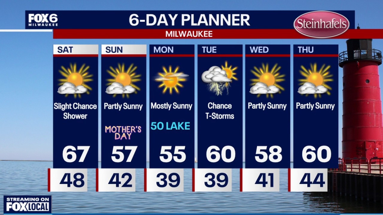
Weather Webcast with Holly Baker
Slight chance of rain arrives on Saturday.
Slight chance of rain arrives on Saturday.