

Weather Webcast with Tom Wachs
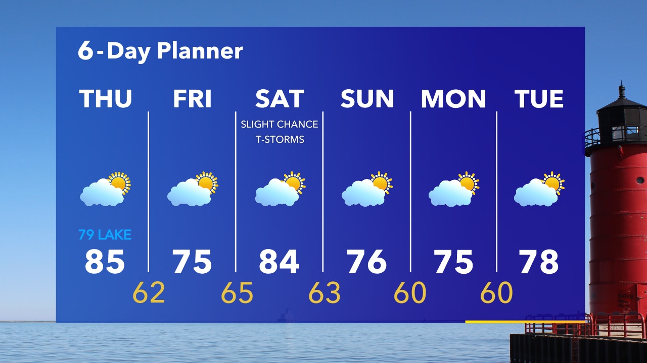
An intense squall line could move through SE WI late this evening and overnight. Hurricane force winds and embedded tornadoes will be possible.
An intense squall line could move through SE WI late this evening and overnight. Hurricane force winds and embedded tornadoes will be possible.
Weather webcast with Rob Haswell
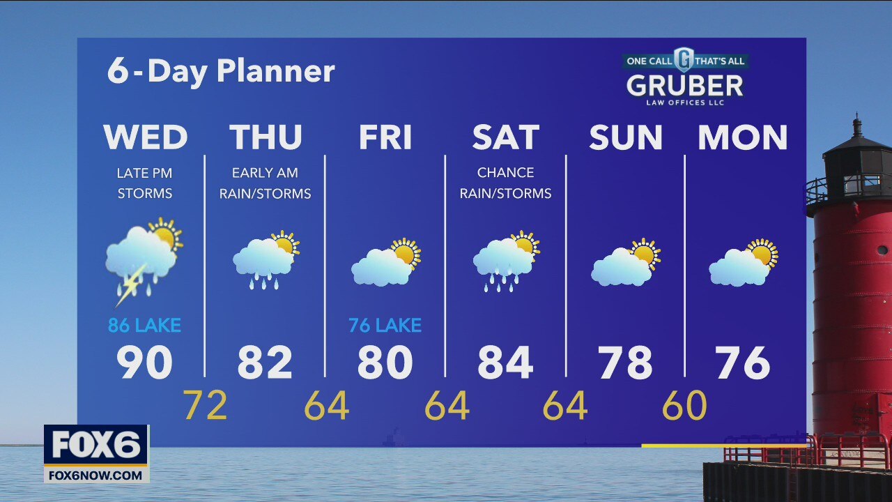
We start the day with some sun but then clouds return and by this afternoon and evening we expect to see thunderstorms in our areas. There is a strong potential for those storms to become severe. That risk for severe storms will last into the overnight.
We start the day with some sun but then clouds return and by this afternoon and evening we expect to see thunderstorms in our areas. There is a strong potential for those storms to become severe. That risk for severe storms will last into the overnight.
Weather webcast with Rob Haswell
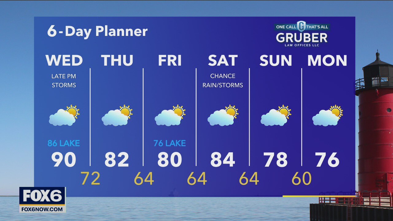
We start the day with some sun but then clouds return and by this afternoon and evening we expect to see thunderstorms in our areas. There is a strong potential for those storms to become severe in our area. That risk for severe storms will last into the overnight.
We start the day with some sun but then clouds return and by this afternoon and evening we expect to see thunderstorms in our areas. There is a strong potential for those storms to become severe in our area. That risk for severe storms will last into the overnight.
Weather Webcast with Tom Wachs
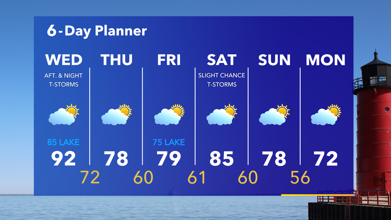
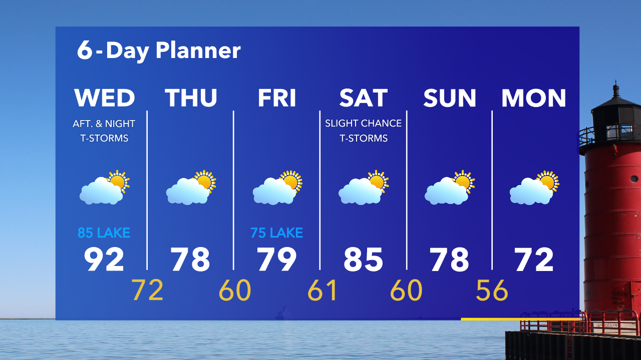
There is a slight chance for a t-storm overnight with temperatures around 70 by sunrise. Partly sunny with an isolated afternoon t-storm possible Wednesday. A squall line with damaging winds is possible Wednesday night.
There is a slight chance for a t-storm overnight with temperatures around 70 by sunrise. Partly sunny with an isolated afternoon t-storm possible Wednesday. A squall line with damaging winds is possible Wednesday night.
Weather Webcast with Tom Wachs
There is a slight chance for a t-storm tonight with temperatures falling through the 70s. Afternoon t-storms are possible on Wednesday but a squall line with damaging winds is forecast across our area Wednesday night.
There is a slight chance for a t-storm tonight with temperatures falling through the 70s. Afternoon t-storms are possible on Wednesday but a squall line with damaging winds is forecast across our area Wednesday night.
Weather webcast with Rob Haswell
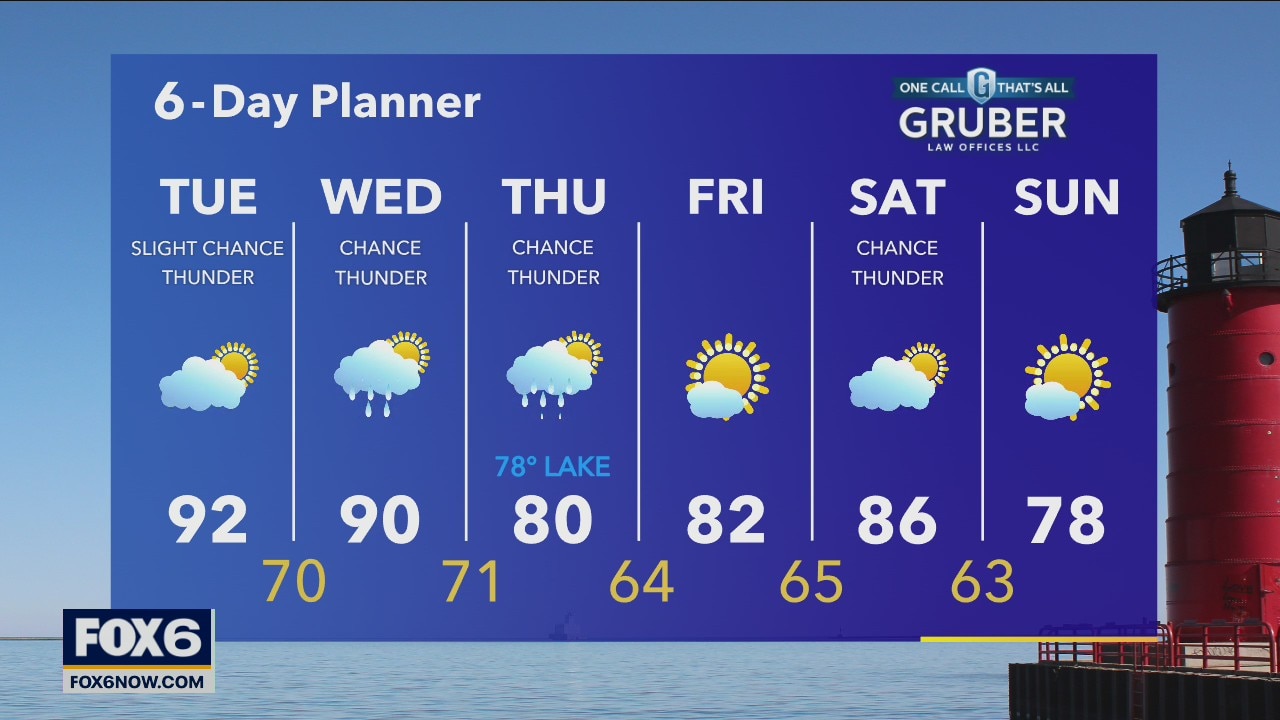
Slight chance for a few early showers and thunderstorms then we clear out to sunshine. Temperatures will be in the low 90s today and dewpoints will climb to to the upper 60s for a very humid day.
Slight chance for a few early showers and thunderstorms then we clear out to sunshine. Temperatures will be in the low 90s today and dewpoints will climb to to the upper 60s for a very humid day.
Weather Webcast with Tom Wachs
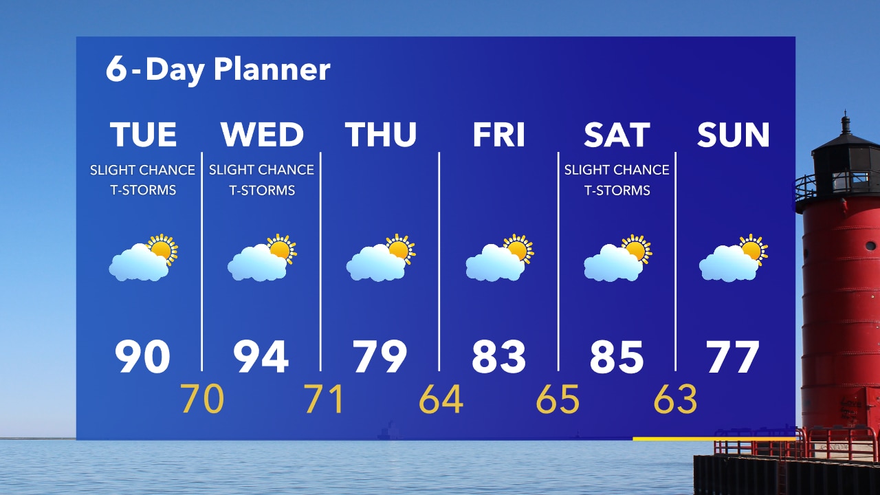
Mostly clear overnight with temperatures around 70 by sunrise. Clouds in the morning with a slight chance for t-storms. Warming up quickly in the afternoon with a high around 90.
Mostly clear overnight with temperatures around 70 by sunrise. Clouds in the morning with a slight chance for t-storms. Warming up quickly in the afternoon with a high around 90.
Weather Webcast with Tom Wachs
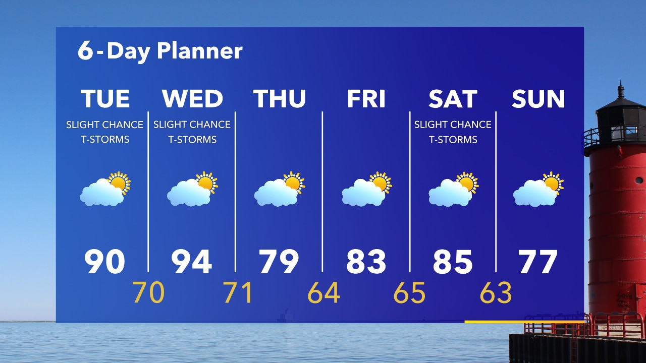
Mostly clear to partly cloudy tonight. Temperatures dropping into the 70s overnight. Another hot day on Tuesday with a slight chance for t-storms and a high around 90.
Mostly clear to partly cloudy tonight. Temperatures dropping into the 70s overnight. Another hot day on Tuesday with a slight chance for t-storms and a high around 90.
Weather Webcast with A.J. Waterman
Another hot one across the area, with temps in the mid-90s! Cooler weather arrives late week after another chance for storms.
Another hot one across the area, with temps in the mid-90s! Cooler weather arrives late week after another chance for storms.
Wildfire Smoke 7/20/21
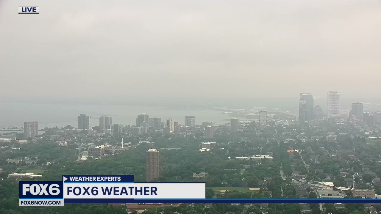
Wildfire smoke along cold frontal boundary heading into Milwaukee.
Wildfire smoke along cold frontal boundary heading into Milwaukee.

Weather Webcast with A.J. Waterman
Heat continues to build in, with the hottest day so far likely today. Storm chances return Tuesday and Wednesday, with cooler weather to follow Thursday and Friday.
Heat continues to build in, with the hottest day so far likely today. Storm chances return Tuesday and Wednesday, with cooler weather to follow Thursday and Friday.
Weather Webcast with Tom Wachs
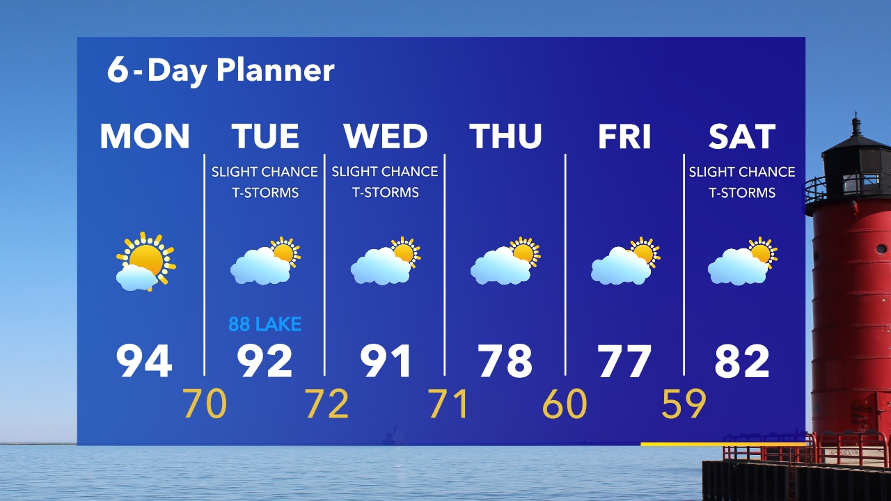
Mostly clear overnight with temperatures in the upper 60s by sunrise. Mostly sunny and hot again on Monday with highs in the low-to-mid 90s. A few t-storms are possible in Fond du Lac & Sheboygan counties Monday night.
Mostly clear overnight with temperatures in the upper 60s by sunrise. Mostly sunny and hot again on Monday with highs in the low-to-mid 90s. A few t-storms are possible in Fond du Lac & Sheboygan counties Monday night.
Weather Webcast with Tom Wachs
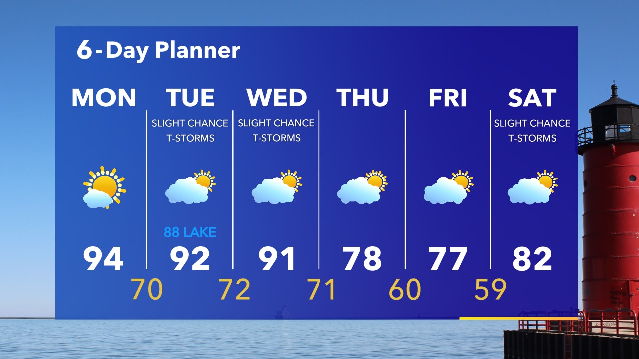
Mostly clear tonight with temperatures falling into the 70s later this evening and into the 60s overnight. Mostly sunny and hot again on Monday with highs in the 90s.
Mostly clear tonight with temperatures falling into the 70s later this evening and into the 60s overnight. Mostly sunny and hot again on Monday with highs in the 90s.

Weather webcast with A.J. Waterman
Mostly sunny but hazy today with temps back into the 90s. We see some drier weather late Sunday and into Monday, but the humidity will return Monday afternoon. Chances for storms return on Tuesday and Wednesday, as weather systems will move through the area.
Mostly sunny but hazy today with temps back into the 90s. We see some drier weather late Sunday and into Monday, but the humidity will return Monday afternoon. Chances for storms return on Tuesday and Wednesday, as weather systems will move through the area.
Weather Webcast with A.J. Waterman
Heat and humidity to continue over the next few days...
Heat and humidity to continue over the next few days...
Weather Webcast with AJ Waterman
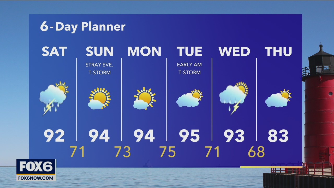
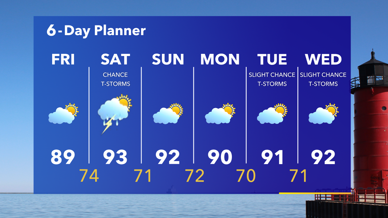
Saturday starts dry, but scattered storms are possible during the mid-afternoon as front is expected to pass through the area. Conditions stay hot and humid for the next several days, with highs in the 90s and dewpoints around 70!
Saturday starts dry, but scattered storms are possible during the mid-afternoon as front is expected to pass through the area. Conditions stay hot and humid for the next several days, with highs in the 90s and dewpoints around 70!
Weather Webcast with A.J. Waterman
Heat and humidity expected to stick around, with storms back in the forecast Saturday...
Heat and humidity expected to stick around, with storms back in the forecast Saturday...

Weather webcast with Rob Haswell
A warm front lifts to our north today and boosts temperatures into the mid to upper 80s with much higher dewpoints making it feel even warmer. We warm into the 90s for the weekend and through much of next week.
A warm front lifts to our north today and boosts temperatures into the mid to upper 80s with much higher dewpoints making it feel even warmer. We warm into the 90s for the weekend and through much of next week.
Weather Webcast with Tom Wachs
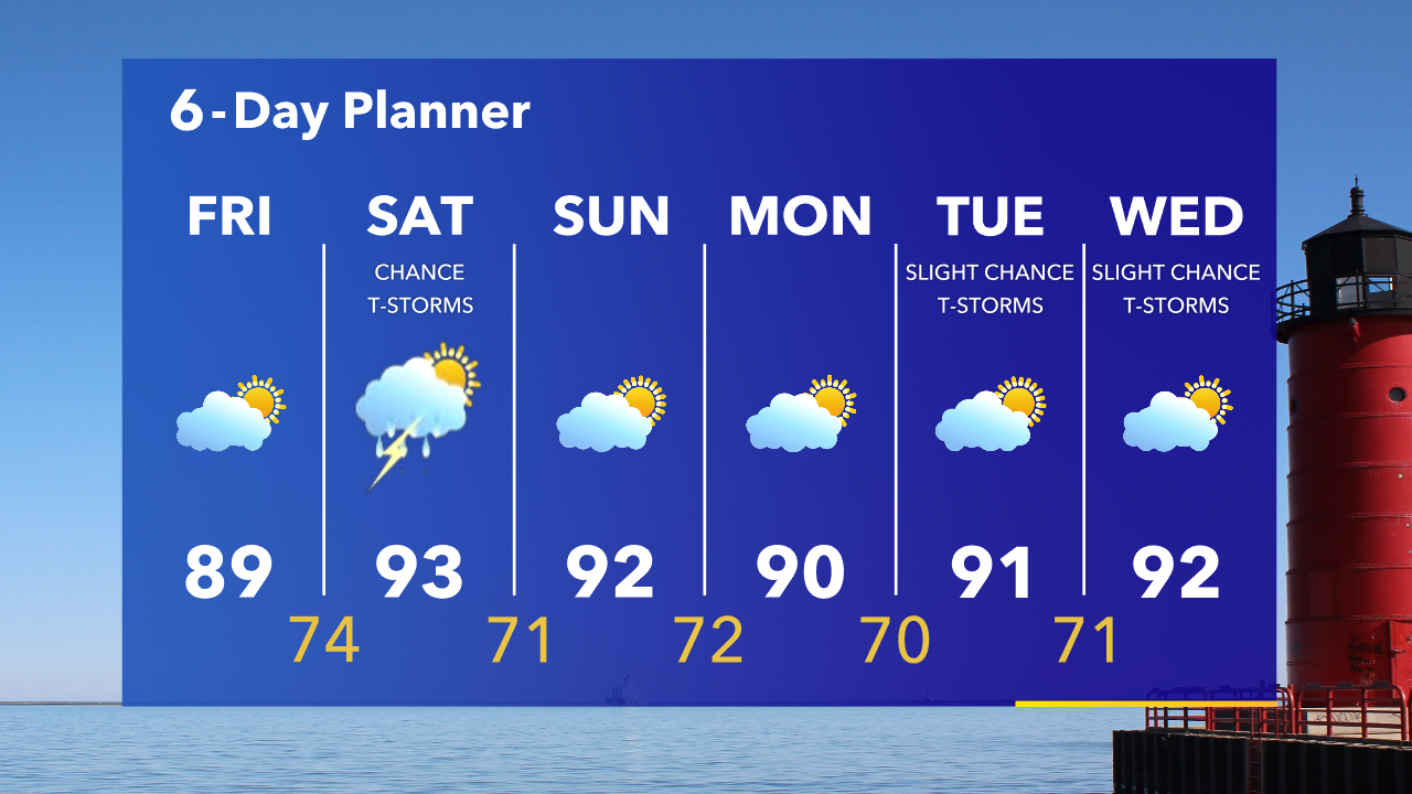
Slight chance for a t-storm overnight. Temperatures dropping into the upper 60s by sunrise. Hot and humid on Friday with temperatures in the upper 80s, slightly cooler the closer you get to the lake.
Slight chance for a t-storm overnight. Temperatures dropping into the upper 60s by sunrise. Hot and humid on Friday with temperatures in the upper 80s, slightly cooler the closer you get to the lake.
Weather Webcast with Tom Wachs
A few isolated t-storms are possible tonight. Temperatures falling into the 60s. Partly sunny on Friday with wildfire smoke expected in our skies. Hot and humid with highs in the upper 80s, turning cooler near the lake in the afternoon.
A few isolated t-storms are possible tonight. Temperatures falling into the 60s. Partly sunny on Friday with wildfire smoke expected in our skies. Hot and humid with highs in the upper 80s, turning cooler near the lake in the afternoon.