

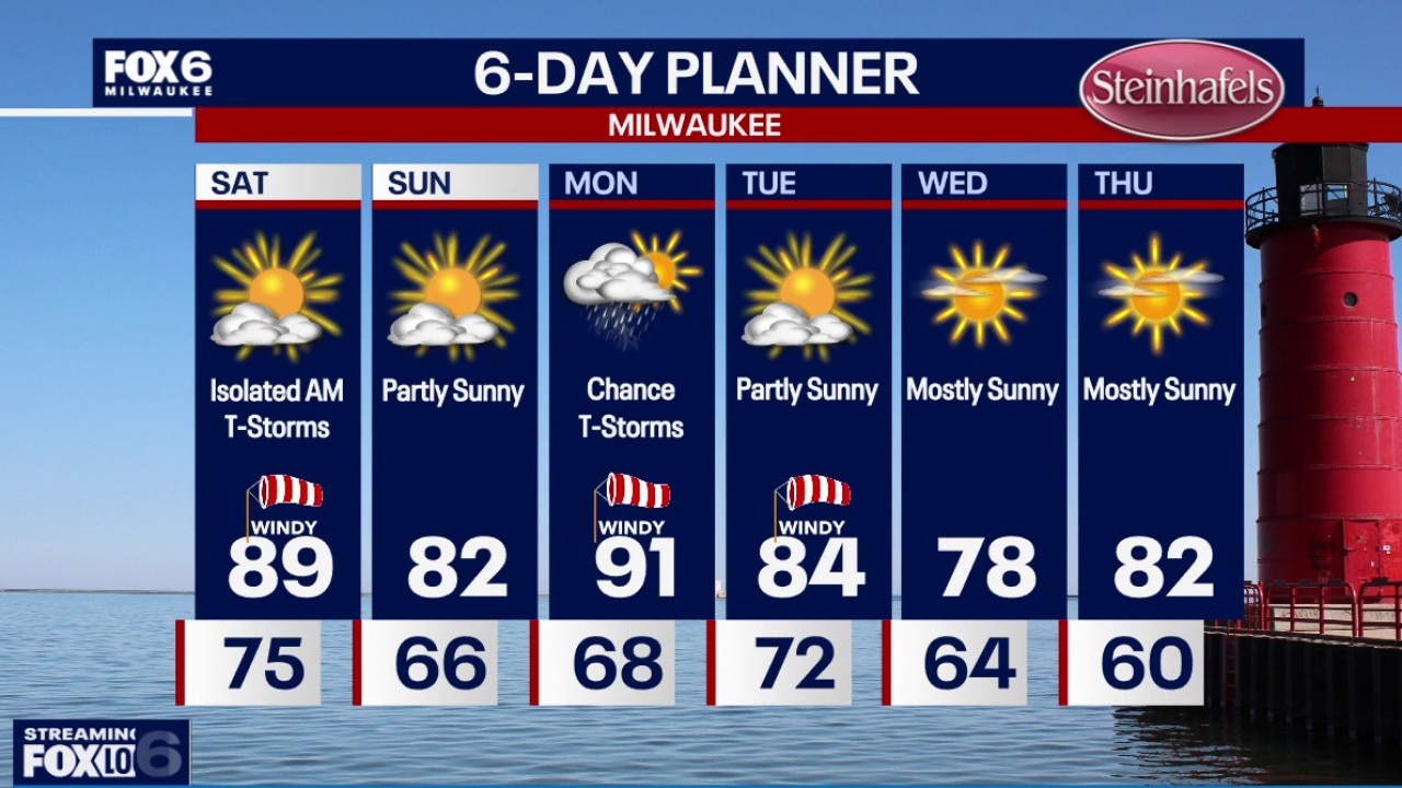
Milwaukee weather: The smoke clears for now.
A chance for an isolated storm is likely Saturday morning before the smoke makes a return.
A chance for an isolated storm is likely Saturday morning before the smoke makes a return.
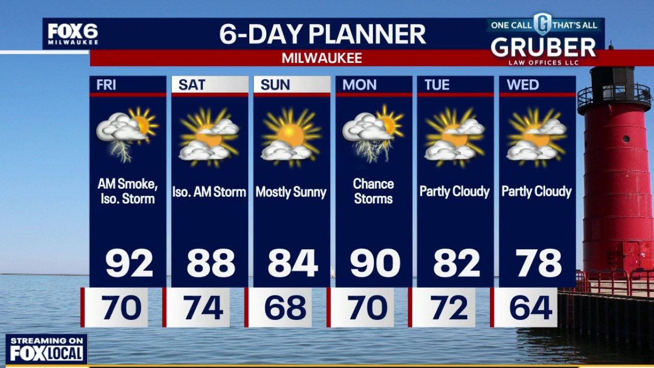
Weather webcast with Stephanie Barichello
Smoke will clear out during the afternoon and early evening, but air quality could still be unhealthy for some.
Smoke will clear out during the afternoon and early evening, but air quality could still be unhealthy for some.
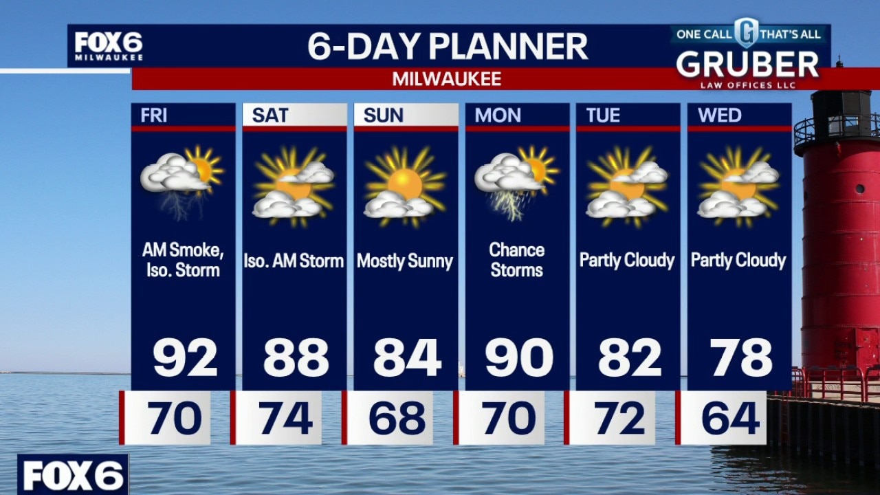
Weather Webcast with Stephanie Barichello
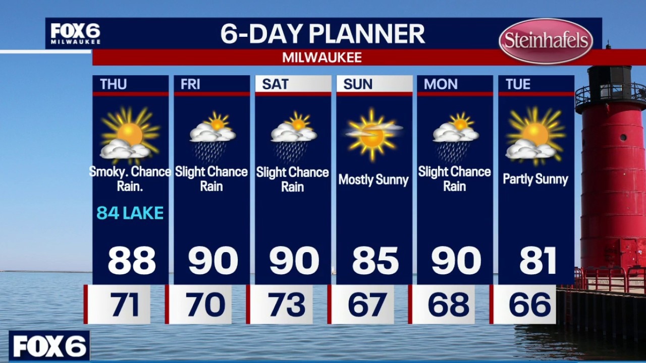
Thick wildfire smoke continues through midday today, creating dangerous air quality. An incoming warm front will bring southwest winds which clear the smoke out of SE WI. It will be hot and humid with temperatures in the 90s. Slight chance of a storm this afternoon again Saturday morning. Thinner wildfire smoke may return over the weekend.
Thick wildfire smoke continues through midday today, creating dangerous air quality. An incoming warm front will bring southwest winds which clear the smoke out of SE WI. It will be hot and humid with temperatures in the 90s. Slight chance of a storm this afternoon again Saturday morning. Thinner wildfire smoke may return over the weekend.
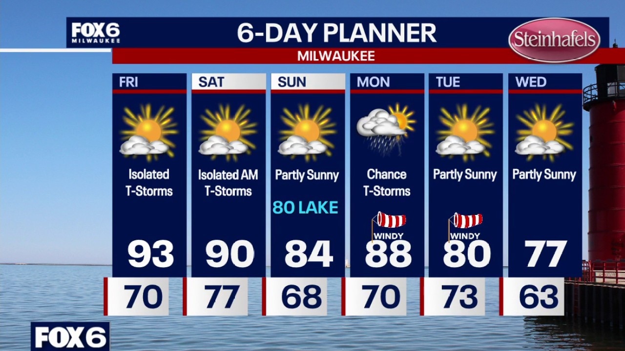
Weather Webcast with Chief Meteorologist Tom Wachs
Air Quality Alert until Noon on Friday for all of SE WI Very smoky overnight into Friday morning, clearing out Friday afternoon. Temperatures in the 70s by sunrise. A few showers are possible overnight as well. Partly sunny with isolated t-storms on Friday. Hot and humid. AM wildfire smoke. Highs in the low-to-mid 90s with a heat index of 99.
Air Quality Alert until Noon on Friday for all of SE WI Very smoky overnight into Friday morning, clearing out Friday afternoon. Temperatures in the 70s by sunrise. A few showers are possible overnight as well. Partly sunny with isolated t-storms on Friday. Hot and humid. AM wildfire smoke. Highs in the low-to-mid 90s with a heat index of 99.
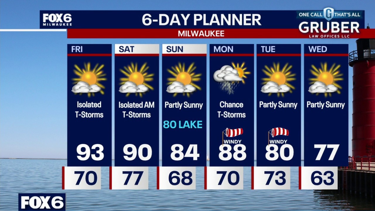
Weather Webcast with Chief Meteorologist Tom Wachs
Air Quality Alert until Noon on Friday for all of SE WI Very smoky tonight into Friday morning, clearing out Friday afternoon. Temperatures in the 70s tonight. A few showers are possible overnight as well.
Air Quality Alert until Noon on Friday for all of SE WI Very smoky tonight into Friday morning, clearing out Friday afternoon. Temperatures in the 70s tonight. A few showers are possible overnight as well.
Weather Webcast with Stephanie Barichello
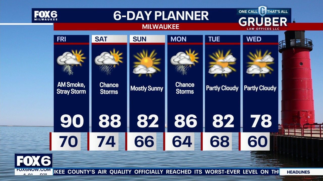
Hazardous to very unhealthy air quality will continue tonight to midday Friday thanks to lingering, thick wildfire smoke. An incoming warm front Friday will clear the smoke in the afternoon but also allow temperatures to climb back to 90s. There is a slight chance of storms Friday and Saturday, then wildfire smoke could return on Saturday.
Hazardous to very unhealthy air quality will continue tonight to midday Friday thanks to lingering, thick wildfire smoke. An incoming warm front Friday will clear the smoke in the afternoon but also allow temperatures to climb back to 90s. There is a slight chance of storms Friday and Saturday, then wildfire smoke could return on Saturday.
Weather webcast with Stephanie Barichello
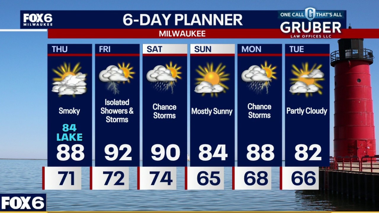
Smoke continues to be the biggest weather story today, with poor air quality and reduced visibility expected across much of southern Wisconsin. It will stay hot and humid through Friday.
Smoke continues to be the biggest weather story today, with poor air quality and reduced visibility expected across much of southern Wisconsin. It will stay hot and humid through Friday.
Weather webcast with Rob Haswell
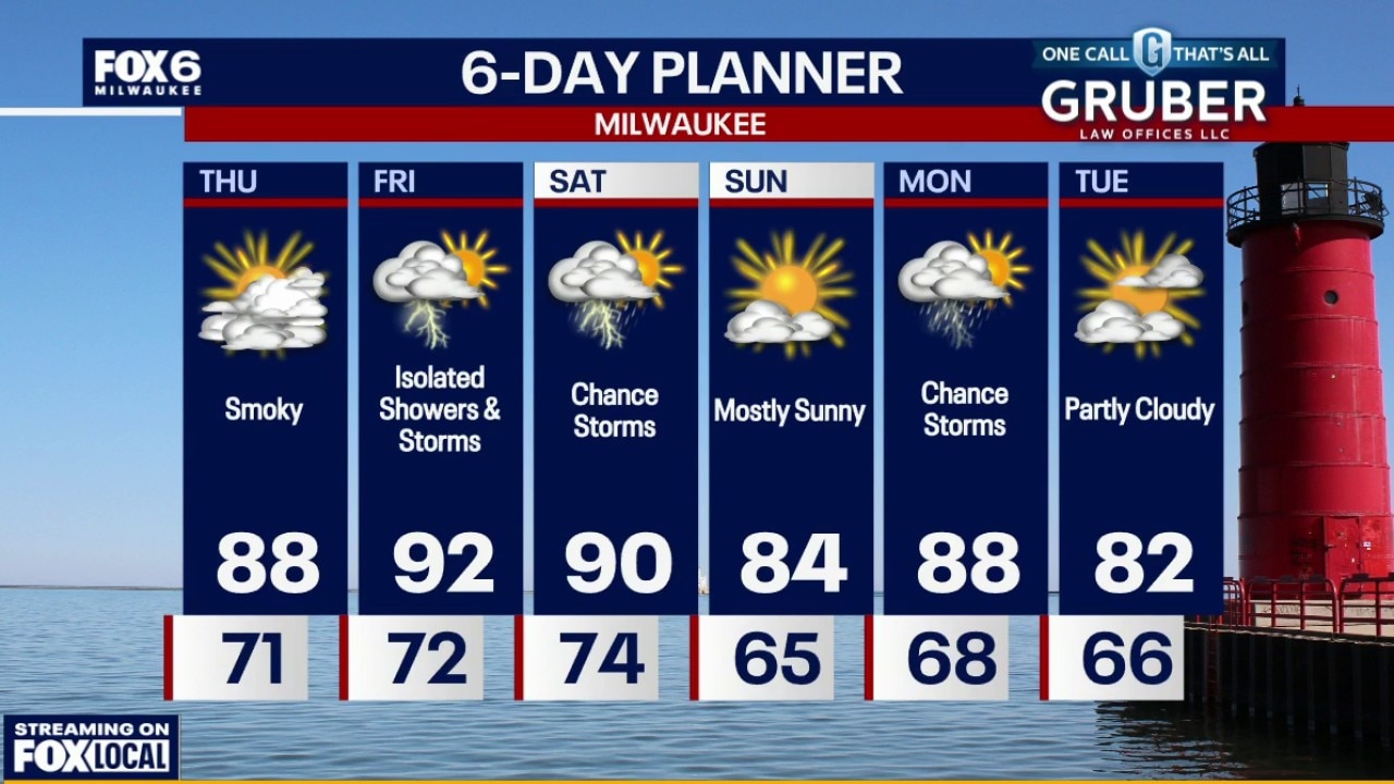
Smoke continues to be the biggest weather story today, with poor air quality and reduced visibility expected across much of southern Wisconsin. It will stay hot and humid through Friday.
Smoke continues to be the biggest weather story today, with poor air quality and reduced visibility expected across much of southern Wisconsin. It will stay hot and humid through Friday.
Webcast Weather with Holly Baker
All eyes are on the Canadian Wildfire Smoke that is moving southward.
All eyes are on the Canadian Wildfire Smoke that is moving southward.
Weather webcast with Rob Haswell
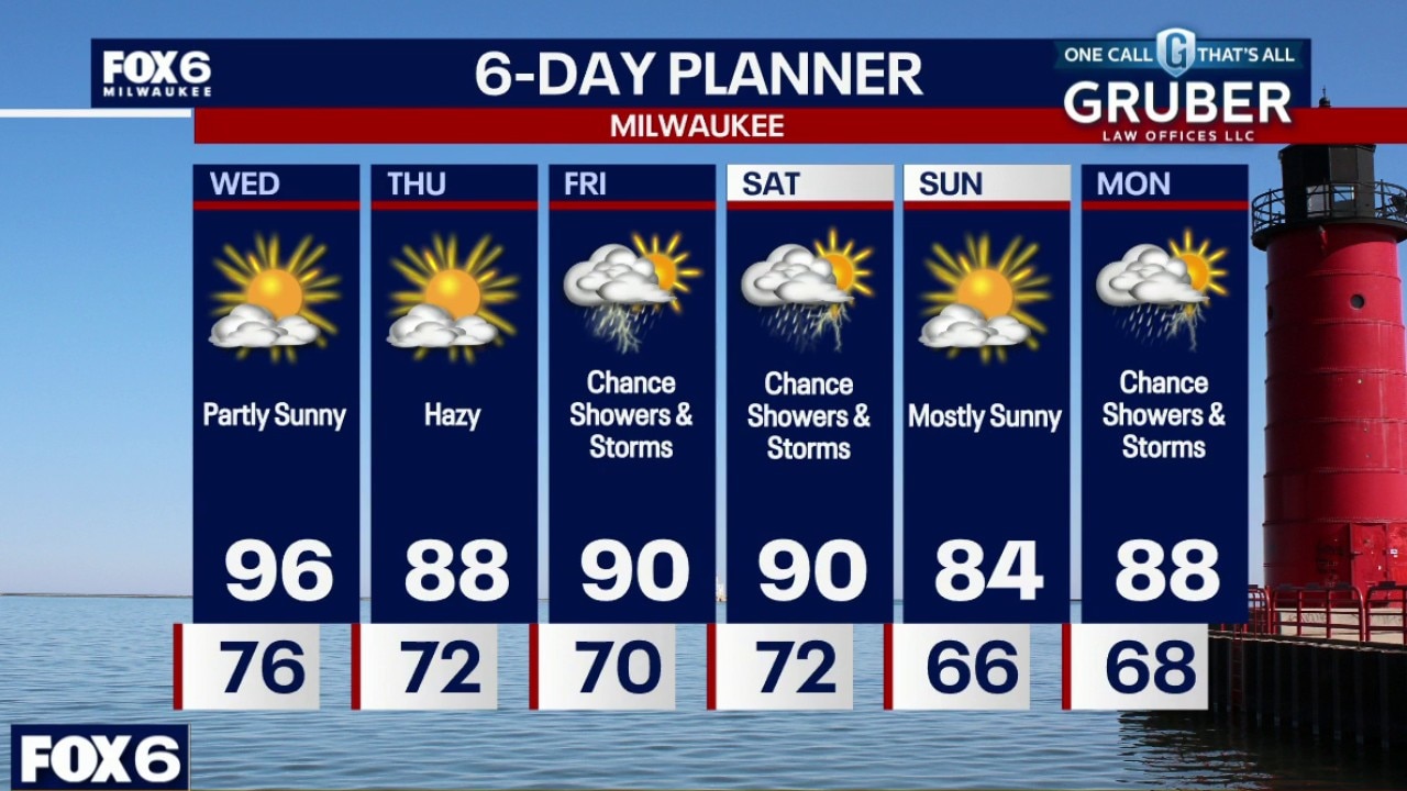
The heat hangs on for at least one more day, with highs well in the 90s Wednesday and heat index values climbing into the low 100s before some relief finally begins to arrive.
The heat hangs on for at least one more day, with highs well in the 90s Wednesday and heat index values climbing into the low 100s before some relief finally begins to arrive.
Weather Webcast with Chief Meteorologist Tom Wachs
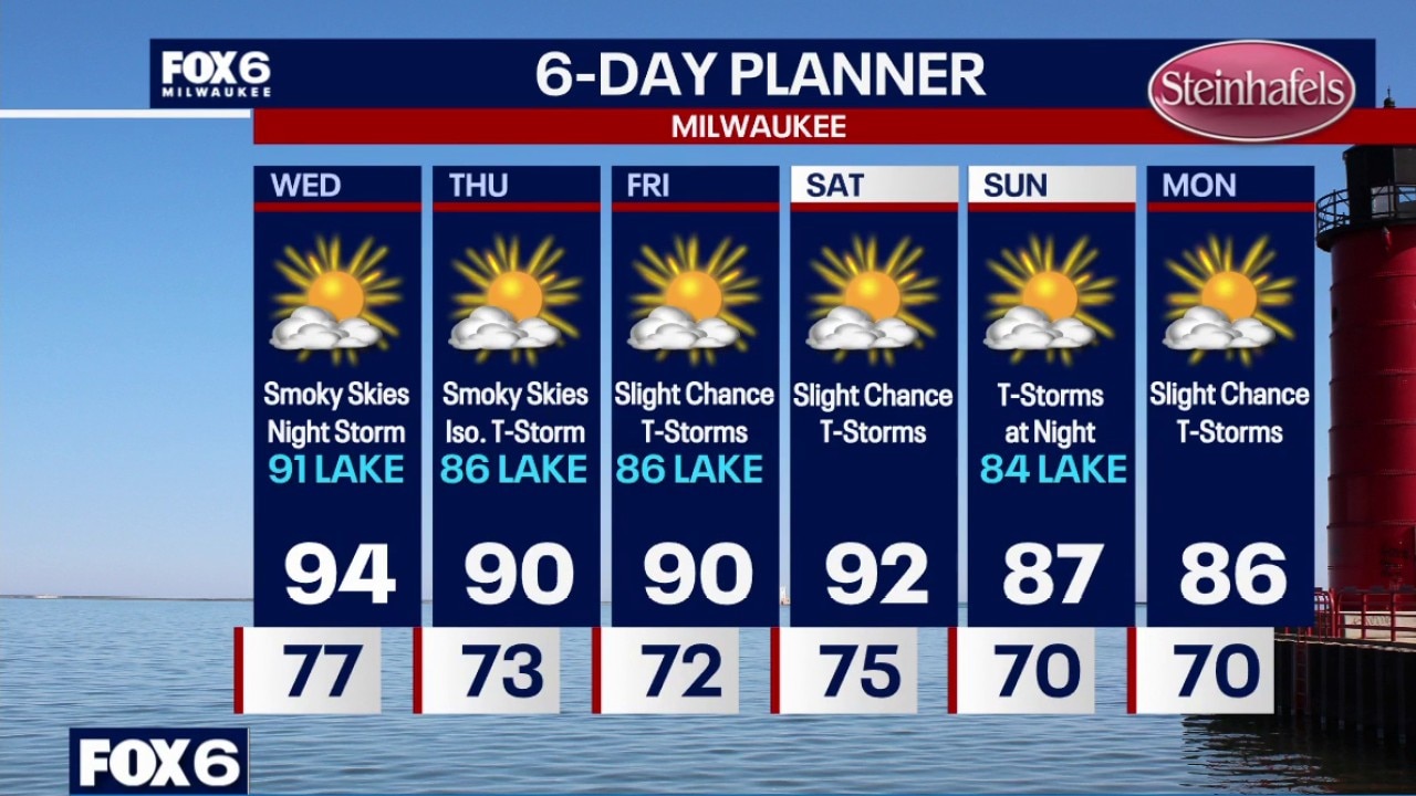
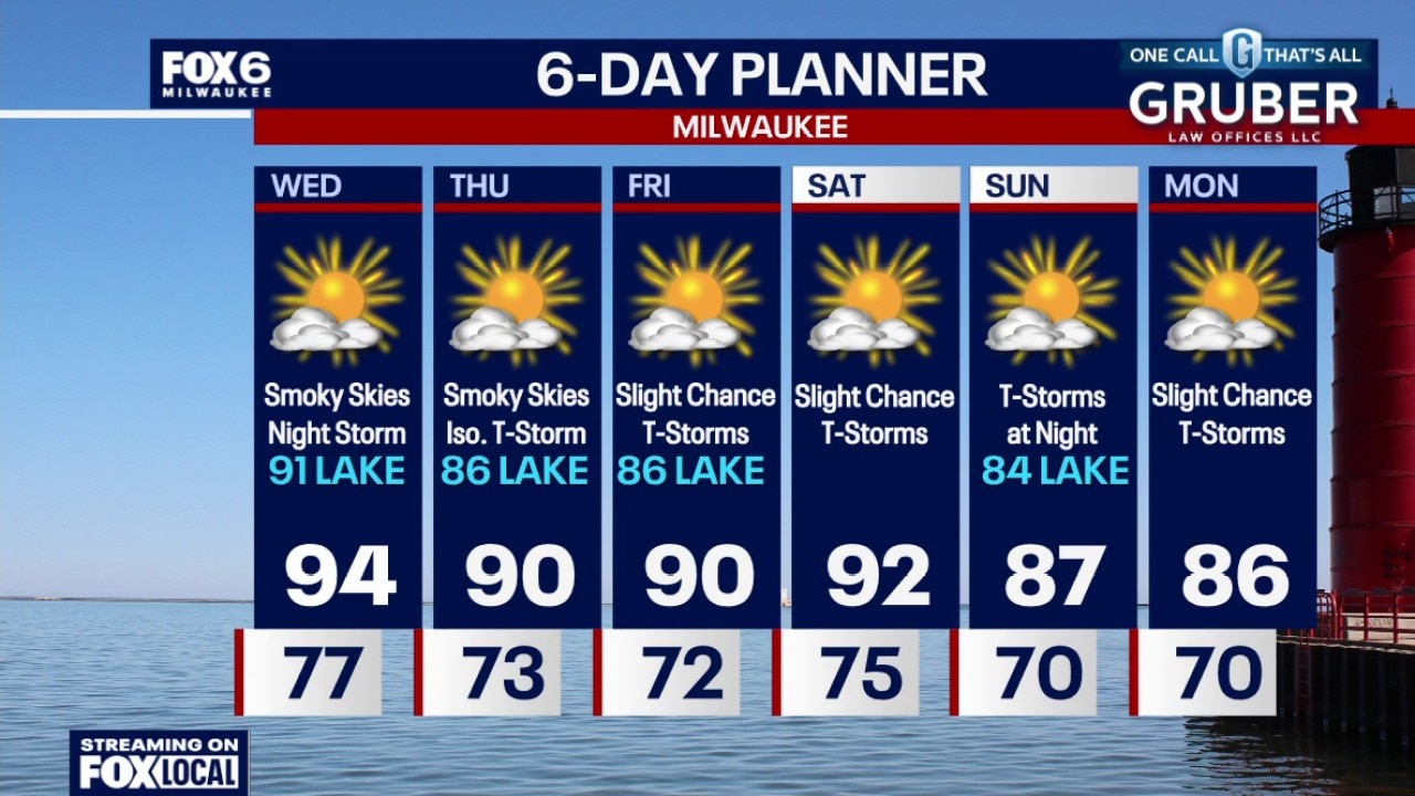
Air Quality Alert for WILDFIRE SMOKE (even near the surface) until at least Noon on Thursday Heat Advisory for ALL OF SE WI until 8pm Wednesday Clear, warm and humid overnight with temperatures dropping into the 70s by sunrise. Another hot day on Wednesday with highs in the mid-90s, cooling near the lake in the afternoon. IMPORTANT. Wildfire smoke from Canada and the Arrowhead of Minnesota will move into SE WI on Wednesday afternoon. This could reach the surface. This could last through Thursday and possibly beyond. Be mindful of those with asthma, COPD, etc.
Air Quality Alert for WILDFIRE SMOKE (even near the surface) until at least Noon on Thursday Heat Advisory for ALL OF SE WI until 8pm Wednesday Clear, warm and humid overnight with temperatures dropping into the 70s by sunrise. Another hot day on Wednesday with highs in the mid-90s, cooling near the lake in the afternoon. IMPORTANT. Wildfire smoke from Canada and the Arrowhead of Minnesota will move into SE WI on Wednesday afternoon. This could reach the surface. This could last through Thursday and possibly beyond. Be mindful of those with asthma, COPD, etc.
Weather Webcast with Chief Meteorologist Tom Wachs
Air Quality Alert for WILDFIRE SMOKE (even near the surface) from Noon on Wednesday to at least Noon on Thursday Clear, warm and humid tonight with temperatures in the 80s this evening and 70s overnight. Another hot day on Wednesday with highs in the mid-90s, cooling near the lake in the afternoon. IMPORTANT. Wildfire smoke from Canada and the Arrowhead of Minnesota will move into SE WI on Wednesday afternoon. This could reach the surface. This could last through Thursday and possibly beyond. Be mindful of those with asthma, COPD, etc.
Air Quality Alert for WILDFIRE SMOKE (even near the surface) from Noon on Wednesday to at least Noon on Thursday Clear, warm and humid tonight with temperatures in the 80s this evening and 70s overnight. Another hot day on Wednesday with highs in the mid-90s, cooling near the lake in the afternoon. IMPORTANT. Wildfire smoke from Canada and the Arrowhead of Minnesota will move into SE WI on Wednesday afternoon. This could reach the surface. This could last through Thursday and possibly beyond. Be mindful of those with asthma, COPD, etc.
Weather webcast with Rob Haswell
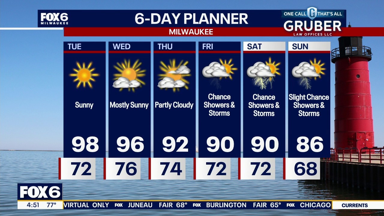
A Heat Advisory is in effect from 12pm Tuesday to 8pm Wednesday for potential heat index values in the 100s. The hottest stretch of the summer continues through Wednesday. Even overnight temperatures will stay unusually warm, offering little relief for anyone without air conditioning.
A Heat Advisory is in effect from 12pm Tuesday to 8pm Wednesday for potential heat index values in the 100s. The hottest stretch of the summer continues through Wednesday. Even overnight temperatures will stay unusually warm, offering little relief for anyone without air conditioning.
Weather Webcast with Chief Meteorologist Tom Wachs
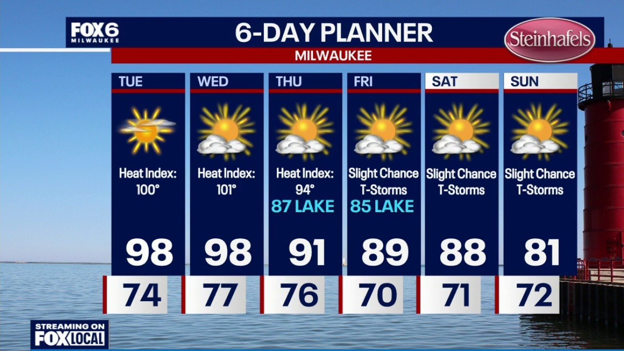
A Heat Advisory is in effect from 12pm Tuesday to 8pm Wednesday for potential heat index values in the 100s. Clear, warm and humid overnight with temperatures settling in the 70s by sunrise. Mostly sunny and hot on Tuesday. Highs in the upper 90s with a heat index around 100. Partly sunny and hot on Wednesday with a high in the upper 90s and a heat index around 101.
A Heat Advisory is in effect from 12pm Tuesday to 8pm Wednesday for potential heat index values in the 100s. Clear, warm and humid overnight with temperatures settling in the 70s by sunrise. Mostly sunny and hot on Tuesday. Highs in the upper 90s with a heat index around 100. Partly sunny and hot on Wednesday with a high in the upper 90s and a heat index around 101.
Weather Webcast with Chief Meteorologist Tom Wachs
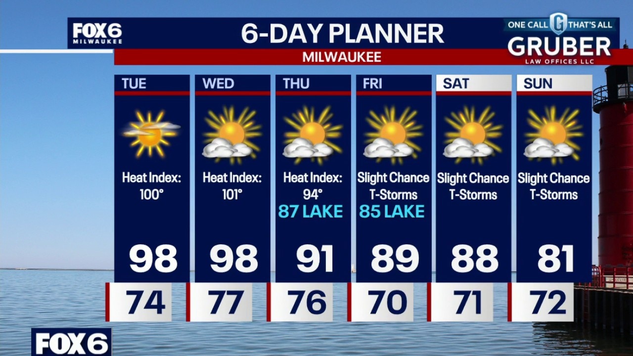
A Heat Advisory is in effect from 12pm Tuesday to 8pm Wednesday for potential heat index values in the 100s. Clear, warm and humid tonight with temperatures dropping through the 80s and settling in the 70s overnight. Mostly sunny and hot on Tuesday. Highs in the upper 90s with a heat index around 100. Partly sunny and hot on Wednesday with a high in the upper 90s and a heat index around 101.
A Heat Advisory is in effect from 12pm Tuesday to 8pm Wednesday for potential heat index values in the 100s. Clear, warm and humid tonight with temperatures dropping through the 80s and settling in the 70s overnight. Mostly sunny and hot on Tuesday. Highs in the upper 90s with a heat index around 100. Partly sunny and hot on Wednesday with a high in the upper 90s and a heat index around 101.
Weather Webcast with Stephanie Barichello
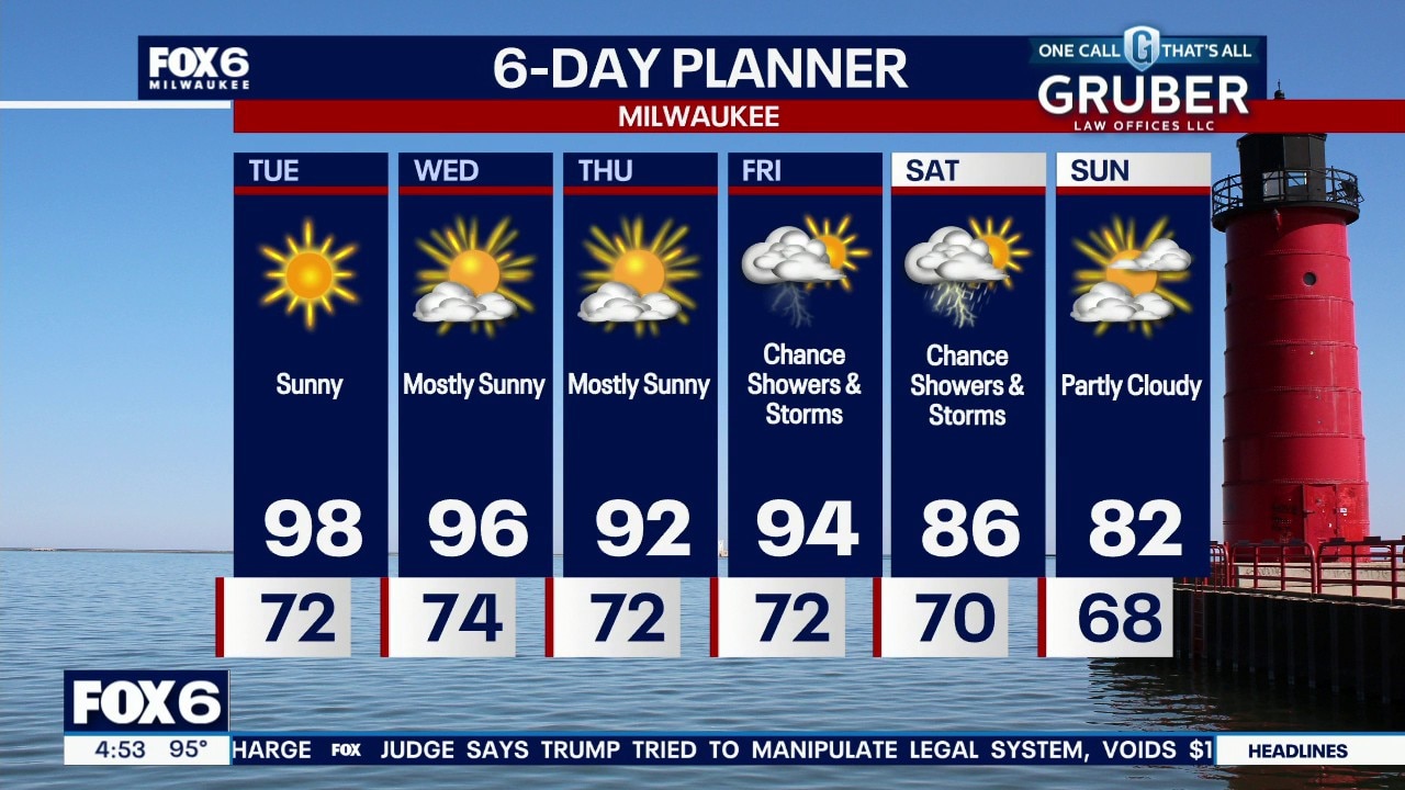
Heat Advisory from 12pm Tuesday to 8pm on Wednesday for heat indices in the 100s both days. Air temperatures themselves will be near 100 on Tuesday. The heat begins to break down by the weekend as storm chances return.
Heat Advisory from 12pm Tuesday to 8pm on Wednesday for heat indices in the 100s both days. Air temperatures themselves will be near 100 on Tuesday. The heat begins to break down by the weekend as storm chances return.
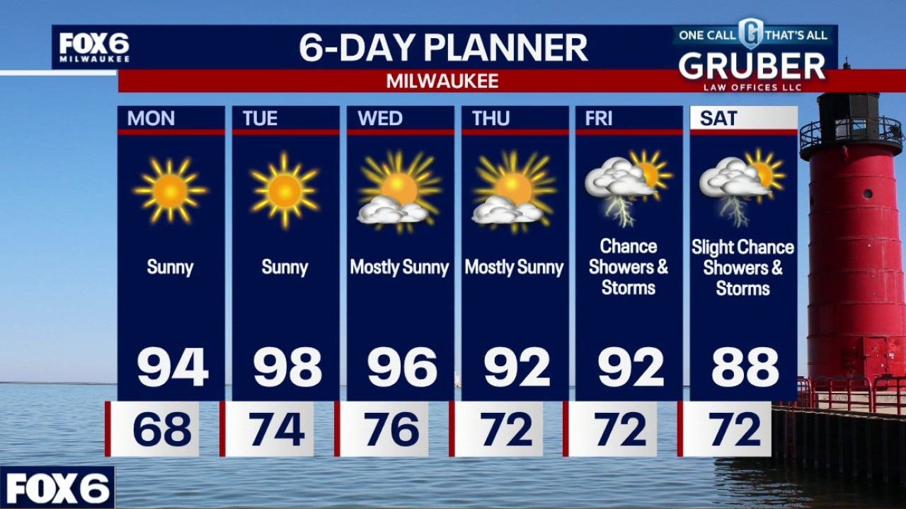
Weather webcast with Chief Meteorologist Rob Haswell
Summer heat is settling in for a long stretch, with highs climbing into the 90s through the middle of the week and Tuesday looking like the hottest day.
Summer heat is settling in for a long stretch, with highs climbing into the 90s through the middle of the week and Tuesday looking like the hottest day.
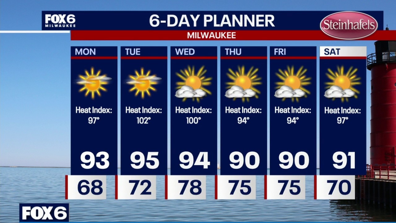
Weather Webcast with Chief Meteorologist Tom Wachs
Clear skies overnight with temperatures dropping into the upper 60s by sunrise. Get ready for a week of heat. High in the 90s all week with dew points in the upper 60s to around 70.
Clear skies overnight with temperatures dropping into the upper 60s by sunrise. Get ready for a week of heat. High in the 90s all week with dew points in the upper 60s to around 70.
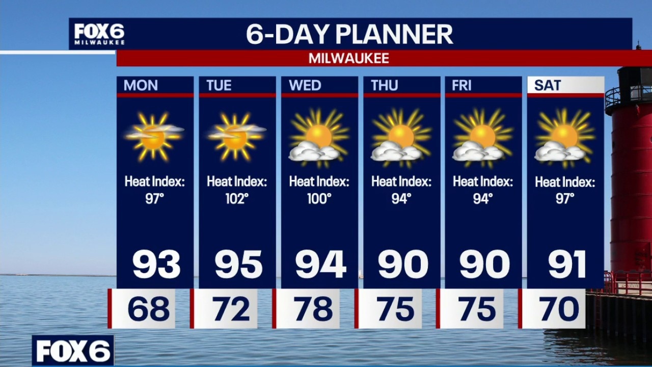
Weather Webcast with Chief Meteorologist Tom Wachs
Clear skies tonight with temperatures dropping through the 70s this evening and settling in the upper 60s overnight. Get ready for a week of heat. High in the 90s all week with dew points in the upper 60s to around 70.
Clear skies tonight with temperatures dropping through the 70s this evening and settling in the upper 60s overnight. Get ready for a week of heat. High in the 90s all week with dew points in the upper 60s to around 70.
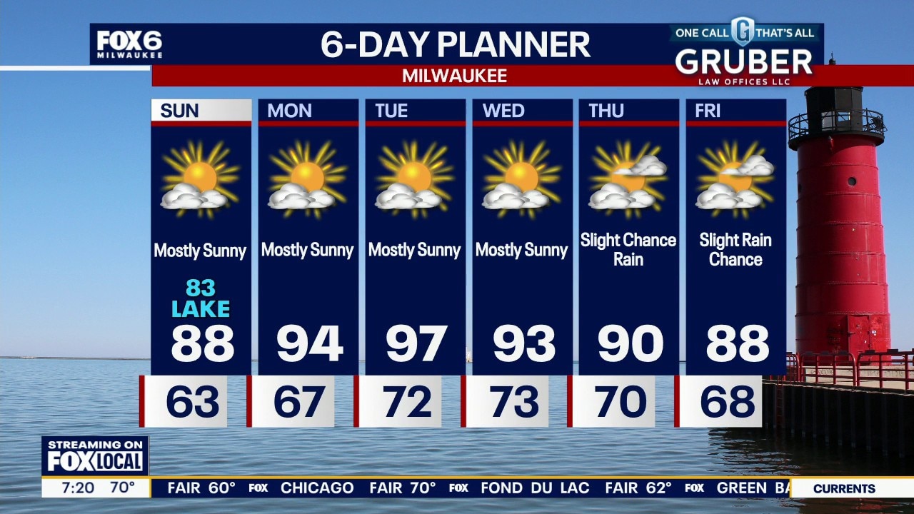
Weather webcast with Lisa Michaels
Mostly sunny skies on Sunday with highs in the upper 80s inland to low 80s near the lake due to an easterly wind. A long stretch of dry and sunny days return during the first half of the week due to a stuck high pressure.
Mostly sunny skies on Sunday with highs in the upper 80s inland to low 80s near the lake due to an easterly wind. A long stretch of dry and sunny days return during the first half of the week due to a stuck high pressure.