

Wisconsin weather: Flash flood warning until 2 a.m. Thursday
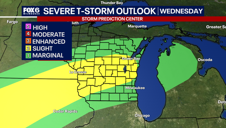
MILWAUKEE - The Storm Prediction Center has issued southeast Wisconsin as a risk for severe storms Wednesday afternoon and evening.
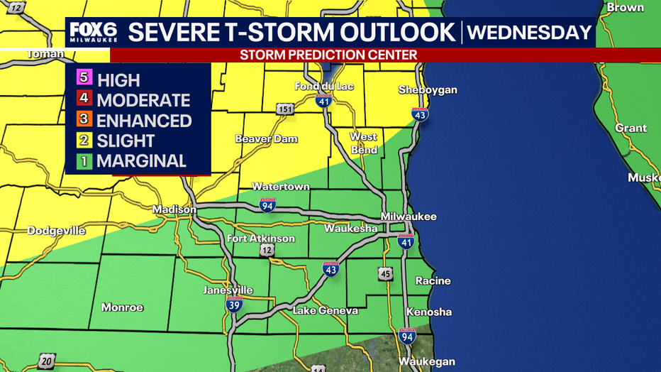
A slight risk (yellow) is issued for Fond du Lac, Sheboygan, Dodge, and portions of Washington and Ozaukee counties. A marginal risk (green) is issued for Walworth, Racine, Kenosha, Jefferson, Waukesha, Milwaukee, and portions of Washington and Ozaukee counties.
A severe thunderstorm watch has been issued for Ozaukee County, Fond du Lac County, Dodge County, Sheboygan County, and Washington County until 10 p.m.
A flash food warning has been issued for Flash Flood Warning for northern Ozaukee County and northeastern Washington County until 2 a.m. Thursday.
Storm impacts
What we know:
With this event, the main threat will be damaging winds, heavy rain that can lead to flooding, and a low-end tornado risk. The threats will be higher in northern counties where the slight risk is located, mainly north of I-94.
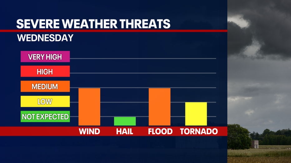
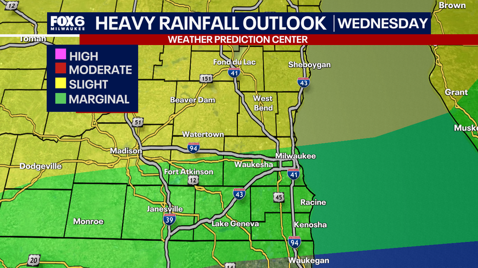
There is a high amount of moisture in the atmosphere with this system that can produce locally heavy pockets of rain. Due to this, the flooding risk has increased for areas that see storms, especially if multiple move over the same area.
Timeline
What we know:
A slow-moving frontal boundary located in northern Wisconsin will move south on Wednesday.
The atmosphere will be conducive for developing strond storms ahead and along the front. Central Wisconsin is looking to have a higher risk for storms during the afternoon, but storms could move into southern Wisconsin as early at 1PM on Wednesday and continue through Wednesday evening.
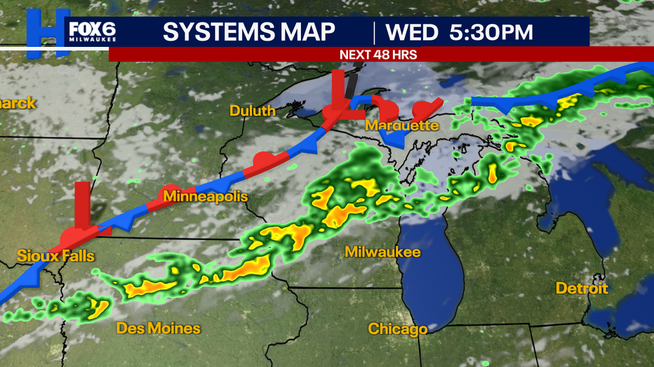
The timing of greatest concern in our areas will be from 4PM-8PM. Storms will weaken as they move from north to south of I-94, but there is uncertainty about how quickly they weaken and the exact timing they will move in.
Additional rounds of rain and storms are possible on Thursday with lighter activity. We will have to monitor the overall atmosphere on Thursday to see if any stronger storms may pop during early Thursday afternoon, but the larger severe threat remains south in Illinois.
Heat and humidity returns
What we know:
Southerly winds with this system will pump in high dew points and warmer temperatures for a few days this week. Behind the cold front, slightly less moist air will be here by Friday, but only for a short time.
Another round of humidity returns Sunday into next week.
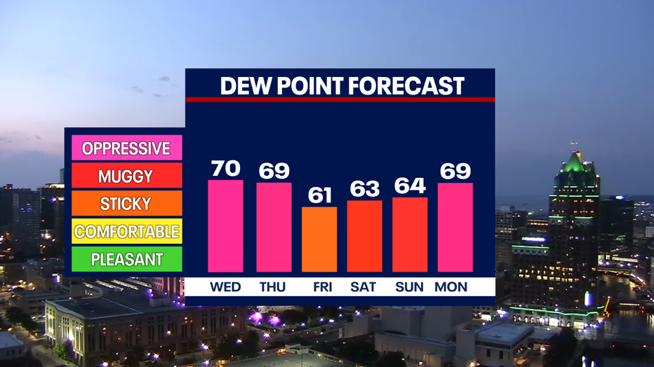
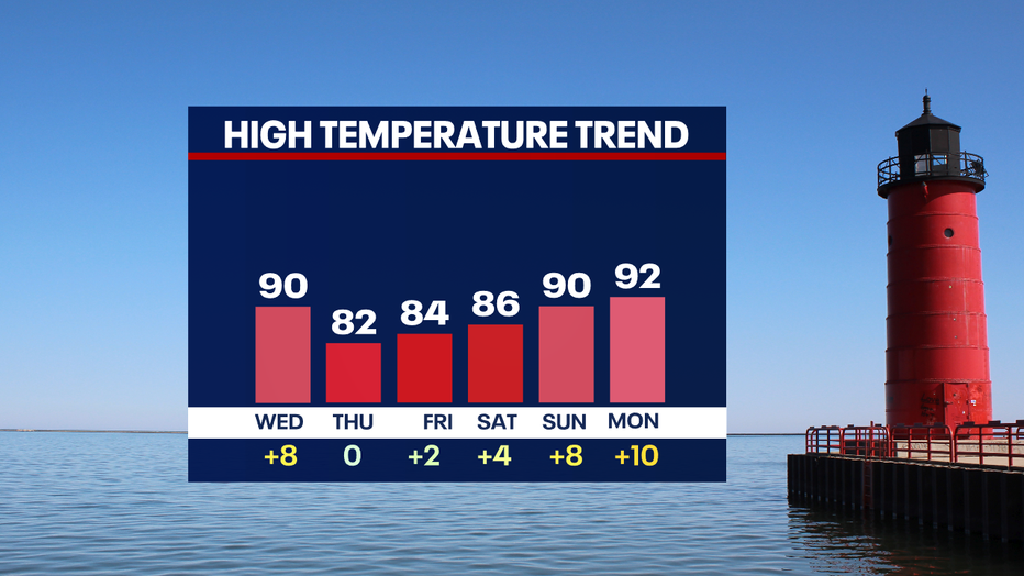
Temperatures will start to inch closer to 10 degrees warmer than average Sunday, with many days looking to have high temperatures in the 90s next week.
Depending on the wind direction, heat index values could reach the upper 90s in a worst case scenario.
The Climate Prediction Center's extended temperature outlook shows a higher probability of above-average temperatures continuing from July 13 through July 17th.
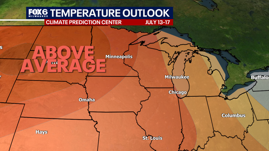
Will we get a cool down? Long-range models project cooler temperatures potentially moving back into southeast Wisconsin by the week of July 20th.
The Source: Information in this story is from the FOX6 Weather Experts and the National Weather Service.