

Wisconsin weather: Heat, humidity return, why it's different this time
MILWAUKEE - Heat headlines – from advisories to watches and even warnings – are stretching from coast to coast in the United States again this week.
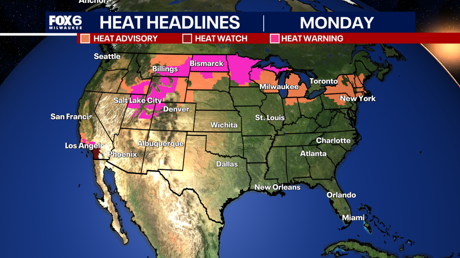
Big picture view:
A heat dome is set up across the United States as the jet stream is positioned north into Canada. This allows warm and moist air to be transported from the Gulf of Mexico into the Great Plains and Midwest.
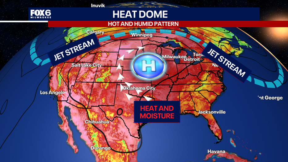
Local perspective:
Although this may look like the same pattern with prolonged heat and humidity in the forecast, this event is slightly different than what we experienced at the end of June into early July 2026. For this event, heat index values may reach the upper 90s to maybe 100 degrees on Tuesday and Wednesday. Due to this, the National Weather Service has added a heat advisory for all of southeast Wisconsin from noon Tuesday through 8p.m. Wednesday.
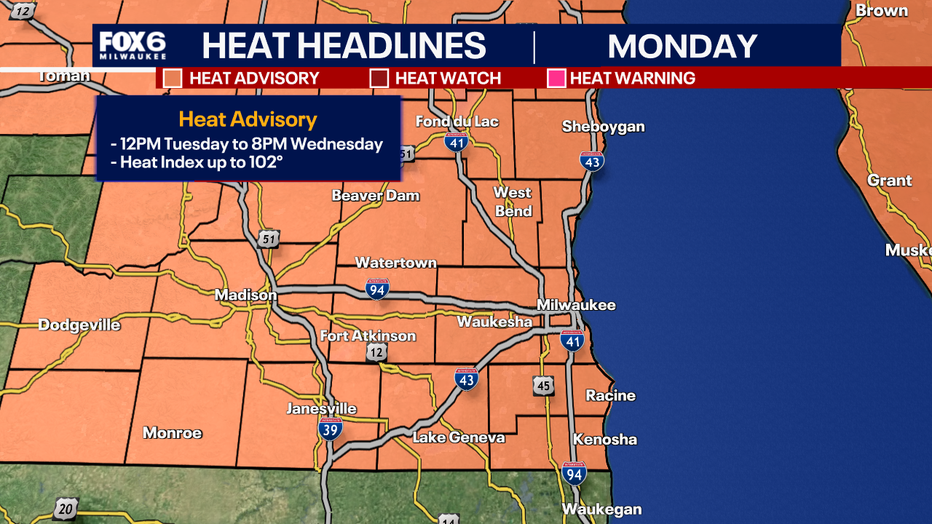
Under these conditions, a heat advisory has been issued but not an extreme heat warning like before.
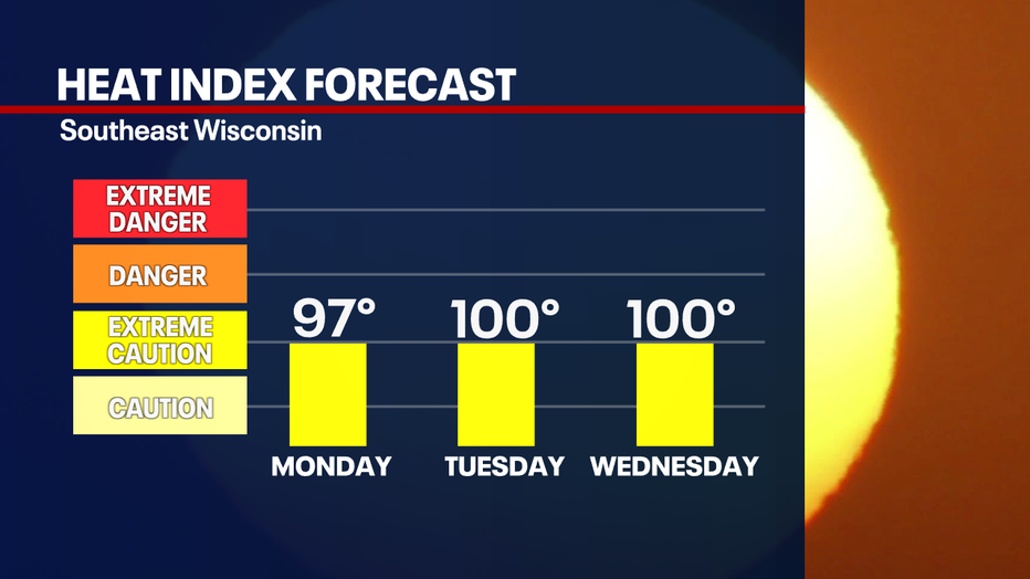
Let's compare recent events
By the numbers:
The high heat indices will not be as prominent in southern Wisconsin this time. For both the previous and current event, high temperatures are in the low to middle 90s. In fact, this week could even be hotter!
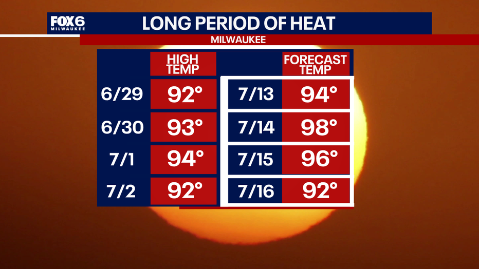
Why will it not be as hot?
Dig deeper:
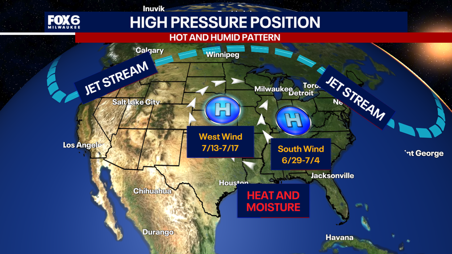
It all has to do with where the high pressure is positioned. During the last event from June 29 through July 4, the high pressure was further east across the Ohio River Valley. This directly brought a southerly wind to southeast Wisconsin, supplying ample heat and moisture. For this event, starting on July 13, the high pressure has shifted to the southwest, bringing southeast Wisconsin a westerly wind. The change in wind direction supplies larger areas in the Great Plains and upper Midwest higher heat and humidity values.
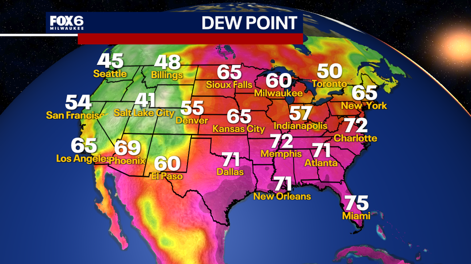
Dew point values will still be high in most areas of the nation feeling sticky to oppressive, but overall, the dew points for this event will be slightly lower, which can lower the heat index value or how it feels outside.
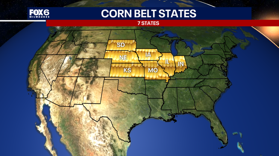
The corn belt of America
Big picture view:
Dew points can rise even more in central portions of the United States due to corn growing in the summer months due to the beloved corn belt, a large area where corn grows, which includes Iowa, Illinois, Indiana, Missouri, and Wisconsin.
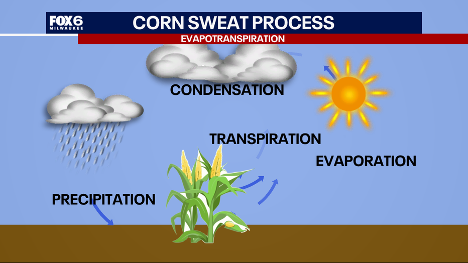
In this area, something called corn sweat occurs – it’s a real thing! It is really known as evapotranspiration. This is when corn absorbs rainwater from the ground, then it goes up the plant, then the moisture is released by the kernels and "sweats" it out.
Evapotranspiration is the sum of all processes by which water moves from land to the atmosphere. The added water vapor in the air increases the humidity levels, making it feel uncomfortable outside.
Higher humidity or dew points can contribute to atmospheric instability, which can create conditions favorable for thunderstorms. This doesn’t mean that corn sweat causes storms, but it can influence the development of them. Higher humidity can also contribute to warmer nighttime temperatures and higher heat index values. You will still need to take proper heat precautions this week, but thankfully, the worst of it will remain west of our area.
The Source: Information in this story is from the FOX6 Weather Experts and the National Weather Service.