

Wisconsin severe weather risk: Rounds of heavy rain, strong storms
MILWAUKEE - All of Wisconsin is under the threat of severe weather Monday afternoon and evening.
The National Weather Service has issued a Severe Thunderstorm Watch until 4 a.m. Tuesday for parts of southeastern Wisconsin.
It includes Dodge, Fond du Lac, Jefferson, Kenosha, Milwaukee, Ozaukee, Racine, Sheboygan, Walworth, Washington and Waukesha counties.
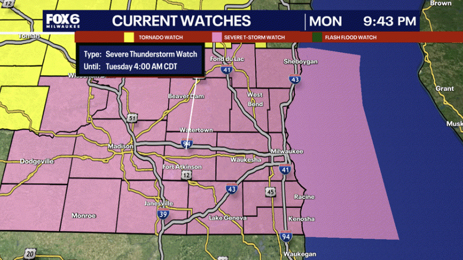
A tornado watch was issued for Dodge, Fond du Lac, Washington, Ozaukee, and Sheboygan Counties until 10 p.m.
Warm and humid air in place for much of the week will provide a favorable environment for strong to severe storms for at least part of every day as a series of low pressure systems move through.

Warm and humid air in place for much of the week will provide a favorable environment for strong to severe storms for at least part of every day as a series of low pressure systems move through.
This will be 20°F to 25°F warmer than average for this time of year. Record high temperatures are in the 80s, which we should stay beneath.
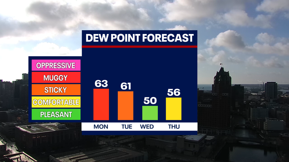
In addition to the warm air, a southerly wind will also bring more moisture, increasing dew points into the low 60s and making it feel more like summer outside.
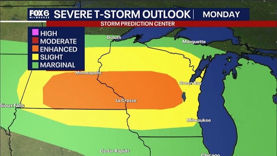
The Storm Prediction Center has put Wisconsin under threat for all types of hazards with the highest threats being damaging winds, large hail, and flooding Monday night into early Tuesday.
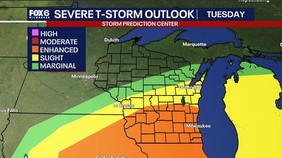
The risk for stronger storms is more favorable in southern Wisconsin on Tuesday, especially in the afternoon and evening hours for all hazards.
There is even a risk for a third day in a row for southern Wisconsin on Wednesday. The higher risk will be in south and southwestern Wisconsin. A lower risk near the lake due to a lake breeze setting up which can cool temperatures on Wednesday.
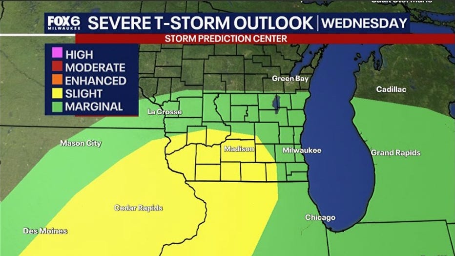
Even though our area is in an outlook for severe storms multiple days in a row, activity will not be continuous.
Heavy rain and storms will come in waves or rounds. In fact, most of the storms will develop during the afternoon and evening hours.
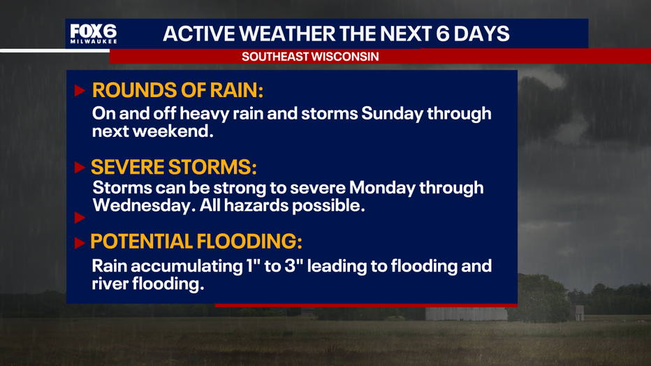
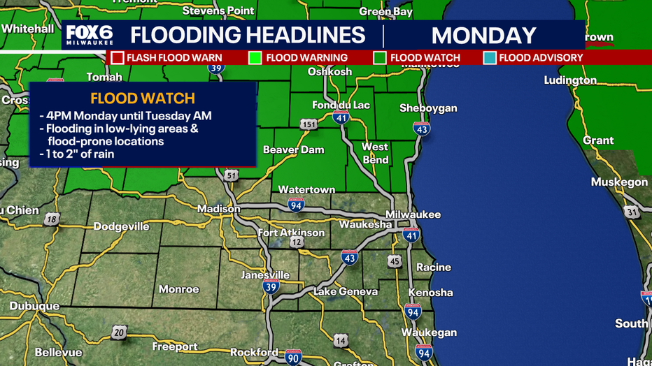
By the end of the week, portions of southeast Wisconsin can experience one to three inches of rain. That can cause flooding in lower areas as well as river flooding. The National Weather Service has issued a flood watch for Fond du Lac, Sheboygan, Dodge, Washington, and Ozaukee counties until Tuesday morning. Areas can experience flooring in low-lying areas and flood-prone locations.
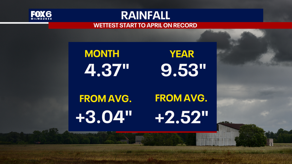
April 2026 has been the wettest start to the month on record so far with a surplus of three inches.
If you are in a flood-prone area, it is important to make sure your sump pump is working. The FOX6 Weather Experts will be tracking all storms that move through. Be weather aware this week.
The Source: Information in this post was provided by the FOX6 Weather Experts and National Weather Service - Sullivan.