

Wisconsin freeze warning: Temperatures could hit 28° Saturday
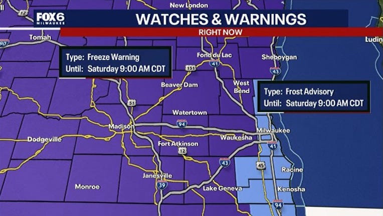
MILWAUKEE - A blast of colder air will send temperatures tumbling across southern Wisconsin overnight Friday. The National Weather Service has issued a Freeze Warning for much of the region and a Frost Advisory for counties along Lake Michigan.
Temperatures could fall as low as 28 degrees in some inland communities early Saturday morning, cold enough to damage or kill sensitive vegetation and potentially affect unprotected outdoor plumbing.
Both the Freeze Warning and Frost Advisory will be in effect from 1 a.m. until 9 a.m. Saturday, Oct. 17.
Where will temperatures drop below freezing?
By the numbers:
The coldest conditions are expected away from Lake Michigan, where temperatures are forecast to fall into the upper 20s and lower 30s.
Freeze Warning:
- Temperatures as low as 28 degrees
- The warning covers 16 counties across east-central, south-central and southeastern Wisconsin:Marquette, Green Lake, Fond du Lac and Sheboygan, Sauk, Columbia, DodgeWashington, Iowa, Dane, Jefferson and Waukesha, Lafayette, Green, Rock and Walworth
- Marquette, Green Lake, Fond du Lac and Sheboygan, Sauk, Columbia, Dodge
- Washington, Iowa, Dane, Jefferson and Waukesha, Lafayette, Green, Rock and Walworth
Frost Advisory:

- Temperatures as low as 30 degrees
- A Frost Advisory covers four counties closer to Lake Michigan: Ozaukee, Milwaukee, Racine, Kenosha
How does frost form when it's above freezing?
Dig deeper:
While the lake's relatively warmer waters may provide some protection against the coldest temperatures, frost remains a concern, particularly in areas farther inland from the immediate shoreline.
This will be particularly notable in far western Racine and Kenosha counties as those counties push farther inland than Ozaukee or Milwaukee counties.
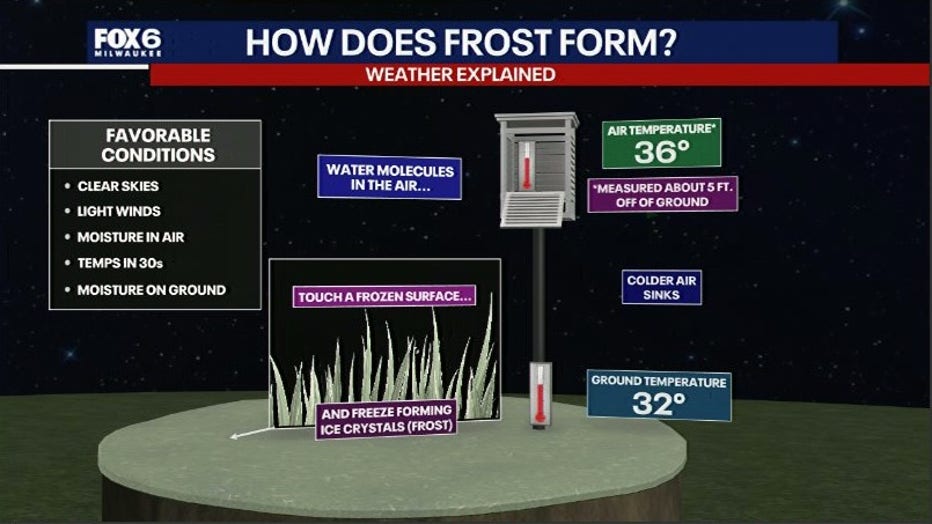
It is important to note that even where air temperatures remain above freezing, frost can develop on exposed surfaces and damage sensitive plants as the colder, more dense air sits at ground level, just below the area thermometers which are set up around 4–6 feet off the ground.
Why is it getting so cold?
Big picture view:
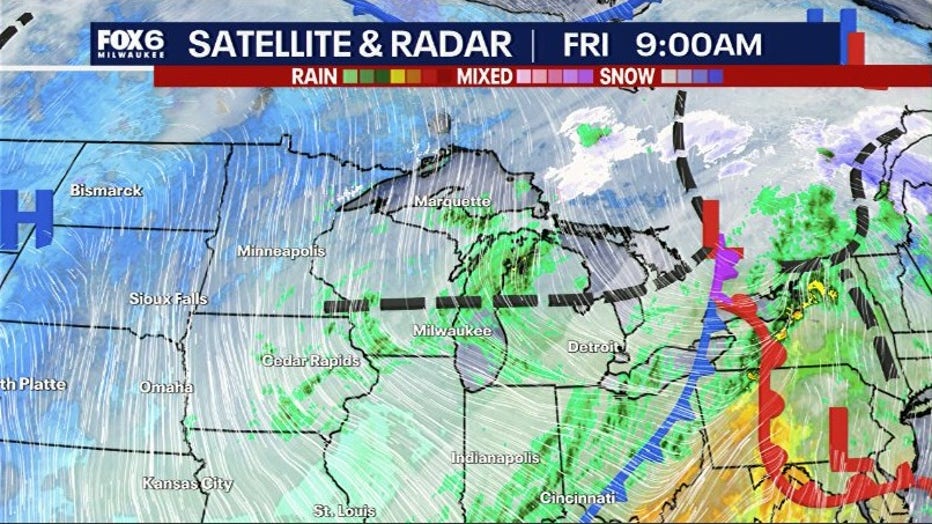
A powerful fall weather system is pulling a much colder air mass into Wisconsin on Friday, accompanied by blustery northwest winds gusting between 30 and 40 mph.
A cold front will push through the region Friday morning, bringing another round of showers before colder, drier air moves in. As high pressure builds into the Midwest, winds will diminish and skies will clear.
That combination will allow the little heat that existed during the day to escape more efficiently into the atmosphere, a process meteorologists call radiational cooling.
With less wind to mix warmer air down toward the surface, temperatures are expected to drop rapidly after midnight.
How to protect your plants and property
What you can do:
For gardeners hoping to squeeze a little more life out of their growing season, Friday afternoon is the time to take precautions and protect tender plants before temperatures fall overnight.
Here's how:
- Cover sensitive plants: Use frost cloths, blankets or sheets to help retain warmth near the ground. Avoid placing plastic directly against foliage.
- Bring potted plants indoors: Move vulnerable flowers, herbs and container plants into a garage, shed or other protected location.
- Protect outdoor plumbing: Disconnect garden hoses and take precautions with exposed pipes or fixtures vulnerable to freezing.
- Plan for an early morning frost: Frost can persist on exposed surfaces until temperatures rise after sunrise.
A freeze can bring an abrupt end to the growing season for many tender annuals and vegetables, particularly where temperatures remain below freezing for an extended period.
The cold won't last
The Good News:
Despite Saturday morning's chilly start, this appears to be a brief chill rather than the beginning of a prolonged cold spell. Temperatures should recover quickly Saturday afternoon, climbing into the middle and upper 50s as sunshine returns. Sunday looks even better, with highs reaching the lower 60s despite breezy southwest winds.
The warming trend will continue into next week, with afternoon temperatures generally in the 60s and potentially approaching 70 degrees by Wednesday.
The Source: Information in this post was provided by the FOX 6 Weather Experts and the NWS Sullivan.