Snow returns to Wisconsin Saturday; highest totals north

Wisconsin Live Desk: Saturday snow (6 p.m. update)
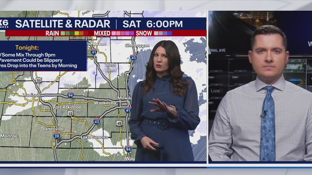
FOX6's Sam Kraemer and Stephanie Barichello take a look at the snow outlook for Saturday, Feb. 8.
MILWAUKEE - Pockets of light snow and some wintry mix, like graupel or sleet, will continue through this evening. Visibility may be reduced at times and untreated pavement could be slippery, but main roads will likely just be wet.
Heavier snow to north of metro Milwaukee
By the numbers:
Between 7-9" of snow has accumulated in some spots across central Wisconsin, as the storm track took more of a northerly route. Parts of Fond du Lac and Sheboygan counties picked up an inch or so, while the rest of southeast Wisconsin has seen minimal if any accumulation. Little to no additional accumulation is expected tonight.


Snow will taper off Saturday night. Clouds will clear out by Sunday afternoon as a high pressure system moves in.
What's next:
Superbowl Sunday will have good travel conditions, along with colder temperatures in the 20s. Travel to any Superbowl parties should be just fine.

FOX6 Weather Extras
Meanwhile, FOX6Now.com offers a variety of extremely useful weather tools to help you navigate the stormy season. They include the following:
FOX6 Storm Center app

FOX LOCAL Mobile app
FOX Weather app
What is the FOX Model?

What is the FOX Model?
FOX Weather Expert Tom Wachs explains the value of the FOX Model for our team -- and our viewers.
FOX Weather
Maps and radar
We have a host of maps and radars on the FOX6 Weather page that are updating regularly — to provide you the most accurate assessment of the weather. From a county-by-county view to the Midwest regional radar and a national view — it’s all there.
School and business closings
When the weather gets a little dicey, schools and businesses may shut down. Monitor the latest list of closings, cancellations, and delays reported in southeast Wisconsin.

FOX6 Weather Experts in social media
- CLICK HERE to "Like" the FOX6 Weather Team on Facebook
- CLICK HERE to "Like" Rob Haswell on Facebook
- CLICK HERE to "Like" Tom Wachs on Facebook
- CLICK HERE to "Like" Stephanie Barichello on Facebook
- CLICK HERE to "Like" Lisa Michaels on Facebook
- CLICK HERE to "Like" Holly Baker on Facebook
- CLICK HERE to "Follow" the FOX6 Weather Team on X
- CLICK HERE to "Follow" Rob Haswell on X
- CLICK HERE to "Follow" Tom Wachs on X
- CLICK HERE to "Follow" Stephanie Barichello on X
- CLICK HERE to "Follow" Lisa Michaels on X
- CLICK HERE to "Follow" Holly Baker on X
The Source: The information in this post was produced by the FOX6 Weather Experts.

