

NWS confirms EF-3 tornado hit Fox Valley; max winds of 140 mph
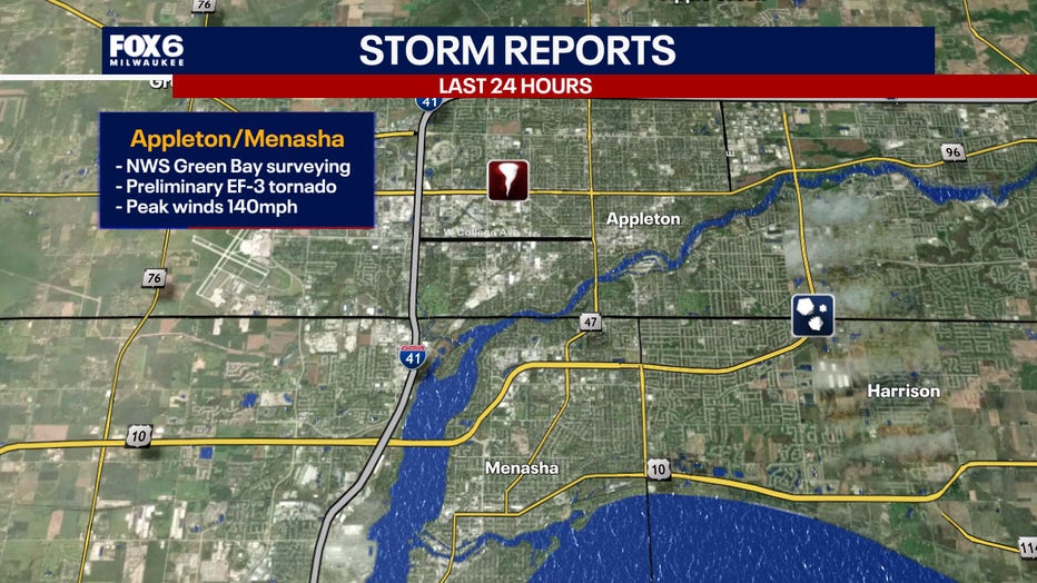
APPLETON, Wis. - The National Weather Service has confirmed an EF-3 tornado with max winds of 140 mph touched down in the Fox Valley during the severe storms on Monday, July 27.
EF-3 tornado
What we know:
According to the NWS damage survey team, a tornado touched down right around 11:56 a.m. just north of Wisconsin Avenue in Appleton.
The tornado rapidly intensified as it tracked south into Winnebago County, the NWS reports.
FREE DOWNLOAD: Get breaking news alerts in the FOX LOCAL Mobile app for iOS or Android
According to the National Weather Service, the worst damage occurred in the Fox Crossing and Menasha areas, where several businesses were heavily damaged near Highway 10.
The tornado then tracked south over Lake Winnebago, dissipating around 12:22 p.m.
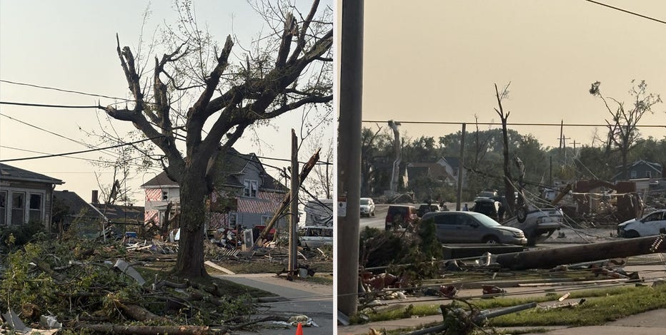
Wisconsin tornado damage; Fox Valley residents begin cleanup
Cleanup efforts are underway in the Fox Valley following severe weather on Monday, July 27.
FOX6 Weather Extras
Local perspective:
Meanwhile, FOX6Now.com offers a variety of extremely useful weather tools to help you navigate the stormy season. They include the following:
FOX6 Storm Center app
FOX LOCAL Mobile app
FOX Weather app
Maps and radar
We have a host of maps and radars on the FOX6 Weather page that are updating regularly — to provide you the most accurate assessment of the weather. From a county-by-county view to the Midwest regional radar and a national view — it’s all there.
School and business closings
When the weather gets a little dicey, schools and businesses may shut down. Monitor the latest list of closings, cancellations, and delays reported in southeast Wisconsin.
FOX6 Weather Experts in social media
- CLICK HERE to "Like" the FOX6 Weather Team on Facebook
- CLICK HERE to "Like" Rob Haswell on Facebook
- CLICK HERE to "Like" Tom Wachs on Facebook
- CLICK HERE to "Like" Stephanie Barichello on Facebook
- CLICK HERE to "Like" Lisa Michaels on Facebook
- CLICK HERE to "Like" Holly Baker on Facebook
- CLICK HERE to "Follow" the FOX6 Weather Team on X
- CLICK HERE to "Follow" Rob Haswell on X
- CLICK HERE to "Follow" Tom Wachs on X
- CLICK HERE to "Follow" Stephanie Barichello on X
- CLICK HERE to "Follow" Lisa Michaels on X
- CLICK HERE to "Follow" Holly Baker on X
The Source: The information in this post was provided by the National Weather Service.