

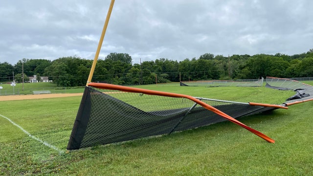

SE Wisconsin tornadoes confirmed; 105 mph wind speeds
The National Weather Service has now confirmed five tornadoes touched down in southeast Wisconsin during severe weather on Saturday, June 22.
The National Weather Service has now confirmed five tornadoes touched down in southeast Wisconsin during severe weather on Saturday, June 22.


Tornado touched down in Janesville; caused 'considerable damage'
Officials in the City of Janesville say a reported tornado touched down on the south side of the city on Saturday, June 22.
Officials in the City of Janesville say a reported tornado touched down on the south side of the city on Saturday, June 22.


Wisconsin severe weather; share pictures from your neighborhood
We invite you to share photos of storms and storm damage in your area by clicking on the "Submit Your Photo" button below.
We invite you to share photos of storms and storm damage in your area by clicking on the "Submit Your Photo" button below.
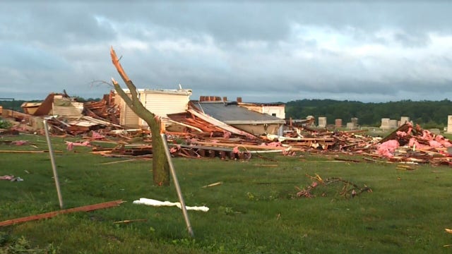

Wisconsin church destroyed after reported tornado hit Argyle
A church in Argyle, Wisconsin was destroyed after severe weather passed through the area.
A church in Argyle, Wisconsin was destroyed after severe weather passed through the area.

Weather webcast with Rob Haswell
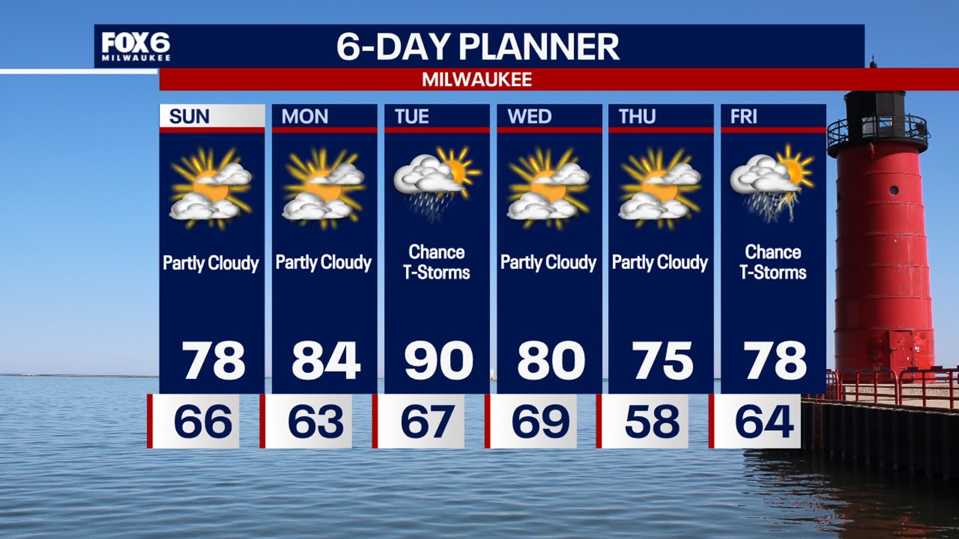
A much calmer day today behind yesterday's cold front. Temperatures will only be slightly cooler but dewpoints have fallen significantly. We should get some sunny break this afternoon and become mostly sunny on Monday however, rain and thunderstorms return on Tuesday. We get hot and humid again by Tuesday with highs reaching 90 once again and dewpoints returning to near 70. Rain and thunderstorms are likely again Tuesday before we dry up for Wednesday and Thursday.
A much calmer day today behind yesterday's cold front. Temperatures will only be slightly cooler but dewpoints have fallen significantly. We should get some sunny break this afternoon and become mostly sunny on Monday however, rain and thunderstorms return on Tuesday. We get hot and humid again by Tuesday with highs reaching 90 once again and dewpoints returning to near 70. Rain and thunderstorms are likely again Tuesday before we dry up for Wednesday and Thursday.
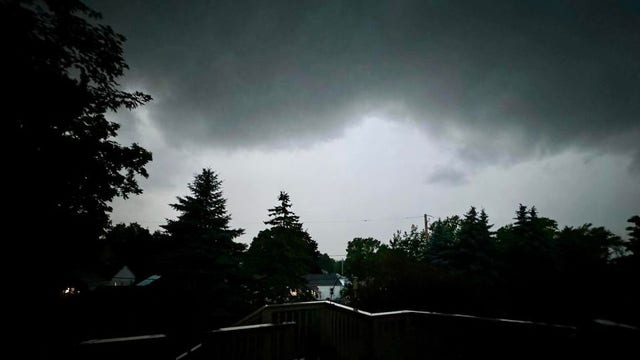

SE Wisconsin severe weather; outages, concert delays
Severe tornado and thunderstorm warnings were issued for several southeastern Wisconsin counties on Saturday, June 22.
Severe tornado and thunderstorm warnings were issued for several southeastern Wisconsin counties on Saturday, June 22.
Weather Webcast with Stephanie Barichello
Thunderstorms are likely this evening and may be severe with damaging wind, tornadoes and heavy rainfall. There is a flood watch in effect for most of SE WI. After tonight, we dry out a bit Sunday, although a few sprinkles will still be possible at times. Hot and humid with storms again by Tuesday.
Thunderstorms are likely this evening and may be severe with damaging wind, tornadoes and heavy rainfall. There is a flood watch in effect for most of SE WI. After tonight, we dry out a bit Sunday, although a few sprinkles will still be possible at times. Hot and humid with storms again by Tuesday.

Weather webcast with Rob Haswell
A busy day today with a Flood Watch in place for most of our viewing area. Periods of rain and thunderstorms could lead to flash flooding. Stronger storms are expected later today with severe storms possible. We will warm into the 80s today with cooler conditions to the north and much warmer conditions to the south. We should dry up on Sunday but rain and thunderstorms returns on Tuesday.
A busy day today with a Flood Watch in place for most of our viewing area. Periods of rain and thunderstorms could lead to flash flooding. Stronger storms are expected later today with severe storms possible. We will warm into the 80s today with cooler conditions to the north and much warmer conditions to the south. We should dry up on Sunday but rain and thunderstorms returns on Tuesday.
Weather Webcast with Chief Meteorologist Tom Wachs
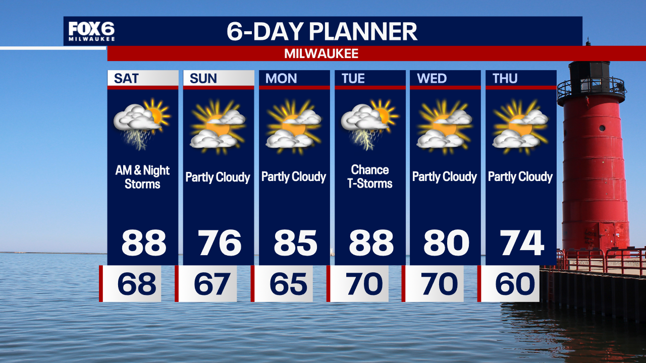
Waves of t-storms and fog overnight with temperatures in the 60s. Off-and-on rain/storms with heavy rain possible Saturday. Highs in the mid-to-upper 80s. A squall line of severe storms is possible Saturday night.
Waves of t-storms and fog overnight with temperatures in the 60s. Off-and-on rain/storms with heavy rain possible Saturday. Highs in the mid-to-upper 80s. A squall line of severe storms is possible Saturday night.

Watch: Hail flows like lava during severe thunderstorm in Nebraska
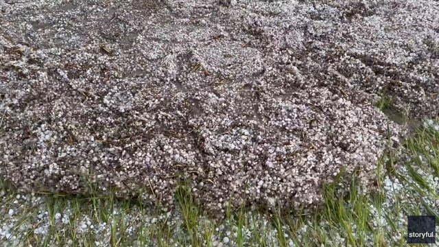
A severe thunderstorm rolled across western Nebraska Thursday afternoon, bringing torrential rain, baseball-sized hail and hurricane-force wind gusts.
A severe thunderstorm rolled across western Nebraska Thursday afternoon, bringing torrential rain, baseball-sized hail and hurricane-force wind gusts.
Weather Webcast with Chief Meteorologist Tom Wachs
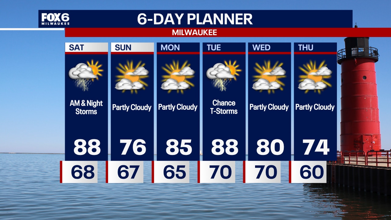
Fog near the lake tonight with scattered t-storms possible. Temperatures dropping into the 60s. Multiple rounds of storms possible Saturday, especially AM and again at night. Highs in the 80s. Severe storms possible Saturday night.
Fog near the lake tonight with scattered t-storms possible. Temperatures dropping into the 60s. Multiple rounds of storms possible Saturday, especially AM and again at night. Highs in the 80s. Severe storms possible Saturday night.
Weather webcast with Rob Haswell
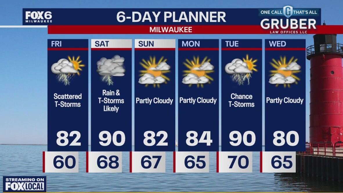
A warm front pushes back into our area today with some warmer and more humid air. It also brings instability and a chance for strong to severe thunderstorms. A Flood Watch goes into effect this afternoon for Waukesha, Jefferson, Washington, Dodge and Fond du Lac counties as well as areas farther to the west. Heavy rain is possible in many areas and the areas that have seen recent heavier rain are susceptible to flooding and could see flash flooding with any downpours that occur.
A warm front pushes back into our area today with some warmer and more humid air. It also brings instability and a chance for strong to severe thunderstorms. A Flood Watch goes into effect this afternoon for Waukesha, Jefferson, Washington, Dodge and Fond du Lac counties as well as areas farther to the west. Heavy rain is possible in many areas and the areas that have seen recent heavier rain are susceptible to flooding and could see flash flooding with any downpours that occur.
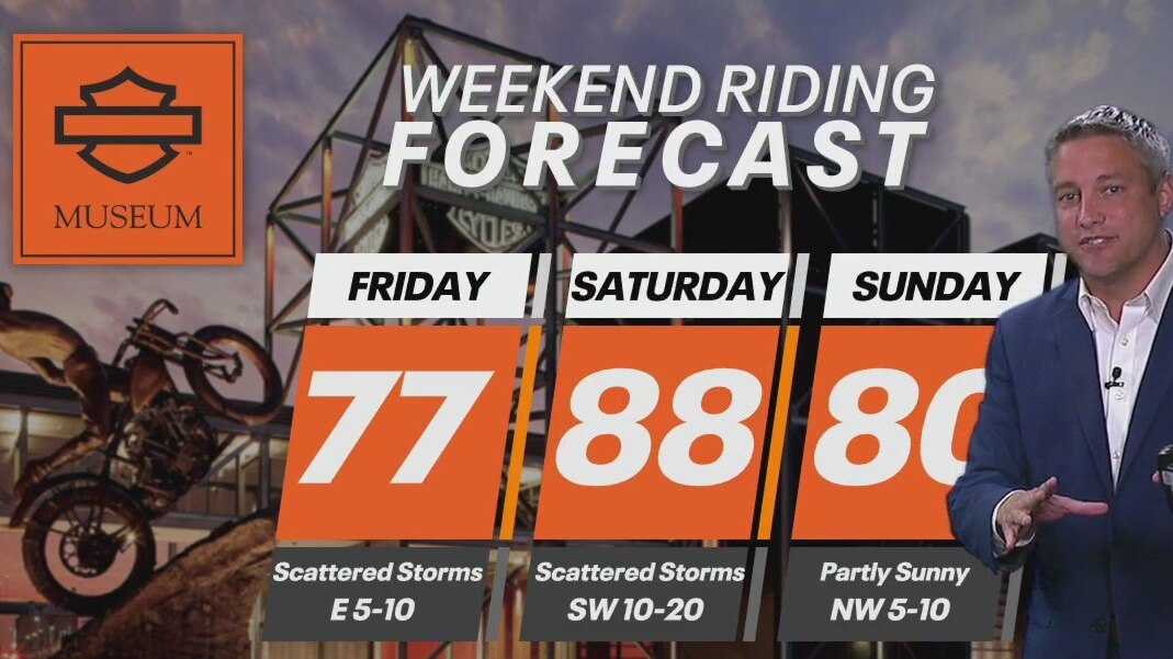
Weekend Riding Forecast for June 21-23
It'll be a mixed bag of weather depending on where you are in the state. FOX6's Tom Wachs has your Weekend Riding Forecast for June 21-23, 2024.
It'll be a mixed bag of weather depending on where you are in the state. FOX6's Tom Wachs has your Weekend Riding Forecast for June 21-23, 2024.

Weather Webcast with Chief Meteorologist Tom Wachs
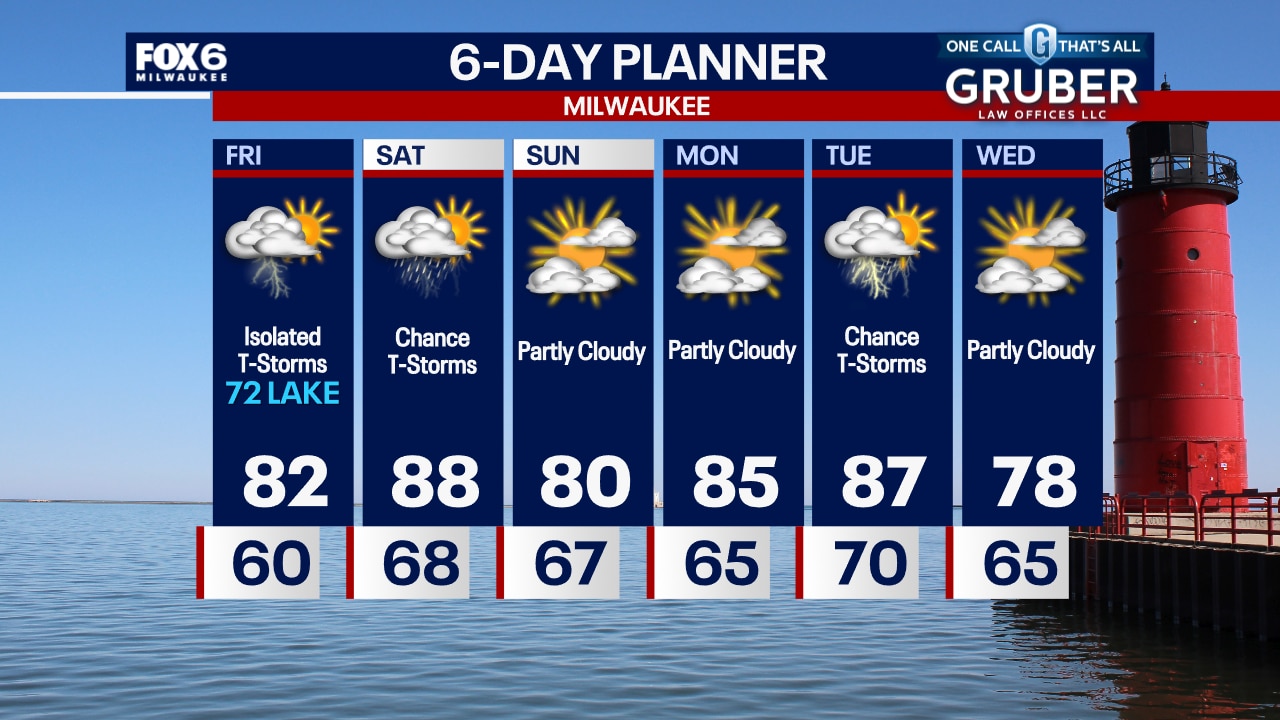
Slight chance for a t-storm overnight with temperatures around 60 by sunrise. Scattered t-storms on Friday, especially afternoon/evening. Highs in the low 70s at Summerfest, low 80s inland.
Slight chance for a t-storm overnight with temperatures around 60 by sunrise. Scattered t-storms on Friday, especially afternoon/evening. Highs in the low 70s at Summerfest, low 80s inland.
Weather Webcast with Chief Meteorologist Tom Wachs
There is a slight chance for a t-storm tonight with temperatures dropping through the 60s. An isolated t-storm or two possible on Friday with highs in the low 70s at Summerfest, low 80s inland.
There is a slight chance for a t-storm tonight with temperatures dropping through the 60s. An isolated t-storm or two possible on Friday with highs in the low 70s at Summerfest, low 80s inland.

Satellite imagery shows massive haboob overtaking parts of Desert Southwest
Winds from strong to severe thunderstorms that impacted West Texas and New Mexico on Wednesday evening triggered a massive dust storm, known as a haboob, which was even visible from space.
Winds from strong to severe thunderstorms that impacted West Texas and New Mexico on Wednesday evening triggered a massive dust storm, known as a haboob, which was even visible from space.

Summer solstice 2024 is here, which means so is summer
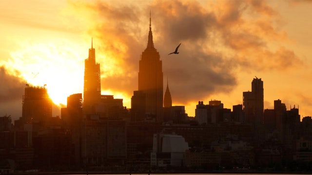
The first day of summer has arrived.
The first day of summer has arrived.

Weather webcast with Rob Haswell
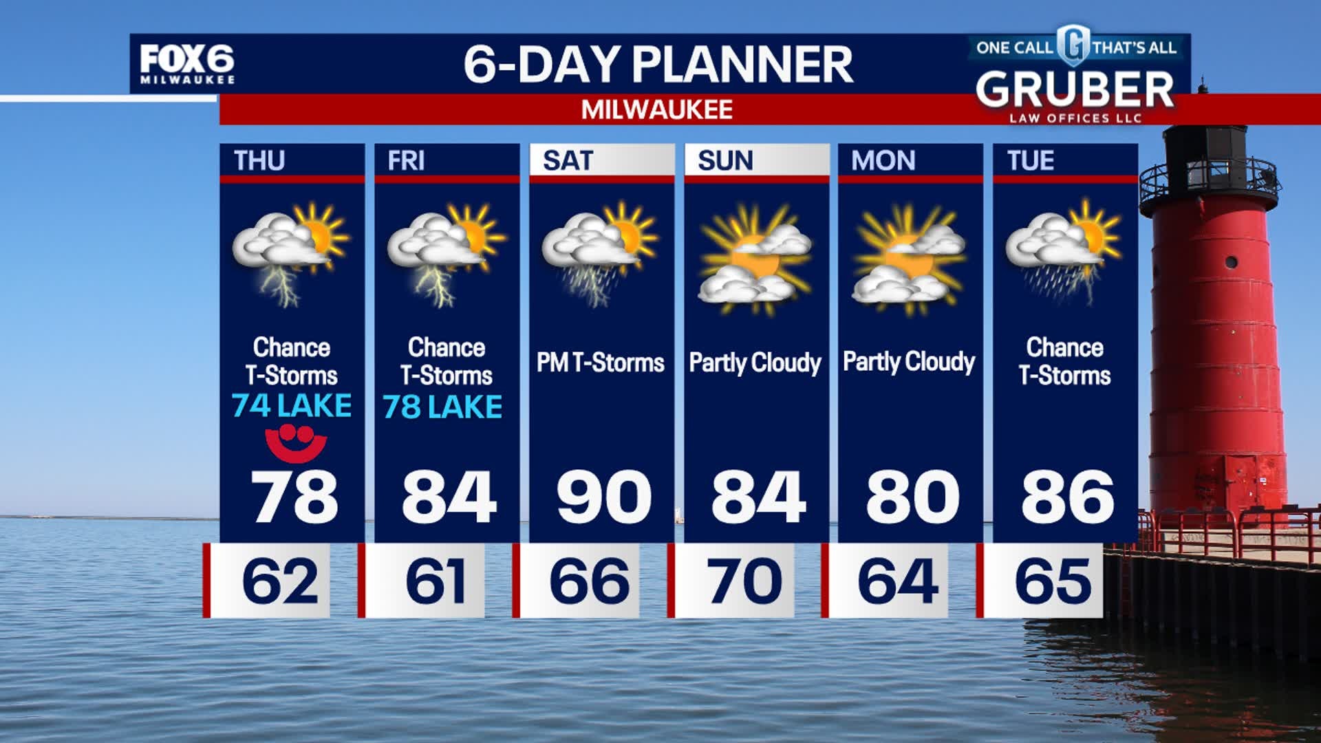
It'll be cooler but still a bit humid on Thursday with temperatures in the 70s. There is still a chance for a few thunderstorms.
It'll be cooler but still a bit humid on Thursday with temperatures in the 70s. There is still a chance for a few thunderstorms.
Weather Webcast with Stephanie Barichello
Scattered thunderstorms tonight as a cold front moves through. Temperatures drop into the 60s by morning. It'll be much cooler Thursday with temperatures in the low 70s lakeside to upper 70s inland. There is a chance for showers in the morning and evening. Similar Friday then heating up Saturday with storms in the evening.
Scattered thunderstorms tonight as a cold front moves through. Temperatures drop into the 60s by morning. It'll be much cooler Thursday with temperatures in the low 70s lakeside to upper 70s inland. There is a chance for showers in the morning and evening. Similar Friday then heating up Saturday with storms in the evening.
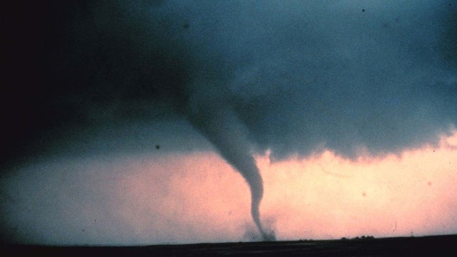

Why does the US have the most tornadoes?
Tornadoes can happen almost anywhere in the world but the U.S. specifically is a hotbed for tornadic activity.
Tornadoes can happen almost anywhere in the world but the U.S. specifically is a hotbed for tornadic activity.