

Weather Webcast with Chief Meteorologist Tom Wachs
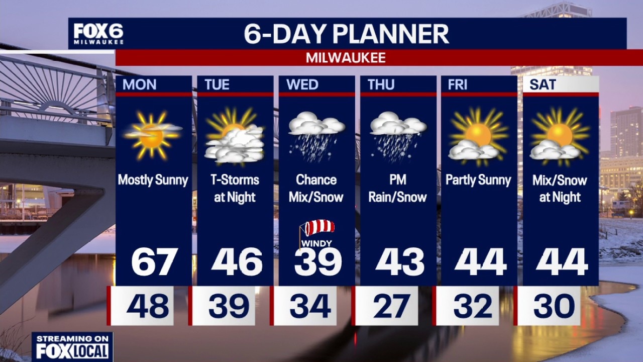
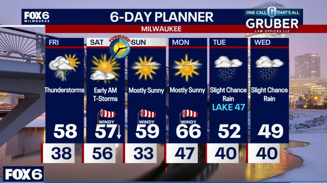
Clear, windy and warm tonight. Temperatures in the 50s this evening and upper 40s overnight. Mostly sunny and warm on Monday with a high around 67. 67 is also our current record high set in 2016. Windy, especially in the morning.
Clear, windy and warm tonight. Temperatures in the 50s this evening and upper 40s overnight. Mostly sunny and warm on Monday with a high around 67. 67 is also our current record high set in 2016. Windy, especially in the morning.
Weather webcast with Lisa Michaels
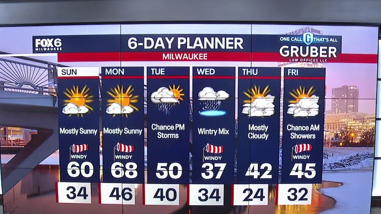
Partly cloudy to mostly sunny morning with temps in the low to mid 30s. Mostly sunny, windy, and warmer on Sunday with a highs near 60F. Getting even warmer on Monday with mostly sunny skies, windy, and highs in the upper 60s!
Partly cloudy to mostly sunny morning with temps in the low to mid 30s. Mostly sunny, windy, and warmer on Sunday with a highs near 60F. Getting even warmer on Monday with mostly sunny skies, windy, and highs in the upper 60s!
Weather Webcast with Holly Baker
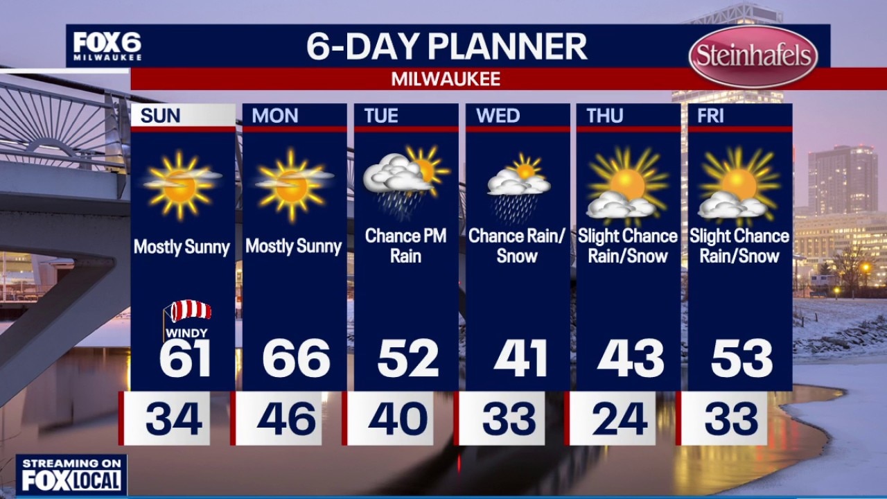
Beautiful weather is on the way for Sunday and Monday.
Beautiful weather is on the way for Sunday and Monday.
Weather webcast with meteorologist Lisa Michaels
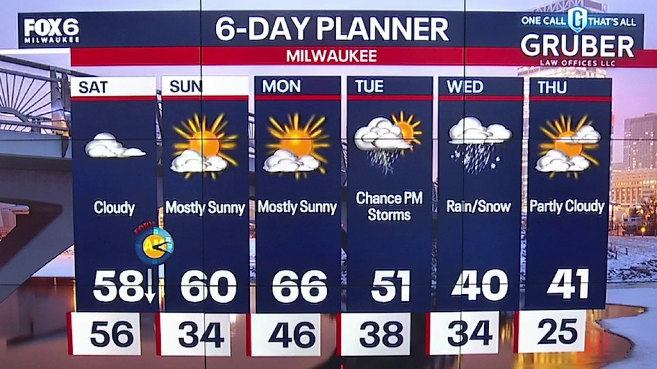
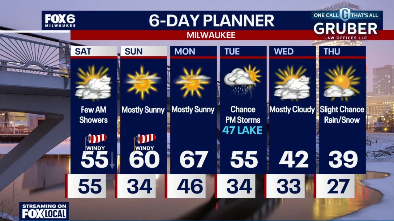
A few morning showers on Saturday, otherwise windy with mostly cloudy skies. Falling temperatures through Saturday with temps in the 40s by the afternoon. Mostly sunny, windy and warmer on Sunday with a high around 60.
A few morning showers on Saturday, otherwise windy with mostly cloudy skies. Falling temperatures through Saturday with temps in the 40s by the afternoon. Mostly sunny, windy and warmer on Sunday with a high around 60.
Weather Webcast with Chief Meteorologist Tom Wachs
Mostly cloudy and warm. Temperatures around 60. Strong to severe t-storms are possible between 11pm-3am. Strong winds and a few tornadoes are possible (along with some hail). Please have cell phone emergency alerts set to "ON."
Mostly cloudy and warm. Temperatures around 60. Strong to severe t-storms are possible between 11pm-3am. Strong winds and a few tornadoes are possible (along with some hail). Please have cell phone emergency alerts set to "ON."
Weather webcast with Chief Meteorologist Rob Haswell
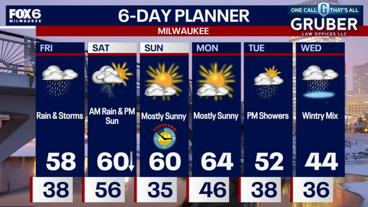
Southern Wisconsin starts Friday with dense fog and quickly transitions into an active weather day as a warm front lifts north. Showers and thunderstorms arrive in the morning, followed by a second round Friday evening that could produce strong to severe storms with hail, gusty winds and even a tornado risk.
Southern Wisconsin starts Friday with dense fog and quickly transitions into an active weather day as a warm front lifts north. Showers and thunderstorms arrive in the morning, followed by a second round Friday evening that could produce strong to severe storms with hail, gusty winds and even a tornado risk.
Weather Webcast with Chief Meteorologist Tom Wachs
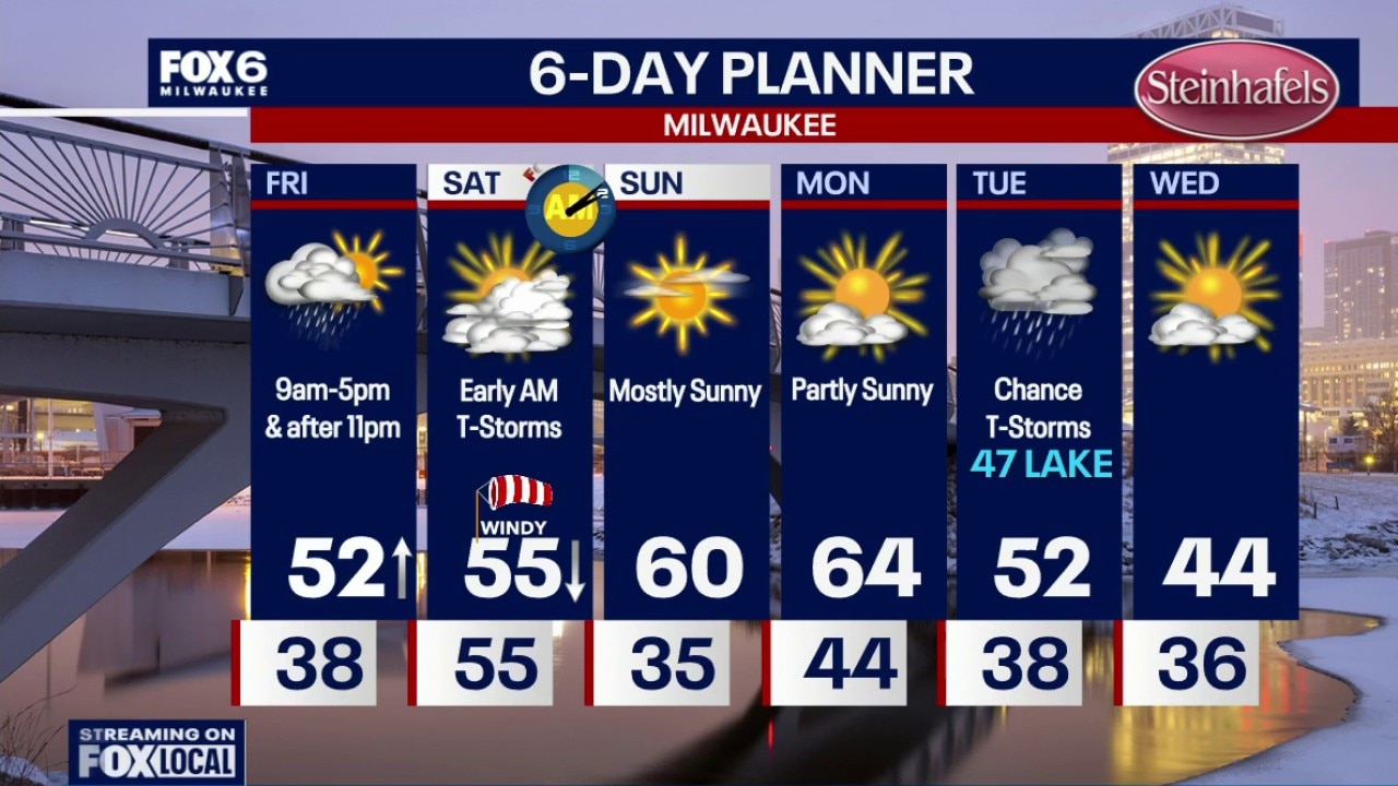
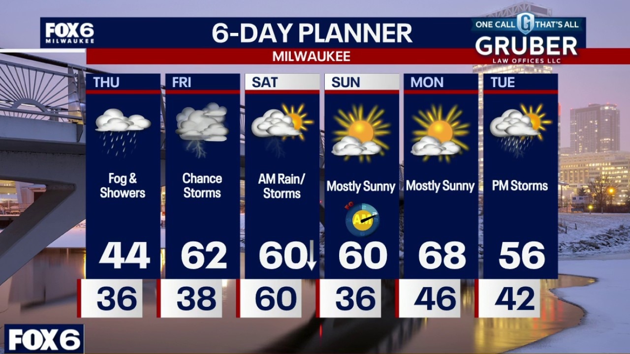
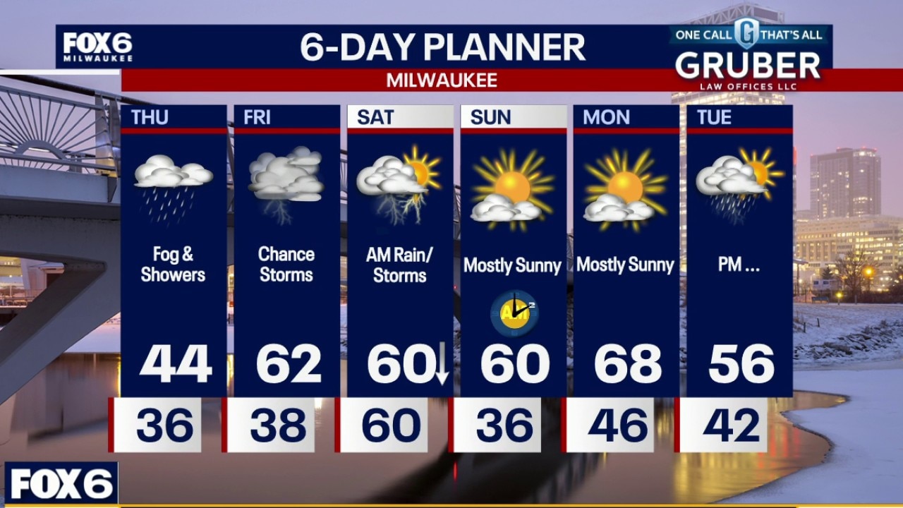
Dense Fog Advisory until 6am for Milwaukee, Racine, Kenosha, Ozaukee and Sheboygan counties. Foggy overnight with steady temperatures in the upper 30s to low 40s. Foggy on Friday morning with scattered t-storms from 9am-5pm. Temperatures will warm into the 50s during the afternoon. Temperatures in the 60s late Friday evening. There will be an evening break in the rain with more storms between 11pm-6am (Saturday). While any storms could be severe, the greatest severe threat is overnight IF those storms hold together.
Dense Fog Advisory until 6am for Milwaukee, Racine, Kenosha, Ozaukee and Sheboygan counties. Foggy overnight with steady temperatures in the upper 30s to low 40s. Foggy on Friday morning with scattered t-storms from 9am-5pm. Temperatures will warm into the 50s during the afternoon. Temperatures in the 60s late Friday evening. There will be an evening break in the rain with more storms between 11pm-6am (Saturday). While any storms could be severe, the greatest severe threat is overnight IF those storms hold together.
Weather Webcast with Chief Meteorologist Tom Wachs
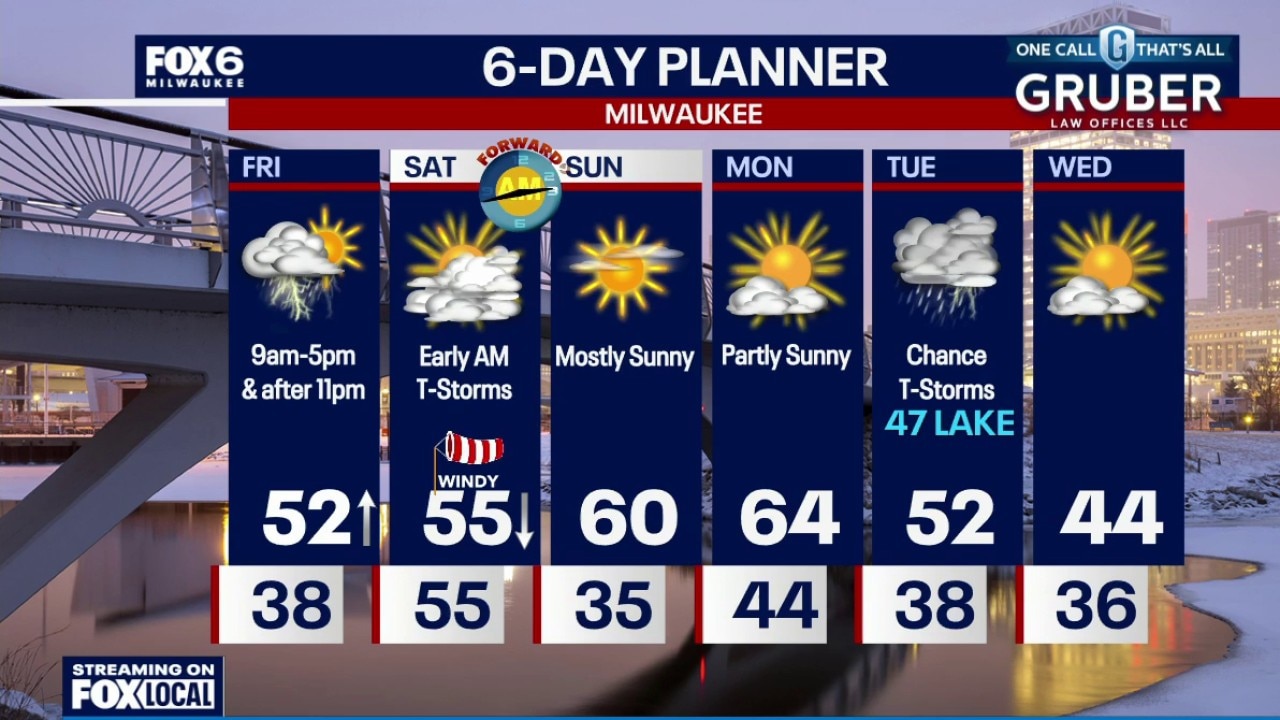
Foggy tonight with steady temperatures in the upper 30s to low 40s. Foggy on Friday morning with scattered t-storms from 9am-5pm. Temperatures will warm into the 50s during the afternoon. Temperatures in the 60s late Friday evening. There will be an evening break in the rain with more storms between 11pm-6am (Saturday). While any storms could be severe, the greatest severe threat is overnight IF those storms hold together.
Foggy tonight with steady temperatures in the upper 30s to low 40s. Foggy on Friday morning with scattered t-storms from 9am-5pm. Temperatures will warm into the 50s during the afternoon. Temperatures in the 60s late Friday evening. There will be an evening break in the rain with more storms between 11pm-6am (Saturday). While any storms could be severe, the greatest severe threat is overnight IF those storms hold together.
Weather Webcast with Holly Baker
Tracking severe weather Friday.
Tracking severe weather Friday.
Weather webcast with Holly Baker
Low clouds and fog are the big story across southern Wisconsin through early Friday as easterly winds off Lake Michigan keep visibility reduced and skies gray.
Low clouds and fog are the big story across southern Wisconsin through early Friday as easterly winds off Lake Michigan keep visibility reduced and skies gray.
Weather webcast with Rob Haswell
Low clouds and fog are the big story across southern Wisconsin through early Friday as easterly winds off Lake Michigan keep visibility reduced and skies gray.
Low clouds and fog are the big story across southern Wisconsin through early Friday as easterly winds off Lake Michigan keep visibility reduced and skies gray.
Weather Webcast with Chief Meteorologist Tom Wachs
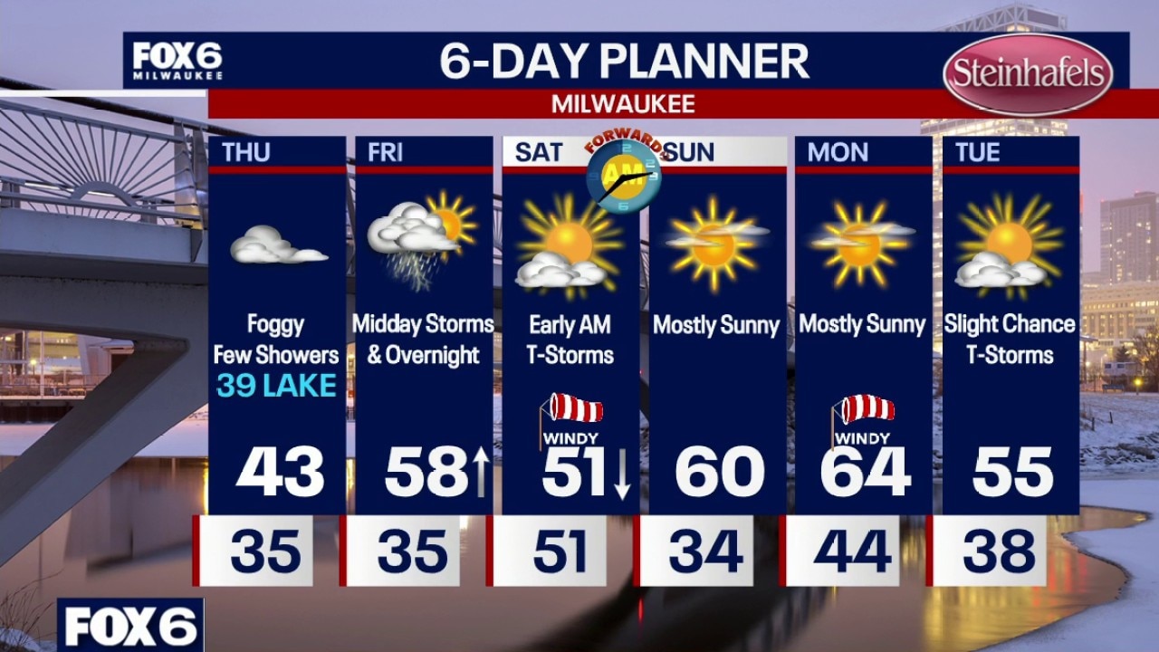
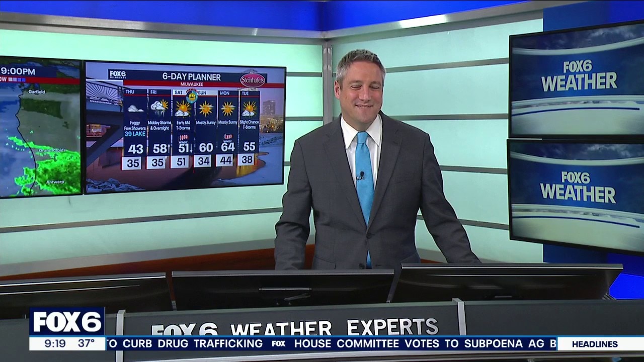
Cloudy with spotty light rain showers overnight. Temperatures dropping into the 30s. Foggy on Thursday with dense fog at times throughout the day. A few spotty rain showers as well. Highs in the upper 30s along the lake, low 40s inland.
Cloudy with spotty light rain showers overnight. Temperatures dropping into the 30s. Foggy on Thursday with dense fog at times throughout the day. A few spotty rain showers as well. Highs in the upper 30s along the lake, low 40s inland.
Weather Webcast with Chief Meteorologist Tom Wachs
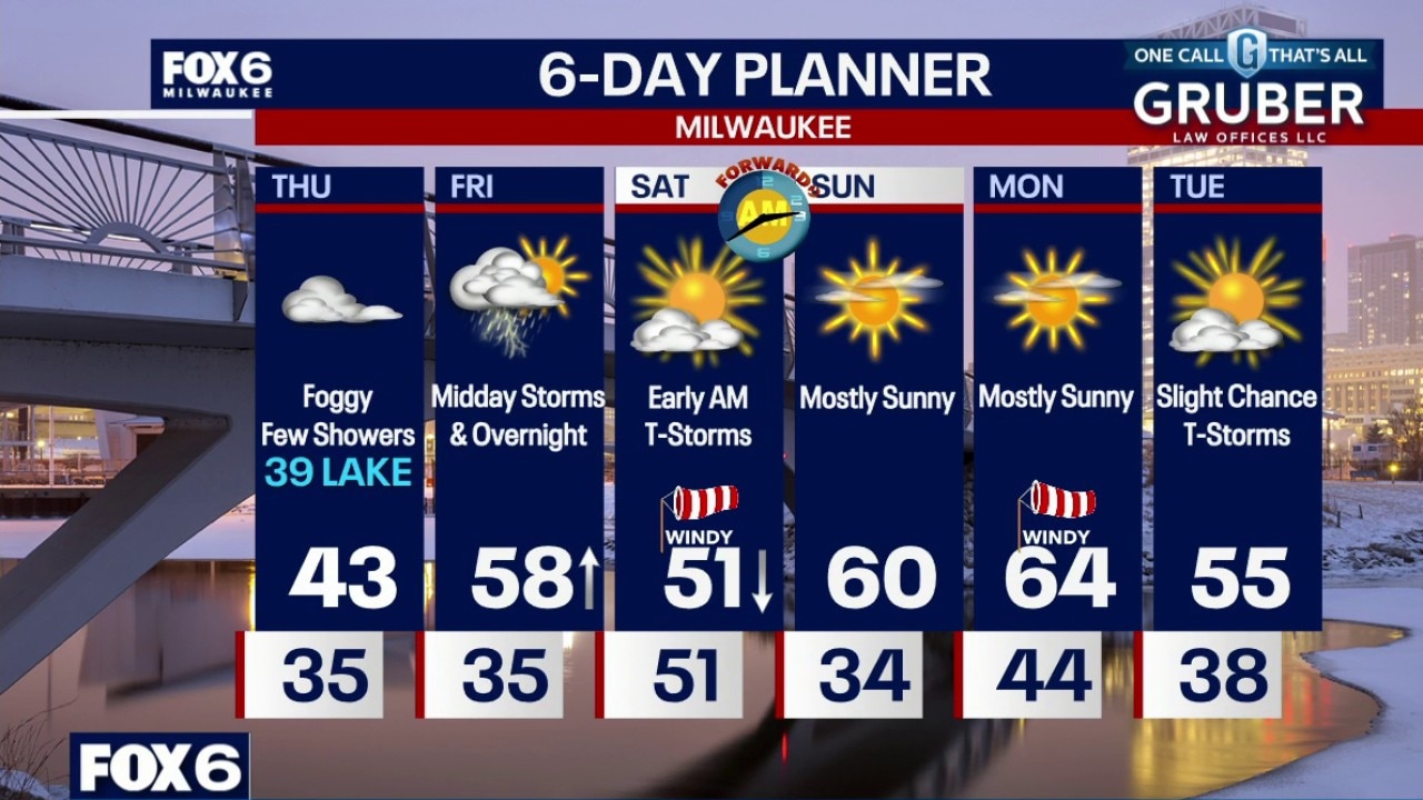
Cloudy with spotty light rain showers overnight. Temperatures dropping into the 30s. Foggy on Thursday with dense fog at times throughout the day. A few spotty rain showers as well. Highs in the upper 30s along the lake, low 40s inland.
Cloudy with spotty light rain showers overnight. Temperatures dropping into the 30s. Foggy on Thursday with dense fog at times throughout the day. A few spotty rain showers as well. Highs in the upper 30s along the lake, low 40s inland.
Weather Webcast with Chief Meteorologist Tom Wachs
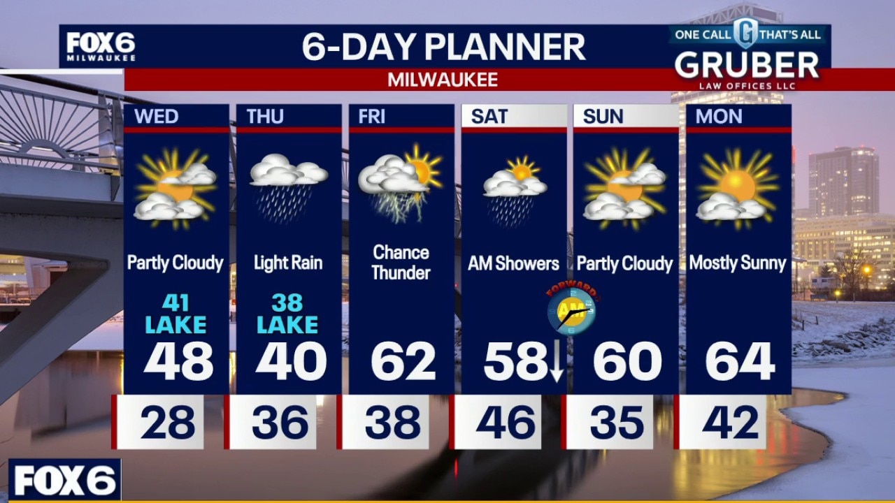
Cloudy with spotty light rain showers tonight. Temperatures dropping into the 30s. Foggy on Thursday with dense fog at times throughout the day. A few spotty rain showers as well. Highs in the upper 30s along the lake, low 40s inland.
Cloudy with spotty light rain showers tonight. Temperatures dropping into the 30s. Foggy on Thursday with dense fog at times throughout the day. A few spotty rain showers as well. Highs in the upper 30s along the lake, low 40s inland.
Weather webcast with Stephanie Barichello
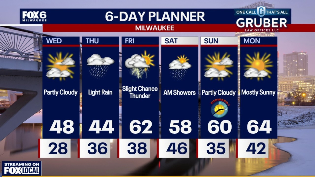
Southern Wisconsin starts Wednesday with fog and low clouds before improving Wednesday afternoon. Rain chances increase again Wednesday night and continue through Thursday as a weak system moves through the Midwest.
Southern Wisconsin starts Wednesday with fog and low clouds before improving Wednesday afternoon. Rain chances increase again Wednesday night and continue through Thursday as a weak system moves through the Midwest.
Weather webcast with Rob Haswell
Southern Wisconsin starts Wednesday with fog and low clouds before improving Wednesday afternoon. Rain chances increase again Wednesday night and continue through Thursday as a weak system moves through the Midwest.
Southern Wisconsin starts Wednesday with fog and low clouds before improving Wednesday afternoon. Rain chances increase again Wednesday night and continue through Thursday as a weak system moves through the Midwest.
Weather Webcast with Chief Meteorologist Tom Wachs
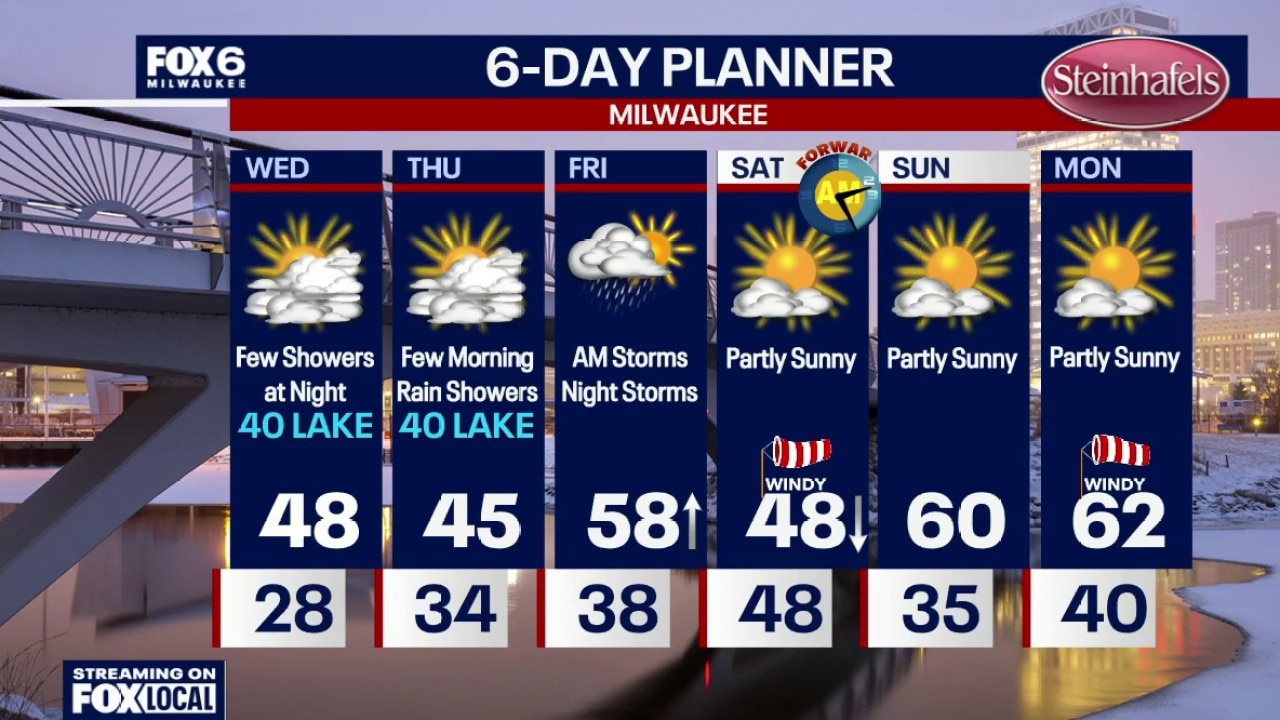
Patchy dense fog overnight. Temperatures will drop through the 30s and settle in the 20s by sunrise. Morning dense fog on Wednesday, otherwise increasing clouds. High around 40 near the lake, upper 40s inland. A few rain showers are possible at night.
Patchy dense fog overnight. Temperatures will drop through the 30s and settle in the 20s by sunrise. Morning dense fog on Wednesday, otherwise increasing clouds. High around 40 near the lake, upper 40s inland. A few rain showers are possible at night.
Weather Webcast with Chief Meteorologist Tom Wachs
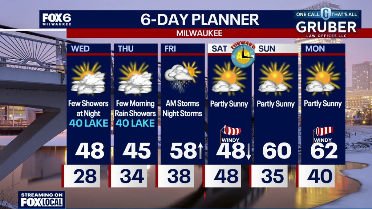
Clearing skies tonight with areas of dense fog developing. Temperatures will drop through the 30s and settle in the 20s overnight.
Clearing skies tonight with areas of dense fog developing. Temperatures will drop through the 30s and settle in the 20s overnight.
Weather webcast with Lisa Michaels
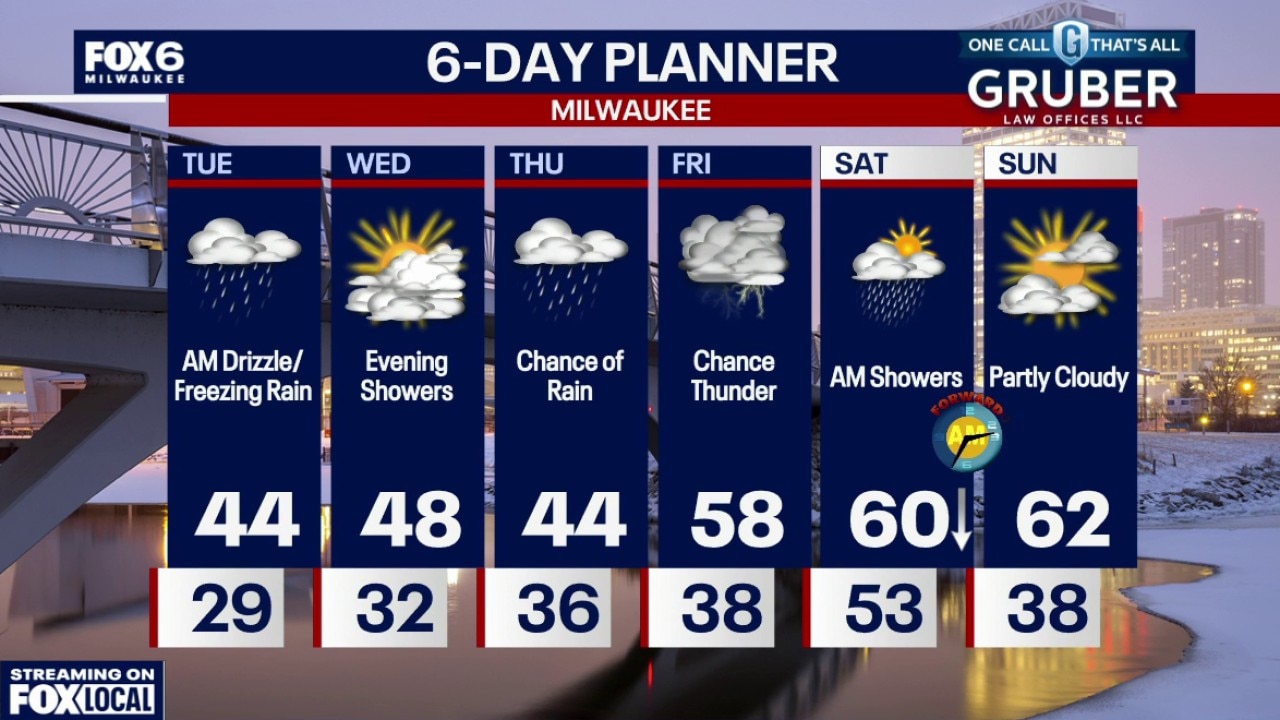
A brief window of light freezing rain is possible early Tuesday morning, but any glaze should melt quickly after sunrise. After that, temperatures trend well above normal with quiet weather through most of Wednesday.
A brief window of light freezing rain is possible early Tuesday morning, but any glaze should melt quickly after sunrise. After that, temperatures trend well above normal with quiet weather through most of Wednesday.
Weather webcast with Rob Haswell
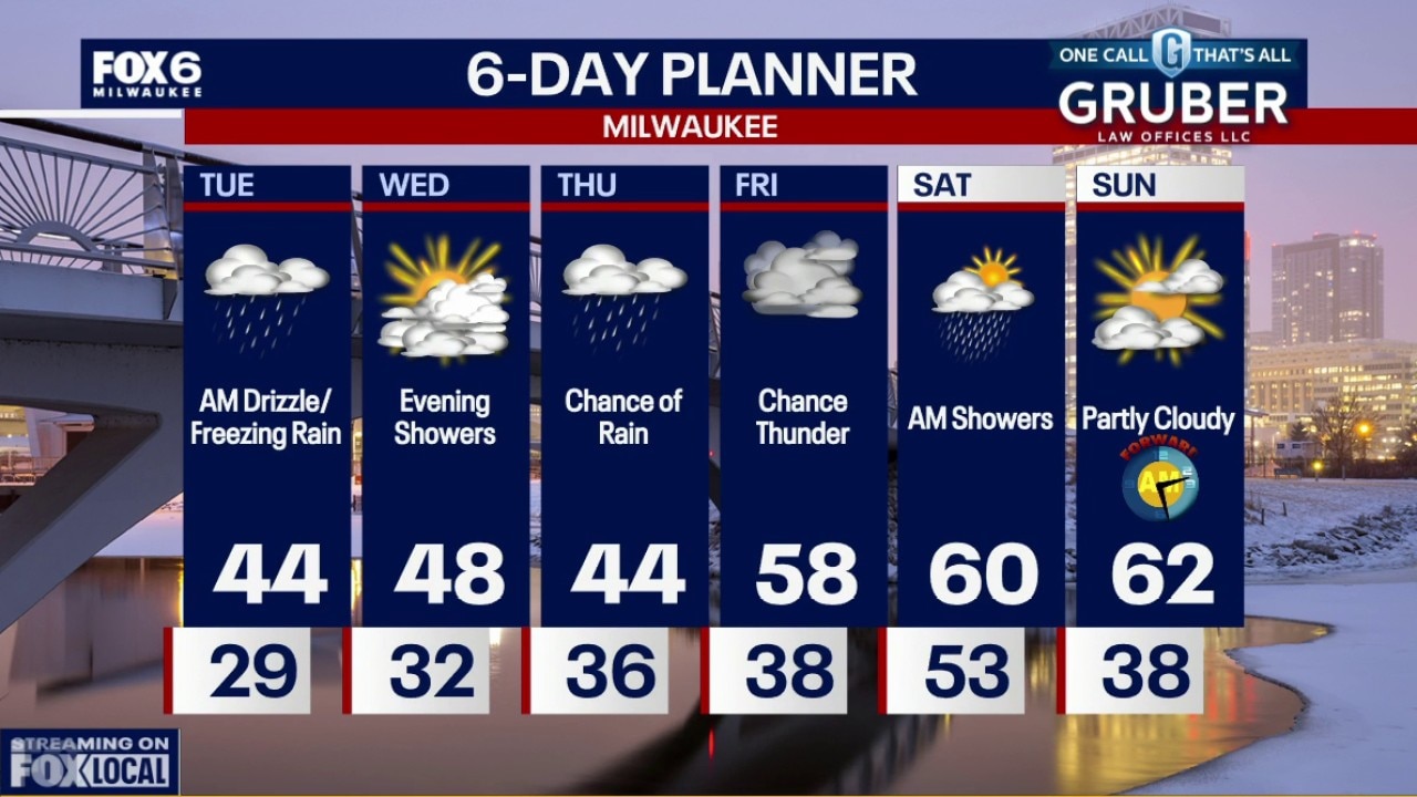
A brief window of light freezing rain is possible early Tuesday morning, but any glaze should melt quickly after sunrise. After that, temperatures trend well above normal with quiet weather through most of Wednesday.
A brief window of light freezing rain is possible early Tuesday morning, but any glaze should melt quickly after sunrise. After that, temperatures trend well above normal with quiet weather through most of Wednesday.