

Temps will reach low to mid-90s Wednesday, seasonable weather returns this weekend
SOUTHEAST WISCONSIN - Our warmer than average trend continues in a big way this afternoon, as high temps climb to the low to mid-90s and feel like temps hit nearly 100˚ for everyone. Rain on Tuesday, Aug. 25 brought brief relief to the heat but warm air has pushed up from the south and won't budge until Friday.
The warm front bringing this heat extends from northern Minnesota all the way to West Virginia, with mostly rain for Michigan.
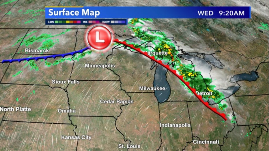
Current surface analysis for August 26, warm front impacted Wisconsin next two days
As a result, of all this warm and humid air feel like temps quickly climb into the upper 90s and near 100 for just about all of southern Wisconsin on Wednesday, Aug. 26. We are not under a heat advisory but it's still important to stay hydrated and have ways of cooling down after extended periods outside.
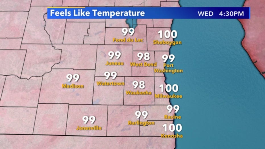
Feel like temps for southeast Wisconsin this afternoon, August 26
The good news is cooler weather will soon be here to end August. Our average highs are in the upper 70s and by the weekend seasonable weather returns with even a chance for below-average temps on Sunday, Aug. 30. Long-term temperature forecasts keep us at seasonable conditions for the start of Sept. as well.
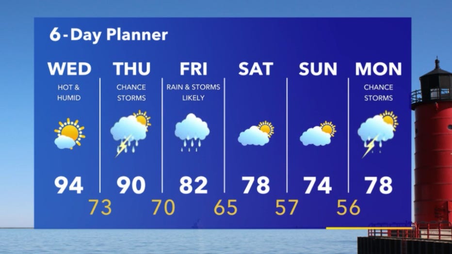
6-Day Planner August 26-August 31