

Southeast Wisconsin Weather: Long-stretch of heat, humidity, and storms return
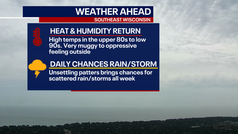
MILWAUKEE - A big shift in the weather is moving in for the first week of September and, rather than feeling like fall, it will feel like summer is sticking around.
The Midwest Picture
What we know:
A frontal boundary will slowly meander in the Midwest heading into early next week. This will gradually turn into a warm front and lift into Wisconsin. This boundary will help bring daily chances of rain and storms to the area. It will also allow southerly winds to help increase temperatures into the upper 80s and low 90s Sunday through next week.
National Pattern View
Big picture view:
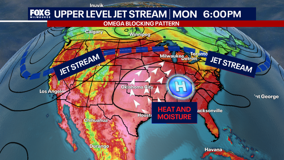
The jet stream will become stuck and draped across the northern United States, while an area of high pressure will be lodged to the south. This will keep the consistent forecast of southerly winds, making it feel hot and humid with rain and storms present.
Local Impacts
Timeline:
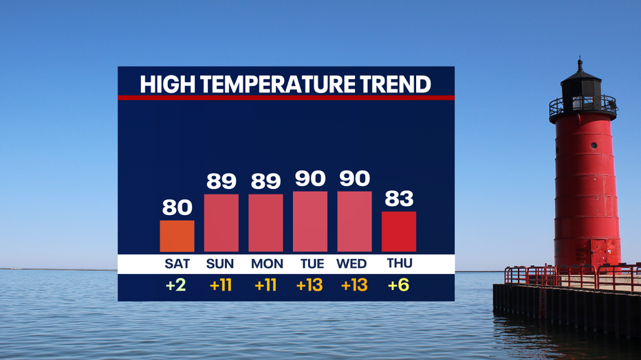
September will start off with high temperatures in the upper 80s to low 90s, which will be 10 to 15 degrees above normal, and that heat could stretch through the week.
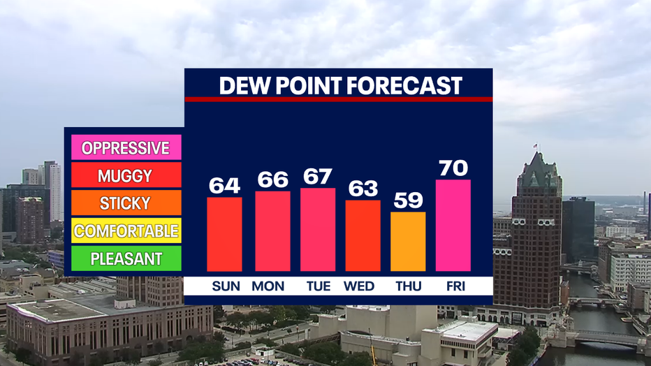
What will make it feel worse are the high dew points that will be in the upper 60s to low 70s, making it feel muggy and oppressive outside. At times, it is possible to have heat index values in the mid-90s.
Because we will be sitting north of the high pressure and along a frontal boundary, this could amplify rounds of heavy rain or storms through the week. There won't be a washout every day and there will be dry time.
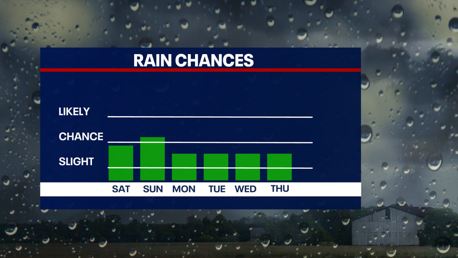
We are monitoring this forecast because it is possible that this trend could continue into Labor Day weekend.
The Source: Information provided by the FOX6 Weather Experts and the National Weather Service.