

Active pattern of storms to last into the weekend
An active pattern of storms and heavy rain will work through Wisconsin to end the week and last through the weekend. Widespread heavy rain will be possible multiple times to end the month of June.
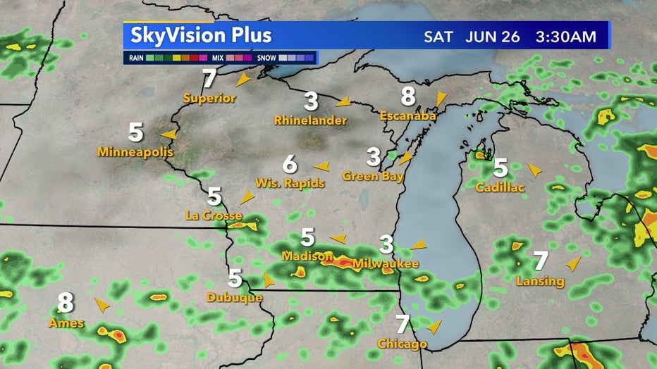
SkyVision Plus Saturday, June 26
Thursday and Friday rain chances will be hit or miss but Saturday and Sunday are looking much more organized. Starting Saturday morning, June 26 a warm front pushes north, giving us thunderstorm potential.
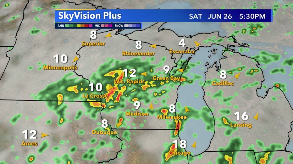
SkyVision Plus Saturday, June 26 5:30 PM
By Saturday afternoon, June 26 the main low rushes in giving more chances of storms and showers. As the cold front heads in this will be worth watching closely for isolated stronger storms.

SkyVision Plus Sunday, June 27
We're still not out of the woods by Sunday, June 27 as the low stalls out over the region and continues to give us heavy rain potential. There continues to be widespread model disagreement on totals but it can be confidently said rain chances are likely Saturday and Sunday. The question that still remains is how much will this stalled out low impact our potential for flooding.