

Weather Webcast with Chief Meteorologist Tom Wachs
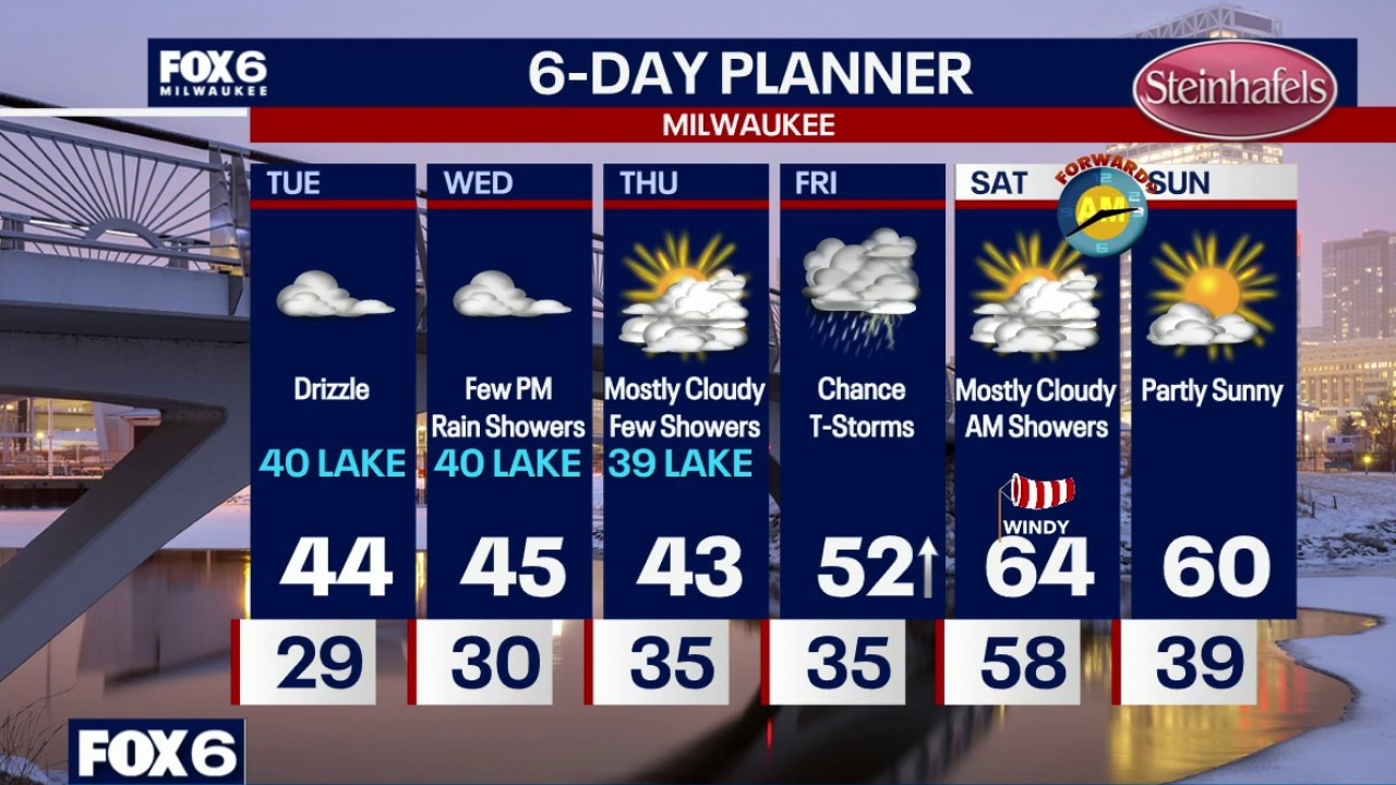
Increasing clouds overnight with temperatures dropping into the upper 20s. Sadly, it will be too cloudy to see the total lunar eclipse around here on Tuesday morning. Cloudy with areas of drizzle on Tuesday. Some freezing drizzle is possible between 2-7am. Highs in the low-to-mid 40s. Coolest of the air near the lake. Cloudy on Wednesday with highs in the 40s and a few PM rain showers.
Increasing clouds overnight with temperatures dropping into the upper 20s. Sadly, it will be too cloudy to see the total lunar eclipse around here on Tuesday morning. Cloudy with areas of drizzle on Tuesday. Some freezing drizzle is possible between 2-7am. Highs in the low-to-mid 40s. Coolest of the air near the lake. Cloudy on Wednesday with highs in the 40s and a few PM rain showers.
Weather Webcast with Chief Meteorologist Tom Wachs
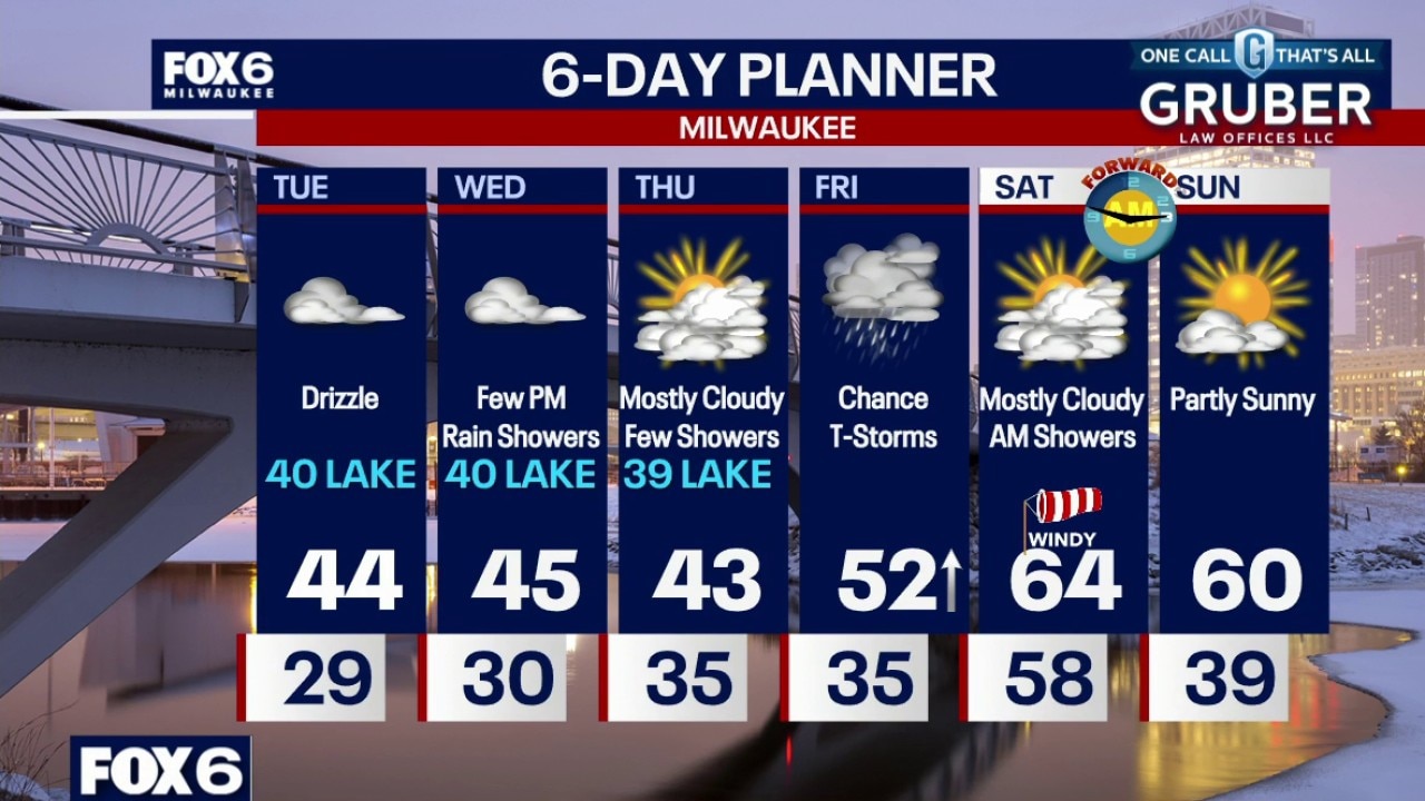
Increasing clouds tonight with temperatures dropping into the upper 20s. Sadly, it will be too cloudy to see the total lunar eclipse around here on Tuesday morning.
Increasing clouds tonight with temperatures dropping into the upper 20s. Sadly, it will be too cloudy to see the total lunar eclipse around here on Tuesday morning.
Weather Webcast with Stephanie Barichello
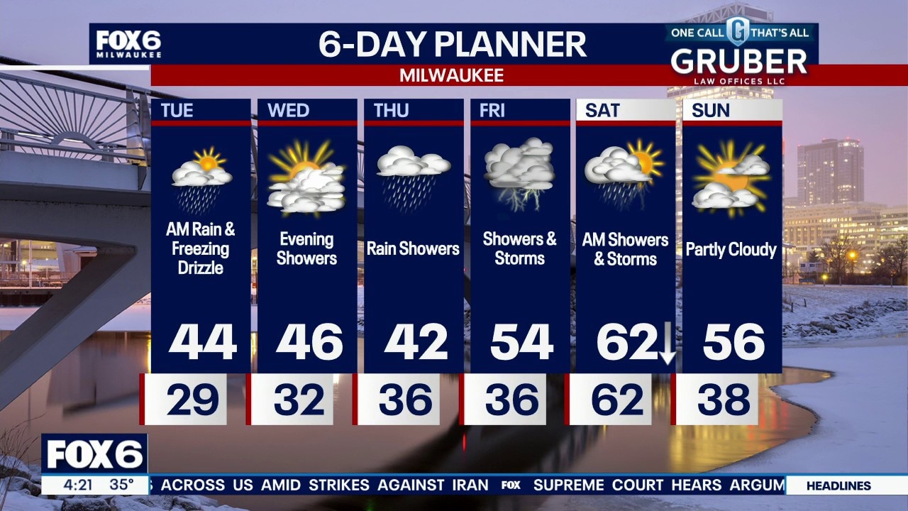
Light rain and freezing drizzle possible to start Tuesday, then another rain chance Wednesday evening into Thursday. Temperatures will remain slightly cooler lakeside during this time. Stronger system expected to bring storms Friday into Saturday, along with falling temperatures Saturday.
Light rain and freezing drizzle possible to start Tuesday, then another rain chance Wednesday evening into Thursday. Temperatures will remain slightly cooler lakeside during this time. Stronger system expected to bring storms Friday into Saturday, along with falling temperatures Saturday.
Weather webcast with Stephanie Barichello
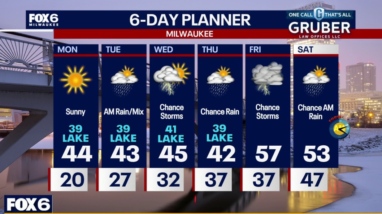
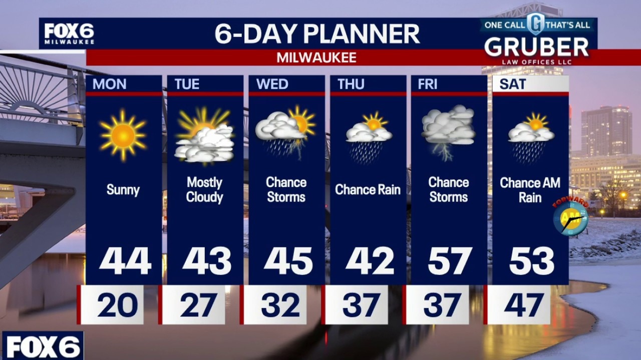
Frosty Monday morning with temps in the teens inland to low 20s near the lake. Mostly sunny to sunny skies on Monday. Highs in the mid-40s inland, upper 30s near the lake.
Frosty Monday morning with temps in the teens inland to low 20s near the lake. Mostly sunny to sunny skies on Monday. Highs in the mid-40s inland, upper 30s near the lake.
Weather webcast with Lisa Michaels
Frosty Monday morning with temps in the teens inland to low 20s near the lake. Mostly sunny to sunny skies on Monday. Highs in the mid-40s inland, upper 30s near the lake.
Frosty Monday morning with temps in the teens inland to low 20s near the lake. Mostly sunny to sunny skies on Monday. Highs in the mid-40s inland, upper 30s near the lake.
Weather Webcast with Chief Meteorologist Tom Wachs
Mostly clear overnight. Temperatures dropping through the 20s. Mostly sunny on Monday with highs in the mid-40s inland, upper 30s near the lake.
Mostly clear overnight. Temperatures dropping through the 20s. Mostly sunny on Monday with highs in the mid-40s inland, upper 30s near the lake.
Weather Webcast with Stephanie Barichello
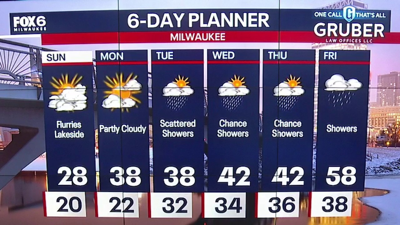
Lake effect flurries today otherwise partly sunny and colder with temperatures in the upper 20s. Snow melts Monday with sunshine and near 40° temperatures. Staying mild this week with multiple chances for rain ahead.
Lake effect flurries today otherwise partly sunny and colder with temperatures in the upper 20s. Snow melts Monday with sunshine and near 40° temperatures. Staying mild this week with multiple chances for rain ahead.
Weather webcast with meteorologist Stephanie Barichello
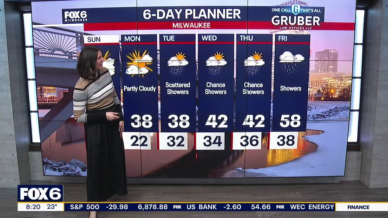
Lake effect flurries and light snow possible at times this morning, otherwise partly sunny today with temperatures in the upper 20s. Cold again tonight with temperatures dropping to low 20s, then we climb back into the 30s and 40s Monday with sunshine.
Lake effect flurries and light snow possible at times this morning, otherwise partly sunny today with temperatures in the upper 20s. Cold again tonight with temperatures dropping to low 20s, then we climb back into the 30s and 40s Monday with sunshine.
Weather Webcast with Holly Baker
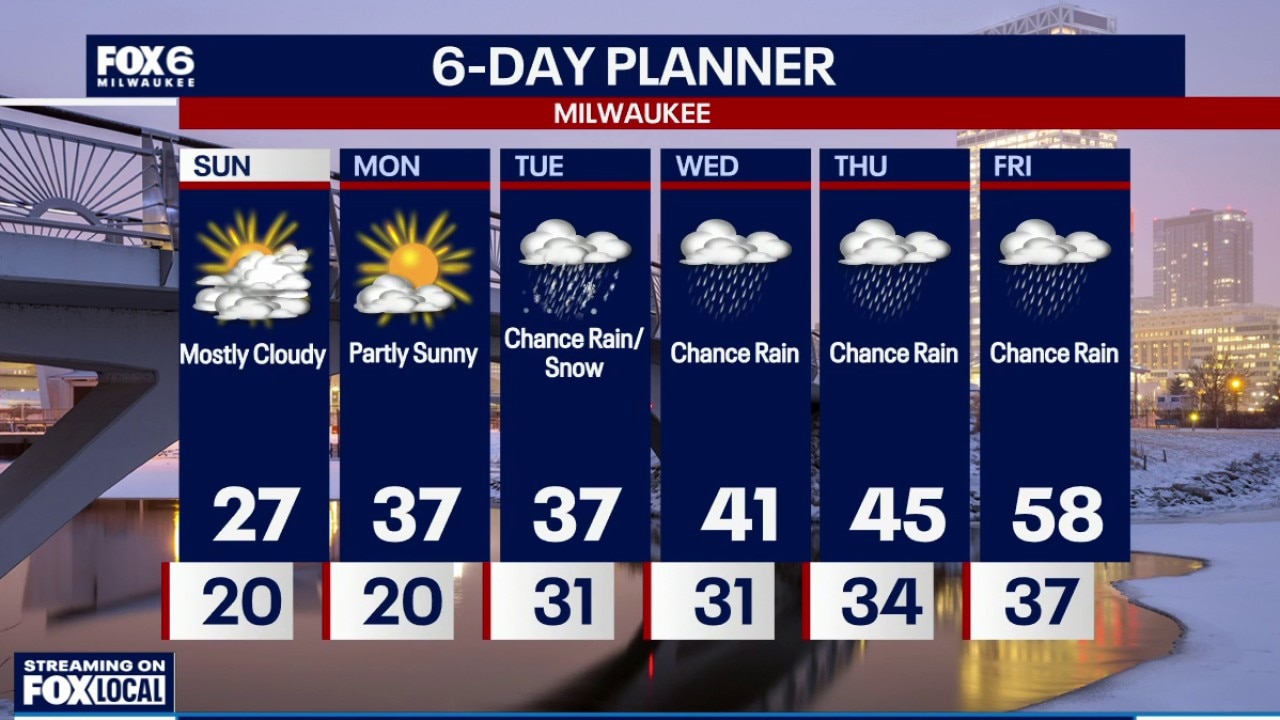
Temperatures will be warming up after Sunday with more rain on the way.
Temperatures will be warming up after Sunday with more rain on the way.
Weather Webcast with Holly Baker
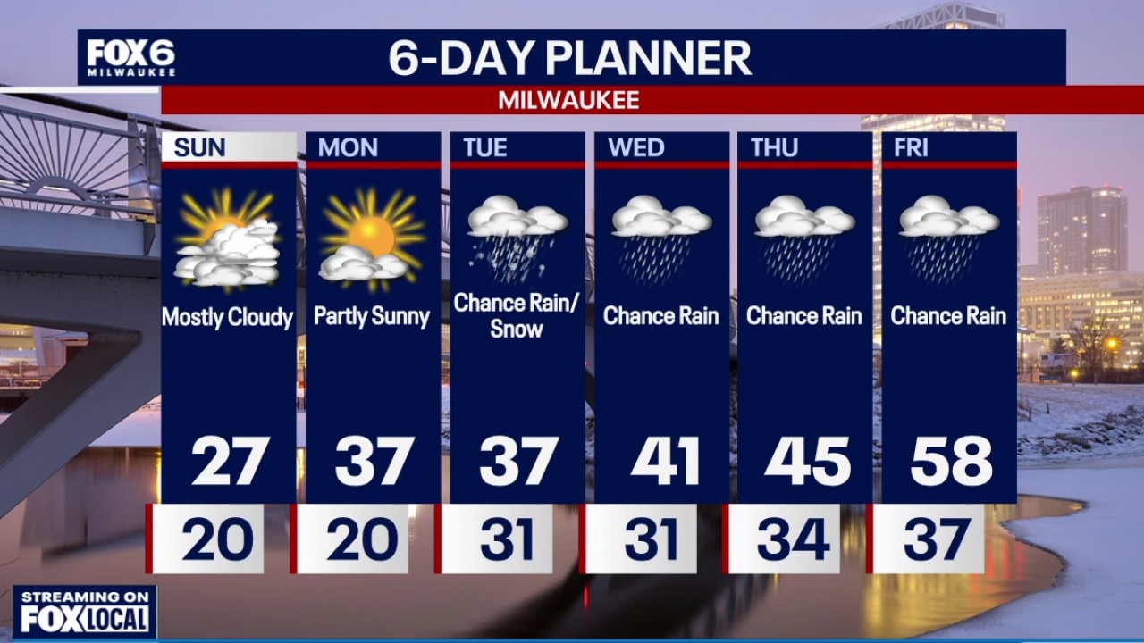
We are tracking what's left of the snow tonight into Sunday.
We are tracking what's left of the snow tonight into Sunday.
Weather Webcast with Stephanie Barichello
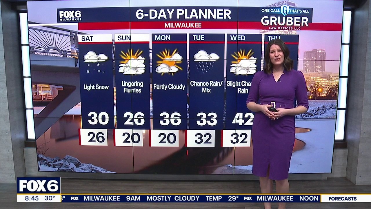
Light snow expected throughout the afternoon and evening with an inch or so of accumulation possible in spots. Colder with temperatures in the 20s. Lake effect snow is possible Sunday morning along the southern lakeshore, then some sunshine. Rain and warmer temps return next week.
Light snow expected throughout the afternoon and evening with an inch or so of accumulation possible in spots. Colder with temperatures in the 20s. Lake effect snow is possible Sunday morning along the southern lakeshore, then some sunshine. Rain and warmer temps return next week.
Weather webcast with meteorologist Stephanie Barichello
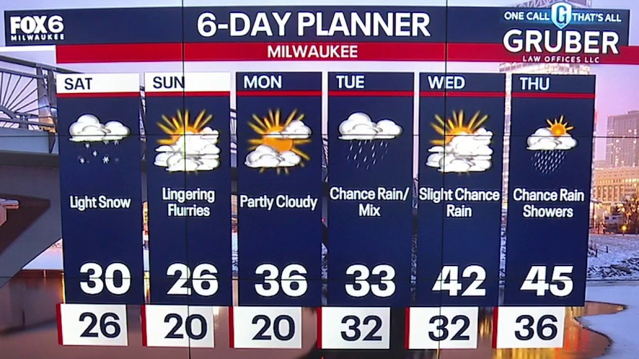
Snow showers out west are moving slow, but still expect periods of light snow in SE WI from mid-morning into the early evening.
Snow showers out west are moving slow, but still expect periods of light snow in SE WI from mid-morning into the early evening.
Webcast Weather with Holly Baker
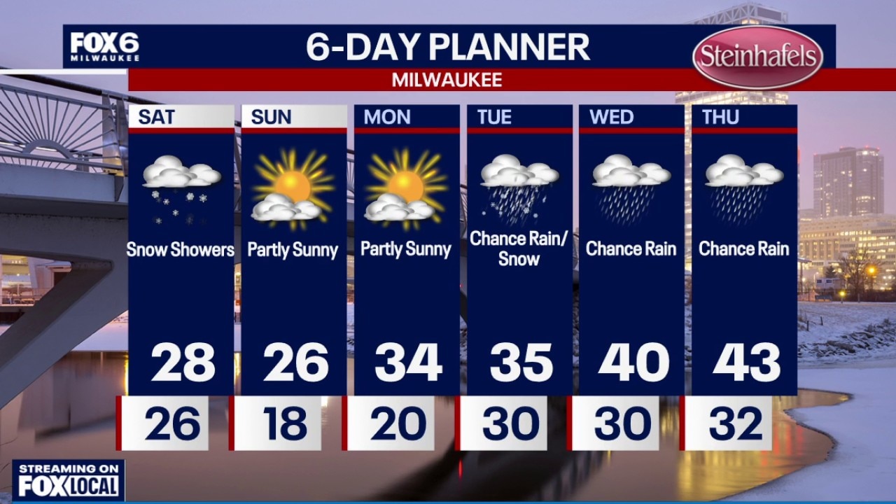
We are tracking snow for Saturday.
We are tracking snow for Saturday.
Weather Webcast with Stephanie Barichello
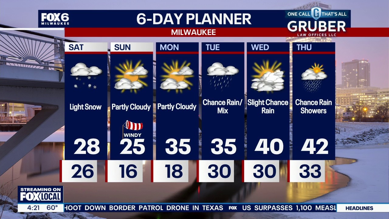
Temperatures drop back into the 20s this weekend with light snow during the day Saturday. Snowfall totals will range from 2-4" far north, an inch or two around Milwaukee, and less than an inch near the IL state line. Not a huge storm, but watch for slushy or slippery spots while traveling. Cold Sunday, then gradually warming next week. There are a few more chances for rain and possibly wintry mix.
Temperatures drop back into the 20s this weekend with light snow during the day Saturday. Snowfall totals will range from 2-4" far north, an inch or two around Milwaukee, and less than an inch near the IL state line. Not a huge storm, but watch for slushy or slippery spots while traveling. Cold Sunday, then gradually warming next week. There are a few more chances for rain and possibly wintry mix.
Weather webcast with Stephanie Barichello
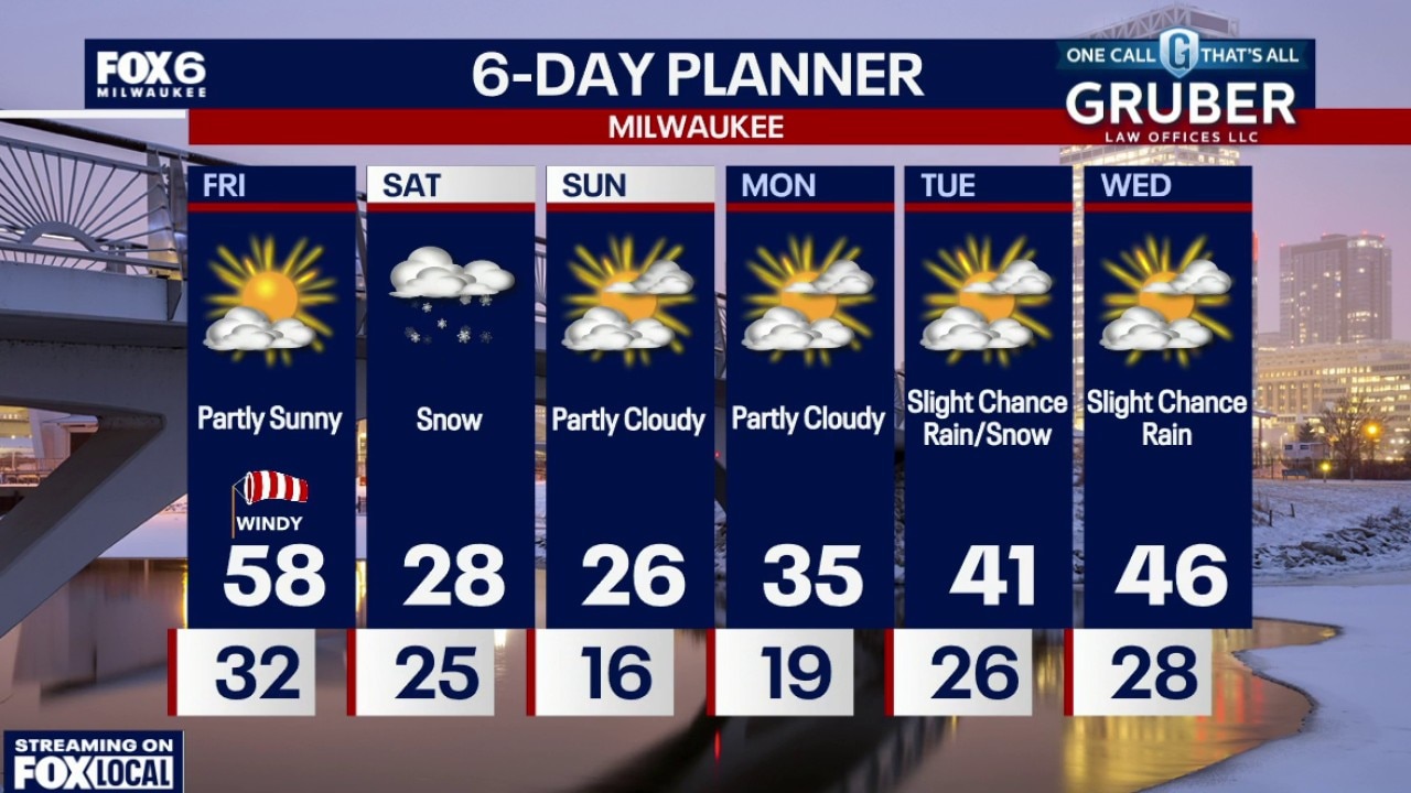
Patchy morning frost and temperatures in the mid 20s to low 30s. Partly sunny, windy and warm on Friday with highs in the upper 50s. Very windy with gusts near 30 mph.
Patchy morning frost and temperatures in the mid 20s to low 30s. Partly sunny, windy and warm on Friday with highs in the upper 50s. Very windy with gusts near 30 mph.
Weather webcast with Lisa Michaels
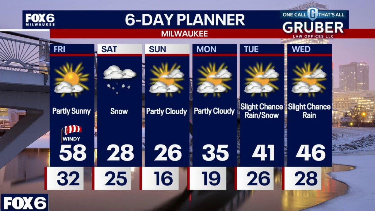
Patchy morning frost and temperatures in the mid 20s to low 30s. Partly sunny, windy and warm on Friday with highs in the upper 50s. Very windy with gusts near 30 mph.
Patchy morning frost and temperatures in the mid 20s to low 30s. Partly sunny, windy and warm on Friday with highs in the upper 50s. Very windy with gusts near 30 mph.
Weather Webcast with Chief Meteorologist Tom Wachs
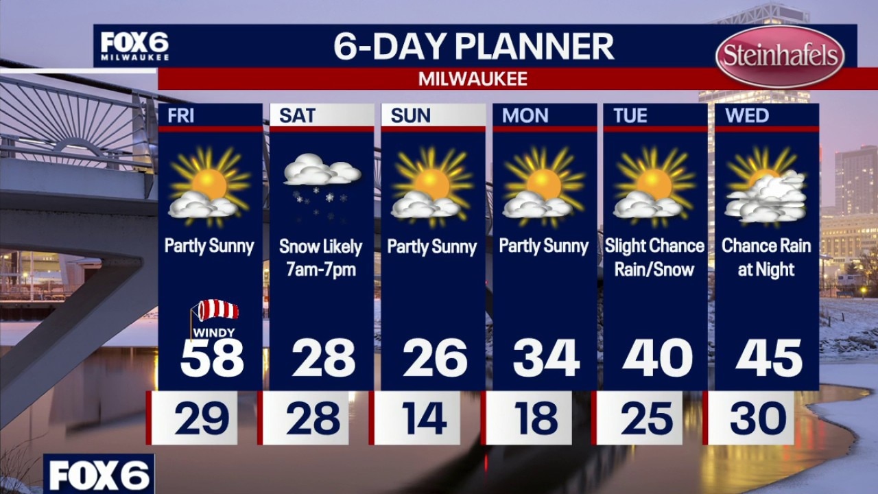
Mostly clear overnight with temperatures falling through the 30s and settling in the upper 20s by sunrise. Partly sunny, windy and warm on Friday with highs in the upper 50s. Temperatures come crashing down this weekend.
Mostly clear overnight with temperatures falling through the 30s and settling in the upper 20s by sunrise. Partly sunny, windy and warm on Friday with highs in the upper 50s. Temperatures come crashing down this weekend.
Weather webcast with Stephanie Barichello
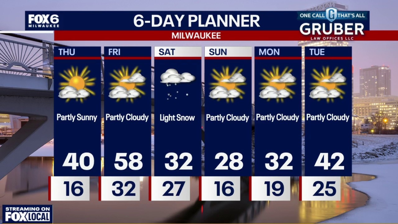
We’re starting quiet and seasonably cool, but don’t get too comfortable; this pattern is about to flip. Thursday rebounds nicely with highs pushing around 40 and dry skies holding strong.
We’re starting quiet and seasonably cool, but don’t get too comfortable; this pattern is about to flip. Thursday rebounds nicely with highs pushing around 40 and dry skies holding strong.
Weather webcast with Rob Haswell
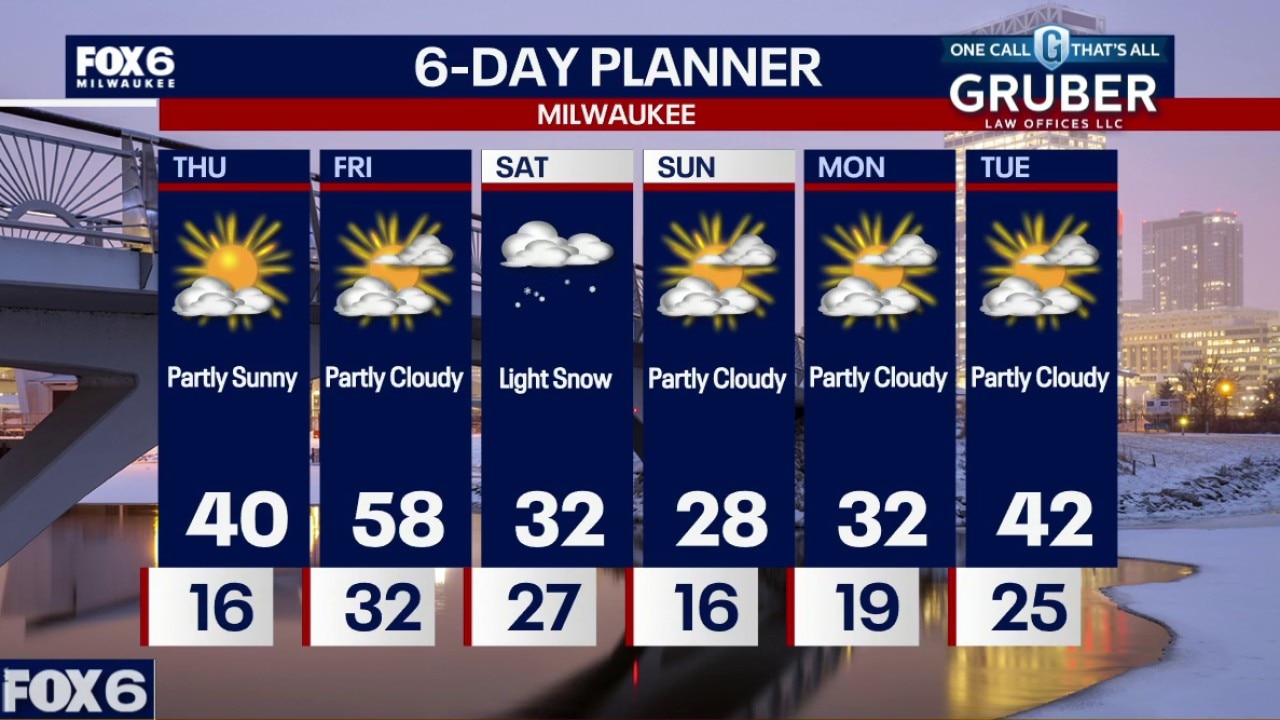
We’re starting quiet and seasonably cool, but don’t get too comfortable; this pattern is about to flip. Thursday rebounds nicely with highs pushing around 40 and dry skies holding strong.
We’re starting quiet and seasonably cool, but don’t get too comfortable; this pattern is about to flip. Thursday rebounds nicely with highs pushing around 40 and dry skies holding strong.
Weather Webcast with Holly Baker
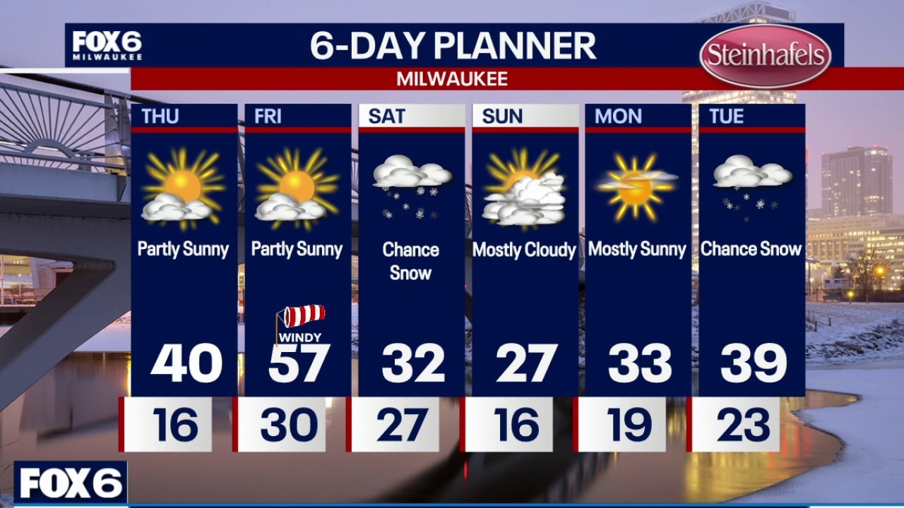
Temperatures will be a little warmer for the remainder of the work week.
Temperatures will be a little warmer for the remainder of the work week.