

Wisconsin Weather: Could a polar vortex create cold and snow this week?
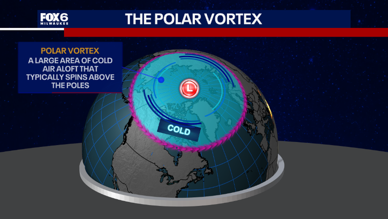
MILWAUKEE - Polar Vortex is making its swirl around on social media again—let's talk about it!
What is the polar vortex?
Digging into the science:
It is a large area of low-pressure and cold air surrounding both of Earth’s poles. It always exists but weakens in the summer and strengthens in the winter. The term "vortex" refers to the counterclockwise flow of air that keeps it cool near the poles. The polar vortex is not at the Earth’s surface—but rather 10 to 30 miles above Earth in the stratosphere. However, cold arctic air can surge down to the surface, which is why we feel cold conditions when it impacts us.
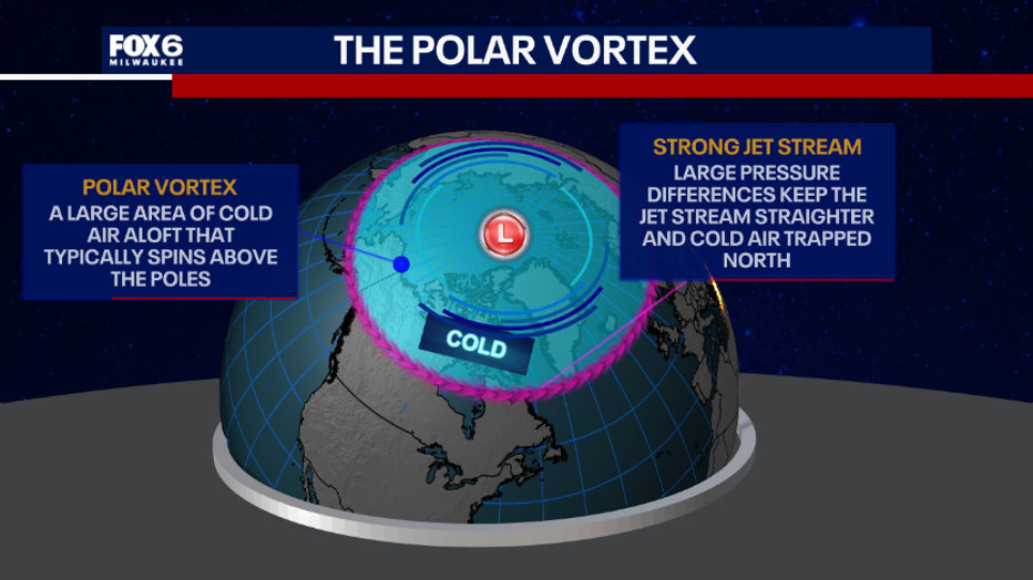
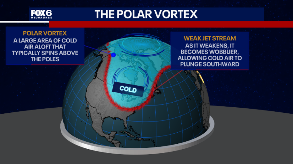
During the winter in the Northern Hemisphere, the polar vortex weakens at times, due to sudden stratospheric warming, sending cold air southward with the jet stream. The warming in the stratosphere is not caused by warm air near the surface of Earth rising in the sky, but rather the weakened jet has sinking air at the poles which compresses and warms from above. Things such as El Niño can have an impact on the Polar Vortex too.
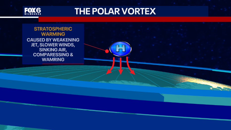
This causes the polar vortex to become weaker, leading to impacts lower in the atmosphere by making the jet stream wavier and slower. This can bring down colder air from the north/aloft and change the weather. The distortion of the polar vortex doesn’t bring impacts to the surface immediately, but over days and weeks it can slowly appear.
Polar vortex is not a new term, it has just been used more on social media, TV, and in web stories, creating the term to surface more frequently. It is nothing to be afraid of because a polar vortex does not always mean it will be cold and lead to doomsday.
Changes on the way this week
Big picture view:
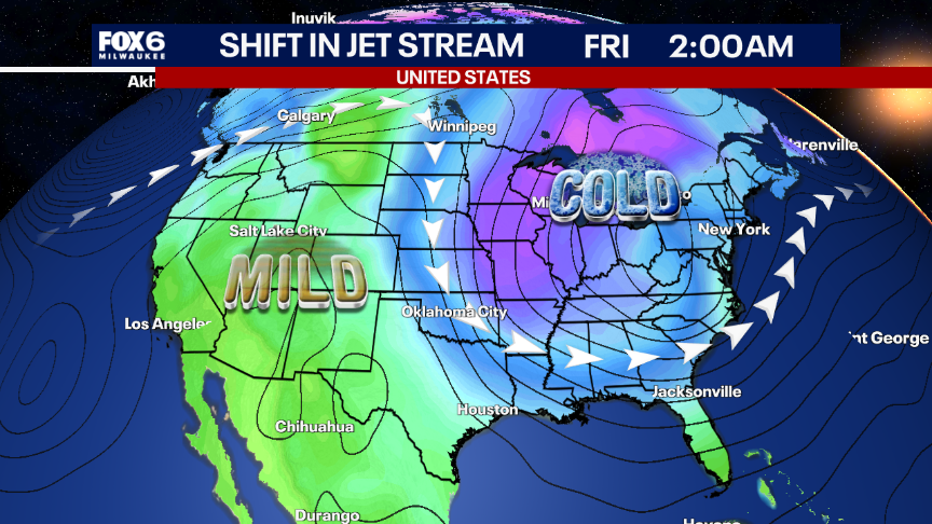
A disruption in the polar vortex is looking to potentially bring some impacts this week. The jet stream is going to stay mainly uniform for the first few days this week, keeping a more uniform mild air mass across the United States.
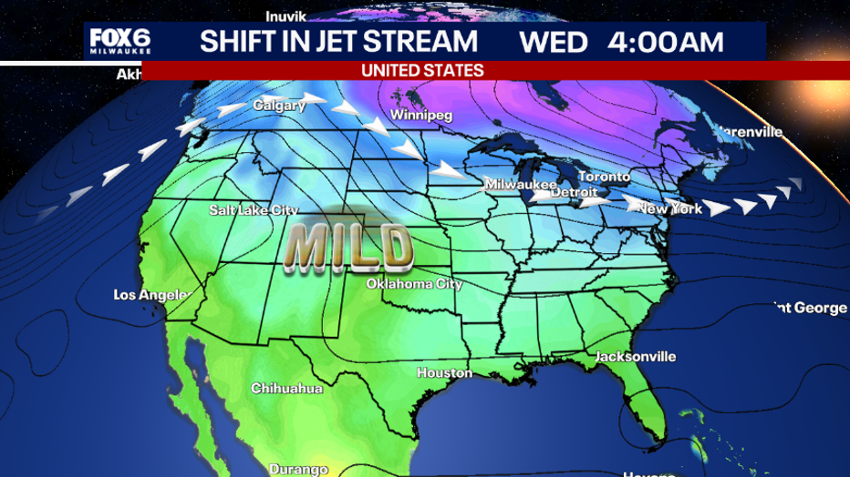
Wednesday into the weekend, a large trough in the jet stream will shift colder than normal temperatures into the Great Lakes region, New England, and potentially the southern United States.
Impacts for southeast Wisconsin
Local perspective:
Mild temperatures persist through Tuesday in the upper 50s to near 60°F, but the colder air starts to slowly move in on Wednesday and beyond. Normal temperatures at this time of the year are in the upper 40s, so there will not be a substantial amount of arctic air moving in, especially since it is early in the season and the air above the arctic is just starting to get colder. Due to this, there isn’t a lot of extremely cold air available to move southward into the mid-latitudes — not to mention a polar vortex this early is very rare.
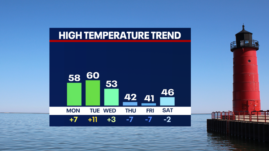
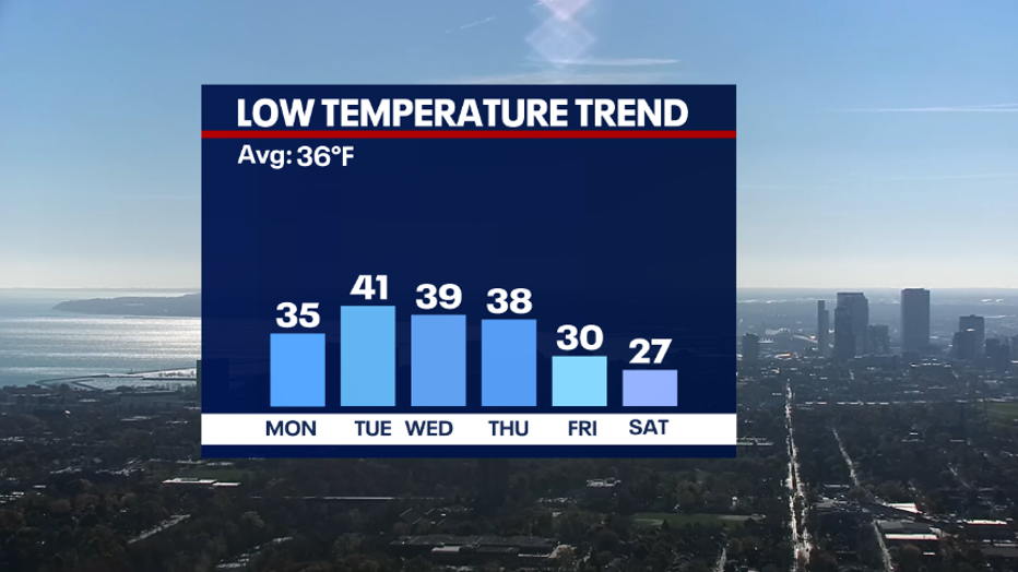
That being said, impacts are forecasted to have high temperatures close to 10°F below average for several days. Low temperatures may dip below freezing and into the upper 20s. Winds will have to be watched too, because, depending on the speed, this could bring bitterly cold wind chills.
Let's talk snow
What we know:
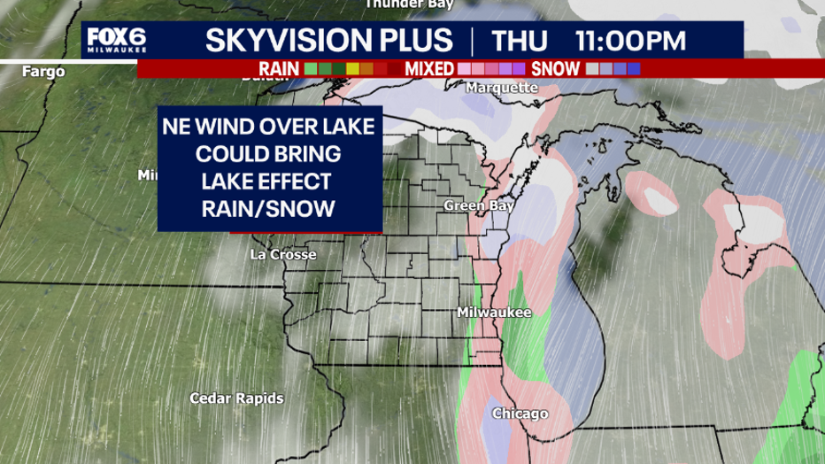
Given that that cold air will arrive next week and the Great Lakes are still very warm, this can impact lake effect precipitation as a mix or change to snow as the cold air moves over the warm water. We don’t know the fine details until the upcoming days, but the trends are looking more likely for below average temperatures to arrive along with the first snowflakes of the season in Milwaukee—but snow accumulation is not looking likely.
The Source: Information in this story is from the National Oceanic and Atmospheric Administration and the FOX6 Weather Experts.