

Southeast Wisconsin: Heavy rain could lead to flooding this weekend

Milwaukee weather: Heavy rain can lead to flooding this weekend
A flood watch has been issued for southcentral Wisconsin and could be added to southeast Wisconsin on Saturday. Rounds of heavy rain can cause high accumulation totals, leading to flooding. Rain will become heavy late Friday night through Saturday afternoon.
MILWAUKEE - The National Weather Service has issued a flood watch from Friday evening through Saturday afternoon for southcentral Wisconsin, and it could be added for southeast Wisconsin on Saturday.
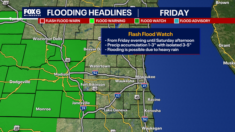
Rainfall totals
What to expect:
Precipitation accumulation could range from 1–3 inches, with isolated areas getting 3–5 inches. Depending on where the rounds of heavy rain and embedded storms move, higher rain totals can shift north or south of our viewing area this weekend. This will make it imperative to be weather aware and prepared.
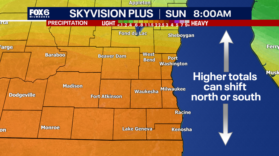
Due to the nature of this system bringing rounds of heavy rain, especially on Saturday, the Weather Prediction Center has issued southeast Wisconsin under a risk of flooding through the weekend.
Flood preparation
Why you should care:
Heavy rain could lead to flooded roads, especially in low-lying or flood-prone areas. This can cause difficult travel conditions for some. Viewers should be urged to clear gutters and drains, check sump pumps, move valuable items off basement floors and relocate vehicles from flood-prone areas before the heaviest rain arrives.
Rain timing
Timeline:
Light rain moves in on Friday night with increasing activity into the predawn hours of Saturday morning. The heaviest rain is expected to continue through sunrise with more by Sunday night shifting towards the Wisconsin-Illinois border. Rain will become lighter Sunday and Monday. Your FOX6 weather experts will have you covered.
The Source: Information in this story is from the National Weather Service and FOX6 Weather Experts.