

Cooler weather with sunshine for the weekend, heat returns Monday
SOUTHEAST WISCONSIN -- Many cities Friday morning, June 5 started with showers and storms which will become much more spotty into the afternoon. This rain is a result of a passing boundary of cold air, which marks the end of our summer heat for at least a couple days.
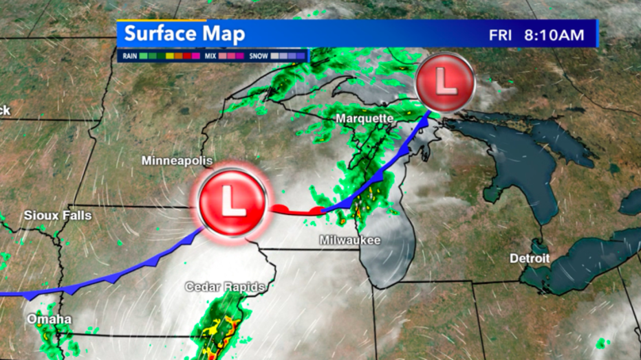
Surface map analysis of Wisconsin as of Friday 8:10am June 5
After this cold front passes, we'll have a noticeable drop in temperatures that return us to more average conditions. We should be in the low 70s this time of year and high temps both Saturday and Sunday will stay in the mid to low 70s.
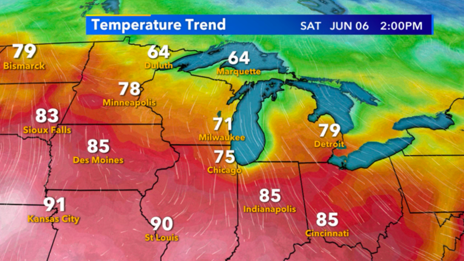
Temperature for Saturday, June 6
For the whole weekend, we'll stay mostly sunny and seasonable. For those missing the heat, don't worry it returns by Monday, June 8. Long term model trends continue to hint at a cooler than average mid-June. Likely, by next weekend, June 13-14 we'll be back in the 70s.
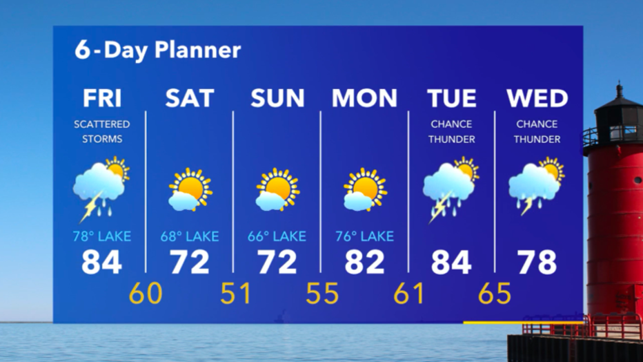
6-Day Planner for June 5-10