

Another messy system is set to impact southeast Wisconsin Friday night
SOUTHEAST WISCONSIN -- Almost exactly a week removed from last weekend's winter storm, we have another round moving in Friday, Jan. 17. Snow total ranges are expected between 2"-6" with a chance of 7"+ in isolated spots. Rain and a wintry mix on Saturday, Jan. 18 is what will stunt some areas from seeing as much snow.
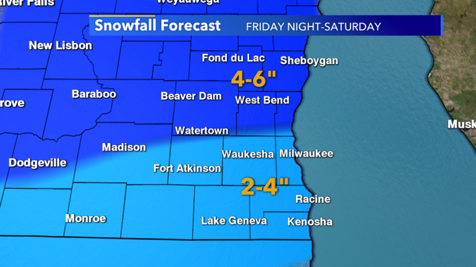
Across our area Friday-Saturday we can expect a range of 2"-6" with isolated spots of 7"+.
The heaviest snow will begin Friday evening, Jan. 17 and will continue through Saturday, Jan. 18 early morning. This is where the big variations in totals will occur as temperatures climb Saturday. The farther south you are, the higher chance that the back end of this system transitions over to a wintry mix while areas up North are still favored for snow. This is why there is a wide range of totals at this time. But by Thursday, we'll have a clearer picture of areas south that will see more rain.
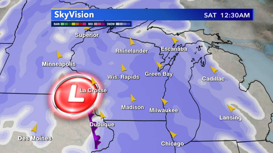
Heaviest snow starts Friday night and continues through Saturday morning
There is something important to mention with this winter blast. With it there will be cold air that trails the snow heading into the start of next week. The cold front will trail the heaviest snow by quite a lot. But once it arrives, gusty winds will bring down cold air in a hurry.
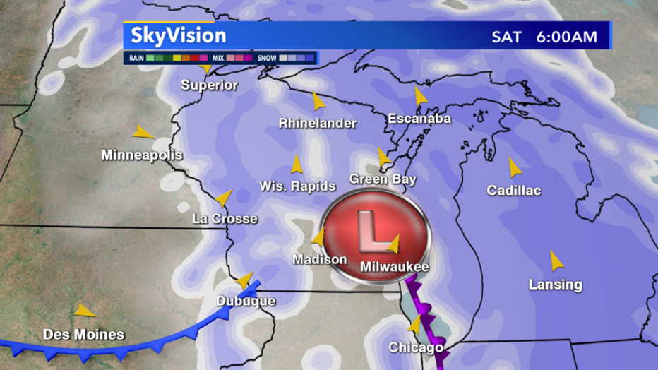
Saturday, Jan. 18 cold air starts to enter Wisconsin.
Low temps early Monday, Jan. 20 could easily plunge down into the single digits and really start making it feel like January.
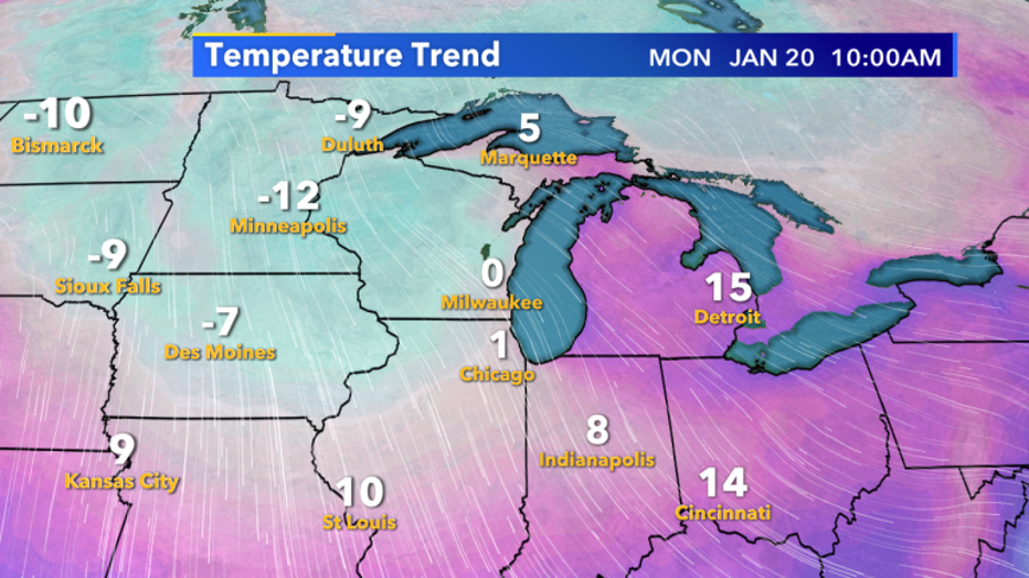
Coldest of air is settled over to Minnesota but Monday, Jan 20. we have a good shot at single digits.