

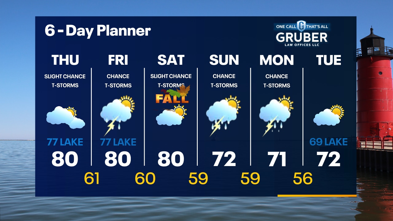
Weather Webcast with Tom Wachs
Mostly cloudy tonight with temperatures dropping into the 60s. Mostly cloudy with a slight chance for a t-storm on Thursday. High around 80 inland, upper 70s near the lake.
Mostly cloudy tonight with temperatures dropping into the 60s. Mostly cloudy with a slight chance for a t-storm on Thursday. High around 80 inland, upper 70s near the lake.

Expect "brilliant" fall foliage; here's why
FOX6 Weather Expert Tom Wachs explains the upcoming peak foliage season for Wisconsin, including why colors may be particularly brilliant this year.
FOX6 Weather Expert Tom Wachs explains the upcoming peak foliage season for Wisconsin, including why colors may be particularly brilliant this year.
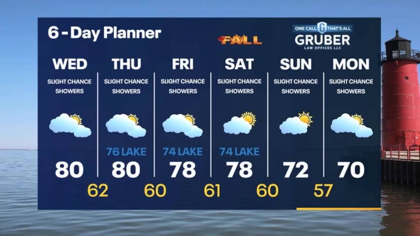
Weather Webcast with Stephanie Barichello
A stray shower or thunderstorm will be possible today and throughout the extended forecast. Temperatures will be warmer, in the 70s and 80s, through the rest of the week. Cooling to more normal numbers by the weekend.
A stray shower or thunderstorm will be possible today and throughout the extended forecast. Temperatures will be warmer, in the 70s and 80s, through the rest of the week. Cooling to more normal numbers by the weekend.
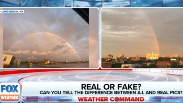

Real or fake? How to spot weather images generated by AI
Artificial intelligence software creates very real looking images of natural phenomena, and is changing the way many of us look at social media posts.
Artificial intelligence software creates very real looking images of natural phenomena, and is changing the way many of us look at social media posts.
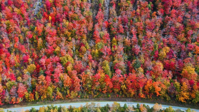

Autumnal equinox 2023: Fall officially begins this weekend
As fall officially begins, the 2023 autumnal equinox arrives on September 23, marking the transition from warmer weather in the Northern Hemisphere to the scenic beauty of fall foliage.
As fall officially begins, the 2023 autumnal equinox arrives on September 23, marking the transition from warmer weather in the Northern Hemisphere to the scenic beauty of fall foliage.
Weather webcast with Rob Haswell
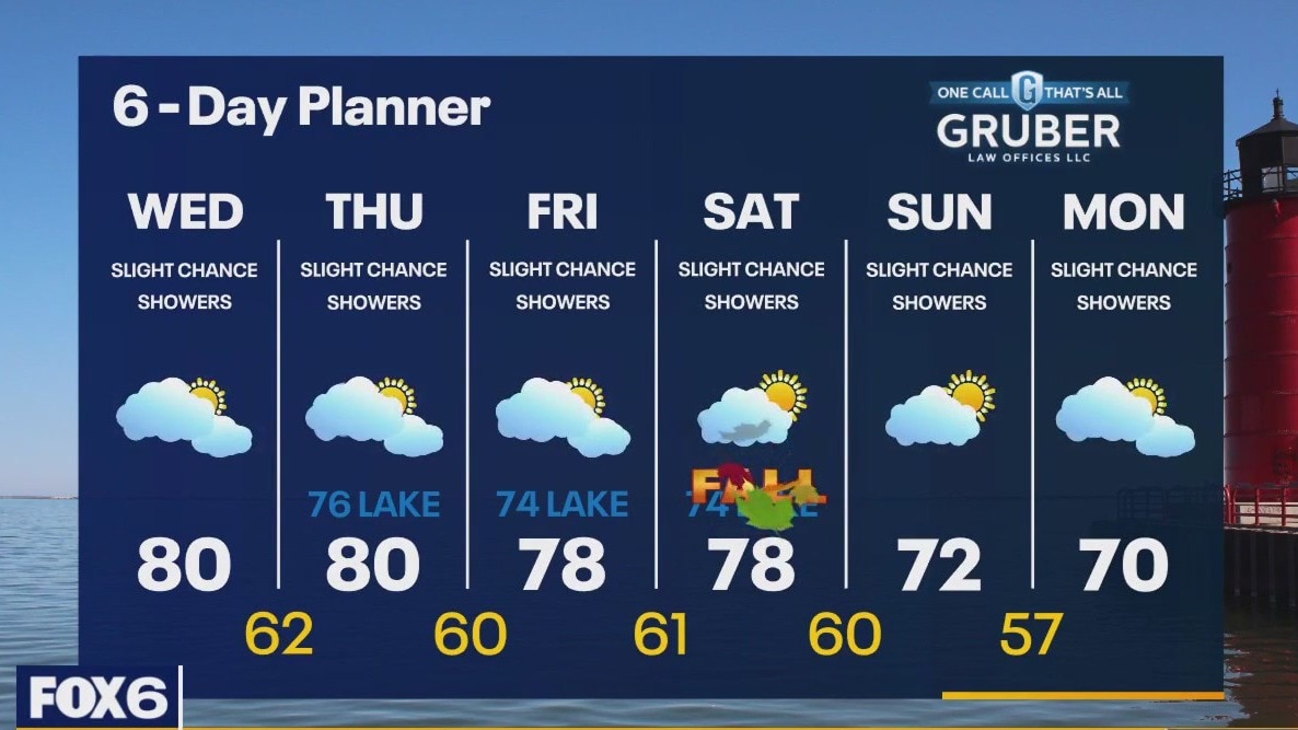
We are behind a warm front today with highs surging to near 80 after spending 3 days in the 60s. The atmosphere will be somewhat unstable for the next few days with a slight chance for showers or thunderstorms today through the weekend. Temperatures will stay above average through Saturday and then cool slightly early next week. Warmer air looks to return next week.
We are behind a warm front today with highs surging to near 80 after spending 3 days in the 60s. The atmosphere will be somewhat unstable for the next few days with a slight chance for showers or thunderstorms today through the weekend. Temperatures will stay above average through Saturday and then cool slightly early next week. Warmer air looks to return next week.
Weather Webcast with Tom Wachs
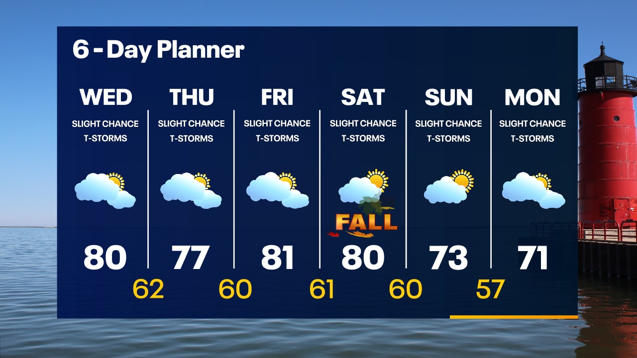
Partly cloudy overnight with temperatures in the 50s. Mostly cloudy, warm and humid on Wednesday with a high around 80. Only a slight chance for a t-storm.
Partly cloudy overnight with temperatures in the 50s. Mostly cloudy, warm and humid on Wednesday with a high around 80. Only a slight chance for a t-storm.
Weather Webcast with Tom Wachs
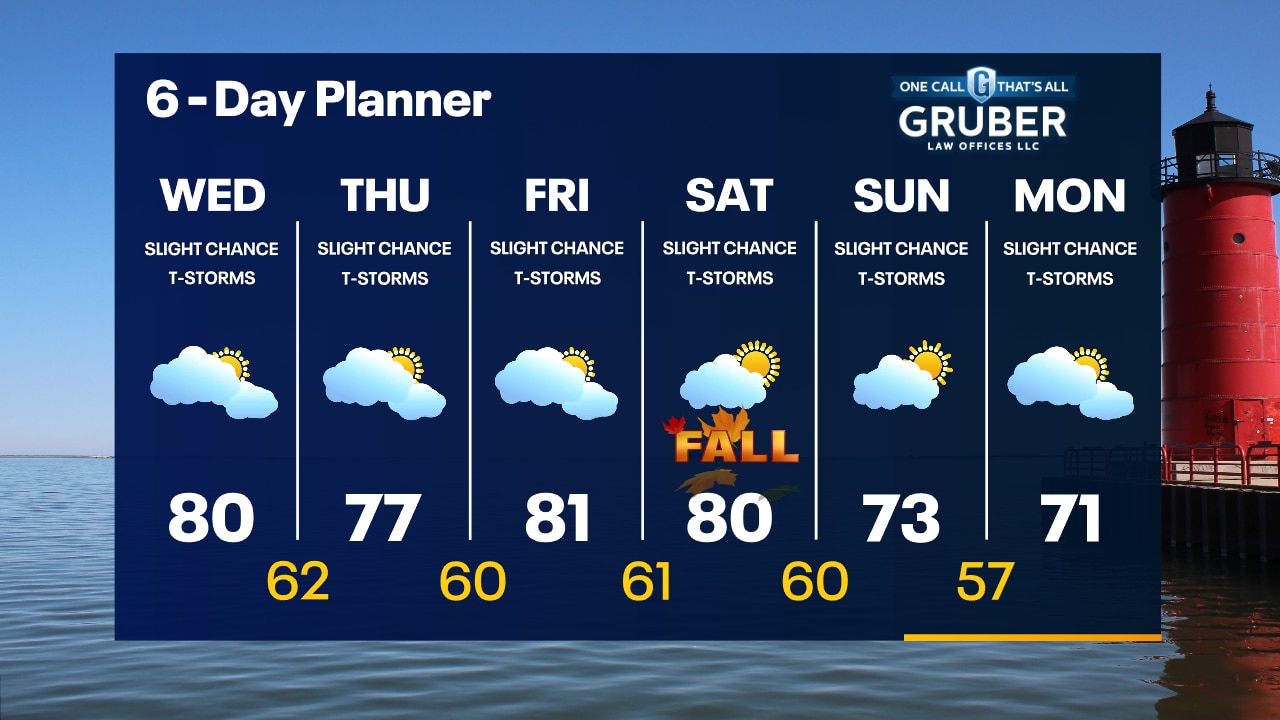
Partly to mostly cloudy tonight with temperatures dropping into the 50s. Mostly cloudy, warm and humid on Wednesday with highs around 80. There is a slight chance for a t-storm on Wednesday.
Partly to mostly cloudy tonight with temperatures dropping into the 50s. Mostly cloudy, warm and humid on Wednesday with highs around 80. There is a slight chance for a t-storm on Wednesday.

SE Wisconsin forecast, temperatures in 80s possible starting Wednesday
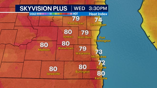
Much of southeast Wisconsin has a chance to hit 80 degrees starting Wednesday, Sept. 20 through Saturday, Sept. 23.
Much of southeast Wisconsin has a chance to hit 80 degrees starting Wednesday, Sept. 20 through Saturday, Sept. 23.
Weather webcast with Lisa Michaels
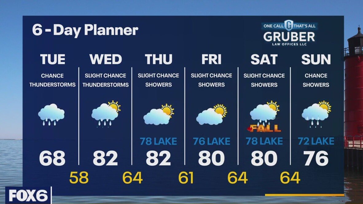
The next few days will be focused on tracking an approaching warm front. As that front moves closer today, we remain on the cooler side but will see enough instability for rain showers and a chance for thunderstorms. With that front in the area tomorrow and north of us by Thursday, we remain unstable with temperatures warming from the 60s today into the 70s and 80s for the remainder of the week. A chance for showers and a slight chance for thunderstorms lingers through the weekend.
The next few days will be focused on tracking an approaching warm front. As that front moves closer today, we remain on the cooler side but will see enough instability for rain showers and a chance for thunderstorms. With that front in the area tomorrow and north of us by Thursday, we remain unstable with temperatures warming from the 60s today into the 70s and 80s for the remainder of the week. A chance for showers and a slight chance for thunderstorms lingers through the weekend.
Weather webcast with Rob Haswell
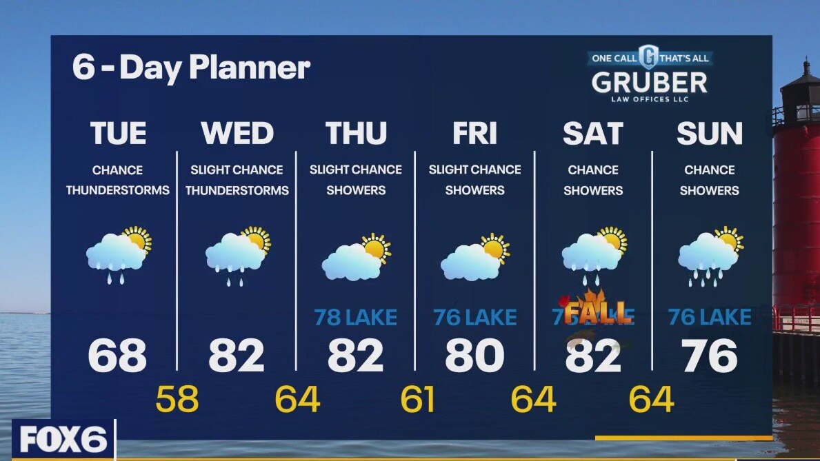
The next few days will be focused on tracking an approaching warm front. As that front moves closer today, we remain on the cooler side but will see enough instability for rain showers and a chance for thunderstorms. With that front in the area tomorrow and north of us by Thursday, we remain unstable with temperatures warming from the 60s today into the 70s and 80s for the remainder of the week. A chance for showers and a slight chance for thunderstorms lingers through the weekend.
The next few days will be focused on tracking an approaching warm front. As that front moves closer today, we remain on the cooler side but will see enough instability for rain showers and a chance for thunderstorms. With that front in the area tomorrow and north of us by Thursday, we remain unstable with temperatures warming from the 60s today into the 70s and 80s for the remainder of the week. A chance for showers and a slight chance for thunderstorms lingers through the weekend.
Weather Webcast with Tom Wachs
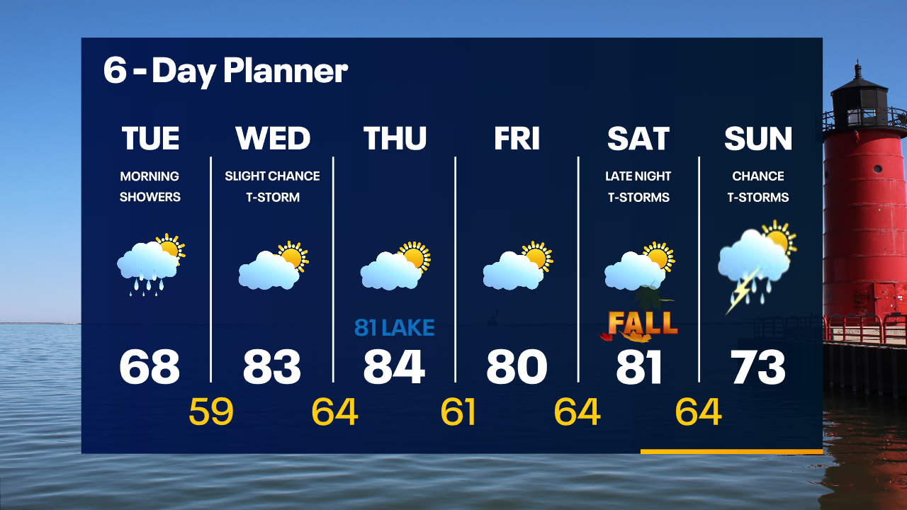
Morning rain showers Tuesday with the steadiest rain near the IL border. Mostly cloudy skies with highs in the upper 60s to around 70. 80s return Wednesday.
Morning rain showers Tuesday with the steadiest rain near the IL border. Mostly cloudy skies with highs in the upper 60s to around 70. 80s return Wednesday.
Weather Webcast with Tom Wachs
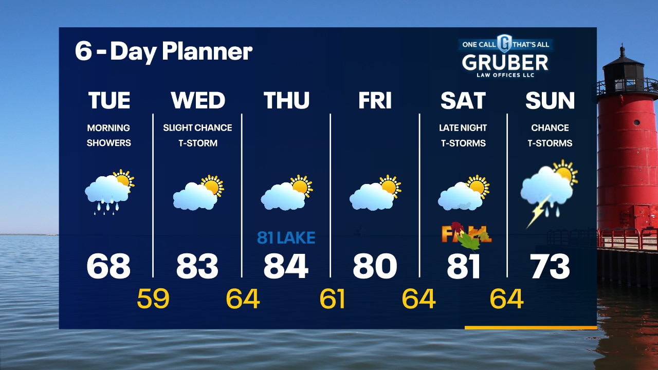
Increasing clouds late tonight with a few rain showers overnight. Morning rain showers on Tuesday with highs in the upper 60s. 80s return Wednesday.
Increasing clouds late tonight with a few rain showers overnight. Morning rain showers on Tuesday with highs in the upper 60s. 80s return Wednesday.
Weather webcast with Lisa Michaels
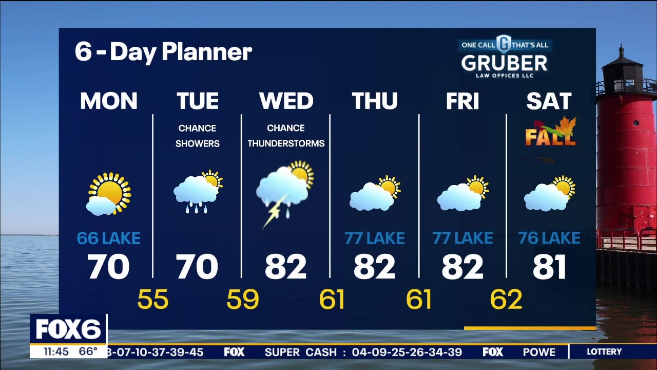
An area of high pressure shifts to the east today keeping us sunny with highs in the mid 60s near the lake to 70 inland. A low moves closer on Tuesday increasing the chance of rain/storms Tuesday into Wednesday. Rain/storms will be scattered in nature so not everyone will see precipitation. We begin to warm back above average for a stretch of time mid week through the beginning of the weekend into the low 80s.
An area of high pressure shifts to the east today keeping us sunny with highs in the mid 60s near the lake to 70 inland. A low moves closer on Tuesday increasing the chance of rain/storms Tuesday into Wednesday. Rain/storms will be scattered in nature so not everyone will see precipitation. We begin to warm back above average for a stretch of time mid week through the beginning of the weekend into the low 80s.
Weather webcast with Rob Haswell
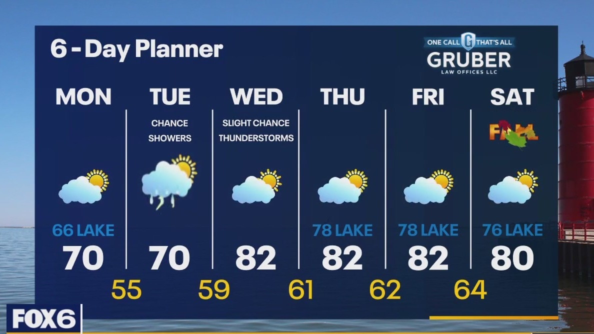
An area of high pressure shifts to the east today keeping us sunny until a low arrives with rain and a chance of thunderstorms on Tuesday. Highs today will reach 70 inland but remain in the 60s lakeside with a breeze off of Lake Michigan. A chance for rain and thunderstorms continues into parts of Wednesday. We start warming up Thursday and stay in the upper 70s and low 80s through the weekend.
An area of high pressure shifts to the east today keeping us sunny until a low arrives with rain and a chance of thunderstorms on Tuesday. Highs today will reach 70 inland but remain in the 60s lakeside with a breeze off of Lake Michigan. A chance for rain and thunderstorms continues into parts of Wednesday. We start warming up Thursday and stay in the upper 70s and low 80s through the weekend.
Weather Webcast with Tom Wachs
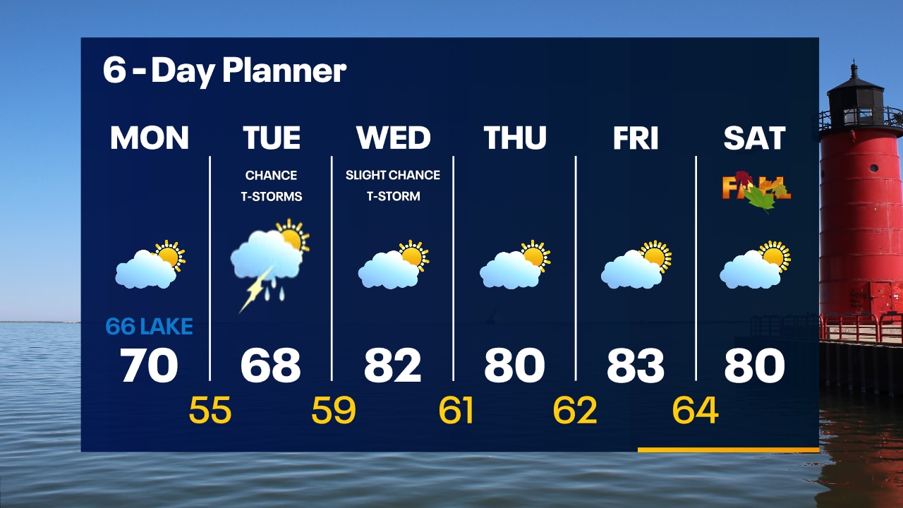
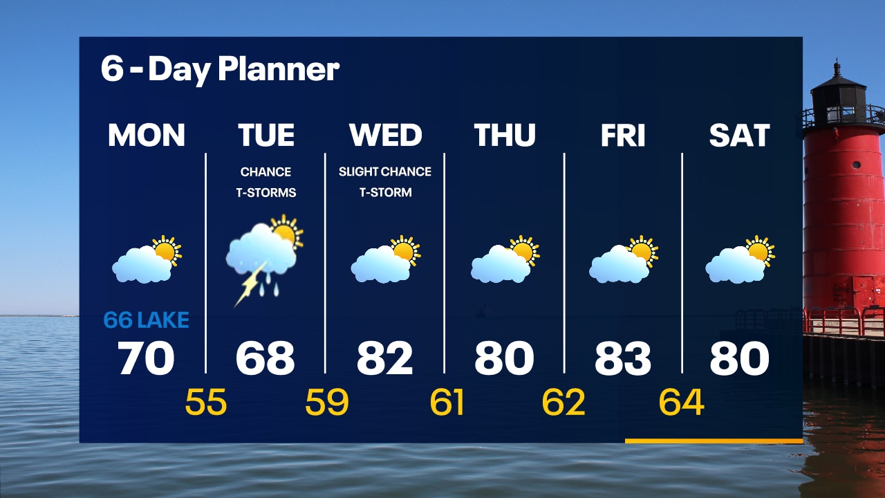
Patchy inland fog overnight with temperatures in the 50s. Partly sunny and mild on Monday with highs around 70 inland, mid-60s near the lake. A few showers/t-storms are possible Tuesday.
Patchy inland fog overnight with temperatures in the 50s. Partly sunny and mild on Monday with highs around 70 inland, mid-60s near the lake. A few showers/t-storms are possible Tuesday.
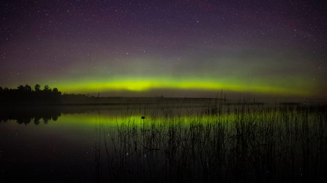

Dazzling auroras could be on display from Seattle to Boston Tuesday during geomagnetic storm watch
Auroras lights could be visible low on the horizon for the U.S. Northern Tier, including in Seattle, Great Falls, Des Moines, Minneapolis, Chicago and Boston. Here's why.
Auroras lights could be visible low on the horizon for the U.S. Northern Tier, including in Seattle, Great Falls, Des Moines, Minneapolis, Chicago and Boston. Here's why.
Weather Webcast with Tom Wachs
Quiet tonight with temperatures falling into the 50s. Partly sunny and mild on Monday. High around 70 Waukesha and west, mid-60s near the lake. A few showers/t-storms are possible Tuesday.
Quiet tonight with temperatures falling into the 50s. Partly sunny and mild on Monday. High around 70 Waukesha and west, mid-60s near the lake. A few showers/t-storms are possible Tuesday.


Watch: 'Corn devil' swirls through freshly harvested Kansas field
Dust devils typically form on fair weather days that include plenty of sunshine, warm temperatures and light winds. They usually only last a few minutes, and they rarely cause damage.
Dust devils typically form on fair weather days that include plenty of sunshine, warm temperatures and light winds. They usually only last a few minutes, and they rarely cause damage.

Lee lashes Maine, Canada with whipping winds, heavy rain as thousands remain without power
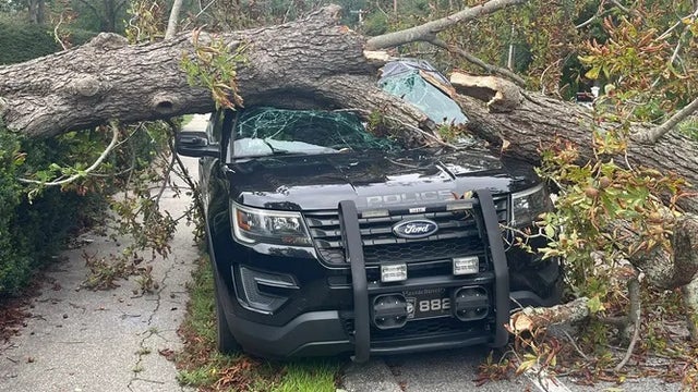
Officials say a 15-year-old boy in Florida and a 50-year-old man in Maine were killed due to the effects of Lee.
Officials say a 15-year-old boy in Florida and a 50-year-old man in Maine were killed due to the effects of Lee.