

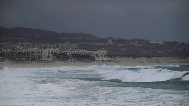

Tropical Storm Hilary arrives in California as Mexico copes with its aftermath
Hilary is no longer a hurricane but still carries so much rain that forecasters say “catastrophic and life-threatening" flooding is likely in Tijuana, Southern California and points north as far as Idaho.
Hilary is no longer a hurricane but still carries so much rain that forecasters say “catastrophic and life-threatening" flooding is likely in Tijuana, Southern California and points north as far as Idaho.
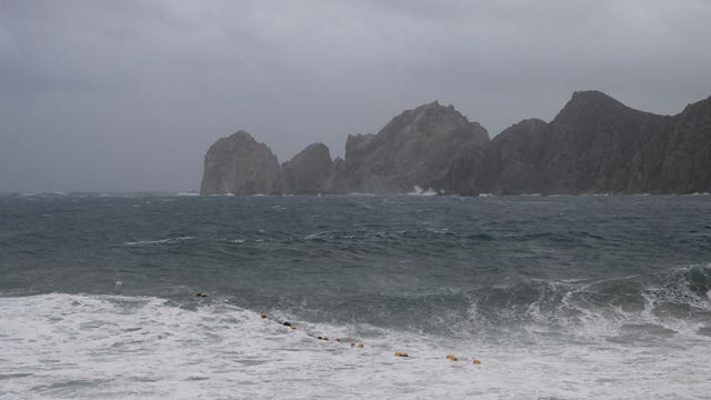

Hurricane Hilary: 'This is a storm everyone needs to take very seriously,' NWS says
Even though Hurricane Hilary is expected to weaken, it won’t be disappearing. From the desert to the mountains to the city – 'This is a storm everyone needs to take very seriously," says an NWS forecaster.
Even though Hurricane Hilary is expected to weaken, it won’t be disappearing. From the desert to the mountains to the city – 'This is a storm everyone needs to take very seriously," says an NWS forecaster.
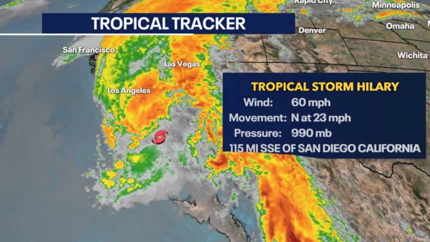
Weather Webcast with Meteorologist Eric Manges
Cooler start to the week but some of the warmest temperatures of the year possible Thursday
Cooler start to the week but some of the warmest temperatures of the year possible Thursday
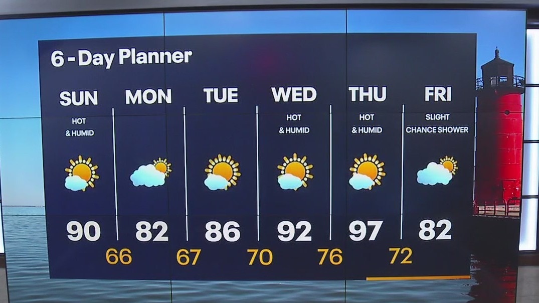
Weather Webcast with Meteorologist Lisa Michaels
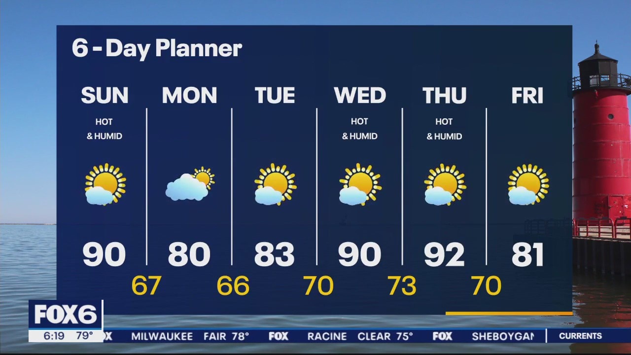
Mostly sunny skies Sunday. Humidity increases with highs in the upper 80s to low 90s. A heat advisory in place today for western counties 11am-8pm. Feel-like temps reaching up to 101F. Low to to mid 80s starting off next week before the heat arrives Wednesday and Thursday.
Mostly sunny skies Sunday. Humidity increases with highs in the upper 80s to low 90s. A heat advisory in place today for western counties 11am-8pm. Feel-like temps reaching up to 101F. Low to to mid 80s starting off next week before the heat arrives Wednesday and Thursday.
Weather Webcast with Meteorologist Eric Manges
Hot and humid weather is back Sunday then another round Wednesday and Thursday of next week
Hot and humid weather is back Sunday then another round Wednesday and Thursday of next week

Weather Webcast with Meteorologist Lisa Michaels
Mostly sunny Saturday with highs in the mid 80s. Beach hazard statement for Ozaukee and Sheboygan counties for 3-6ft waves today. Heating up Sunday in the the upper 80s/low 90s. A Heat advisory in effect tomorrow feeling like upper 90s to low 100s.
Mostly sunny Saturday with highs in the mid 80s. Beach hazard statement for Ozaukee and Sheboygan counties for 3-6ft waves today. Heating up Sunday in the the upper 80s/low 90s. A Heat advisory in effect tomorrow feeling like upper 90s to low 100s.

Weather Webcast with Meteorologist Eric Manges
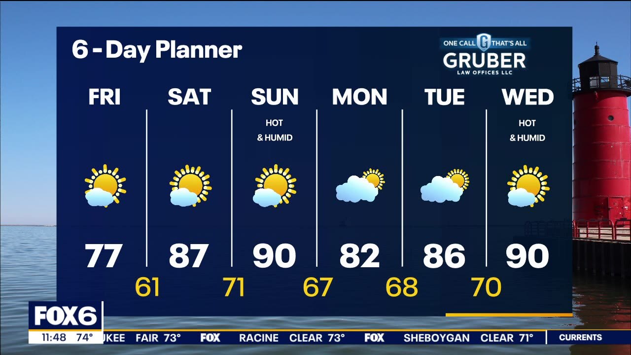
Hotter conditions into the weekend and no rain in sight
Hotter conditions into the weekend and no rain in sight
Weather Webcast With Lisa Michaels
An Air Quality Alert continues today. Wildfire smoke is likely to increase later today and weekend ozone levels will increase. An area of high pressure moves over our area today and into the weekend bringing ample sun and increasing heat. Today will be cooler than average - in the upper 70s but warm into the upper 80s and low 90s for the weekend. Dewpoints will also rise this weekend. More heat is possible next week if a warm front is able to overcome the breeze off of Lake Michigan. Stay tuned for updates.
An Air Quality Alert continues today. Wildfire smoke is likely to increase later today and weekend ozone levels will increase. An area of high pressure moves over our area today and into the weekend bringing ample sun and increasing heat. Today will be cooler than average - in the upper 70s but warm into the upper 80s and low 90s for the weekend. Dewpoints will also rise this weekend. More heat is possible next week if a warm front is able to overcome the breeze off of Lake Michigan. Stay tuned for updates.

When was the last time a hurricane or tropical storm hit California?
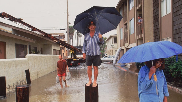
California is rarely discussed in the context of the tropics, but that is exactly what is happening this week with Hurricane Hilary.
California is rarely discussed in the context of the tropics, but that is exactly what is happening this week with Hurricane Hilary.
Weather webcast with Rob Haswell
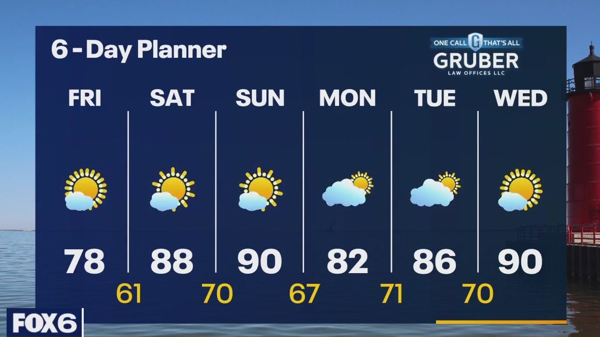
An Air Quality Alert continues today. Wildfire smoke is likely to increase later today and weekend ozone levels will increase. An area of high pressure moves over our area today and into the weekend bringing ample sun and increasing heat. Today will be cooler than average - in the upper 70s but warm into the upper 80s and low 90s for the weekend. Dewpoints will also rise this weekend. More heat is possible next week if a warm front is able to overcome the breeze off of Lake Michigan. Stay tuned for updates.
An Air Quality Alert continues today. Wildfire smoke is likely to increase later today and weekend ozone levels will increase. An area of high pressure moves over our area today and into the weekend bringing ample sun and increasing heat. Today will be cooler than average - in the upper 70s but warm into the upper 80s and low 90s for the weekend. Dewpoints will also rise this weekend. More heat is possible next week if a warm front is able to overcome the breeze off of Lake Michigan. Stay tuned for updates.
Weather Webcast with Meteorologist Eric Manges
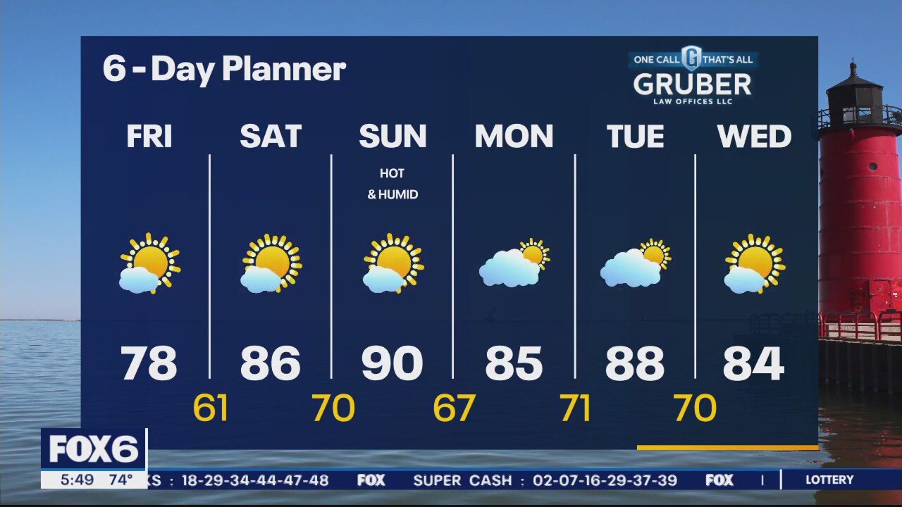
Hot and humid conditions return by the weekend but enjoy a cooler Friday
Hot and humid conditions return by the weekend but enjoy a cooler Friday

Southeast Wisconsin drought conditions improve, aided by soaking rain
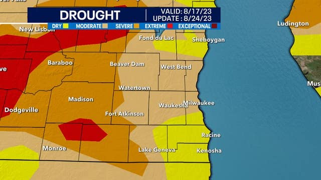
Sufficient rainfall over this week has significantly helped our drought conditions across southeast Wisconsin.
Sufficient rainfall over this week has significantly helped our drought conditions across southeast Wisconsin.
Weather Webcast With Lisa Michaels
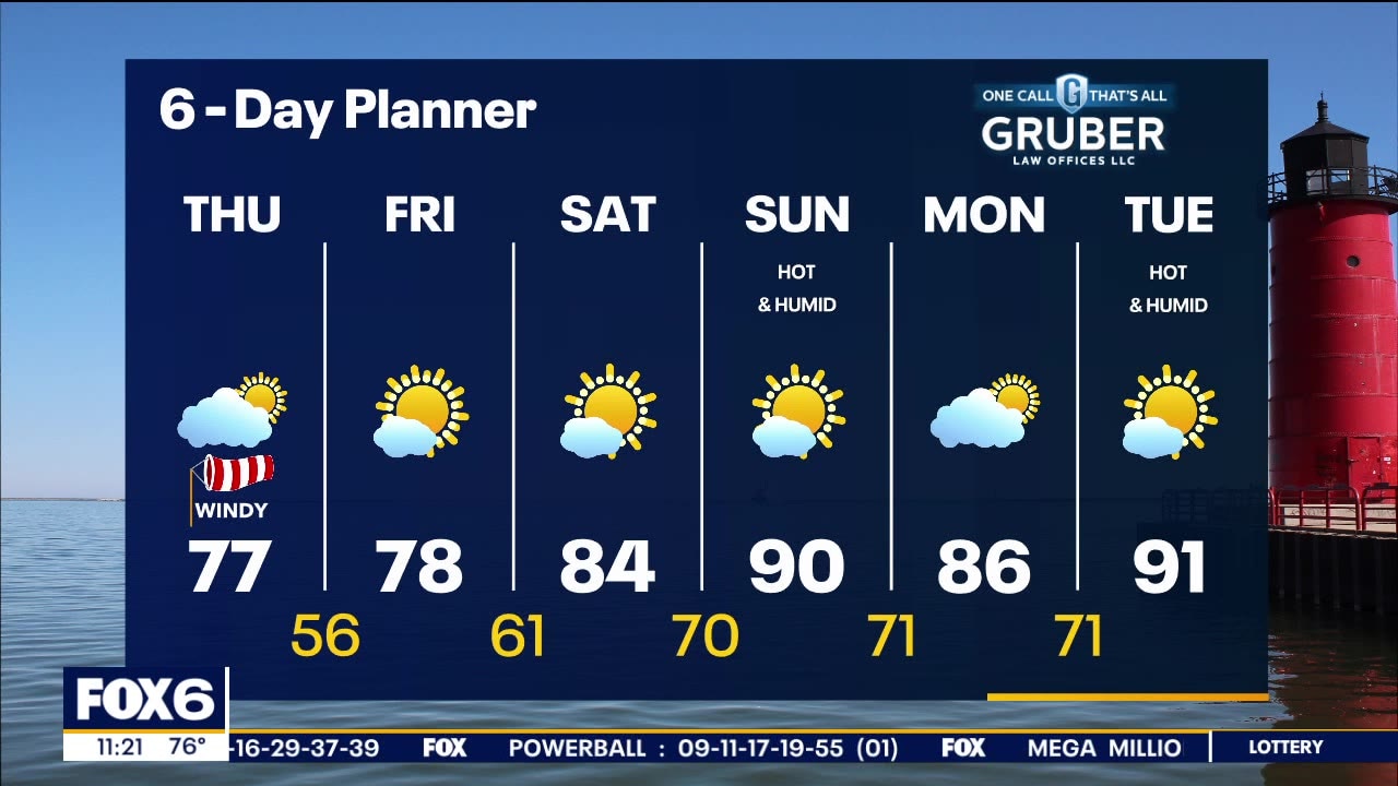
Cold front moves further away and high pressure takes control clearing skies. Highs in the mid to upper 70s. NW winds gusting up to 30mph. Wildfire smoke returns to the area today and an Air Quality Alert has been issued for all of SE Wisconsin from this morning until Monday morning. Bad ground level ozone will be more of a concern over the weekend. The summer time heat build back Sunday and into next week with the upper 80s to low 90s. A lake breeze could help out during this time. A long dry stretch begins later today and runs through the middle of next week.
Cold front moves further away and high pressure takes control clearing skies. Highs in the mid to upper 70s. NW winds gusting up to 30mph. Wildfire smoke returns to the area today and an Air Quality Alert has been issued for all of SE Wisconsin from this morning until Monday morning. Bad ground level ozone will be more of a concern over the weekend. The summer time heat build back Sunday and into next week with the upper 80s to low 90s. A lake breeze could help out during this time. A long dry stretch begins later today and runs through the middle of next week.

Severe thunderstorm warning expires for Walworth County
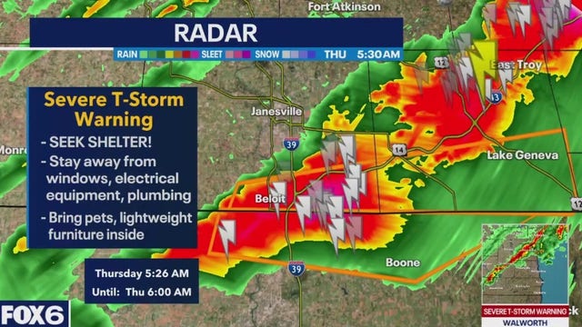
The National Weather Service issued a severe thunderstorm warning for Walworth County until 6 a.m. Thursday, Aug. 17.
The National Weather Service issued a severe thunderstorm warning for Walworth County until 6 a.m. Thursday, Aug. 17.

Weather webcast with Rob Haswell
A cold front clears our area early this morning bringing a round of rain and thunderstorms along with strong wind gusts shifting from the SW to NW. Wildfire smoke returns to the area today and an Air Quality Alert has been issued for all of SE Wisconsin from this morning until Monday morning! Sunshine returns behind the front as an area of high pressure builds over the region. We will be a bit below average today and tomorrow but as the high sifts to the East, we warm into the upper 80s and low 90s this weekend. A long dry stretch begins later today and runs through the middle of next week.
A cold front clears our area early this morning bringing a round of rain and thunderstorms along with strong wind gusts shifting from the SW to NW. Wildfire smoke returns to the area today and an Air Quality Alert has been issued for all of SE Wisconsin from this morning until Monday morning! Sunshine returns behind the front as an area of high pressure builds over the region. We will be a bit below average today and tomorrow but as the high sifts to the East, we warm into the upper 80s and low 90s this weekend. A long dry stretch begins later today and runs through the middle of next week.

Weather Webcast with Tom Wachs
Showers and t-storms are expected between 3-7am Thursday. We will quickly dry out as the cold front moves through. Windy and cooler on Thursday with highs in the 70s.
Showers and t-storms are expected between 3-7am Thursday. We will quickly dry out as the cold front moves through. Windy and cooler on Thursday with highs in the 70s.

Weather Webcast with Tom Wachs
Mostly clear and breezy this evening. A quick moving area of t-storms will move through between 4-8am. Windy and cooler on Thursday with highs in the 70s.
Mostly clear and breezy this evening. A quick moving area of t-storms will move through between 4-8am. Windy and cooler on Thursday with highs in the 70s.

Weather Webcast with Meteorologist Eric Manges
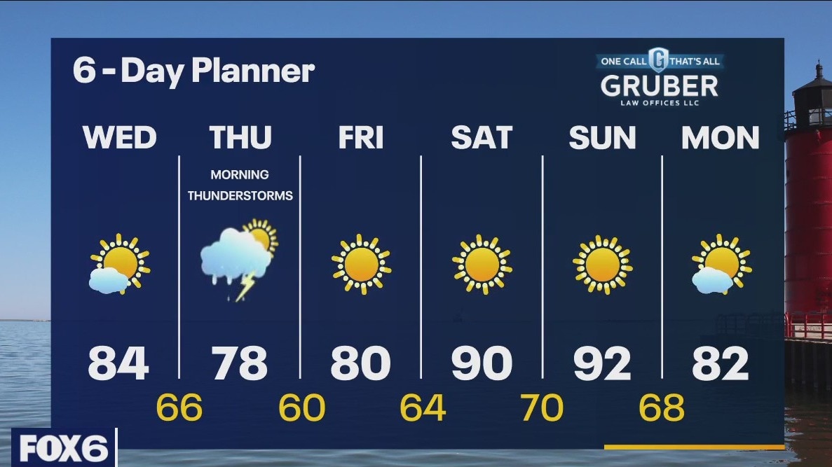
Chance for early Thursday morning storms but then sunshine and warmer temperatures into the weekend
Chance for early Thursday morning storms but then sunshine and warmer temperatures into the weekend
Weather webcast with Rob Haswell
A cold front moves from the Dakotas through our area today into tomorrow morning. Ahead of that front we warm into the low to mid 80s today. As the front moves through tonight and tomorrow morning we can expect rain and thunderstorms. While severe storms are not likely tomorrow morning, we could see a few stronger storms before mid-day. A big warm up is coming for the weekend as we return to the 90s!
A cold front moves from the Dakotas through our area today into tomorrow morning. Ahead of that front we warm into the low to mid 80s today. As the front moves through tonight and tomorrow morning we can expect rain and thunderstorms. While severe storms are not likely tomorrow morning, we could see a few stronger storms before mid-day. A big warm up is coming for the weekend as we return to the 90s!

Weather Webcast with Tom Wachs
Mostly clear overnight with temperatures in the 50s in many areas by sunrise. Mostly sunny. breezy and warmer on Wednesday. Highs in the low-to-mid 80s. A few t-storms early Thursday morning.
Mostly clear overnight with temperatures in the 50s in many areas by sunrise. Mostly sunny. breezy and warmer on Wednesday. Highs in the low-to-mid 80s. A few t-storms early Thursday morning.